Mountain hikes Hiking tour to Merschenhütte 2.248m

Virgen in Osttirol / Venedigergruppe
Difficulty ratings: medium
Route length: 16.4 km
Duration: 7:30 h

Hiking tour to Merschenhütte 2.248m

Tour information

  • Requirement: medium
  • Length: 16.4 km
  • Duration: 7:30 h
  • Elevation uphill:1,160 hm
  • Elevation downhill:1,160 hm
Highest point2,250 m

Starting point

Parkplatz Würfelehütte

Finishing point

Parkplatz Würfelehütte
  • Fitness level 3 / 6
  • Technique 3 / 6

Best time of year

  • January
  • February
  • March
  • April
  • May
  • June
  • July
  • August
  • September
  • October
  • November
  • December
Source: TVB Osttirol

Description

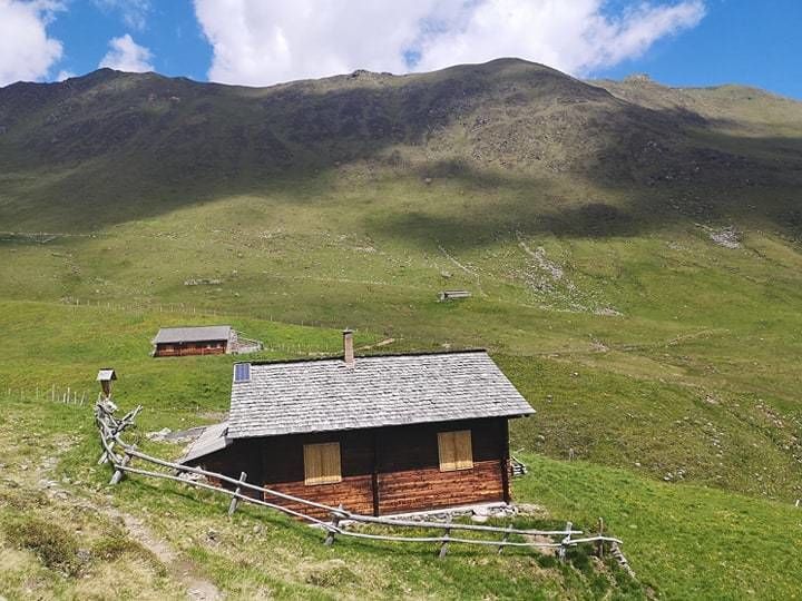
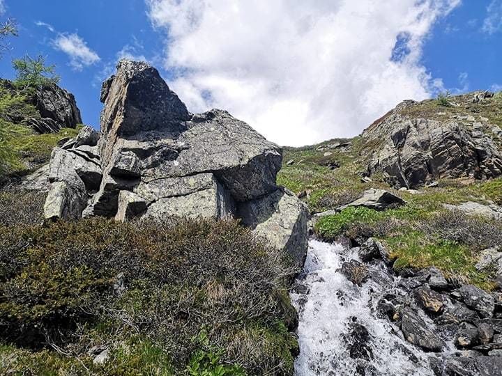
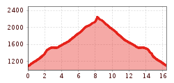
The hiking tour to the hut Merschenhütte starts from the parking place Würfelehütte. First of all you have to follow the toboggan track until reaching the hut Würfelehütte. Then walk along the broader driveway behind the Würfelehütte. At its end, a hiking trail branches off and leads all the way up to the hut Merschenhütte. Once you have arrived at the Merschenhütte, you can enjoy the magnificent view onto the mountains of Virgen.


Nearby huts and mountain restaurants

Getting here

  • Arrival by public transport

    Virgen Kirche

  • Parking

    Parking place Würfelehütte

More tours in the surrounding area

  • Figerhorn

    Difficulty: difficult
    Length: 6.5 km Duration: 6:00 h Elevation uphill: 807 m
  • Venediger altitude trail

    Difficulty: difficult
    Length: 55.5 km Duration: 27:00 h Elevation uphill: 3,915 m
  • Hike to the Venedigerhaus Innergschlöß

    Difficulty: easy
    Length: 8.5 km Duration: 2:30 h Elevation uphill: 180 m
  • Hike to Neuen Reichenberger Hütte

    Difficulty: medium
    Length: 9.1 km Duration: 9:00 h Elevation uphill: 1,210 m
  • Badener Hütte

    Difficulty: difficult
    Length: 23.2 km Duration: 11:30 h Elevation uphill: 1,750 m
  • Hike to Kalser Tauernhaus

    Difficulty: medium
    Length: 12.2 km Duration: 4:00 h Elevation uphill: 244 m
  • Hiking tour to Neue Sajathütte 2.600m

    Difficulty: medium
    Length: 10.3 km Duration: 6:50 h Elevation uphill: 1,080 m
  • Rotenkogel

    Difficulty: difficult
    Length: 3.9 km Duration: 3:00 h Elevation uphill: 383 m
  • Umbal waterfalls nature force trail

    Difficulty: easy
    Length: 5.8 km Duration: 2:30 h Elevation uphill: 250 m
  • Lasörling 3.098m

    Difficulty: difficult
    Length: 21.9 km Duration: 12:00 h Elevation uphill: 1,940 m
  • Muhs panorama trail

    Difficulty: medium
    Length: 15.2 km Duration: 6:00 h Elevation uphill: 1,090 m
  • Lasörling altitude trail

    Difficulty: medium
    Length: 57.0 km Duration: 25:00 h Elevation uphill: 3,740 m
  • Hiking tour to Lasörlinghütte 2.350m

    Difficulty: medium
    Length: 14.6 km Duration: 7:10 h Elevation uphill: 1,080 m
  • Lucknerhaus - Stüdlhütte

    Difficulty: medium
    Length: 9.3 km Duration: 5:30 h Elevation uphill: 862 m
  • Böses Weibl

    Difficulty: difficult
    Length: 14.1 km Duration: 8:00 h Elevation uphill: 1,193 m
Newsletter

The mountain is calling? So does our newsletter!

In our monthly newsletter we reveal the best holiday tips for Tyrol.