
Opening hours:Today closed
Place:Sölden
:Alpine pasture / hut / mountain restaurant
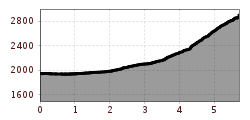
WINDACHALM --> Gaisstabel -->steiler Gaiskarweg --> HILDESHEIMER HÜTTE
Red mountain trails are moderately difficult: some narrow and steep, but assured walking and climbing passages are waiting for hikers. The corresponding signs are in yellow basic color and have a red circle as a difficulty indication.
Suitable for sure-footed and experienced hikers;good physical condition, mountain experience and mountain equipment (see under equipment) necessary.
Please note the current weather report under Weather Sölden
It is recommended to wear hiking equipment such as breathable and weather-adapted outdoor clothing, ankle-high mountain boots, wind, rain and sun protection, cap and possibly gloves. It is also important to have enough food, as well as a first-aid package, a cell phone and a hiking map.
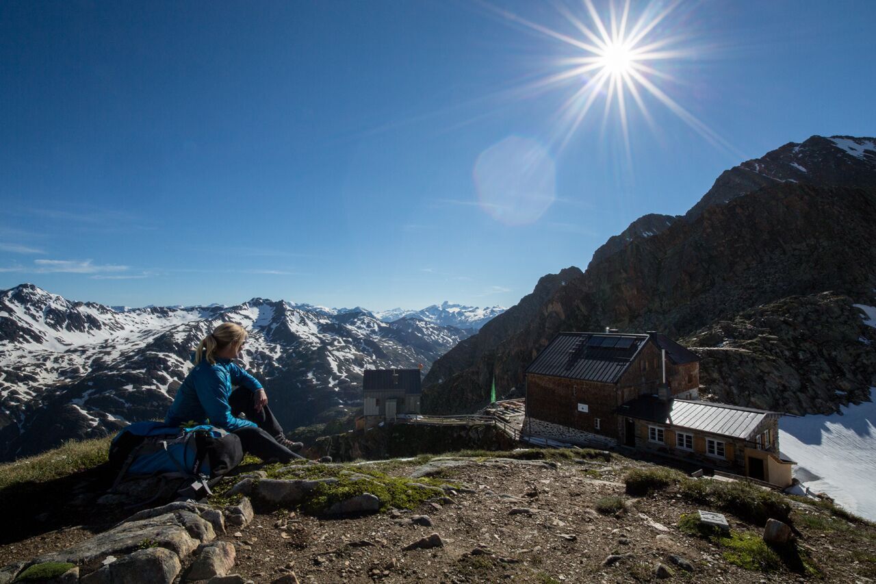
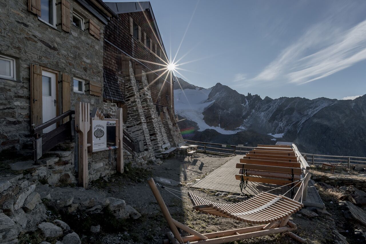
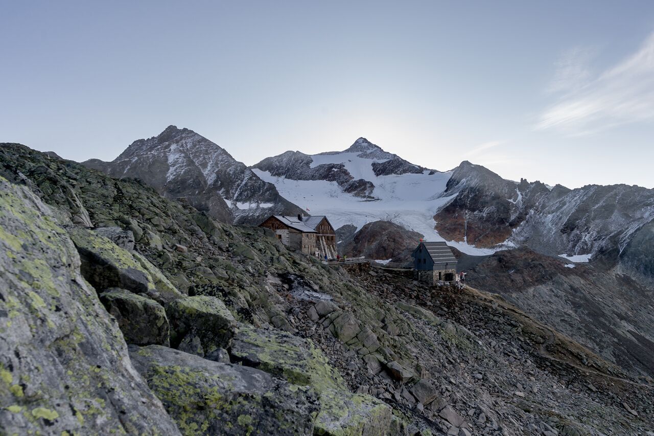
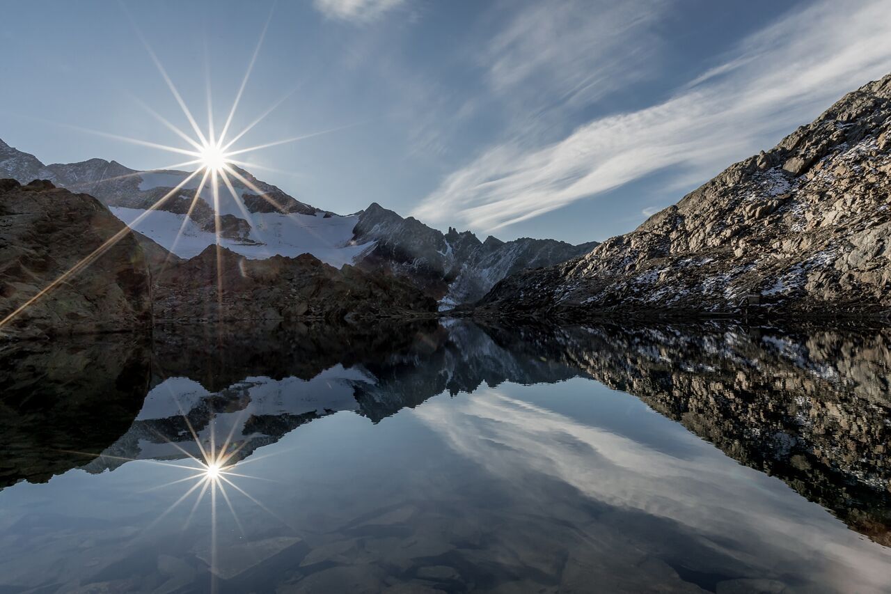
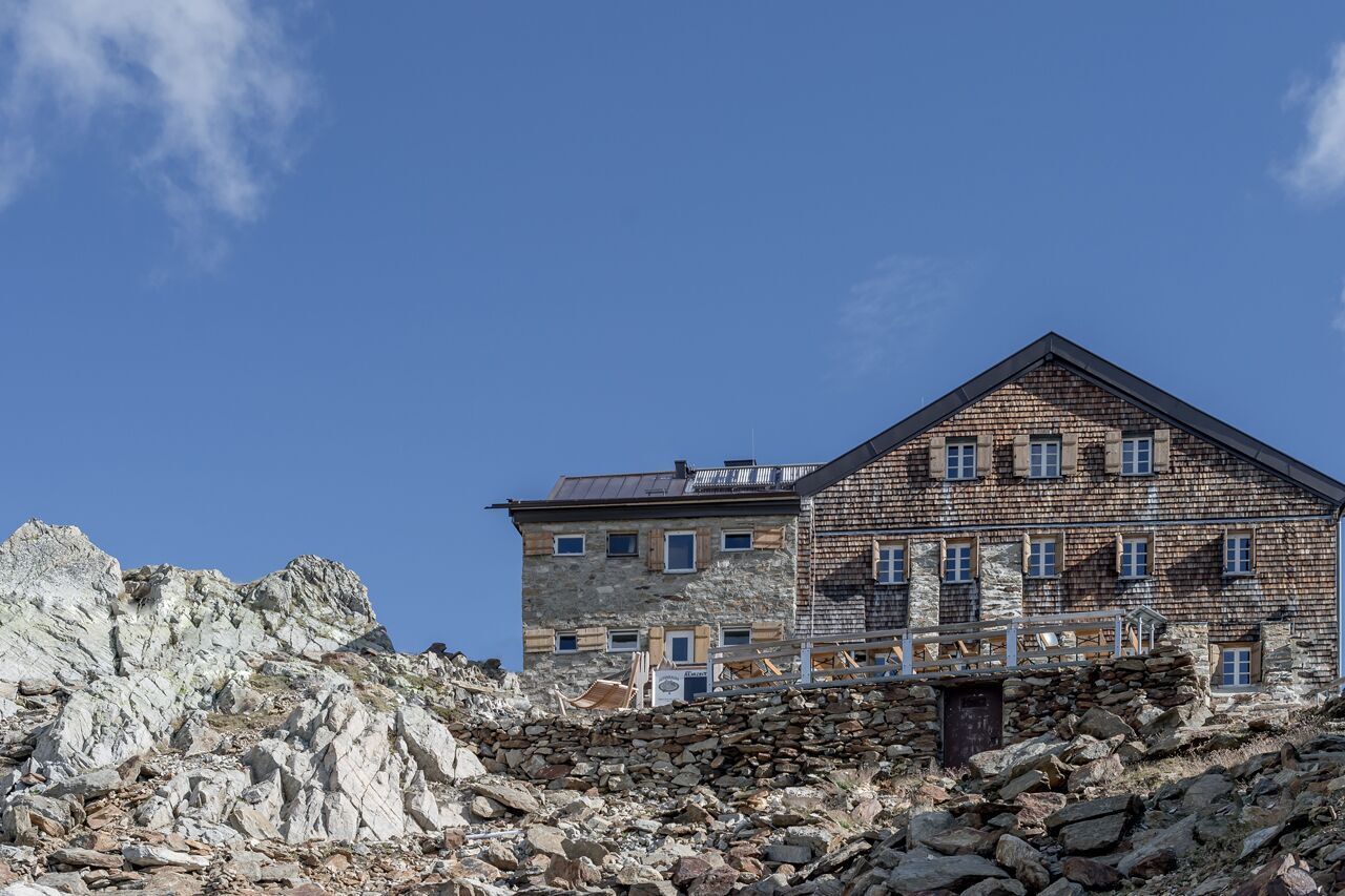
The Hildesheimer hut (2899m) was built in 1896 and is located in the Stubai Alps, surrounded by Zuckerhütl (highest mountain of the Stubai Alps) 3.505m, Schußgrubenkogel 3.211m, Schaufelspitze 3.333m, Stubaierwildspitz 3.340m, Gaiskogel 3.129m, Wilder Pfaff 3.458m, the Pfaffenschneide 3.498m
The hike will be started at the Windachalm / Fiegls hut. Through the wide Windachtal wanders up to the Gaisstabel material cable car.From here there are two possibilities of ascent: The Ludwig-Aschenbrenner-Weg has a slight but longer ascent and the Steep Gaiskar-Weg (as described here), as the name suggests, a steeper but shorter climb.
Enjoy a both comfortable and relaxing train ride to the train station in Ötztal Bahnhof. You get off the train in ÖTZTAL Bahnhof where you change to a public bus or local taxi. The current bus schedule can be found at: http://fahrplan.vvt.at
The following parking facilities are available in Sölden:
All parking is free during the day.
Parking for several days (eg hike tour):


")


