
Place:Oetz
:Restaurant, Bar / Pub
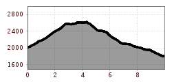
ACHERKOGELBAHN BERGSTATION -> Bielefelder Hut -> Roßköpfe -> Wetterkreuz -> Wörgetal Saddle -> Mittergrathütte-> BUS STOP MITTERGRATHÜTTE


Difficult mountain route, suitable for sure-footed and experienced mountain hikers. Good physical condition, mountain experience and mountain equipment (see under equipment) necessary. Please observe the current weather report at: www.oetztal.com/de/sommer.html
Appropriate equipment such as breathable and weather-adapted outdoor clothing, ankle-high hiking boots, wind, rain and sun protection, hat, possibly gloves, is required for all hikes and routes. Carrying a first aid kit, a mobile phone and possibly a hiking map, as well as sufficient provisions for hikes without opportunities for refreshment, is necessary.
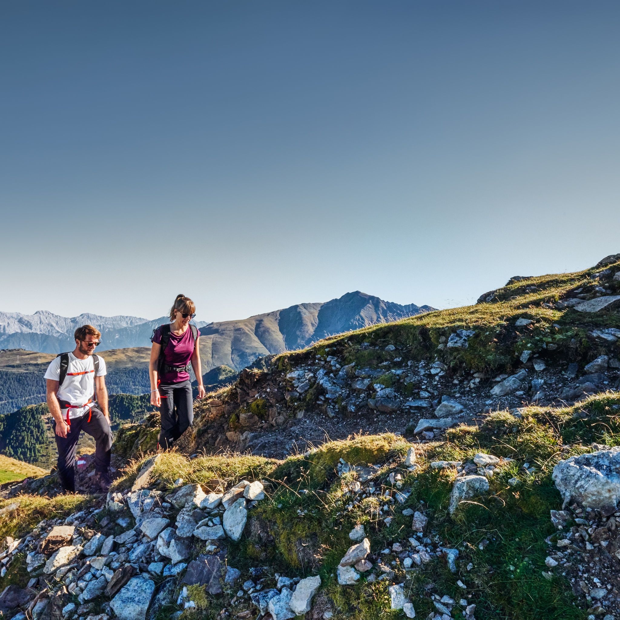
With the Acherkogelbahn you can comfortably reach the starting point in Hochoetz. A wide, gently ascending gravel path initially leads to the Bielefelder Hut. Soon you leave the main path and enter an idyllic stone pine forest. A pleasant, mostly flat trail leads further to a short but challenging ascent up to the Roßköpfe.
Without significant elevation loss, you then follow a narrow path towards Wetterkreuzkogel. From the summit, an impressive panorama opens up onto the Stubai Alps and the Mieminger Chain – ideal for a scenic break.
The descent leads through the Wörgetal, until an old path on the right rises to the Wörgetal saddle. Afterwards follows a steep descent over a grassy mountain ridge. Once at the bottom, the path leads into a gentle, scenic hiking trail through the picturesque Mittertal – a true highlight of this route.
At the end of the valley, the path gently descends. Just before the dam, the path to Mittergrathütte branches off, from where you finally continue hiking to the bus stop.


")


