
Place:Oetz
:Restaurant, Bar / Pub
PANORAMARESTAURANT HOCHOETZ -> Bielefelder Hut -> Wetterkreuz -> Wörgetal -> Pocher Lake -> Knappenhaus -> Obere Issalm -> Iss Bridge
Challenging mountain route, suitable for sure-footed and experienced mountain hikers. Good physical condition, mountain experience and mountain equipment (see equipment section) are necessary. Please note the current weather report at: www.oetztal.com/de/sommer.html
Appropriate equipment such as breathable and weather-appropriate outdoor clothing, ankle-high hiking boots, wind, rain and sun protection, a hat, possibly gloves, is required for all hikes and routes. Carrying a first aid kit, a mobile phone and possibly a hiking map, as well as sufficient provisions for hikes without dining possibilities, is necessary.
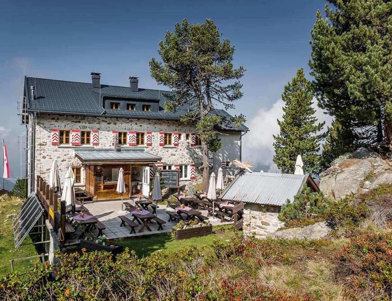
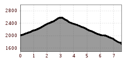
The starting point of the hike is the Panoramarestaurant Hochoetz at 2,020 m above sea level. From there, a wide forest path initially leads towards the Bielefelder Hut. Then a steep ascent begins, which shortly below the Brunnenkopf summit transitions into a gently flowing high path. This winds impressively along the mountainside.
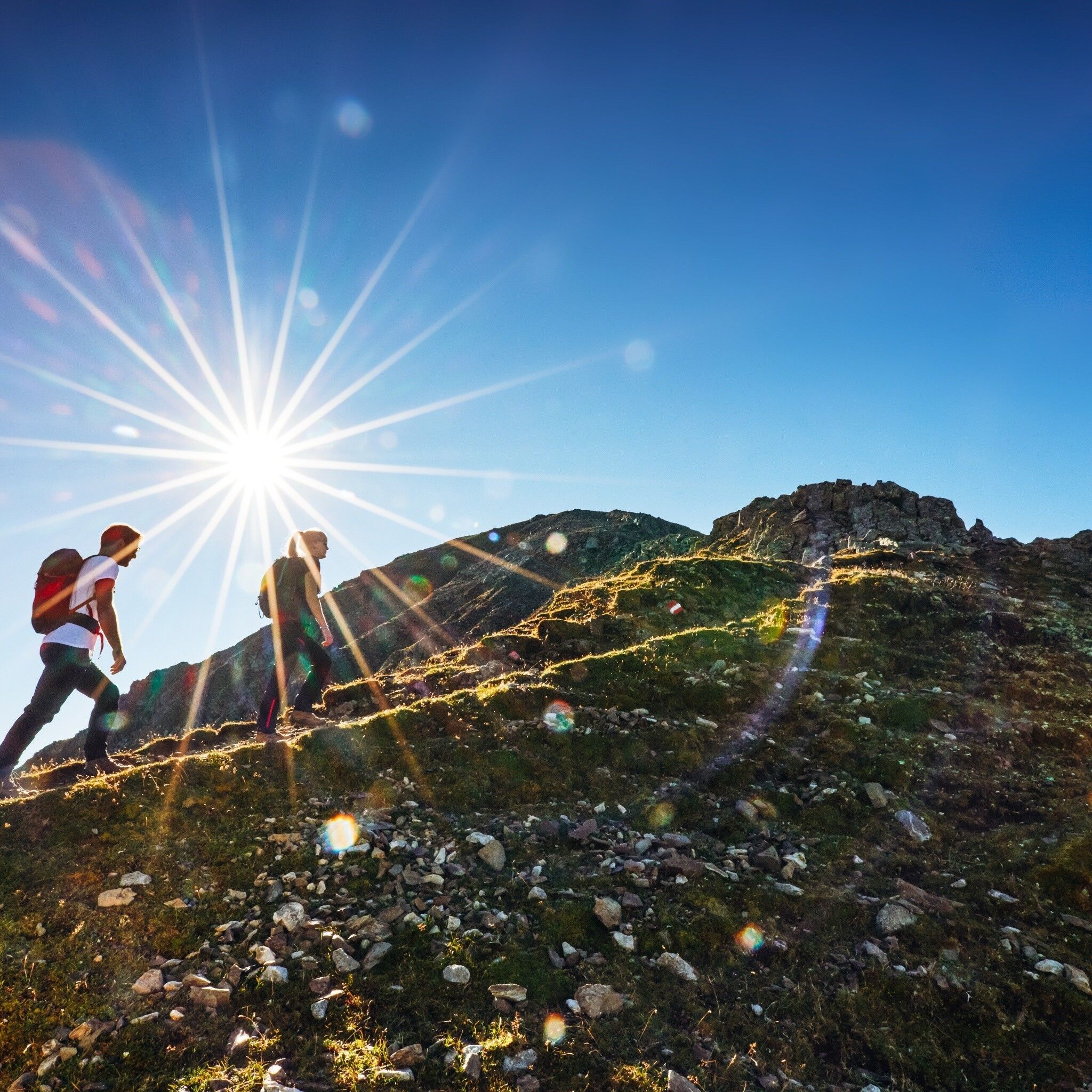
At a fork in the path, the ascent to Rosskopf branches off to the left, while the trail continues to the Wetterkreuz, which you reach after a moderate climb. From the summit, there is an impressive panorama of the Stubaier Alps and the Mieminger Chain, ideal for a short rest with a view.
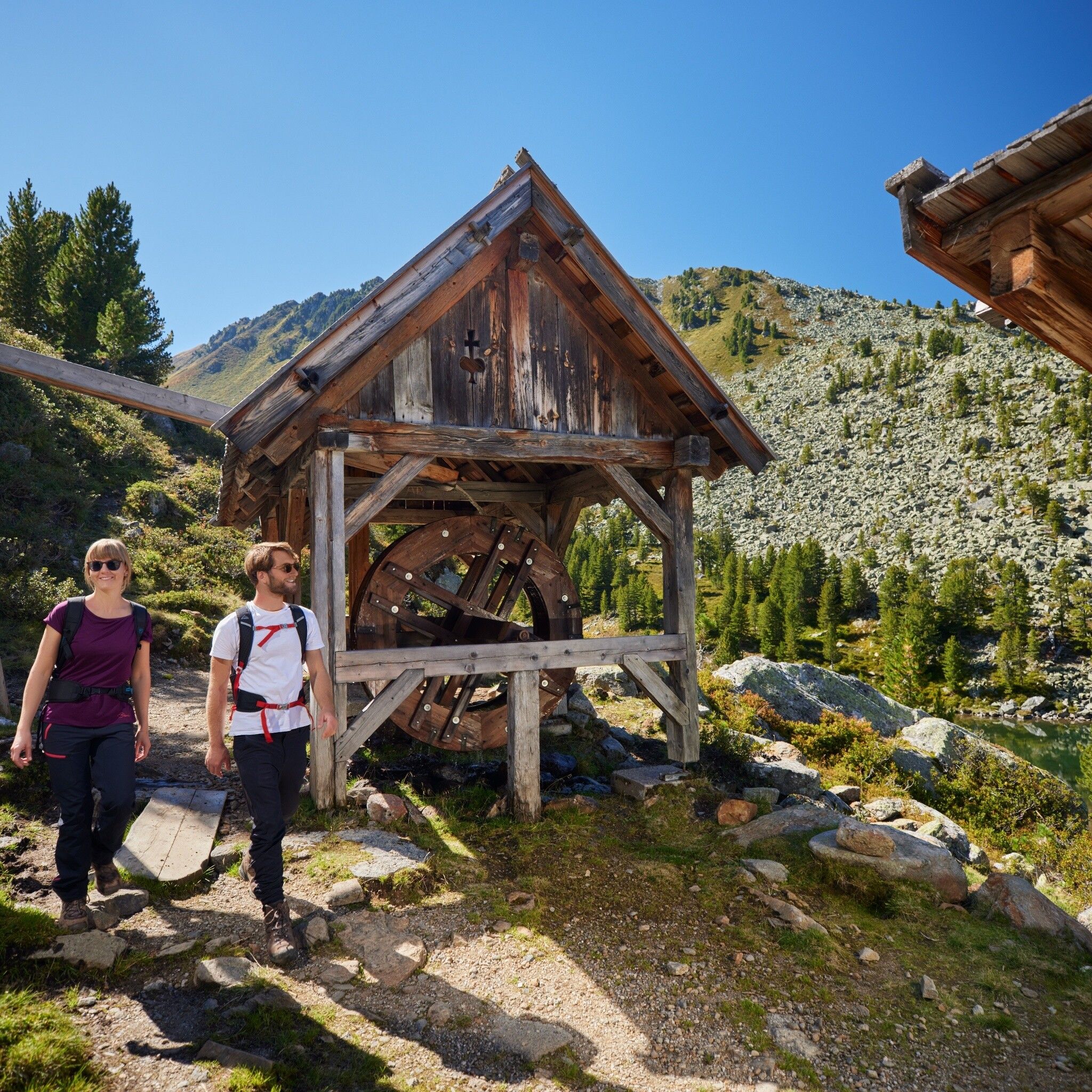
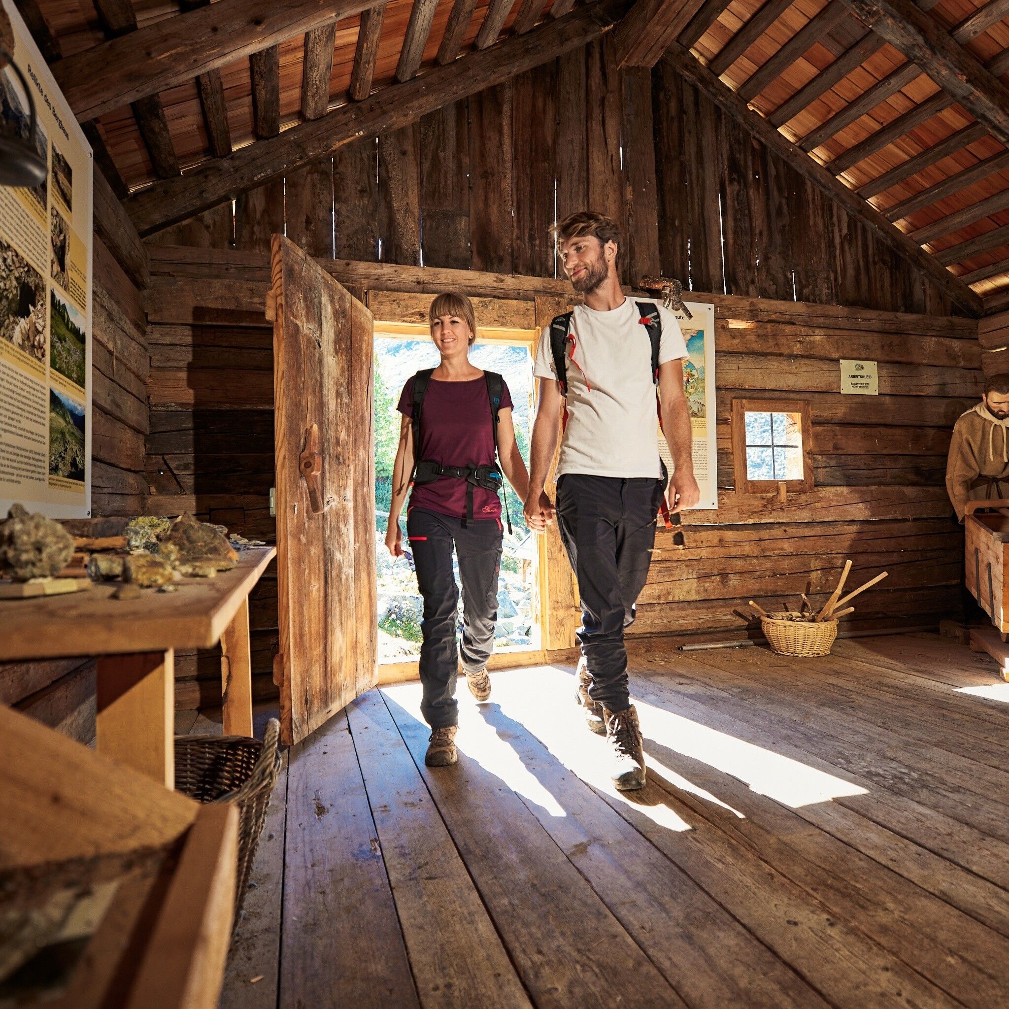
The descent takes place on the backside of the Wetterkreuz down into the romantically wild Wörgetal. A narrow trail winds through this remote valley section to the Knappenhaus with the stamping mill – an faithfully reconstructed ore processing facility. Here you delve deep into the region's over 350-year mining history. A real highlight of the route.
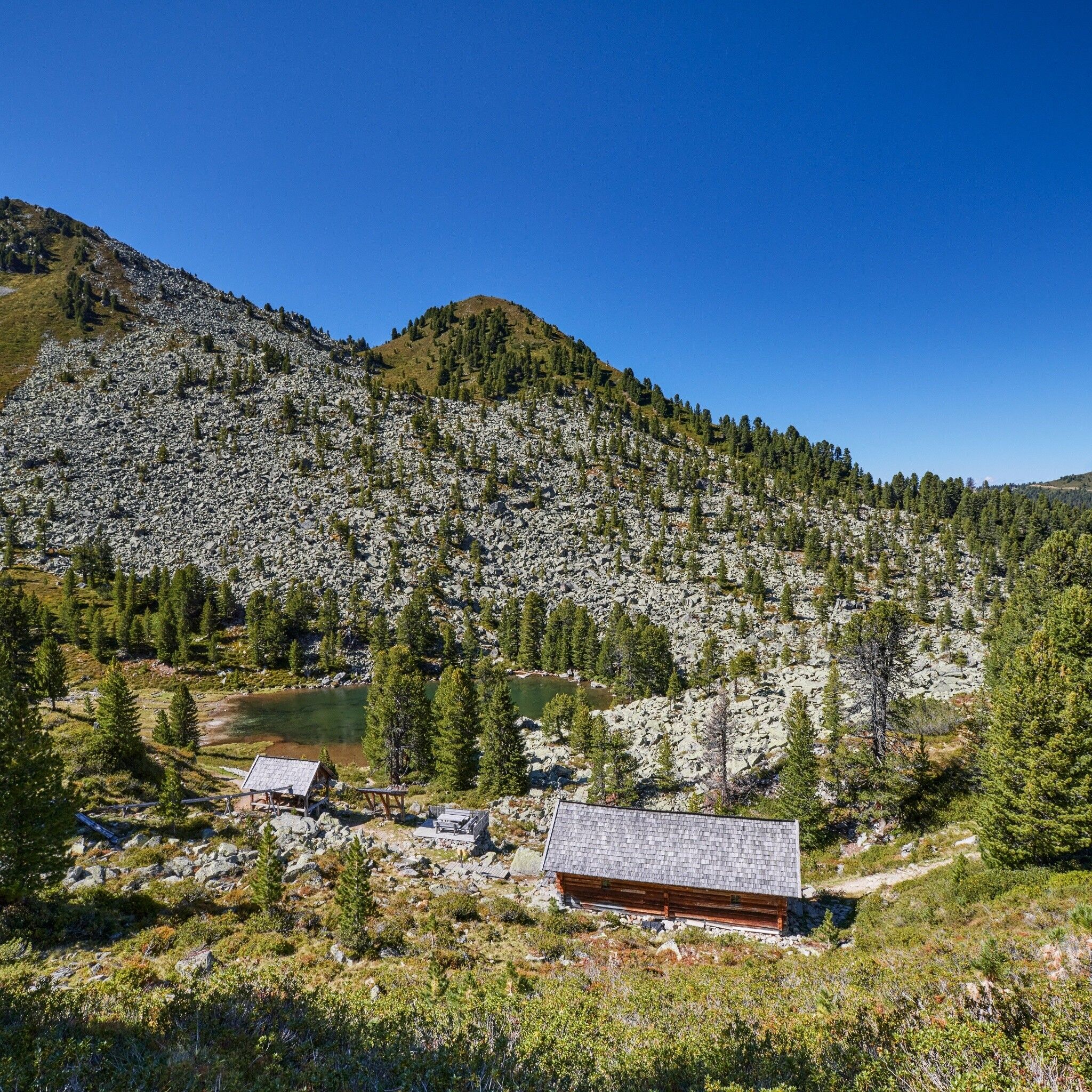
A little further, the path leads past the idyllic Pocher Lake, then over the now dilapidated Obere Issalm down to the Iss Bridge, where you can conveniently take the bus back to Oetz.
Tip: Explore the Knappenweg with the free audio guide from Hearonymus!
Travel comfortably and safely by train to the Ötztal train station. The final stop or exit point is ÖTZTAL station. Afterwards, travel conveniently and quickly by public transport or local taxi companies throughout the entire valley to your desired destination! The current bus schedule is available at: http://fahrplan.vvt.at
The following parking options are available:


