Mountain hikes Stage 3 Hut Trekking Ötztal

closed
Umhausen / Ötztal Alps
Route length: 4.5 km
Duration: 1:15 h

From the Frischmann Hut over the idyllic "Waalweg" to the Hintere Fundus Alm. 

Tour information

  • Length: 4.5 km
  • Duration: 1:15 h
  • Elevation uphill:24 hm
  • Elevation downhill:261 hm
Highest point2,208 m

Starting point

Frischmann Hut

Finishing point

Hintere Fundus Alm

Equipment

This stage of the hike does not require special safety instructions. General surefootedness and mountain equipment are considered a matter of course on our tours; otherwise, this stage is a comfortable hike without major alpine key points or dangerous passages.  

Proper equipment for alpine mountain hikes is a matter of course for all tours in the Alps. Secure hiking boots or mountaineering shoes, breathable outdoor pants, a rain jacket, as well as a backpack with provisions, drinks, and a first aid kit are always part of the standard equipment on tours in the Alps. Sunglasses, sunscreen, headwear such as a bandana or hiking hat are also highly recommended, as well as a warm second jacket, trekking poles if desired, and possibly gloves. The choice of clothing should of course always be adapted to the current weather conditions.

Source: TVB Ötztal Tourismus

Description

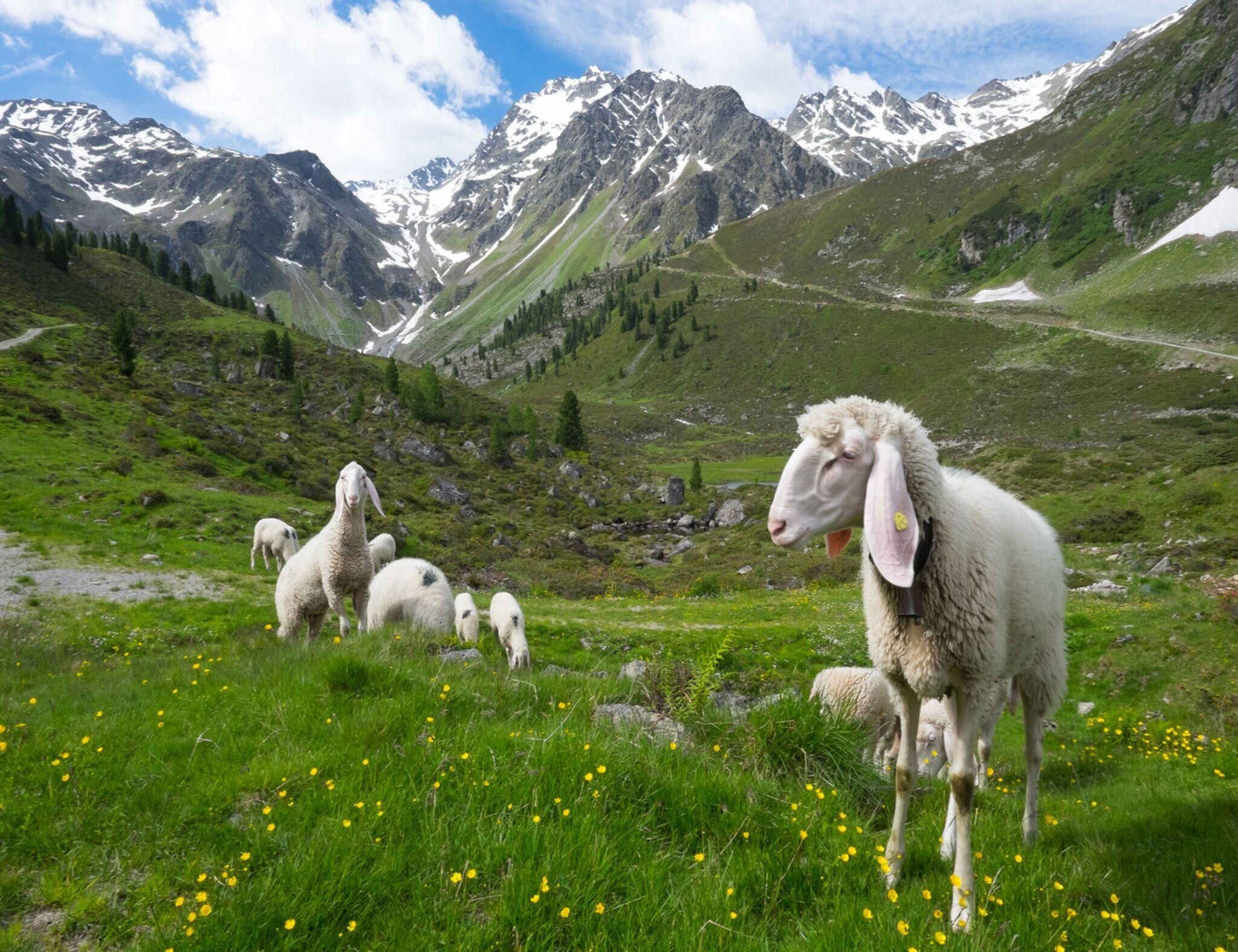
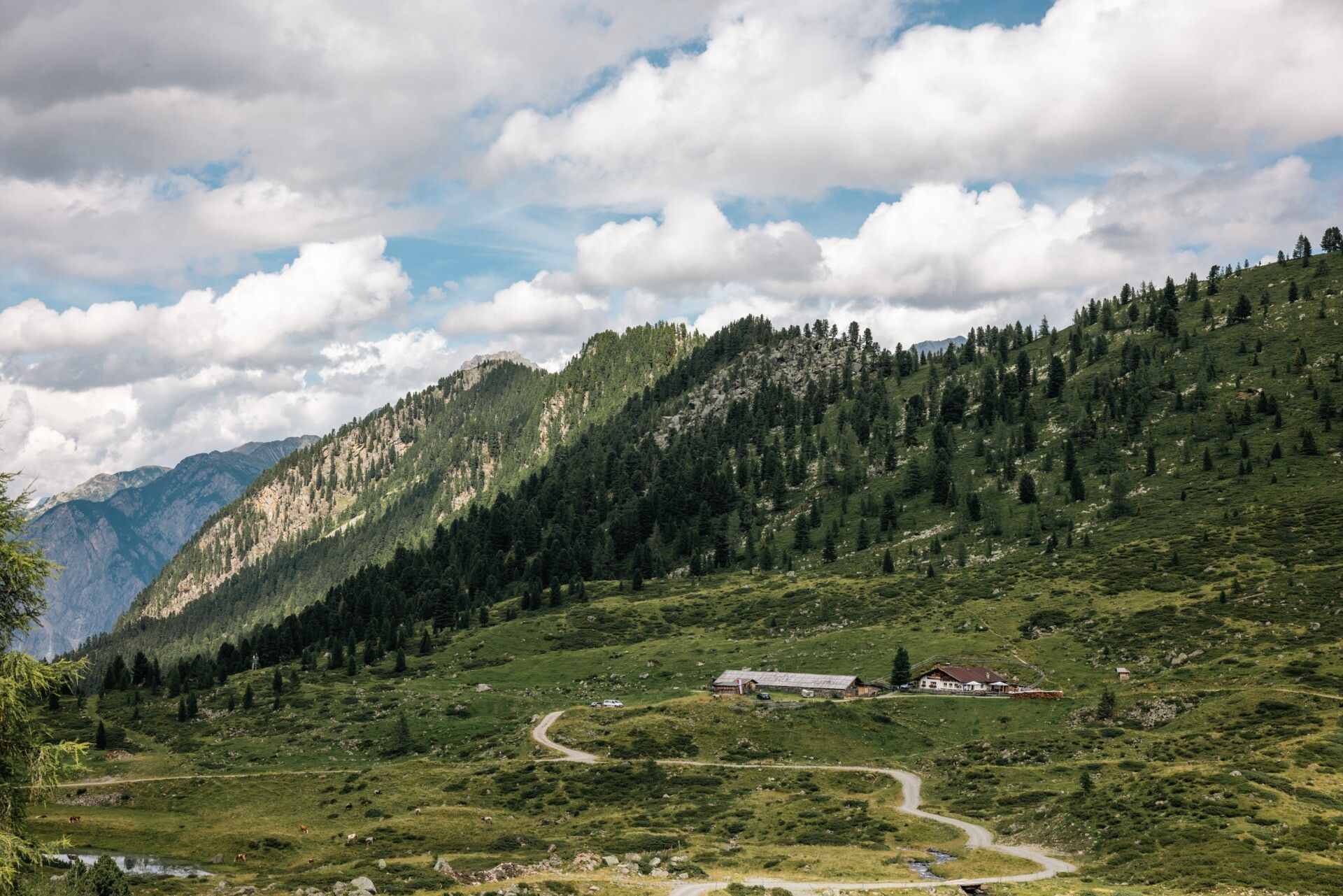
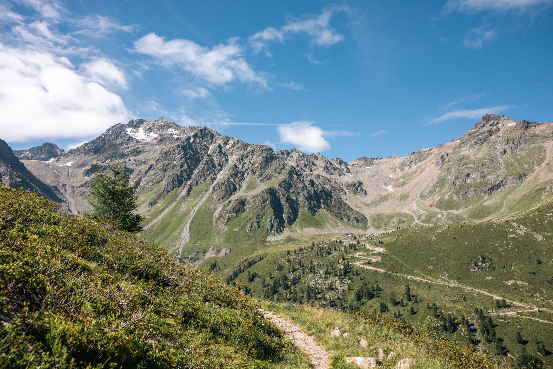
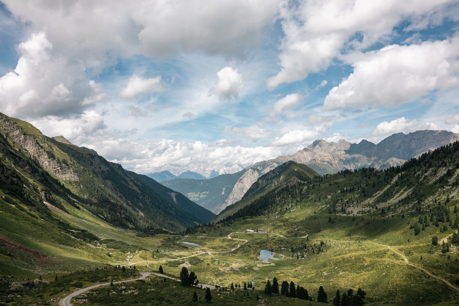
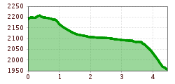
The conclusion of the trekking tour is a leisurely "migrating out" along historic paths. From the Frischmann Hut, you start flat and gently uphill towards the "Waalweg," a historic path beside a small brook, which shortly afterward along the way was channeled with wooden troughs and ingenious guiding systems to a irrigation canal for fields and alpine pastures. With a magnificent view over the Fundus Valley, you then reach the Köfler Pass, from there it's only a short leap between the alpine roses to descend to the Hintere Fundus Alm. There the local hut taxi awaits to bring the participants back down to the valley to their accommodation.


Nearby huts and mountain restaurants

More tours in the surrounding area

  • Ötztal Trek Stage 6

    Difficulty:difficult
    Length:7.6 kmDuration:3:30 hElevation uphill:640 m
  • Ötztal Trek Stage 7

    Difficulty:difficult
    Length:5.3 kmDuration:2:00 hElevation uphill:376 m
  • Ötztal Trek Stage 17

    Difficulty:difficult
    Length:16.4 kmDuration:6:00 hElevation uphill:1,080 m
  • Ötztal Trek Stage 16

    Difficulty:difficult
    Length:6.9 kmDuration:2:30 hElevation uphill:358 m
  • Ötztal Trek Stage 12

    Difficulty:difficult
    Length:4.8 kmDuration:2:00 hElevation uphill:592 m
  • Ötztal Trek Stage 4

    Difficulty:difficult
    Length:8.9 kmDuration:4:00 hElevation uphill:802 m
  • Ötztal Trek Stage 3

    Difficulty:difficult
    Length:10.4 kmDuration:4:00 hElevation uphill:842 m
  • Ötztal Trek Stage 1

    Difficulty:medium
    Length:18.6 kmDuration:6:30 hElevation uphill:1,561 m
  • Ötztal Trek Stage 14

    Difficulty:difficult
    Length:6.3 kmDuration:3:00 hElevation uphill:1,004 m
  • Ötztal Trek Stage 20

    Opening hours:closed
    Difficulty:medium
    Length:6.4 kmDuration:3:00 hElevation uphill:610 m
  • Ötztal Trek Stage 10

    Difficulty:difficult
    Length:11.1 kmDuration:4:30 hElevation uphill:1,476 m
  • Ötztal Trek Stage 8

    Difficulty:difficult
    Length:9.3 kmDuration:3:30 hElevation uphill:274 m
  • Ötztal Trek

    Length:246.4 kmDuration:84:25 hElevation uphill:18,910 m
  • Ötztal Trek Stage 11

    Difficulty:difficult
    Length:12.0 kmDuration:5:00 hElevation uphill:705 m
  • Mutsbühl

    Difficulty:medium
    Length:4.5 kmDuration:1:30 hElevation uphill:470 m
  • Stuibenfall hike - Umhausen

    Opening hours:open
    Difficulty:easy
    Length:2.9 kmDuration:1:45 hElevation uphill:456 m
  • Mountain peak Rosskopf

    Difficulty:medium
    Length:2.0 kmDuration:2:00 hElevation uphill:379 m
Newsletter

The mountain is calling? So does our newsletter!

In our monthly newsletter we reveal the best holiday tips for Tyrol.