Mountain hikes Summit route Weather Cross from Hochoetz

Oetz / Stubaier Alpen
Difficulty ratings: medium
Route length: 3.0 km
Duration: 2:30 h

PANORAMA RESTAURANT HOCHOETZ -> Bielefelder Hut -> WEATHER CROSS

Tour information

  • Requirement: medium
  • Length: 3.0 km
  • Duration: 2:30 h
  • Elevation uphill:571 hm
  • Elevation downhill:1 hm
Highest point2,591 m

Starting point

Panorama Restaurant Hochoetz

Finishing point

Weather Cross
  • Fitness level 3 / 6

Best time of year

  • January
  • February
  • March
  • April
  • May
  • June
  • July
  • August
  • September
  • October
  • November
  • December

Equipment

Moderate mountain path; suitable for sure-footed and experienced mountain hikers; good physical condition, mountain experience, and equipment (see equipment section) necessary. Please check the current weather report at: www.oetztal.com/de/sommer.html Appropriate equipment such as breathable and weather-appropriate outdoor clothing, ankle-high hiking boots, wind, rain, and sun protection, a hat, and possibly gloves are required for all hikes and tours. It is necessary to carry a first-aid kit, a mobile phone, and possibly a hiking map, as well as enough provisions for hikes without catering options.
Source: Ötztal

Description

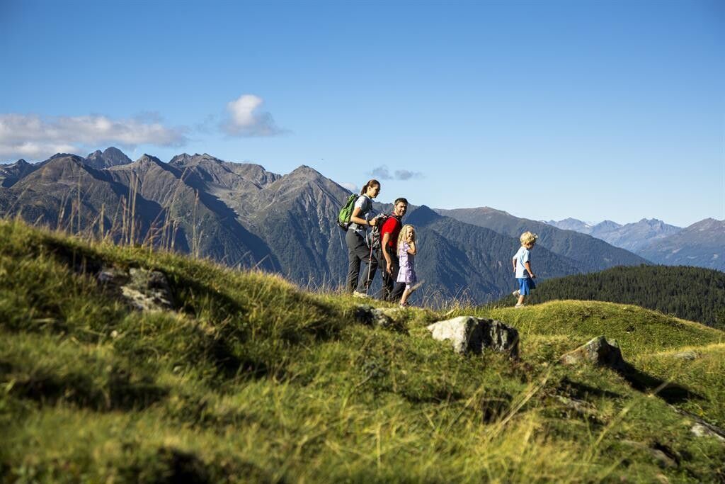
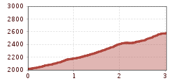
From the mountain station of the Acherkogelbahn, walk on the wide forest road to the Bielefelder Hut (2,150 m). Pass the hut and reach a steep path towards Mohrenkopf. Below the summit, the well-trodden "Reflection Path" branches off to the right. Follow it for a while until a junction. There, keep left and hike up over the Rosskopf to the weather cross (2,591 m). Several options are available for the return journey.

1) Same way back

2) Descent through the Wörgetal - along the Knappenweg and then to the Balbach Alm and back to the mountain station (duration of the entire round approx. 6h)

3) Descent to the old Bielefelder Hut. This path is partly exposed and requires some mountain experience. From the dilapidated hut, go to the Acherberg Alm (1,888 m) and then slightly uphill back to the panorama restaurant.


Nearby huts and mountain restaurants

Getting here

  • Arrival by public transport

    Travel comfortably and safely by train to the Ötztal train station. The final station or exit point is the ÖTZTAL station. Then travel conveniently and quickly with public transport or local taxi companies throughout the valley to your desired destination! The current bus schedule is available at: http://fahrplan.vvt.at

  • Parking

    The following parking options are available:

    • Acherkogelbahn parking lot (fee required)
    • Rafting entry point parking lot (at the end of Oetz on the right side) (fee required)
    • Oetz center parking lot (fee required)
    • Parking overnight during multi-day tours: Oetz center parking lot, tickets are available at the Oetz information office.
    • If you take the Ochsengarten gondola, free parking is available in Ochsengarten - camping prohibited

More tours in the surrounding area

Newsletter

The mountain is calling? So does our newsletter!

In our monthly newsletter we reveal the best holiday tips for Tyrol.