Mountain hikes Valluga- Ulmer Hütte - Steißbachtal - St. Anton

closed
Difficulty ratings: medium
Route length: 9.1 km
Duration: 4:00 h

Valluga- Ulmer Hütte - Steißbachtal - St. Anton

Tour information

  • Requirement: medium
  • Length: 9.1 km
  • Duration: 4:00 h
  • Elevation downhill:1,500 hm
Highest point2,802 m

Starting point

Valluga

Finishing point

Arlberg WellCom

Best time of year

  • January
  • February
  • March
  • April
  • May
  • June
  • July
  • August
  • September
  • October
  • November
  • December

Trail condition

Panoramic hike, alpine

Equipment

Good walking boots, poles and drinks/snacks, rain jacket, sun protection

Description

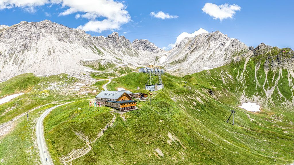
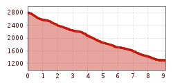
Take the cable car up to the Val- View of the Gampen from the Arlensattel luga Ridge. From the mountain station, head down the snow field on the switchback curves to the Valfagehrjoch. From there, continue down to the Ulmer Hütte. Follow the AV 645 (Adlerweg) into the Steißbachtal and to St. Anton via Moos.

Nearby huts and mountain restaurants

More tours in the surrounding area

Newsletter

The mountain is calling? So does our newsletter!

In our monthly newsletter we reveal the best holiday tips for Tyrol.