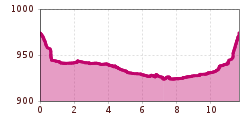
Open interactive mapOpen this POI on the interactive mapElevation profileWinterwanderweg Flussweg.gpx
Ötztal Trek Stage 6Difficulty: difficult Length: 7.6 km Duration: 3:30 h Elevation uphill: 640 m See trailSee trail: Ötztal Trek Stage 6
Ötztal Trek Stage 2Difficulty: difficult Length: 10.7 km Duration: 4:00 h Elevation uphill: 926 m See trailSee trail: Ötztal Trek Stage 2
Ötztal Trek Stage 7Difficulty: difficult Length: 5.3 km Duration: 2:00 h Elevation uphill: 376 m See trailSee trail: Ötztal Trek Stage 7
Ötztal Trek Stage 17Difficulty: difficult Length: 16.4 km Duration: 6:00 h Elevation uphill: 1,080 m See trailSee trail: Ötztal Trek Stage 17
Ötztal Trek Stage 20Opening hours: closed Difficulty: medium Length: 6.4 km Duration: 3:00 h Elevation uphill: 610 m See trailSee trail: Ötztal Trek Stage 20
Ötztal Trek Stage 19Difficulty: difficult Length: 11.0 km Duration: 5:00 h Elevation uphill: 1,246 m See trailSee trail: Ötztal Trek Stage 19
Summit hike: Ginzling Schlegeis reservoir - Hoher RifflerDifficulty: difficult Length: 17.0 km Duration: 7:30 h Elevation uphill: 1,500 m See trailSee trail: Summit hike: Ginzling Schlegeis reservoir - Hoher Riffler
Ötztal Trek Stage 11Difficulty: difficult Length: 12.0 km Duration: 5:00 h Elevation uphill: 705 m See trailSee trail: Ötztal Trek Stage 11
Vent - Hochjoch Hospiz - Brandenburger HausDifficulty: difficult Length: 14.7 km Duration: 6:00 h Elevation uphill: 1,573 m See trailSee trail: Vent - Hochjoch Hospiz - Brandenburger Haus
Winter hiking trail to Rotes Wandl vantage pointOpening hours: closed Difficulty: easy Length: 1.5 km Duration: 0:45 h Elevation uphill: 52 m Go to winter hikeGo to winter hike: Winter hiking trail to Rotes Wandl vantage point
Ötztal Trek Stage 4Difficulty: difficult Length: 8.9 km Duration: 4:00 h Elevation uphill: 802 m See trailSee trail: Ötztal Trek Stage 4
Ötztal Trek Stage 3Difficulty: difficult Length: 10.4 km Duration: 4:00 h Elevation uphill: 842 m See trailSee trail: Ötztal Trek Stage 3
Ötztal Trek Stage 9Difficulty: difficult Length: 12.8 km Duration: 6:00 h Elevation uphill: 1,623 m See trailSee trail: Ötztal Trek Stage 9
Ötztal TrekLength: 246.4 km Duration: 84:25 h Elevation uphill: 18,910 m See trailSee trail: Ötztal Trek
Ötztal Trek Stage 14Difficulty: difficult Length: 6.3 km Duration: 3:00 h Elevation uphill: 1,004 m See trailSee trail: Ötztal Trek Stage 14
Ötztal Trek Stage 18Difficulty: difficult Length: 9.5 km Duration: 9:30 h Elevation uphill: 979 m See trailSee trail: Ötztal Trek Stage 18
Fernar Trail (6041)Difficulty: difficult Length: 6.0 km Duration: 0:49 h Elevation uphill: 18 m Go to biketourGo to biketour: Fernar Trail (6041)
Erlanger Hütte - Umhausen-NiederthaiDifficulty: difficult Length: 10.5 km Duration: 5:30 h Elevation uphill: 1,550 m See trailSee trail: Erlanger Hütte - Umhausen-Niederthai
Ötztal Trek Stage 21Difficulty: difficult Length: 9.4 km Duration: 4:30 h Elevation uphill: 1,270 m See trailSee trail: Ötztal Trek Stage 21
Ötztal Trek Stage 1Difficulty: medium Length: 18.6 km Duration: 6:30 h Elevation uphill: 1,561 m See trailSee trail: Ötztal Trek Stage 1
Ötztal Trek Stage 12Difficulty: difficult Length: 4.8 km Duration: 2:00 h Elevation uphill: 592 m See trailSee trail: Ötztal Trek Stage 12
Lehner Wasserfall - Kraftquell LängenfeldDifficulty: easy Length: 540 m Duration: 0:25 h Elevation uphill: 239 m See trailSee trail: Lehner Wasserfall - Kraftquell Längenfeld
Cross-country trail HubenOpening hours: closed Difficulty: easy Length: 1.7 km Duration: 20:00 h Elevation uphill: 5 m : Style: Skating, Classic Go to Cross-country skiing trailGo to Cross-country skiing trail: Cross-country trail Huben
Mountain peak RosskopfDifficulty: medium Length: 2.0 km Duration: 2:00 h Elevation uphill: 379 m See trailSee trail: Mountain peak Rosskopf
Vent - Similaunhütte - Ötzi-FundstelleDifficulty: medium Length: 14.9 km Duration: 6:00 h Elevation uphill: 1,397 m See trailSee trail: Vent - Similaunhütte - Ötzi-Fundstelle
Give feedback for a chance to win a special holiday experience!Click here for the surveyClick here for the survey


")


