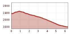
Mountain hikes Auf den Spuren des Wassers - Tag 5

Längenfeld / Stubaier Alpen
Difficulty ratings: medium
Route length: 6.3 km
Duration: 2:30 h

 5-Tagestour im Ötztal über 4 Gipfel auf den Spuren des Wassers

Tour information

  • Requirement: medium
  • Length: 6.3 km
  • Duration: 2:30 h
  • Elevation uphill:150 hm
  • Elevation downhill:940 hm
Highest point2,507 m

Starting point

Winnebach-see-hut

Finishing point

Gries
  • Fitness level 3 / 6

Equipment

Suitable for hikers with a good head for heights and surefootedness. A good physical condition, some alpine experience, and proper mountain equipment are recommended. Please check the current weather report. Proper equipment for alpine mountain hikes is essential for all tours in the Alps. Surefooted hiking boots or mountain shoes, a breathable outdoor pants, a rain jacket, as well as a backpack with provisions, drinks, and a first-aid kit are always part of the standard gear. Sunglasses, sunscreen, headwear such as a bandana or hiking hat are also highly recommended, along with a warm second jacket, trekking poles, and gloves if needed. The choice of clothing should always be adapted to the current weather conditions.
Source: TVB Ötztal Tourismus

Description

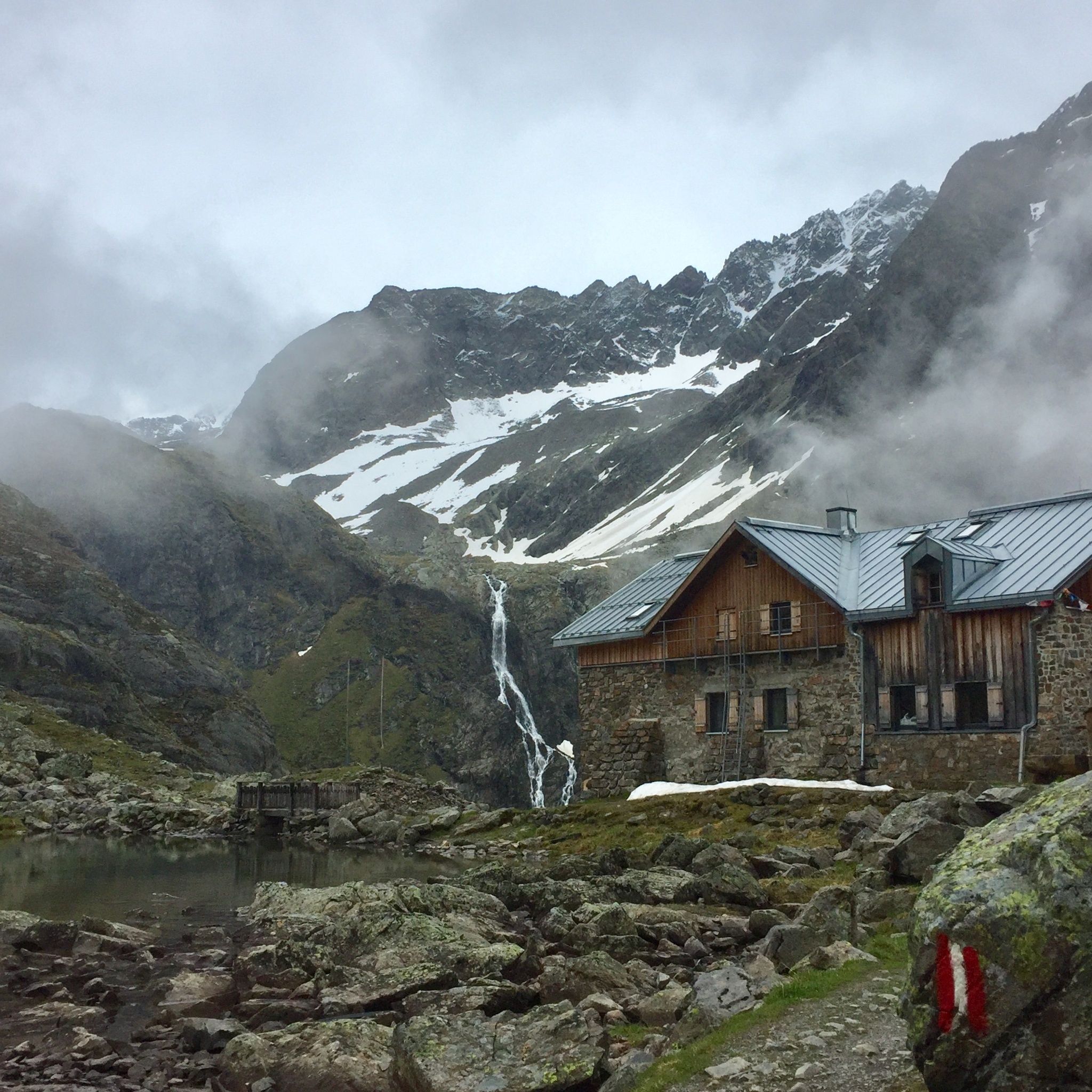
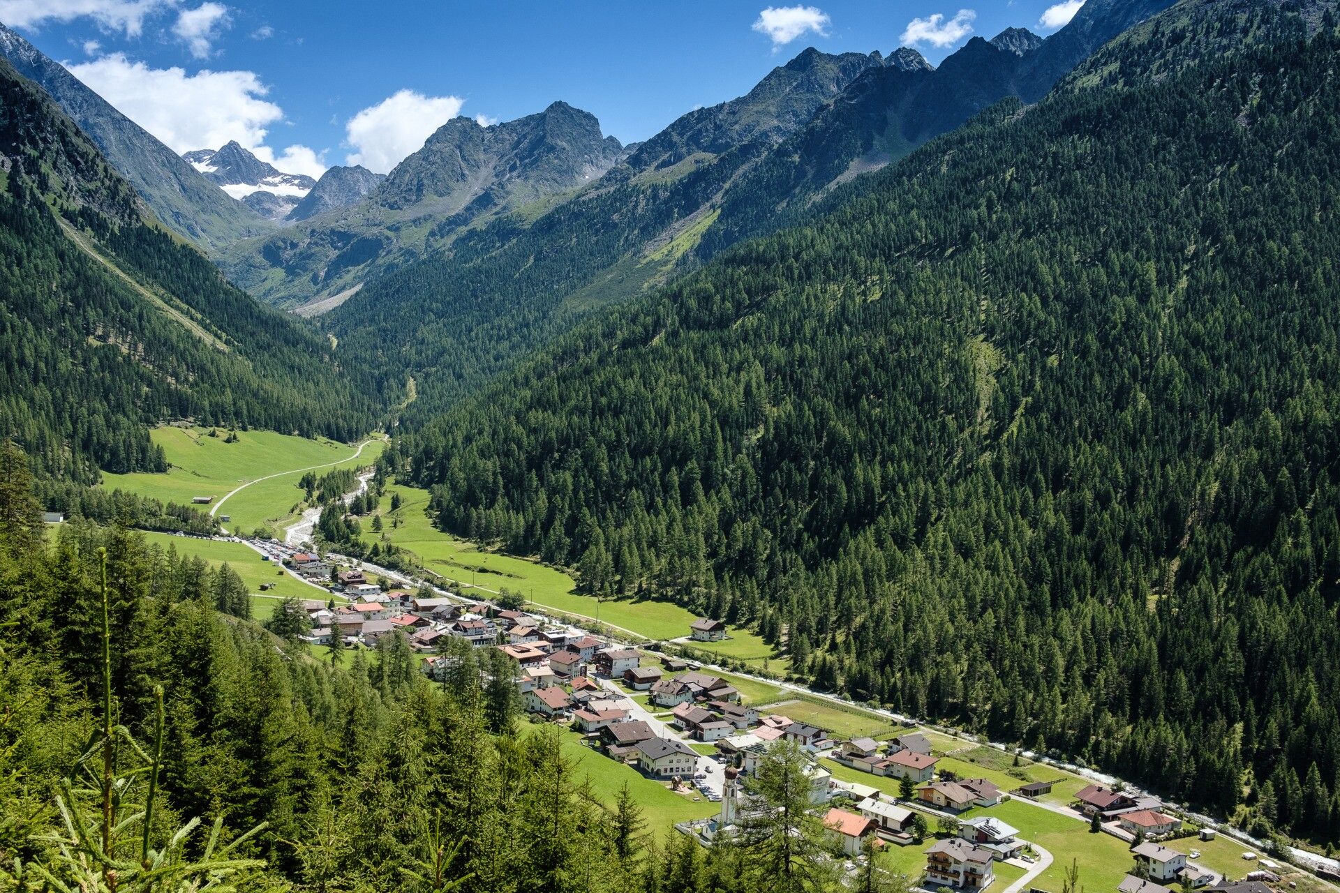
Frühstück auf der Winnebach-See-Hütte und Aufbruch zum letzten Gipfelerlebnis vor dem AbstiegNach dem gemütlichen Frühstück folgt zum Abschluss noch ein letzter Gipfel bevor es zurück ins Sulztal geht. Die Erst Riml Spitze auf 2.507m ist in einer knappen Dreiviertelstunde und in unter 200 Höhenmetern von der Hütte zur erreichen.Nach diesem letzten Gipfelerlebnis folgt ein gemütlicher und sehr schöner Abstieg entlang des Winnebaches zum Wanderdorf Gries im Sulztal. Nach einer Einkehr dort bringt uns das Wandertaxi zurück zum Ausgangspunkt nach Oetz.


More tours in the surrounding area

  • Ötztal Trek Stage 4

    Difficulty: difficult
    Length: 8.9 km Duration: 4:00 h Elevation uphill: 802 m
  • Ötztal Trek Stage 3

    Difficulty: difficult
    Length: 10.4 km Duration: 4:00 h Elevation uphill: 842 m
  • Ötztal Trek Stage 8

    Difficulty: difficult
    Length: 9.3 km Duration: 3:30 h Elevation uphill: 274 m
  • Ötztal Trek Stage 1

    Difficulty: medium
    Length: 18.6 km Duration: 6:30 h Elevation uphill: 1,561 m
  • Ötztal Trek Stage 14

    Difficulty: difficult
    Length: 6.3 km Duration: 3:00 h Elevation uphill: 1,004 m
  • Ötztal Trek Stage 20

    Opening hours: closed
    Difficulty: medium
    Length: 6.4 km Duration: 3:00 h Elevation uphill: 610 m
  • Ötztal Trek Stage 5

    Difficulty: difficult
    Length: 8.1 km Duration: 3:30 h Elevation uphill: 1,125 m
  • Ötztal Trek Stage 6

    Difficulty: difficult
    Length: 7.6 km Duration: 3:30 h Elevation uphill: 640 m
  • Ötztal Trek Stage 10

    Difficulty: difficult
    Length: 11.1 km Duration: 4:30 h Elevation uphill: 1,476 m
  • Ötztal Trek Stage 7

    Difficulty: difficult
    Length: 5.3 km Duration: 2:00 h Elevation uphill: 376 m
  • Ötztal Trek

    Length: 246.4 km Duration: 84:25 h Elevation uphill: 18,910 m
  • Ötztal Trek Stage 17

    Difficulty: difficult
    Length: 16.4 km Duration: 6:00 h Elevation uphill: 1,080 m
  • Ötztal Trek Stage 16

    Difficulty: difficult
    Length: 6.9 km Duration: 2:30 h Elevation uphill: 358 m
  • Ötztal Trek Stage 11

    Difficulty: difficult
    Length: 12.0 km Duration: 5:00 h Elevation uphill: 705 m
  • Ötztal Trek Stage 12

    Difficulty: difficult
    Length: 4.8 km Duration: 2:00 h Elevation uphill: 592 m
  • Ötztaler Urweg

    Length: 189.1 km Duration: 72:19 h Elevation uphill: 9,428 m
  • Ötztal Trek Stage 21

    Difficulty: difficult
    Length: 9.4 km Duration: 4:30 h Elevation uphill: 1,270 m
  • Vent - Breslauer Hütte - Vernagthütte

    Difficulty: medium
    Length: 10.4 km Duration: 4:00 h Elevation uphill: 1,203 m
  • Ötztal Trek Stage 22

    Difficulty: difficult
    Length: 21.5 km Duration: 8:00 h Elevation uphill: 647 m
Newsletter

The mountain is calling? So does our newsletter!

In our monthly newsletter we reveal the best holiday tips for Tyrol.