Badesee Ried | accessible

Ried im Oberinntal / Ötztal Alps
Difficulty ratings: medium
Route length: 2.8 km
Duration: 0:25 h

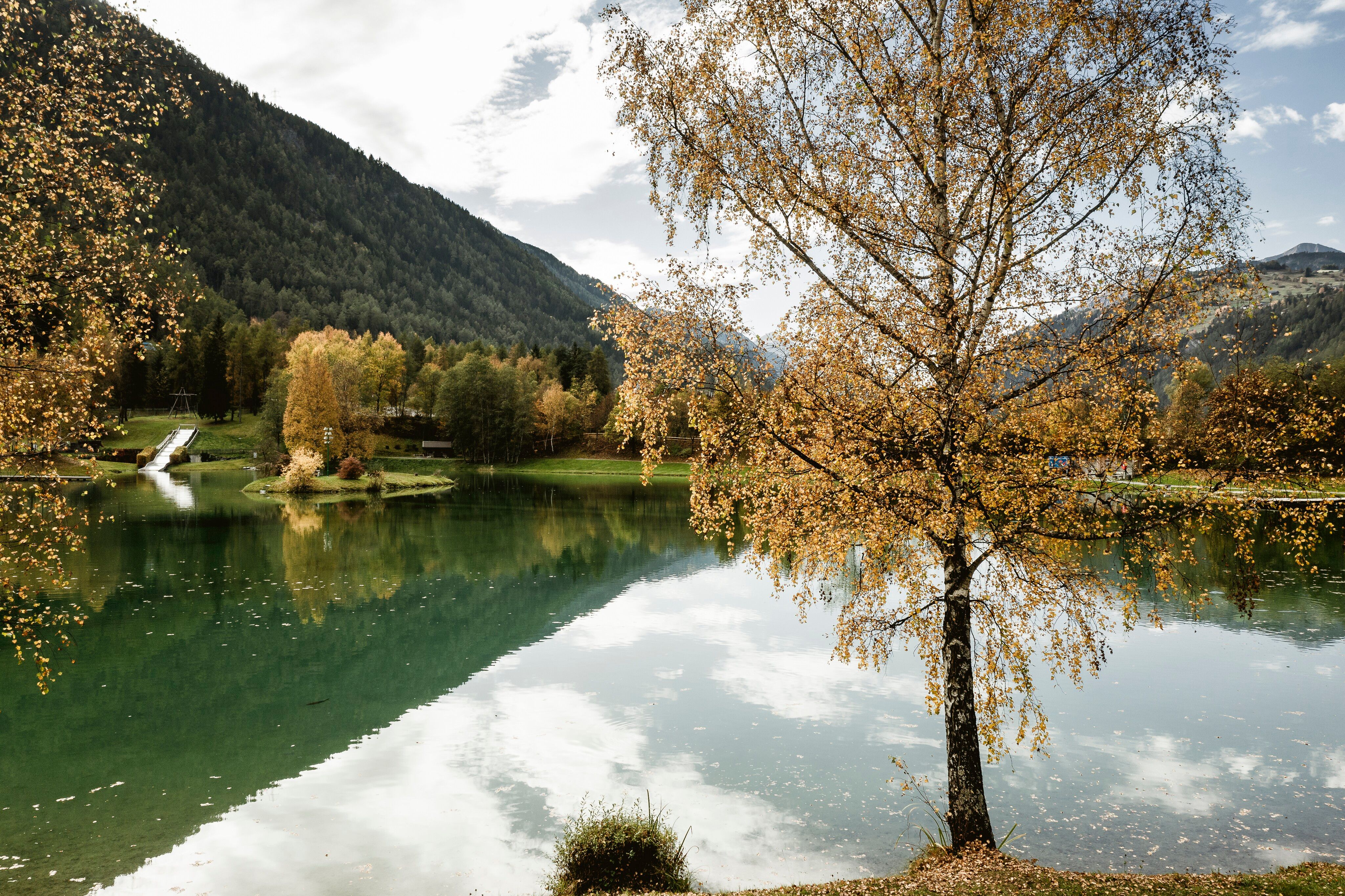
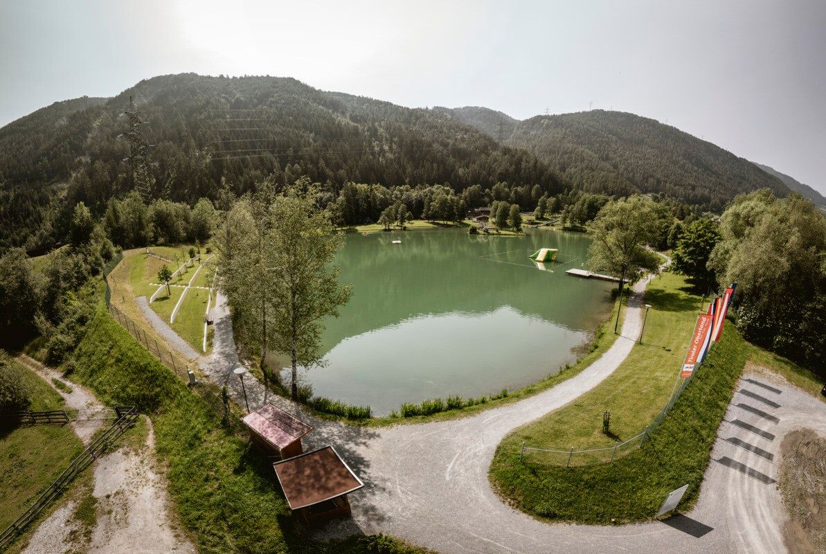
An idyllic walk from the village centre to the picturesque swimming lake in Ried.
Tour information

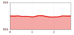
  • Requirement: medium
  • Length: 2.8 km
  • Duration: 0:25 h
  • Elevation uphill:10 hm
  • Elevation downhill:10 hm
Highest point877 m

Starting point

Infobüro | Ried

Finishing point

Infobüro | Ried
  • Fitness level 2 / 6
  • Technique 2 / 6

Features

  • Wheelchair hike

Best time of year

  • January
  • February
  • March
  • April
  • May
  • June
  • July
  • August
  • September
  • October
  • November
  • December

Trail condition

asphalt, gravel

Equipment

We recommend equipment suitable for the tour and weather conditions, including sturdy shoes, weatherproof clothing, food, and appropriate maps.
Source: TVB Tiroler Oberland

Description

The route starts at the information office in Ried im Oberinntal and is cycled anti-clockwise. It is classified as moderately difficult overall, is mostly well-surfaced with tarmac and fine gravel, features mainly gentle gradients, and is stable throughout and generally comfortable to cycle on.

Getting here

  • Arrival by public transport

    Line 210, 220, Bus stop: Ried i. O. Gemeindeamt, walking distance to the tourist information office: 200 m

  • Parking

    Drive to Ried im Oberinntal, to the parking area at the lake.
    Parking area at the lake, free of charge

Weather

Today

mainly clear
15°C/4°C
5%0l5 km/h

Tue

mainly clear
16°C/1°C
40%0.4l5 km/h

Wed

partly Cloudy
19°C/7°C
35%0l5 km/h
Go to weather forecast

More tours in the surrounding area

  • Rolli-Wanderung Nassereinalm

    Difficulty:medium
    Length:5.5 kmDuration:1:45 hElevation uphill:269 m
  • Rolli-Wanderung Gepatschhaus

    Length:8.5 kmDuration:1:45 hElevation uphill:156 m
  • Rolli-Wanderung Aifner Alm

    Difficulty:medium
    Length:6.0 kmDuration:2:30 hElevation uphill:460 m
  • Rolli-Wanderung Falkaunsalm

    Difficulty:medium
    Length:4.5 kmDuration:1:45 hElevation uphill:392 m
  • Sternenweg im Gepatsch

    Difficulty:medium
    Length:4.0 kmDuration:1:30 hElevation uphill:202 m
  • Großer Mutzkopf

    Opening hours:closed
    Difficulty:easy
    Length:10.3 kmDuration:4:00 hElevation uphill:507 m
  • Talwanderweg Kaunertal

    Difficulty:easy
    Duration:2:30 hElevation uphill:295 m
  • Kaunerberger Wasserweg

    Opening hours:open
    Difficulty:medium
    Length:15.2 kmDuration:6:00 hElevation uphill:935 m
  • Hohe Aifnerspitze (2.779 m)

    Difficulty:medium
    Length:7.2 kmDuration:5:15 hElevation uphill:815 m
  • Gletscherlehrpfad Gepatschferner

    Difficulty:medium
    Length:8.4 kmDuration:3:45 hElevation uphill:400 m
  • Rundwanderung Frudiger

    Difficulty:medium
    Length:13.5 kmDuration:4:55 hElevation uphill:588 m
  • Kapelle Maria Schnee

    Difficulty:easy
    Length:1.7 kmDuration:0:30 hElevation uphill:90 m
  • Radurschlklamm Gorge

    Opening hours:open
    Difficulty:medium
    Length:7.5 kmDuration:3:20 hElevation uphill:442 m
  • Verpeilschlucht

    Opening hours:open
    Difficulty:medium
    Length:4.9 kmDuration:3:00 hElevation uphill:386 m
  • Ötztal Trek Stage 15

    Difficulty:difficult
    Length:6.5 kmDuration:2:30 hElevation uphill:332 m
Newsletter

The mountain is calling? So does our newsletter!

In our monthly newsletter we reveal the best holiday tips for Tyrol.