Mountain hikes Beautiful path to the restaurant Stablein

Sölden /
Difficulty ratings: medium
Route length: 2.0 km
Duration: 1:04 h

Steep hiking trail below the double chairlift to the panoramic restaurant Stableinalm (closed in summer 2022).

Tour information

  • Requirement: medium
  • Length: 2.0 km
  • Duration: 1:04 h
  • Elevation uphill:461 hm
Highest point2,353 m

Starting point

Bergsteigerdorf Vent - P9

Finishing point

Stableinalm
  • Fitness level 3 / 6

Best time of year

  • January
  • February
  • March
  • April
  • May
  • June
  • July
  • August
  • September
  • October
  • November
  • December

Equipment

It is recommended to wear hiking equipment such as breathable and weather-adapted outdoor clothing, ankle-high mountain boots, wind, rain and sun protection, cap and possibly gloves. It is also important to have enough food, as well as a first-aid package, a cell phone and a hiking map.
Source: Ötztal

Description

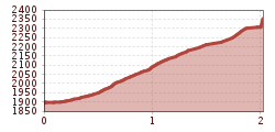
The way starts at the exit P9, follow the way and and the fence, the trail leads off to the left. And now we climb quite steeply in numerous serpetines to the Stableinalm. If we look back, we always have a wonderful view of the mountaineering village and the surrounding mountains.

Nearby huts and mountain restaurants

Getting here

  • Arrival by public transport

    Enjoy a both comfortable and relaxing train ride to the train station in Ötztal Bahnhof. You get off the train in ÖTZTAL Bahnhof where you change to a public bus or local taxi. The current bus schedule can be found at: http://fahrplan.vvt.at

  • Parking

    Available parking in Vent:

    In front of the village and at the valley station of the chairlift - chargeable

More tours in the surrounding area

Newsletter

The mountain is calling? So does our newsletter!

In our monthly newsletter we reveal the best holiday tips for Tyrol.