Mountain hikes Border tour Plamortboden via Kompatsch
Nauders / Ötztal Alps
Difficulty ratings: easy
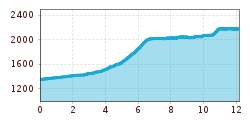
Route length: 12.2 km
Duration: 4:30 h

Border tour Plamortboden via Kompatsch
Tour information

  • Requirement: easy
  • Length: 12.2 km
  • Duration: 4:30 h
  • Elevation uphill:907 hm
  • Elevation downhill:99 hm
Highest point2,188 m

Starting point

Nauders

Finishing point

Nauders

Features

  • Circular route
Source: TVB Tiroler Oberland

Description

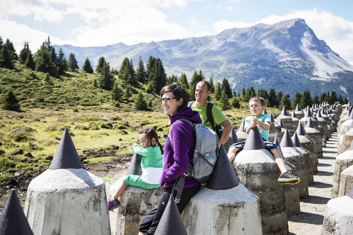
Starting from Nauders, the route first goes along Via Claudia Augusta no. 26, past the Bergkastel valley station, towards the Italian border. In the Fuhrmannsloch district, branch off to the left and follow a narrow path No 27. Then a forest path leads after approximately 250 metres to the Kompatscher stream. The route continues to the left via an old cart track to the Kompatschhof with a beautiful chapel. Trail no. 37 begins above the mountain farm. The mountain trail leads through a varied forest to the Italian border. If you are in good condition, you can take a detour to the tank traps and the lookout rock. Trail no.36 leads over the Plamortboden slightly uphill to Stieralm and after a stop, further to the mountain station of the Bergkastel cable car (no.33).
 

Weather

Today

partly Cloudy
16°C/6°C
50%0.3l5 km/h

Sat

clear sky
19°C/4°C
0%0l5 km/h

Sun

mainly clear
20°C/6°C
30%0.7l5 km/h
Go to weather forecast

More tours in the surrounding area

  • Großer Mutzkopf

    Opening hours:closed
    Difficulty:easy
    Length:10.3 kmDuration:4:00 hElevation uphill:507 m
  • Ötztal Trek Stage 15

    Difficulty:difficult
    Length:6.5 kmDuration:2:30 hElevation uphill:332 m
  • Rolli-Wanderung Aifner Alm

    Difficulty:medium
    Length:6.0 kmDuration:2:30 hElevation uphill:460 m
  • Rolli-Wanderung Nassereinalm

    Difficulty:medium
    Length:5.5 kmDuration:1:45 hElevation uphill:269 m
  • Rolli-Wanderung Gepatschhaus

    Length:8.5 kmDuration:1:45 hElevation uphill:156 m
  • Rolli-Wanderung Falkaunsalm

    Difficulty:medium
    Length:4.5 kmDuration:1:45 hElevation uphill:392 m
  • Talwanderweg Kaunertal

    Difficulty:easy
    Duration:2:30 hElevation uphill:295 m
  • Kaunerberger Wasserweg

    Opening hours:closed
    Difficulty:medium
    Length:15.2 kmDuration:6:00 hElevation uphill:935 m
  • Gletscherlehrpfad Gepatschferner

    Difficulty:medium
    Length:8.4 kmDuration:3:45 hElevation uphill:400 m
  • Hohe Aifnerspitze (2.779 m)

    Difficulty:medium
    Length:7.2 kmDuration:5:15 hElevation uphill:815 m
  • Kapelle Maria Schnee

    Difficulty:easy
    Length:1.7 kmDuration:0:30 hElevation uphill:90 m
  • Radurschlklamm Gorge

    Opening hours:open
    Difficulty:medium
    Length:7.5 kmDuration:3:20 hElevation uphill:442 m
  • Rundwanderung Frudiger

    Difficulty:medium
    Length:13.5 kmDuration:4:55 hElevation uphill:588 m
  • Verpeilschlucht

    Opening hours:open
    Difficulty:medium
    Duration:3:00 hElevation uphill:386 m
Newsletter

The mountain is calling? So does our newsletter!

In our monthly newsletter we reveal the best holiday tips for Tyrol.