
Opening hours:Open today
Place:Obergurgl
:Alpine pasture / hut / mountain restaurant
CENTER OBERGURGL -> Hohe Mut Bahn -> Schönwieshütte -> Langtalereckhütte -> Piccard Bridge -> Shepherd's Path -> CENTER GURGL
Black mountain paths are narrow, almost entirely steep and exposed trails. Anyone embarking on a black mountain path must expect longer secured walking and climbing passages. Black mountain paths are marked on the yellow base signs with a black circle as a difficulty rating. Suitable for sure-footed, experienced alpine climbers without vertigo; very good physical condition, alpine experience, and mountain equipment (see under Equipment), sometimes alpine securing means, good weather conditions are recommended.
Please check the current weather report: www.gurgl.com/de/sommer/live-info/weather/wetter-heute.html
Wearing hiking equipment such as breathable and weather-appropriate outdoor clothing, ankle-high hiking boots, wind, rain, and sun protection, a hat, and possibly gloves is recommended! It is also important to bring sufficient provisions as well as a first aid kit, a mobile phone, and possibly a hiking map.
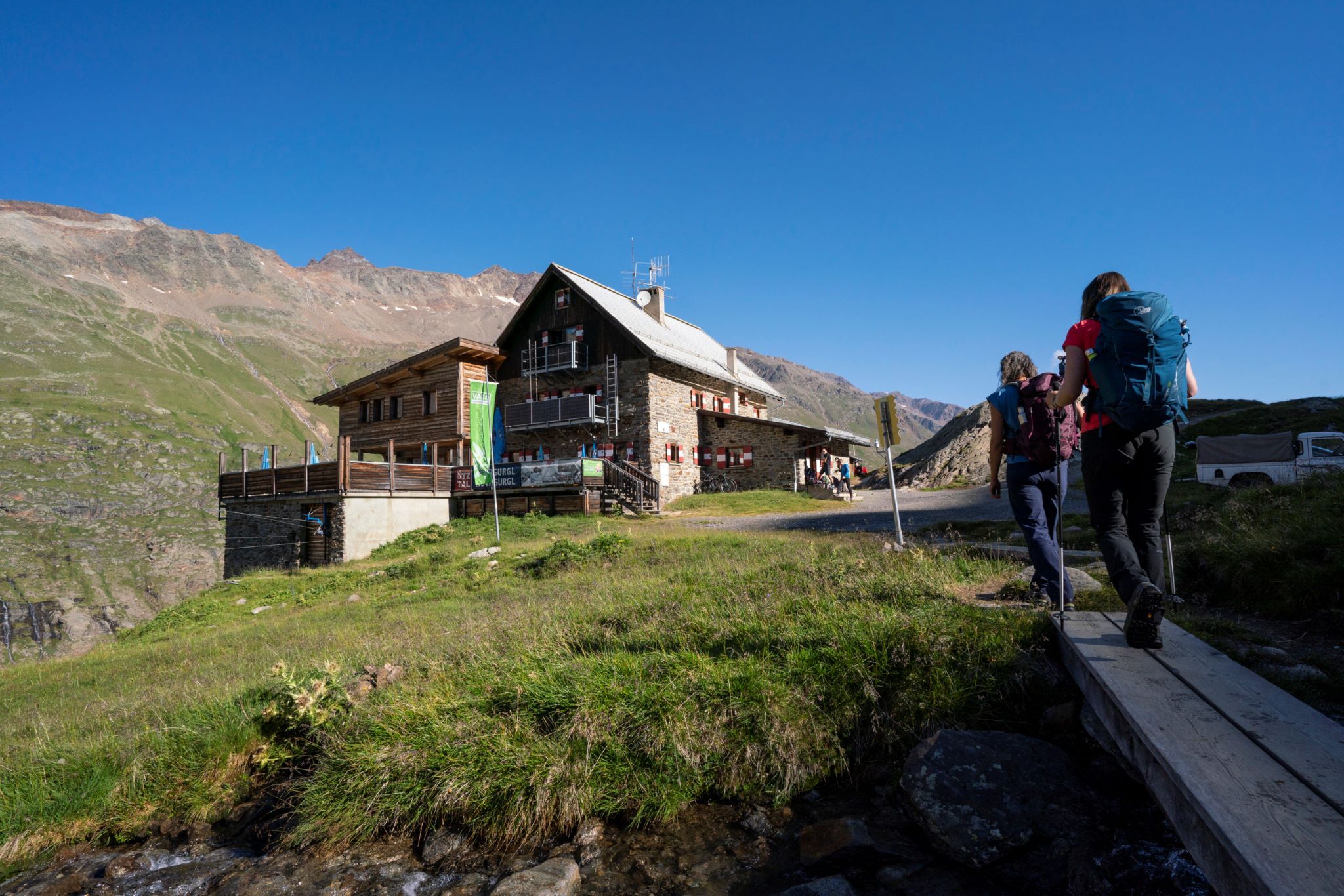
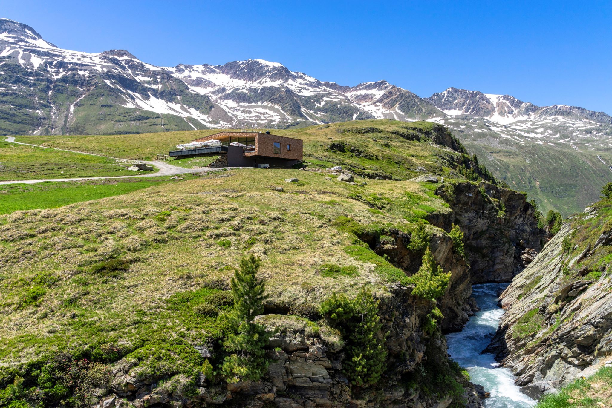
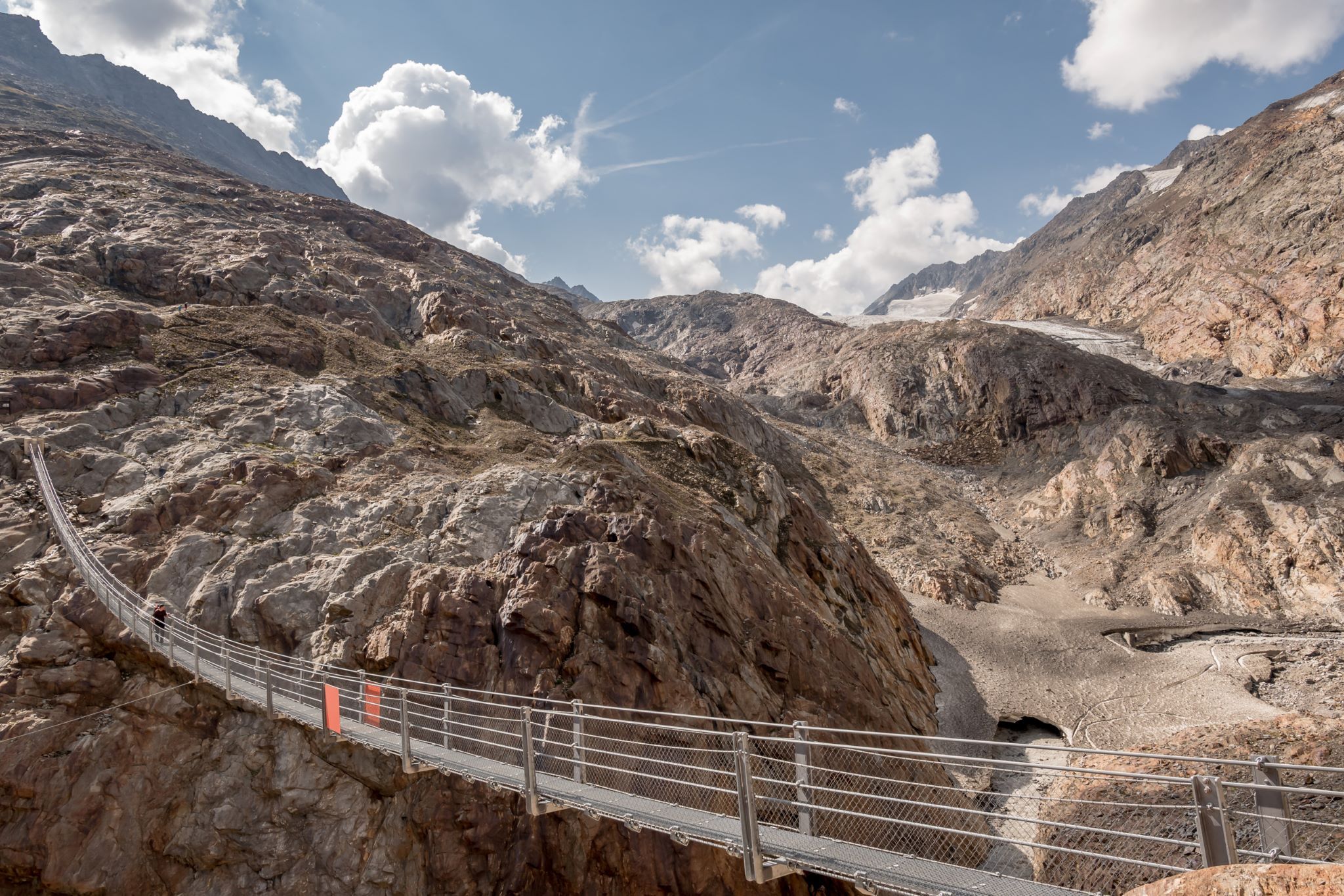
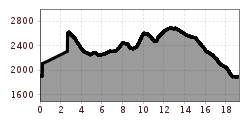
From the center in Obergurgl, follow the street until the base station of the Hohe Mut Bahn and enjoy the ascent up to 2,670 meters above sea level. Behind the Hohe Mut Alm, hike along the narrow path. Follow the switchbacks down until you reach the reservoir pond. From there, you can already see the Schönwieshütte. Then it leads valleywards past a small chapel, ascends to the old customs hut, and leads over the saddle to the Langtalereckhütte. The Piccard Bridge crosses over the remains of the glacier tongue of the Gurgler Ferner. Below the Ramol house, follow the shepherd’s path towards the valley floor. Almost at the end of the hike, walk down the steep grassy slopes until you reach the paved road. From there, return to the village center of Gurgl.
Travel comfortably and safely by train to the Ötztal station. The final stop and exit point is ÖTZTAL station. Afterwards, you can travel comfortably and quickly by public transport or local taxi companies through the entire valley to your desired destination. The current bus schedule can be found at: fahrplan.vvt.at.
The following parking options are available in Gurgl:


")


