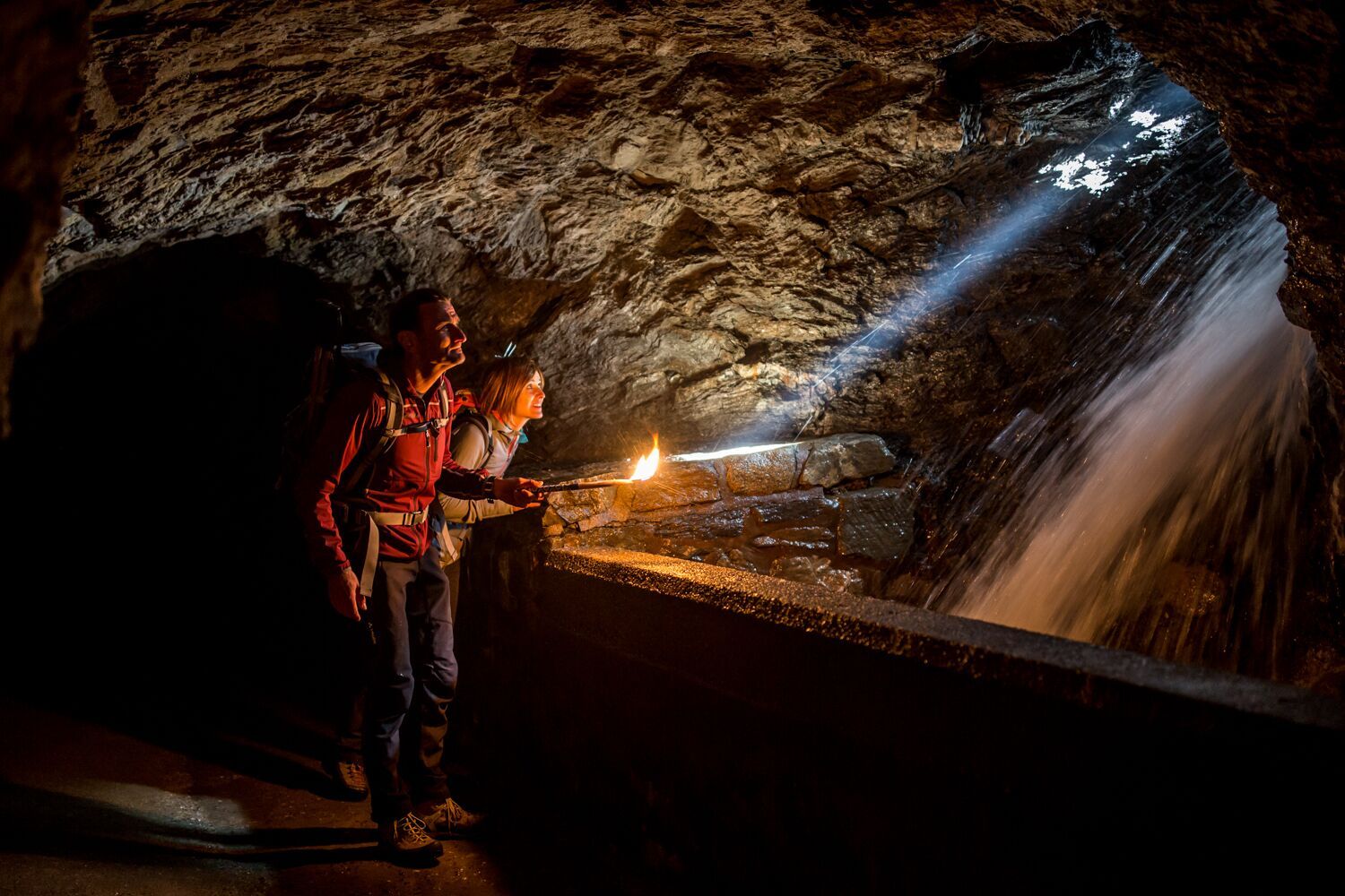
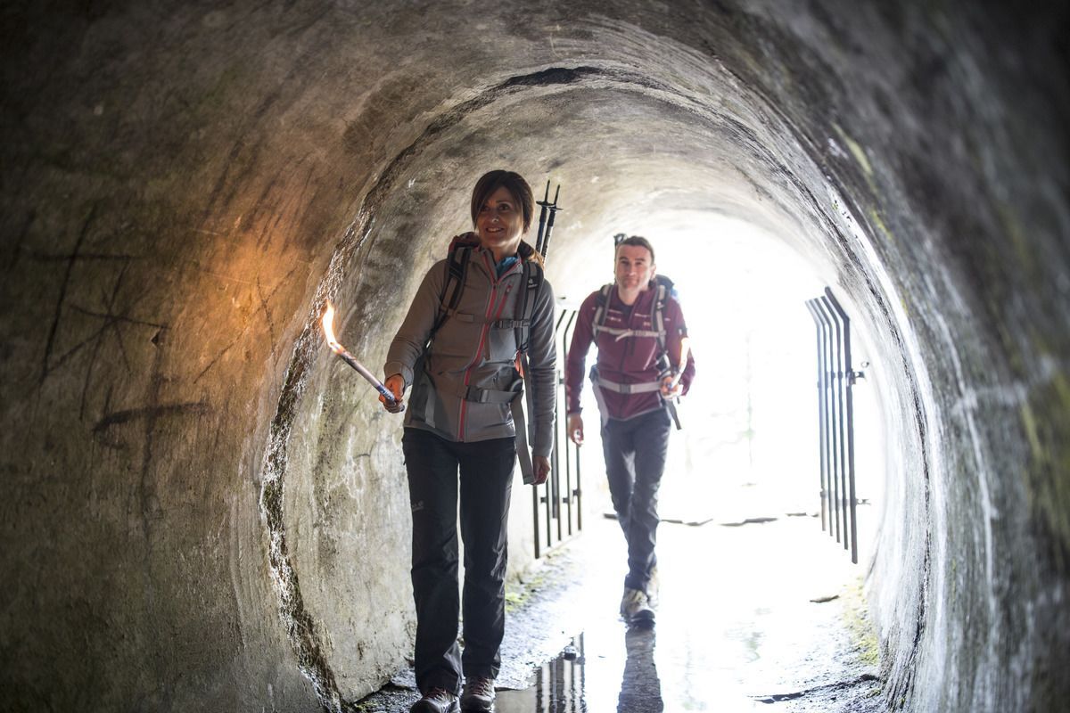
Rundwanderung durch den spannenden Gallruthstollen und die prachtvolle Gebirgslandschaft entlang des Höhenweges.
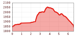
Open interactive mapOpen this POI on the interactive mapElevation profiledownloadGallruthalm - Stollenwanderung.gpx
Alpine hike to Lienzer HütteDifficulty:easyLength:6.8 kmDuration:2:30 hElevation uphill:297 mSee trailSee trail: Alpine hike to Lienzer Hütte
Kaiserjochhaus © Lechtal Tourismus Lechtaler Höhenweg: 3. Etappe Kasierjochhaus-Ansbacher HütteDifficulty:difficultLength:6.9 kmDuration:4:45 hElevation uphill:768 mSee trailSee trail: Lechtaler Höhenweg: 3. Etappe Kasierjochhaus-Ansbacher Hütte
Kaiserjochhaus © Lechtal Tourismus Lechtaler Höhenweg: 3. Etappe Kasierjochhaus-Ansbacher HütteDifficulty:difficultLength:7.8 kmDuration:4:45 hElevation uphill:844 mSee trailSee trail: Lechtaler Höhenweg: 3. Etappe Kasierjochhaus-Ansbacher Hütte
Kaiserjochhaus © Lechtal Tourismus Lechtaler Höhenweg: 3. Etappe Kasierjochhaus-Ansbacher HütteDifficulty:difficultLength:7.9 kmDuration:4:15 hElevation uphill:511 mSee trailSee trail: Lechtaler Höhenweg: 3. Etappe Kasierjochhaus-Ansbacher Hütte
Kundl GorgeDifficulty:easyLength:6.5 kmDuration:3:00 hElevation uphill:10 mSee trailSee trail: Kundl Gorge
swiss-track02-c-npht-martin-kurzthaler.jpeg © Nationalpark Hohe Tauern / Martin Kurzthaler Rollitour with Swiss TracDifficulty:easyLength:3.2 kmDuration:1:30 hElevation uphill:135 mSee trailSee trail: Rollitour with Swiss Trac
imagemeta.apiv2.1593523029518 © TVB Stubai Sulzenau Hütte - Blaue Lacke und GrünauseeDifficulty:mediumLength:3.2 kmDuration:1:07 hElevation uphill:117 mSee trailSee trail: Sulzenau Hütte - Blaue Lacke und Grünausee
Feldberg, Stripsenjoch, Kaiserbachtal, Region St. Johann in Tirol, Kirchdorf © Mirja Geh Kaiserbachtal - Feldberg - StripsenjochDifficulty:mediumLength:21.0 kmDuration:9:00 hElevation uphill:1,170 mSee trailSee trail: Kaiserbachtal - Feldberg - Stripsenjoch
Hoch oben an der Rastkogelhütte © Archiv TVB Mayrhofen Circuit & summit hike: Schwendberg (Jausenstation Melchboden) Arbiskopf, Rauhenkopf and KreuzjochDifficulty:mediumLength:8.6 kmDuration:3:30 hElevation uphill:450 mSee trailSee trail: Circuit & summit hike: Schwendberg (Jausenstation Melchboden) Arbiskopf, Rauhenkopf and Kreuzjoch
neuer-wanderweg-im-stilluptal-foto-stefan-absenger © Archiv TVB Mayrhofen Themed hike: Stilluptal "Wasserfallweg"Difficulty:easyLength:15.3 kmDuration:5:00 hElevation uphill:325 mSee trailSee trail: Themed hike: Stilluptal "Wasserfallweg"
Kotalm Mitterleger - dahinter die mächtigen Klobenjoch Wände © Achensee Tourismus Achenkirch - Köglalm - Kotalm Mitterleger - Kotalm Niederleger – AchenkirchDifficulty:mediumLength:9.6 kmDuration:5:00 hElevation uphill:720 mSee trailSee trail: Achenkirch - Köglalm - Kotalm Mitterleger - Kotalm Niederleger – Achenkirch
imst_tourismus_rosengartenschlucht_wyhlidal_west_0009.jpg © Rudi Wyhlidal / WEST - Kollreider RosengartenschluchtOpening hours:openDifficulty:easyLength:4.4 kmDuration:2:30 hElevation uphill:282 mSee trailSee trail: Rosengartenschlucht
Elbigenalp Gibler AlmDifficulty:easyLength:1.4 kmElevation uphill:153 mSee trailSee trail: Elbigenalp Gibler Alm
die Gufferthütte - sie gehört der Deutschen Alpenvereinssektion Mühldorf a. Inn © Achensee Tourismus Achenkirch - Geopfad Obere Ampelsbach- und Filzmoosbach Schlucht - Gufferthütte - AchenkirchDifficulty:mediumLength:15.2 kmDuration:4:30 hElevation uphill:490 mSee trailSee trail: Achenkirch - Geopfad Obere Ampelsbach- und Filzmoosbach Schlucht - Gufferthütte - Achenkirch
Schloss Bruck Lienz © TVBOsttirol Walter Mair Trail Lienzer TalbodenDifficulty:easyLength:48.0 kmDuration:15:40 hElevation uphill:1,280 mSee trailSee trail: Walter Mair Trail Lienzer Talboden
Kitzbüheler Alpen_KATwalk2018-Etappe4_Erwin Haiden07.jpg © Erwin Haiden KAT WALK ALPINEDifficulty:mediumLength:113.0 kmDuration:45:00 hElevation uphill:6,300 mSee trailSee trail: KAT WALK ALPINE
Weitwanderung Peter Habeler Runde © Archiv TVB Mayrhofen Long-distance hike: Peter Habeler RundeDifficulty:difficultLength:56.7 kmDuration:25:00 hElevation uphill:3,705 mSee trailSee trail: Long-distance hike: Peter Habeler Runde
Stuttgarter HütteDifficulty:mediumLength:12.3 kmDuration:5:30 hElevation uphill:1,124 mSee trailSee trail: Stuttgarter Hütte
Kaiserjochhaus © Lechtal Tourismus Lechtaler Höhenweg: 3. Etappe Kasierjochhaus-Ansbacher HütteDifficulty:difficultLength:8.3 kmDuration:3:30 hElevation uphill:490 mSee trailSee trail: Lechtaler Höhenweg: 3. Etappe Kasierjochhaus-Ansbacher Hütte
Kaiserlift Tour tip 1: Berghaus Aschenbrenner und Duxer AlmDifficulty:easyLength:4.9 kmElevation uphill:35 mSee trailSee trail: Kaiserlift Tour tip 1: Berghaus Aschenbrenner und Duxer Alm
©-TVB-Tiroler-Oberland-Kaunertal-Daniel-Zangerl-Falkaunsalm-2016-(6).jpg © Daniel Zangerl Rolli-Wanderung FalkaunsalmDifficulty:mediumLength:4.5 kmDuration:1:45 hElevation uphill:392 mSee trailSee trail: Rolli-Wanderung Falkaunsalm
Wandern am Penken © Christian Lorenz Themed hike: Mayrhofen "PanoramaRundWeg" at Mount PenkenDifficulty:easyLength:4.4 kmDuration:1:45 hElevation uphill:195 mSee trailSee trail: Themed hike: Mayrhofen "PanoramaRundWeg" at Mount Penken
©-TVB-Tiroler-Oberland-Kaunertal-Daniel-Zangerl-Piller-Moor-Familie-2014-(28).jpg © Daniel Zangerl Rolli-Wanderung Piller MoorDifficulty:easyLength:2.0 kmSee trailSee trail: Rolli-Wanderung Piller Moor
Benni-Raich-Brücke_0518_001.jpg © TVB Pitztal/Chris Walch Arzl - Benni-Raich-Bridge - WaldDifficulty:easyLength:1.8 kmDuration:0:40 hElevation uphill:120 mSee trailSee trail: Arzl - Benni-Raich-Bridge - Wald
Going_Ausblick vom Baumgartenköpfl_Wilder Kaiser © TVB Wilder Kaiser/Thomas Hennerbichler Tauernblick panorama circular hiking routeDifficulty:mediumLength:13.6 kmDuration:6:00 hElevation uphill:980 mSee trailSee trail: Tauernblick panorama circular hiking route
Give feedback for a chance to win a special holiday experience!Click here for the surveyClick here for the survey


.jpg")


")
.jpg")

.jpg")


