
Opening hours:Open today
Place:
Längenfeld
:
Alpine pasture / hut / mountain restaurant
GRIES -> Nisslalm -> Gasse -> GAMSKOGEL Increased truck and car traffic on the entire Sulztal road.Driving times: Trucks: Mon – Fri from 6:00 am – 10:00 pm Cars: all day
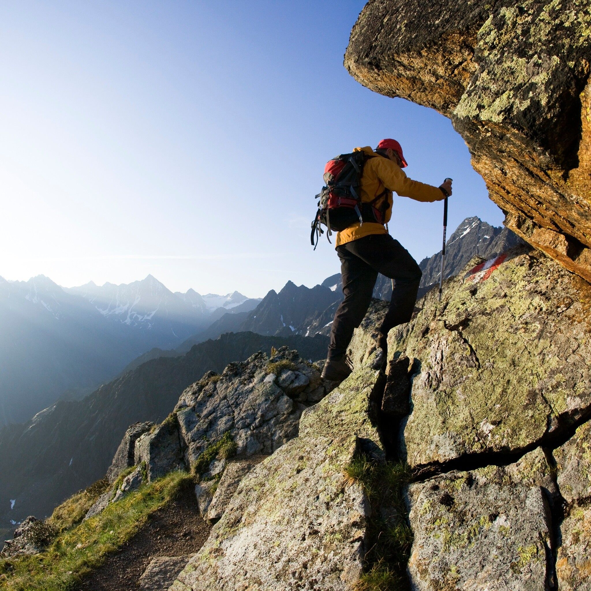
Suitable for those free from dizziness, with sure-footedness and alpine experience; very good physical condition, alpine experience and mountain equipment (see under Equipment), occasionally alpine safety equipment, good weather conditions recommended. Please pay attention to the current weather report.
Suitable equipment such as breathable and weather-appropriate outdoor clothing is required for all hikes and routes. Carrying a first aid kit, a mobile phone, and possibly a hiking map, as well as sufficient provisions for hikes without any opportunity to stop, is necessary.
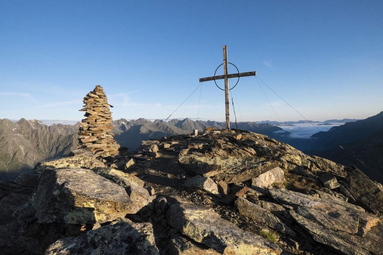
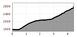
The parking lot at the edge of town offers an ideal starting point. To cross to the other side of the Fischbach river, walk a few meters downhill directly behind the parking lot to the small wooden bridge that is crossed. Past the Tiroler Hütte, through meadows, begins the steep ascent to Nisslalm. In narrow, steep switchbacks, the narrow path winds up through the forest, crossing the forest road several times. A more comfortable but longer access to the alpine pasture is via the forest road. Upon reaching Nisslalm, the trail continues behind the alpine pasture, slightly ascending to beautiful grassy areas. The next section leads steeply over stone slabs and stretches over grassy ridges to the east ridge. For the summit ascent in steep, rocky terrain, another hour is needed. The view from the summit cross is breathtaking. You can overlook large parts of the Ötztal, from the Inn valley to the glaciated peaks in the innermost valley.
Travel comfortably and safely by train. The final stop or exit point is the ÖTZTAL train station. Afterwards, you can conveniently and quickly travel through the entire valley to your desired destination by public transport or local taxi companies. The current bus timetable is available at: fahrplan.vvt.at
The following parking options are available:
Gries at the end of the village – fee required


