Hut hike Hike to the Wildsauhütte

Reith im Alpbachtal / Kitzbühel Alps
Difficulty ratings: medium
Route length: 11.3 km
Duration: 3:00 h

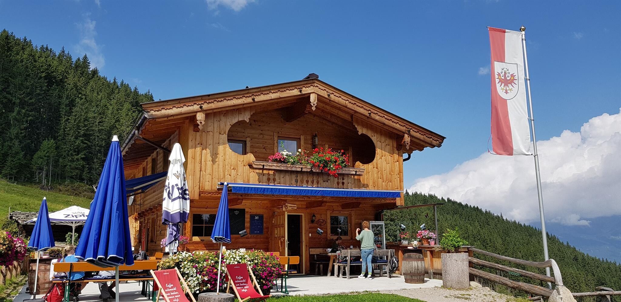
Beautiful circular route to the Wildsauhütte at 1,394 m. A wonderful view and culinary indulgence are guaranteed!
Tour information

  • Requirement: medium
  • Length: 11.3 km
  • Duration: 3:00 h
  • Elevation uphill:450 hm
  • Elevation downhill:450 hm
Highest point1,391 m

Starting point

Mountain station Reitherkogelbahn

Finishing point

Mountain station Reitherkogelbahn
  • Fitness level 4 / 6

Features

  • Circular route
  • Suitable for families

Best time of year

  • January
  • February
  • March
  • April
  • May
  • June
  • July
  • August
  • September
  • October
  • November
  • December

Equipment

Hiking equipment, drinking water, head covering

Source: Alpbachtal Tourismus

Description

Anyone looking for a comfortable circular hike with a place to stop and eat will enjoy this route. With only 400 meters of elevation, you can hike the alpine pasture area around the Wildsauhütte in about 1.5 hours.

The circular hike starts at the mountain station of the Reitherkogelbahn. You hike leisurely in 30 minutes to the Kerschbaumer Sattel (1,100 m) in Reith im Alpbachtal and then continue for 2.5 km gently ascending directly to the Wildsauhütte near the Hechenblaikenalm. The path is well signposted and therefore hardly missed. After a rest on the cozy terrace of the Wildsauhütte, the circular hike leads a short way back to the fork in the path and then over Zulehen back to the Kerschbaumer Sattel and back to the mountain station.


Nearby huts and mountain restaurants

Getting here

  • Arrival by public transport

    Bus 620

    Bus stop Reitherkogelbahn, Reith im Alpbachtal

    www.vvt.at

  • Parking

    A12 motorway exit Kramsach - turn left Brixlegg - Reith im Alpbachtal - valley station Reitherkogelbahn


    Valley station Reitherkogelbahn

Weather

Today

light rain
11°C/2°C
85%8.8l5 km/h

Mon

clear sky
12°C/2°C
10%0l5 km/h

Tue

mainly clear
16°C/2°C
5%0l5 km/h
Go to weather forecast

More tours in the surrounding area

  • Rofan tour - stage 3

    Difficulty:difficult
    Length:11.8 kmDuration:7:30 hElevation uphill:1,150 m
  • Day 1: 4 days - 4 summits tour

    Difficulty:medium
    Length:9.8 kmDuration:5:00 hElevation uphill:984 m
  • 3-peak-tour Kienberg-Plessenberg-Heuberg

    Difficulty:medium
    Length:8.6 kmDuration:4:30 hElevation uphill:779 m
  • Day 3: 4 days - 4 summits tour

    Difficulty:medium
    Length:19.3 kmDuration:8:00 hElevation uphill:1,371 m
  • 4 days - 4 summits tour

    Difficulty:medium
    Length:54.4 kmDuration:4 daysElevation uphill:3,408 m
  • Kundler Klamm

    Difficulty:easy
    Length:6.4 kmDuration:2:00 hElevation uphill:116 m
  • Farmkehralm 1.521 m

    Difficulty:medium
    Length:9.3 kmDuration:3:30 hElevation uphill:506 m
  • Loop tour Juppi Zauberwald

    Difficulty:easy
    Length:2.5 kmDuration:1:00 hElevation uphill:93 m
  • Kaiser Gorge - loop trail

    Difficulty:easy
    Length:4.2 kmDuration:1:00 hElevation uphill:198 m
  • 3-day Family Tour Alpbachtal

    Difficulty:easy
    Length:18.3 kmDuration:3 daysElevation uphill:998 m
  • Barrier-free path Lake Reintal

    Difficulty:medium
    Length:7.0 kmDuration:1:45 hElevation uphill:15 m
  • Voldöpper Spitze Loop Hike

    Difficulty:medium
    Length:12.9 kmDuration:5:00 hElevation uphill:988 m
Newsletter

The mountain is calling? So does our newsletter!

In our monthly newsletter we reveal the best holiday tips for Tyrol.
