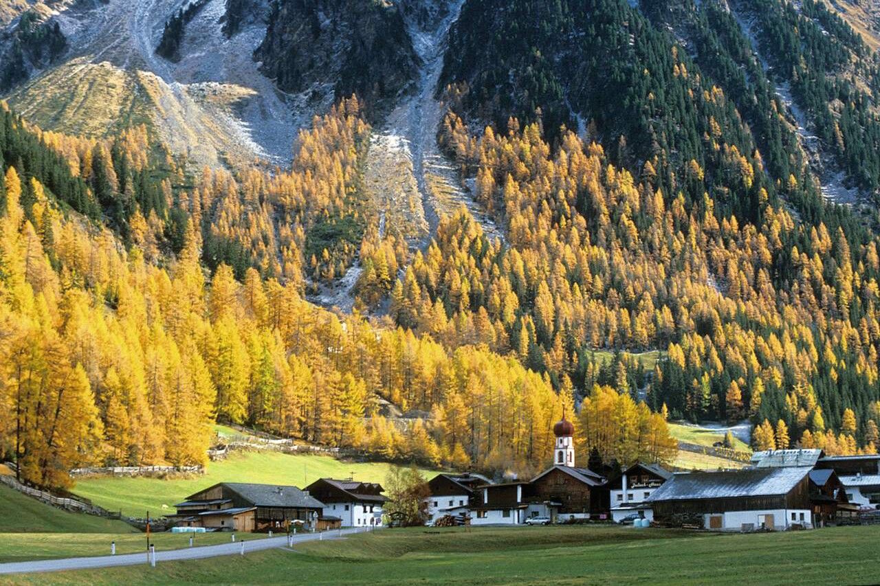
Mountain hikes Hoher Seeblaskogel 3235m - Längenfeld/Gries

Längenfeld / Stubaier Alpen
Difficulty ratings: difficult
Route length: 8.2 km
Duration: 5:00 h

GRIES -> Winnebach -> Winnebachsee Hut -> HOHER SEEBLASKOGEL

Tour information

  • Requirement: difficult
  • Length: 8.2 km
  • Duration: 5:00 h
  • Elevation uphill:1,671 hm
  • Elevation downhill:41 hm
Highest point3,235 m

Starting point

Gries

Finishing point

Hoher Seeblaskogel
  • Fitness level 5 / 6

Best time of year

  • January
  • February
  • March
  • April
  • May
  • June
  • July
  • August
  • September
  • October
  • November
  • December

Equipment

Suitable for climbers without fear of heights, sure-footed and alpine experienced; very good physical fitness, alpine experience and mountaineering equipment (see under Equipment), sometimes alpine safety equipment, good weather conditions recommended. Please observe the current weather report.

Appropriate equipment such as breathable and weather-appropriate outdoor clothing is required for all hikes and routes. Carrying a first aid kit, a mobile phone, and possibly a hiking map, as well as sufficient provisions for hikes without the possibility to stop for food, is necessary. 

Source: Ötztal

Description

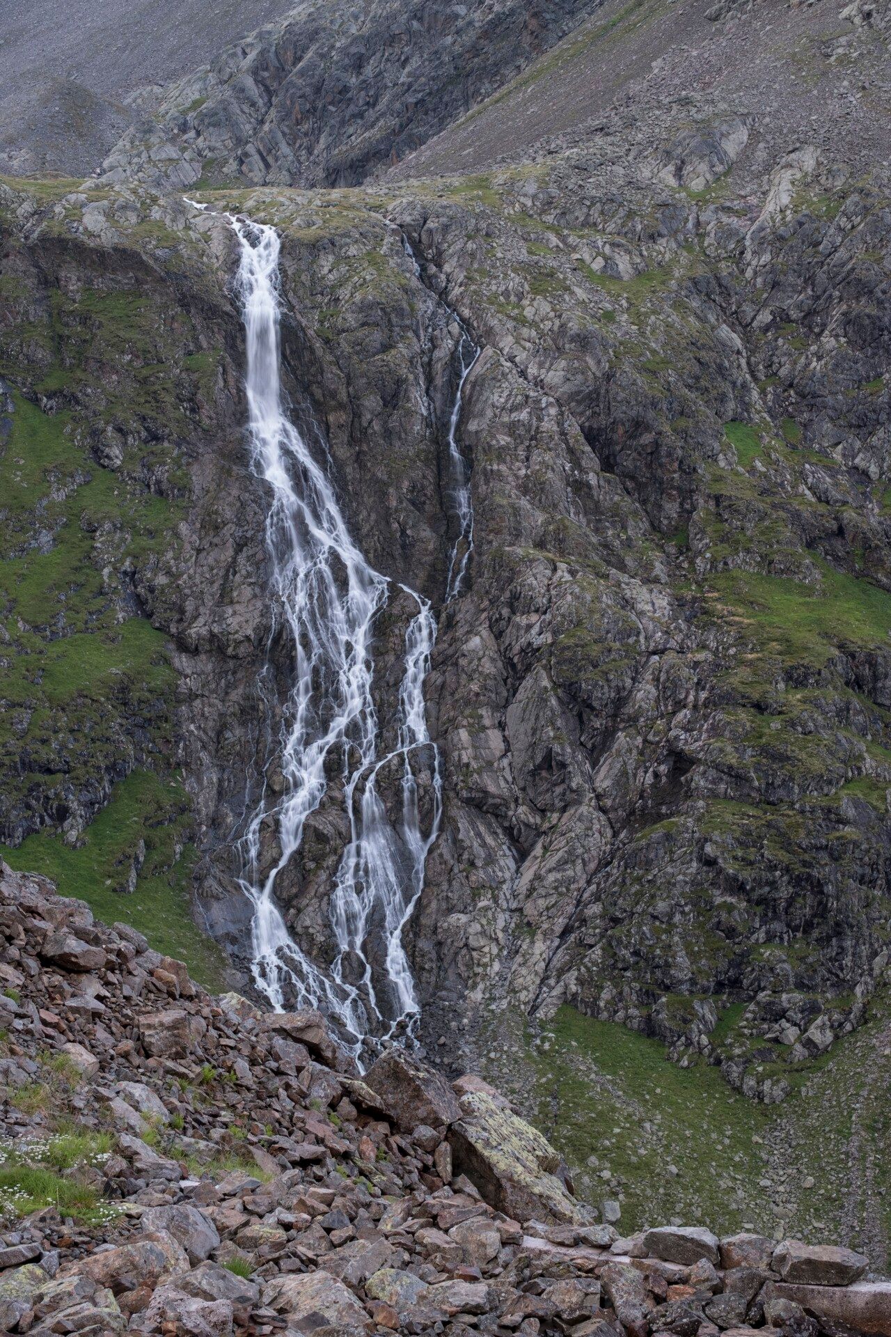
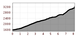
From the parking lot at the end of Gries, follow the road to Winnebach to take the footbridge towards the Winnebachsee Hut. Soon the path leads out of the forest past numerous avalanche tracks. The well-constructed path twists steeply uphill at the end; to the right, the Winnebach cascades down the "Bachfalle." Walking time approx. 2 hours. At the hut, cross over the lake outflow, ascend a short step, and head east across the picturesque glacially polished rock floors to three small lakes. Continue over grass and rock up to the tongue of the extensive Bachfallenferner. At the fork on the upper path, go around a striking rock pillar into a hidden valley. Through this valley and the adjoining high cirque over scree and snow all the way up to the ridge and into a small saddle. Then descend briefly to the upper part of the Grünen Tatzenferner, ascend through the basin to the upper east ridge and from there over rubble to the summit.


Nearby huts and mountain restaurants

Getting here

  • Arrival by public transport

    Travel comfortably and safely by train. The final stop or exit point is the ÖTZTAL train station. Afterwards, you can travel conveniently and quickly with public transportation or local taxi companies through the entire valley to your desired destination. The current bus schedule is available at: http://fahrplan.vvt.at

  • Parking

    The following parking options are available in Gries:

    Gries at the end of the village – paid parking

More tours in the surrounding area

  • Mountain peak Rosskopf

    Difficulty: medium
    Length: 2.0 km Duration: 2:00 h Elevation uphill: 379 m
  • Mutsbühl

    Difficulty: medium
    Length: 4.5 km Duration: 1:30 h Elevation uphill: 470 m
  • Fundusfeiler - Umhausen

    Difficulty: difficult
    Length: 4.5 km Duration: 3:00 h Elevation uphill: 1,109 m
  • Gampe Thaya

    Difficulty: medium
    Length: 2.6 km Duration: 1:45 h Elevation uphill: 623 m
  • Brizzisee

    Difficulty: medium
    Length: 9.0 km Duration: 3:30 h Elevation uphill: 1,057 m
  • Loop trail Stuibenfall Umhausen

    Opening hours: open
    Difficulty: easy
    Length: 9.2 km Duration: 4:00 h Elevation uphill: 608 m
  • Ramolhaus - Obergurgl

    Difficulty: difficult
    Length: 7.8 km Duration: 4:00 h Elevation uphill: 1,095 m
  • Siegerlandhütte - Sölden

    Difficulty: medium
    Length: 8.0 km Duration: 3:30 h Elevation uphill: 780 m
  • Ötztal Trek Stage 6

    Difficulty: difficult
    Length: 7.6 km Duration: 3:30 h Elevation uphill: 640 m
  • Ötztal Trek Stage 7

    Difficulty: difficult
    Length: 5.3 km Duration: 2:00 h Elevation uphill: 376 m
  • Ötztal Trek Stage 16

    Difficulty: difficult
    Length: 6.9 km Duration: 2:30 h Elevation uphill: 358 m
  • Ötztal Trek Stage 4

    Difficulty: difficult
    Length: 8.9 km Duration: 4:00 h Elevation uphill: 802 m
  • Ötztal Trek Stage 8

    Difficulty: difficult
    Length: 9.3 km Duration: 3:30 h Elevation uphill: 274 m
  • Ötztal Trek Stage 14

    Difficulty: difficult
    Length: 6.3 km Duration: 3:00 h Elevation uphill: 1,004 m
  • Ötztal Trek Stage 11

    Difficulty: difficult
    Length: 12.0 km Duration: 5:00 h Elevation uphill: 705 m
  • Ötztal Trek Stage 5

    Difficulty: difficult
    Length: 8.1 km Duration: 3:30 h Elevation uphill: 1,125 m
Newsletter

The mountain is calling? So does our newsletter!

In our monthly newsletter we reveal the best holiday tips for Tyrol.