Mountain hikes Local round Huben - Längenfeld

Längenfeld / Ötztaler Alpen
Difficulty ratings: easy
Route length: 2.9 km
Duration: 0:45 h

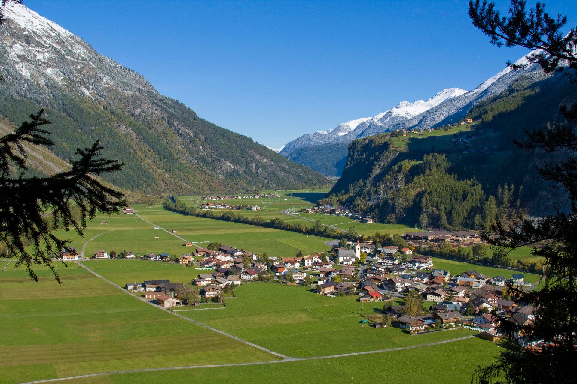
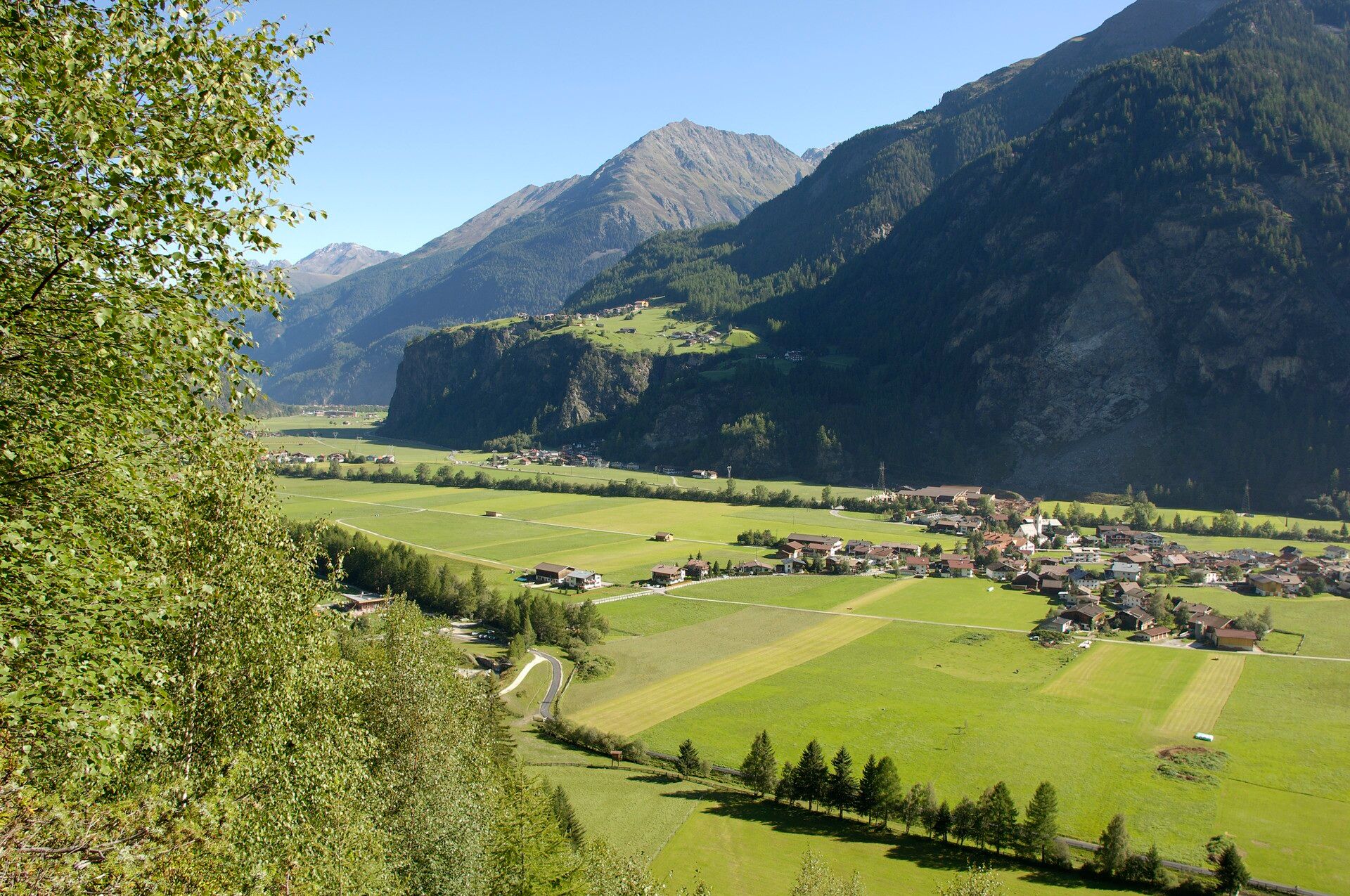
HUBEN CHURCH -> Huben Mühl -> sports field -> fire station -> Ötztaler Ache -> HUBEN CHURCH

Tour information

  • Requirement: easy
  • Length: 2.9 km
  • Duration: 0:45 h
  • Elevation uphill:12 hm
  • Elevation downhill:11 hm
Highest point1,198 m

Starting point

Huben parish church

Finishing point

Huben parish church
  • Fitness level 1 / 6

Best time of year

  • January
  • February
  • March
  • April
  • May
  • June
  • July
  • August
  • September
  • October
  • November
  • December

Equipment

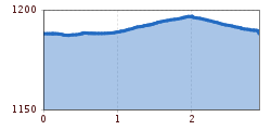
Easy hiking trail; suitable for beginners and walkers. Please note the current weather report.

Appropriate equipment such as breathable suitable outdoor clothes for the weather, ankle-high walking boots.
Source: TVB Ötztal Tourismus

Description

The starting point of this circular route is the Huben parish church dedicated to St. Martin. Walk along the low-traffic road towards Mühl. Leave the small settlement on the right and follow the path to the left in a southerly direction. After a short walk, you reach the sports field (starting point to the Alpengasthof am Feuerstein). Continue straight along the road to the fire station. After crossing the road in front of the bridge you reach the riverbank of the Ötztaler Ache. Follow the left riverbank in the direction of flow to the starting point at the Huben parish church.


Nearby huts and mountain restaurants

Getting here

  • Arrival by public transport

    Travel comfortably and safely by train. The final stop or exit point is the ÖTZTAL train station. Afterwards, you travel comfortably and quickly with the public bus service or the local taxi companies through the entire valley to your desired destination. The current bus schedule is available at: http://fahrplan.vvt.at

  • Parking

    The following parking options are available:

    • Huben first village entrance before Praxmarer carpentry – free of charge
    • Huben parish church - free of charge

More tours in the surrounding area

  • Ötztal Trek Stage 6

    Difficulty: difficult
    Length: 7.6 km Duration: 3:30 h Elevation uphill: 640 m
  • Ötztal Trek Stage 7

    Difficulty: difficult
    Length: 5.3 km Duration: 2:00 h Elevation uphill: 376 m
  • Ötztal Trek Stage 17

    Difficulty: difficult
    Length: 16.4 km Duration: 6:00 h Elevation uphill: 1,080 m
  • Ötztal Trek Stage 16

    Difficulty: difficult
    Length: 6.9 km Duration: 2:30 h Elevation uphill: 358 m
  • Ötztal Trek Stage 4

    Difficulty: difficult
    Length: 8.9 km Duration: 4:00 h Elevation uphill: 802 m
  • Ötztal Trek Stage 3

    Difficulty: difficult
    Length: 10.4 km Duration: 4:00 h Elevation uphill: 842 m
  • Ötztal Trek Stage 1

    Difficulty: medium
    Length: 18.6 km Duration: 6:30 h Elevation uphill: 1,561 m
  • Ötztal Trek Stage 14

    Difficulty: difficult
    Length: 6.3 km Duration: 3:00 h Elevation uphill: 1,004 m
  • Ötztal Trek Stage 20

    Opening hours: closed
    Difficulty: medium
    Length: 6.4 km Duration: 3:00 h Elevation uphill: 610 m
  • Ötztal Trek Stage 12

    Difficulty: difficult
    Length: 4.8 km Duration: 2:00 h Elevation uphill: 592 m
  • Ötztaler Urweg

    Length: 189.1 km Duration: 72:19 h Elevation uphill: 9,428 m
  • Ötztal Trek Stage 22

    Difficulty: difficult
    Length: 21.5 km Duration: 8:00 h Elevation uphill: 647 m
  • Vent - Breslauer Hütte - Vernagthütte

    Difficulty: medium
    Length: 10.4 km Duration: 4:00 h Elevation uphill: 1,203 m
  • Ötztal Trek Stage 21

    Difficulty: difficult
    Length: 9.4 km Duration: 4:30 h Elevation uphill: 1,270 m
  • Ötztal Trek Stage 10

    Difficulty: difficult
    Length: 11.1 km Duration: 4:30 h Elevation uphill: 1,476 m
  • Ötztal Trek Stage 8

    Difficulty: difficult
    Length: 9.3 km Duration: 3:30 h Elevation uphill: 274 m
  • Ötztal Trek

    Length: 246.4 km Duration: 84:25 h Elevation uphill: 18,910 m
  • Ötztal Trek Stage 11

    Difficulty: difficult
    Length: 12.0 km Duration: 5:00 h Elevation uphill: 705 m
  • Ötztal Trek Stage 5

    Difficulty: difficult
    Length: 8.1 km Duration: 3:30 h Elevation uphill: 1,125 m
  • Mutsbühl

    Difficulty: medium
    Length: 4.5 km Duration: 1:30 h Elevation uphill: 470 m
  • Mountain peak Rosskopf

    Difficulty: medium
    Length: 2.0 km Duration: 2:00 h Elevation uphill: 379 m
Newsletter

The mountain is calling? So does our newsletter!

In our monthly newsletter we reveal the best holiday tips for Tyrol.