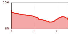
Path between Badsteig and the Information Office | Accessible

Pfunds / Ötztal Alps
Difficulty ratings: medium
Route length: 2.5 km
Duration: 0:40 h

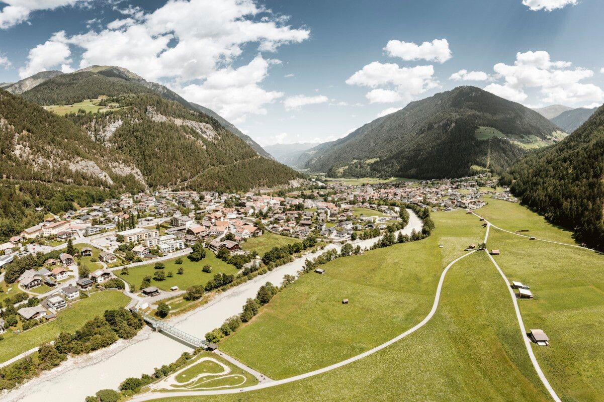
This path serves as a link between the ‘Secrets of the Forest’ themed trail in Badsteig and the information centre in Pfunds.
Tour information

  • Requirement: medium
  • Length: 2.5 km
  • Duration: 0:40 h
  • Elevation uphill:10 hm
  • Elevation downhill:0 hm
Highest point985 m

Starting point

Kreuzung Badsteig | Pfunds

Finishing point

Infobüro | Pfunds
  • Fitness level 2 / 6
  • Technique 2 / 6

Features

  • Wheelchair hike
  • suitable for pushchairs

Best time of year

  • January
  • February
  • March
  • April
  • May
  • June
  • July
  • August
  • September
  • October
  • November
  • December

Trail condition

Asphalt 

Equipment

We recommend equipment suitable for the tour and weather conditions, including sturdy shoes, weatherproof clothing, food, and appropriate maps.
Source: TVB Tiroler Oberland

Description

The route is classified as moderately difficult. It stretches for 2,485 metres and is mostly well-surfaced with tarmac. The gradients are mostly gentle (0 to 6 per cent), with short, moderately difficult sections of up to 8 per cent. The ride comfort is rated as generally comfortable, and the stability is consistently good, making the route practical to use. The effort required is generally low to moderate and easily manageable, particularly for users with good to athletic physical fitness or appropriate assistive devices.

Getting here

  • Arrival by public transport

    Bus route 210, Pfunds Dorf stop;
    bus route 273, Pfunds Stuben secondary school stop

  • Parking

    Drive to Pfunds, as far as the car park at the roundabout. Walk to the Badsteig themed trail: 600 m
    Car park at the roundabout, free of charge

Weather

Today

light rain
11°C/2°C
85%7.2l5 km/h

Mon

mainly clear
11°C/2°C
5%0l5 km/h

Tue

clear sky
16°C/3°C
0%0l5 km/h
Go to weather forecast

More tours in the surrounding area

  • Talwanderweg Kaunertal

    Difficulty:easy
    Duration:2:30 hElevation uphill:295 m
  • Kaunerberger Wasserweg

    Opening hours:open
    Difficulty:medium
    Length:15.2 kmDuration:6:00 hElevation uphill:935 m
  • Sternenweg im Gepatsch

    Difficulty:medium
    Length:4.0 kmDuration:1:30 hElevation uphill:202 m
  • Rolli-Wanderung Aifner Alm

    Difficulty:medium
    Length:6.0 kmDuration:2:30 hElevation uphill:460 m
  • Rolli-Wanderung Nassereinalm

    Difficulty:medium
    Length:5.5 kmDuration:1:45 hElevation uphill:269 m
  • Rolli-Wanderung Gepatschhaus

    Length:8.5 kmDuration:1:45 hElevation uphill:156 m
  • Rolli-Wanderung Falkaunsalm

    Difficulty:medium
    Length:4.5 kmDuration:1:45 hElevation uphill:392 m
  • Großer Mutzkopf

    Opening hours:closed
    Difficulty:easy
    Length:10.3 kmDuration:4:00 hElevation uphill:507 m
  • Hohe Aifnerspitze (2.779 m)

    Difficulty:medium
    Length:7.2 kmDuration:5:15 hElevation uphill:815 m
  • Gletscherlehrpfad Gepatschferner

    Difficulty:medium
    Length:8.4 kmDuration:3:45 hElevation uphill:400 m
  • Radurschlklamm Gorge

    Opening hours:open
    Difficulty:medium
    Length:7.5 kmDuration:3:20 hElevation uphill:442 m
  • Rundwanderung Frudiger

    Difficulty:medium
    Length:13.5 kmDuration:4:55 hElevation uphill:588 m
  • Kapelle Maria Schnee

    Difficulty:easy
    Length:1.7 kmDuration:0:30 hElevation uphill:90 m
  • Verpeilschlucht

    Opening hours:open
    Difficulty:medium
    Length:4.9 kmDuration:3:00 hElevation uphill:386 m
  • Ötztal Trek Stage 15

    Difficulty:difficult
    Length:6.5 kmDuration:2:30 hElevation uphill:332 m
Newsletter

The mountain is calling? So does our newsletter!

In our monthly newsletter we reveal the best holiday tips for Tyrol.