
Opening hours:Open today
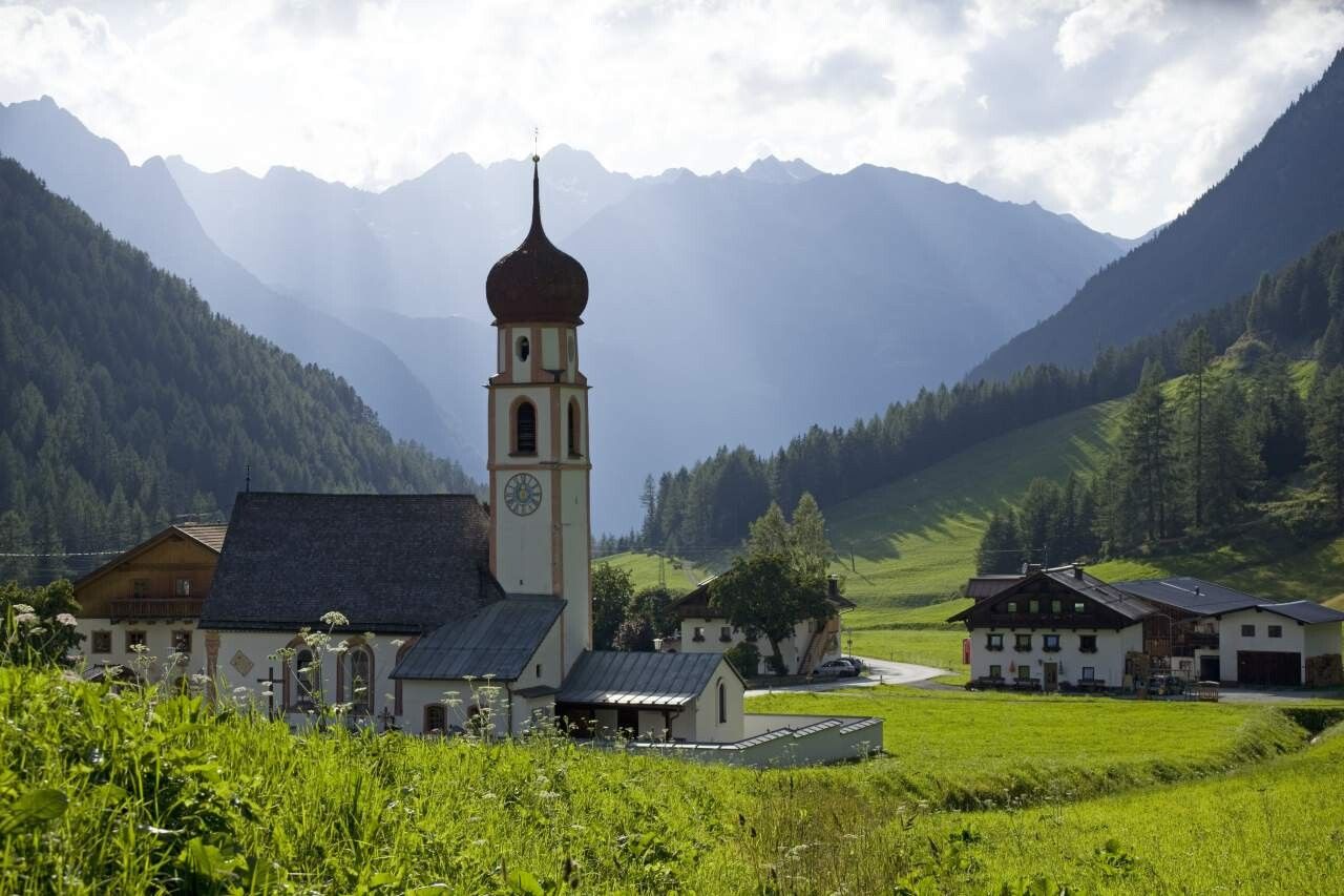
Place:Längenfeld
:Alpine pasture / hut / mountain restaurant
GRIES PARKING LOT -> Village center Gries -> Path towards Nissl Alm -> Nissl Alm -> Path towards Schönrinnenkarsee -> SCHÖNRINNENKARSEE Increased truck and car traffic on the entire Sulztal road. Driving times: Trucks: Mon – Fri from 06:00 – 22:00 Cars: all day
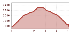
Moderate mountain trail; suitable for sure-footed and experienced mountain hikers; good physical condition, mountain experience and mountaineering equipment (see equipment section) necessary. Please observe the current weather forecast.
Appropriate equipment such as breathable and weather-appropriate outdoor clothing is necessary for all hikes and routes. Carrying a first aid kit, a mobile phone, and possibly a hiking map, as well as sufficient provisions on hikes without the possibility of stopping for food, is required.
In the village center of Gries, turn south, cross the wooden bridge towards the forest edge. The path leads quite steeply through the forest uphill to the Nissl Alm and intermittently touches the forest road. A more comfortable but longer access to the Alm is via the forest road that turns right at the entrance of the Sulztal. Upon arrival at the Nissl Alm, the path continues behind the Alm to the wonderfully located lake. The path leads just behind the Alm to the west, then steeper over vegetated slopes upwards into the Schönrinnenkar and over two further steps to the lake. Return the same way.
Travel comfortably and safely by train. The final stop or exit point is ÖTZTAL train station. Afterwards, you can conveniently and quickly travel through the entire valley to your desired destination using public transport or local taxi companies. The current bus schedule is available at: fahrplan.vvt.at
The following parking options are available in Gries:
Parking lot at the end of the village – paid


