Mountain hikes Sellesköpfe

Nauders / Ötztal Alps
Difficulty ratings: easy
Route length: 7.5 km
Duration: 3:30 h

Sellesköpfe

Tour information

  • Requirement: easy
  • Length: 7.5 km
  • Duration: 3:30 h
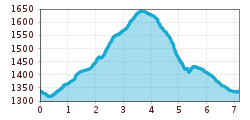
  • Elevation uphill:426 hm
  • Elevation downhill:405 hm
Highest point1,653 m

Starting point

Lochmühle

Finishing point

Mutzkopf Talstation

Features

  • Circular route
  • Suitable for families

Best time of year

  • January
  • February
  • March
  • April
  • May
  • June
  • July
  • August
  • September
  • October
  • November
  • December
Source: TVB Tiroler Oberland

Description

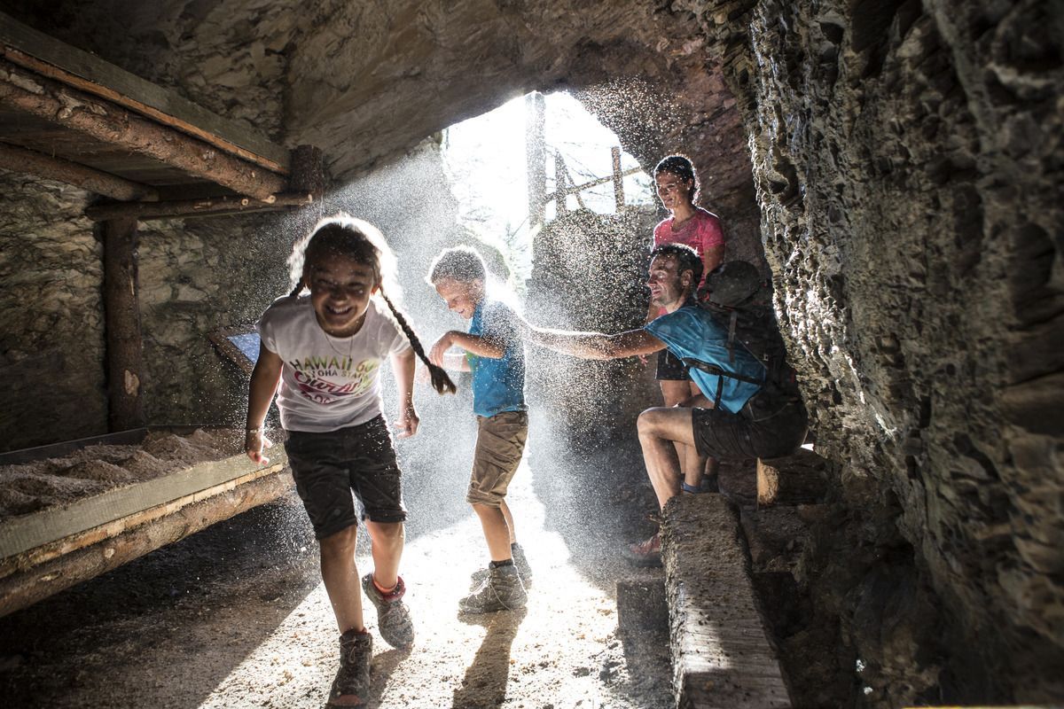
Hiking trail no. 1 starts in Lochmühle. After a few hundred metres, follow Trail no. 2 towards Sellesköpfe. Over a short flat section and through the larch forest the route goes up to the municipal pastures and on to the pastures on Selles. Now a short pass leads in a northeasterly direction to Finstermünz and Bergkastelblick (1,586 m). From here back to the signpost. After a few hairpin bends you reach the highest point of the Sellesköpfe (1,646 m). Now the route goes back over the Langen Boden, past the Zettler Alm and the still very visible positions and rock caverns from the First World War. The marked trail continues down through the forest towards the Schöpfwarte and Norbertshöhe (refreshments available). From there via Hiking trail no. 1 back to Nauders.

Weather

Today

mainly clear
21°C/8°C
0%0l0 km/h

Mon

mainly clear
18°C/7°C
0%0l5 km/h

Tue

clear sky
16°C/5°C
0%0l5 km/h
Go to weather forecast

More tours in the surrounding area

  • Sternenweg im Gepatsch

    Difficulty:medium
    Length:4.0 kmDuration:1:30 hElevation uphill:202 m
  • Großer Mutzkopf

    Opening hours:closed
    Difficulty:easy
    Length:10.3 kmDuration:4:00 hElevation uphill:507 m
  • Rolli-Wanderung Aifner Alm

    Difficulty:medium
    Length:6.0 kmDuration:2:30 hElevation uphill:460 m
  • Rolli-Wanderung Nassereinalm

    Difficulty:medium
    Length:5.5 kmDuration:1:45 hElevation uphill:269 m
  • Rolli-Wanderung Gepatschhaus

    Length:8.5 kmDuration:1:45 hElevation uphill:156 m
  • Rolli-Wanderung Falkaunsalm

    Difficulty:medium
    Length:4.5 kmDuration:1:45 hElevation uphill:392 m
  • Talwanderweg Kaunertal

    Difficulty:easy
    Duration:2:30 hElevation uphill:295 m
  • Kaunerberger Wasserweg

    Opening hours:open
    Difficulty:medium
    Length:15.2 kmDuration:6:00 hElevation uphill:935 m
  • Gletscherlehrpfad Gepatschferner

    Difficulty:medium
    Length:8.4 kmDuration:3:45 hElevation uphill:400 m
  • Hohe Aifnerspitze (2.779 m)

    Difficulty:medium
    Length:7.2 kmDuration:5:15 hElevation uphill:815 m
  • Kapelle Maria Schnee

    Difficulty:easy
    Length:1.7 kmDuration:0:30 hElevation uphill:90 m
  • Radurschlklamm Gorge

    Opening hours:open
    Difficulty:medium
    Length:7.5 kmDuration:3:20 hElevation uphill:442 m
  • Rundwanderung Frudiger

    Difficulty:medium
    Length:13.5 kmDuration:4:55 hElevation uphill:588 m
  • Verpeilschlucht

    Opening hours:open
    Difficulty:medium
    Duration:3:00 hElevation uphill:386 m
  • Ötztal Trek Stage 15

    Difficulty:difficult
    Length:6.5 kmDuration:2:30 hElevation uphill:332 m
Newsletter

The mountain is calling? So does our newsletter!

In our monthly newsletter we reveal the best holiday tips for Tyrol.