
Opening hours:Today closed
Place:Sölden
:Restaurant, Alpine pasture / hut / mountain restaurant
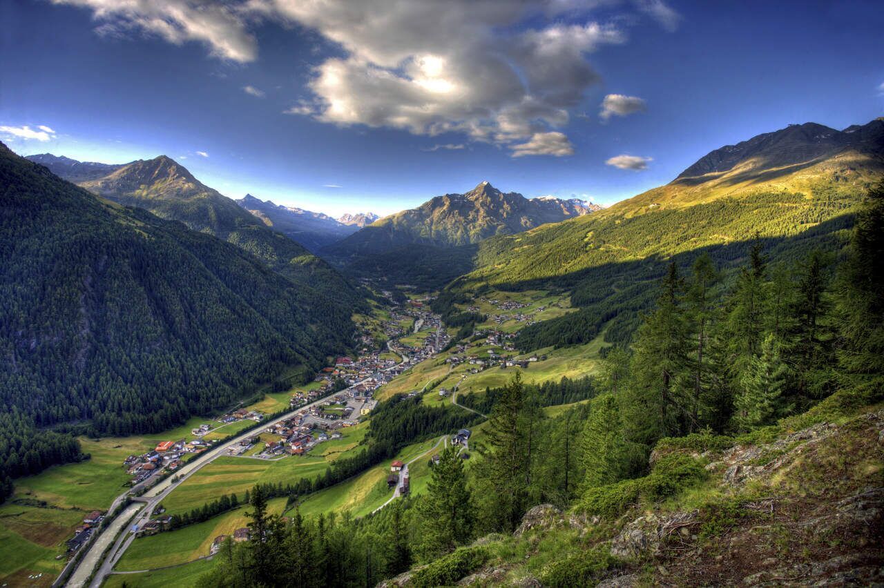
SÖLDEN -> SILBERTAL -> SÖLDEN
Red mountain paths are moderately difficult: some narrow and steep but secured walking and climbing passages await hikers.The appropriate signs are yellow with a red circle indicating the difficulty level.
For red mountain paths: Moderately difficult mountain path; suitable for sure-footed and experienced mountain hikers;Good physical condition, mountain experience, and mountain equipment (see under equipment) are necessary.Please observe the current weather report at: www.oetztal.com/de/sommer.html
Proper equipment such as breathable and weather-appropriate outdoor clothing, ankle-high hiking boots, wind, rain and sun protection, hat, possibly gloves, is required for all hikes and routes.Taking a first aid kit, a mobile phone, and possibly a hiking map, as well as sufficient provisions for hikes without dining options, is necessary.
Start your hike in the center of Sölden and walk past the church towards the Innerwald district. From here, a narrow paved path leads you steeply uphill.
Through the shady Innerwald, you reach the Ötztal Glacier Road. Follow this road comfortably up to the "Stiegele" junction (turnoff Gaislach / Glacier Road).
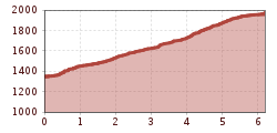
From Stiegele, the forest road first runs flat, later it rises moderately up to the first curve. The route often follows parallel to the ski slope and offers beautiful views of the surrounding mountains.
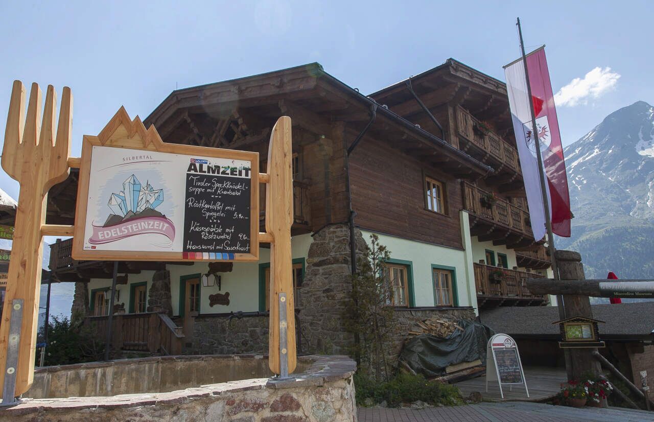
After a few curves, you reach the Alpengasthof Sonneck, an ideal rest stop. From there, it continues to the Gaislachalm and finally to the idyllic Silbertal.
Along the way, you can enjoy the impressive view into the Ventertal – a perfect companion for your hike.
Travel comfortably and safely by train to the Ötztal station.The final stop or exit point is ÖTZTAL station.Afterwards, you can conveniently and quickly continue by public bus or local taxi services throughout the valley to your desired destination.The current bus timetable is available at: fahrplan.vvt.at
In Sölden, the following parking facilities are available:
The parking lots are chargeable.
For parking for several days (e.g., hut tour):


