
Opening hours:Today closed
Place:
Oetz
:
Restaurant
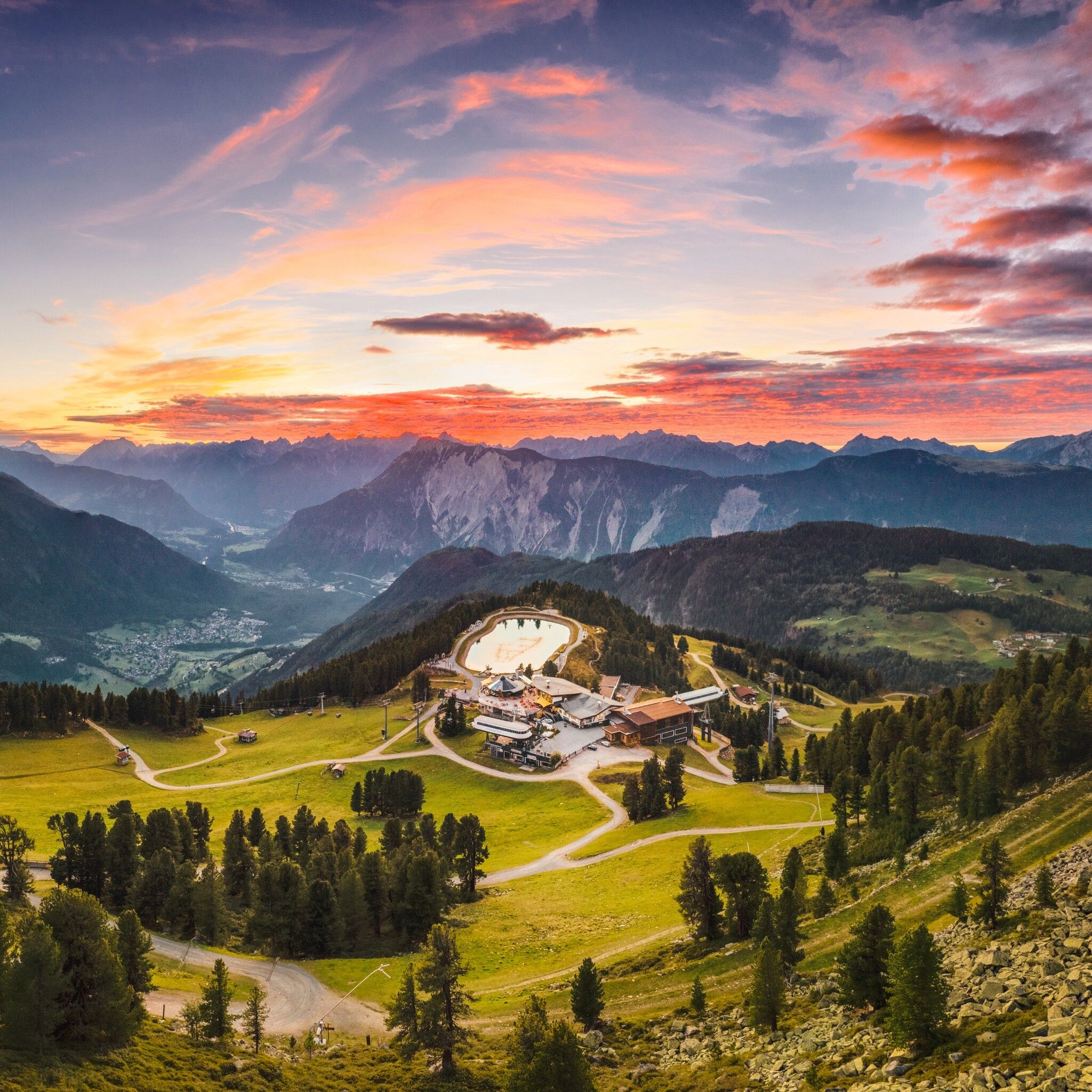
ACHERKOGELBAHN MOUNTAIN STATION --> Schaferkreuz --> ACHERKOGELBAHN MOUNTAIN STATION


Easy to moderate hiking trail; suitable for beginners. Please note the current weather report at: www.oetztal.com/de/sommer.html
Appropriate equipment such as breathable and weather-adapted outdoor clothing, ankle-high hiking shoes, wind, rain, and sun protection, a hat, and possibly gloves, is required for all hikes and routes. Carrying a first aid kit, a mobile phone, and possibly a hiking map, as well as sufficient provisions for hikes without refreshment options, is necessary.
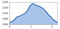
The starting point of this short hike to the Schaferkreuz is the mountain station Acherkogelbahn. From here, you walk straight ahead until you reach a narrow path that leads upwards to the right. After about 250 m, you reach a wide forest road, which you leave again after about 60 m and then snake up the next narrow path. After about 300 m, you reach a fork. Here you follow the left path. This path gently crosses upwards and opens up a dreamlike view of the Ötztal Alps and Mieminger Chain. After about 400 carefree meters, you reach the Schaferkreuz, where you can enjoy the panorama once again in full. Especially at dusk, spectacular sky shows can occur here, definitely a holiday "must see."
The descent is on the same route back down.
Travel comfortably and safely by train to Ötztal station. The final stop or exit point is ÖTZTAL station. Afterwards, you can travel conveniently and quickly with public buses or local taxi companies throughout the valley to your desired destination! The current bus schedule is available at: http://fahrplan.vvt.at
Parking spaces are available at the Acherkogelbahn.


")


