
Mountain hikes Wanderung über Wanderweg 9c zum Riatschhof
Nauders / Sesvenna Group
Difficulty ratings: easy
Route length: 3.5 km
Duration: 1:00 h

Wanderung über Wanderweg 9c zum Riatschhof
Tour information

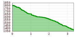
  • Requirement: easy
  • Length: 3.5 km
  • Duration: 1:00 h
  • Elevation uphill:16 hm
  • Elevation downhill:441 hm

Starting point

Bergstation Mutzkopfsessellift

Finishing point

Nauders Dorf
Source: TVB Tiroler Oberland

Description

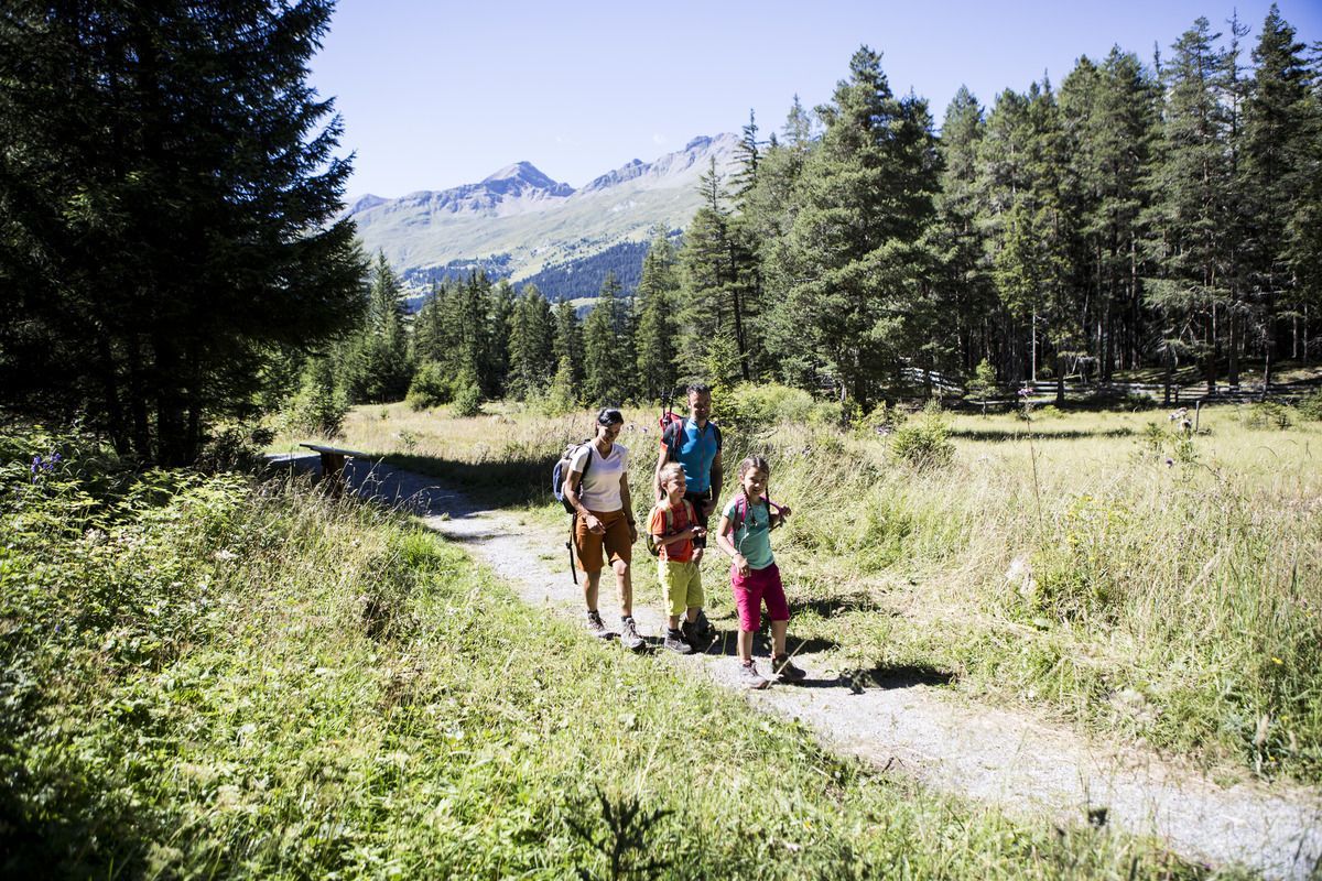
The chairlift leads comfortably from the valley station to the Kleiner Mutzkopf. Once at the top, you can see Piz Lad, the first member of the Sesvenna group, in the south. On the right you can see the Lower Engadine and the Samnaun mountains. Starting from the mountain station, the hiking trail leads past the Mutzkopf mountain inn to the Kreuzlers Lucke. After a further 100 metres on Trail no. 9 you will reach a hiking pole. Here Trail no. 9c branches off to the east. This leads along the former family ski run to the Riatschhof. Across meadows along the old Riatschweg No. 5a to Nauders.
 

Weather

Today

mainly clear
19°C/6°C
0%0l5 km/h

Sun

partly Cloudy
21°C/7°C
0%0l5 km/h

Mon

mainly clear
18°C/7°C
5%0l5 km/h
Go to weather forecast

More tours in the surrounding area

  • Sternenweg im Gepatsch

    Difficulty:medium
    Length:4.0 kmDuration:1:30 hElevation uphill:202 m
  • Großer Mutzkopf

    Opening hours:closed
    Difficulty:easy
    Length:10.3 kmDuration:4:00 hElevation uphill:507 m
  • Rolli-Wanderung Aifner Alm

    Difficulty:medium
    Length:6.0 kmDuration:2:30 hElevation uphill:460 m
  • Rolli-Wanderung Nassereinalm

    Difficulty:medium
    Length:5.5 kmDuration:1:45 hElevation uphill:269 m
  • Rolli-Wanderung Gepatschhaus

    Length:8.5 kmDuration:1:45 hElevation uphill:156 m
  • Rolli-Wanderung Falkaunsalm

    Difficulty:medium
    Length:4.5 kmDuration:1:45 hElevation uphill:392 m
  • Ötztal Trek Stage 15

    Difficulty:difficult
    Length:6.5 kmDuration:2:30 hElevation uphill:332 m
  • Talwanderweg Kaunertal

    Difficulty:easy
    Duration:2:30 hElevation uphill:295 m
  • Kaunerberger Wasserweg

    Opening hours:open
    Difficulty:medium
    Length:15.2 kmDuration:6:00 hElevation uphill:935 m
  • Verpeilschlucht

    Opening hours:open
    Difficulty:medium
    Duration:3:00 hElevation uphill:386 m
  • Gletscherlehrpfad Gepatschferner

    Difficulty:medium
    Length:8.4 kmDuration:3:45 hElevation uphill:400 m
  • Hohe Aifnerspitze (2.779 m)

    Difficulty:medium
    Length:7.2 kmDuration:5:15 hElevation uphill:815 m
  • Kapelle Maria Schnee

    Difficulty:easy
    Length:1.7 kmDuration:0:30 hElevation uphill:90 m
  • Radurschlklamm Gorge

    Opening hours:open
    Difficulty:medium
    Length:7.5 kmDuration:3:20 hElevation uphill:442 m
  • Rundwanderung Frudiger

    Difficulty:medium
    Length:13.5 kmDuration:4:55 hElevation uphill:588 m
Newsletter

The mountain is calling? So does our newsletter!

In our monthly newsletter we reveal the best holiday tips for Tyrol.
