
Rodelhütte Runde

Eben am Achensee / Karwendel
Route length: 10.4 km
Duration: 2:00 h

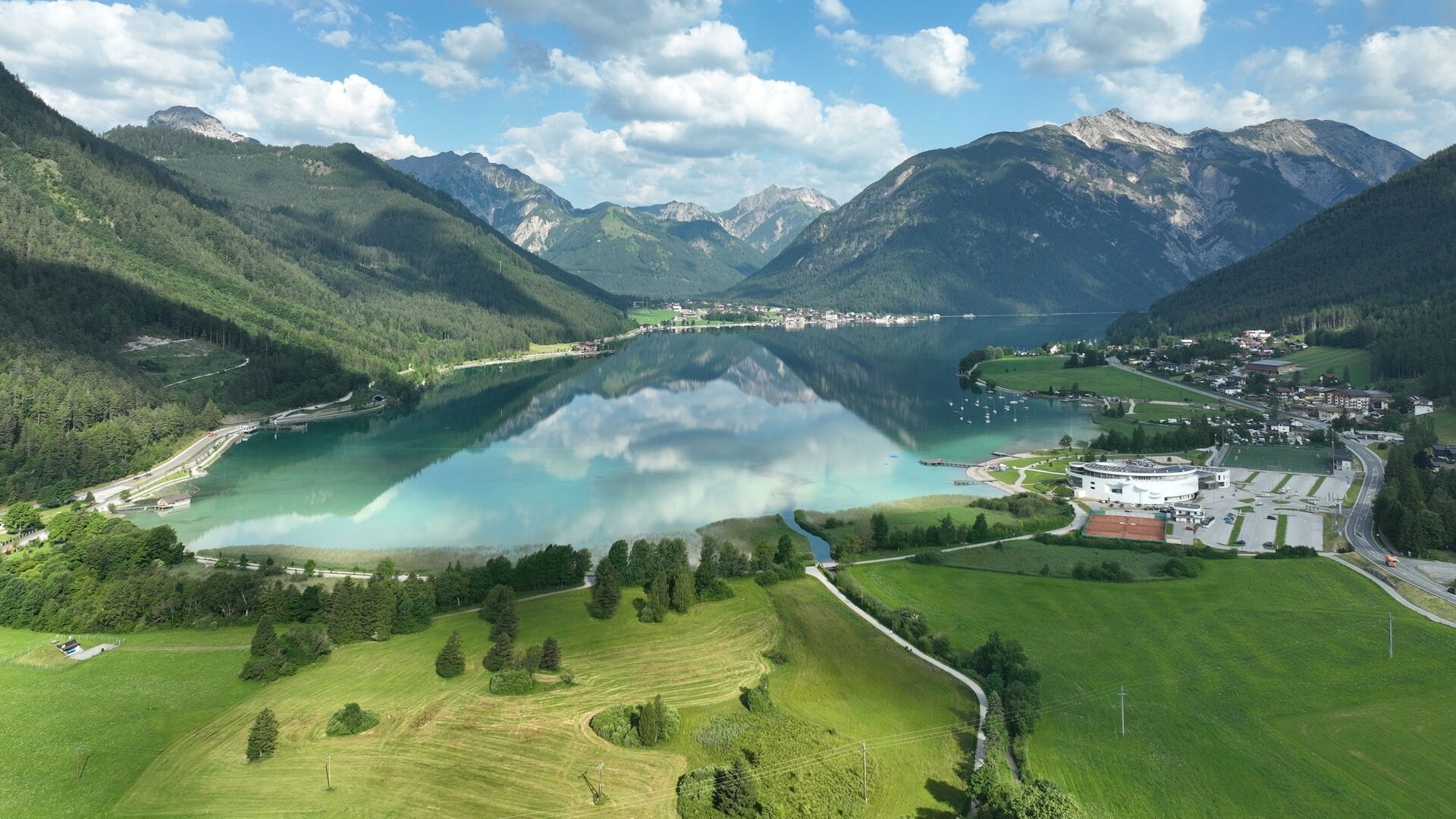
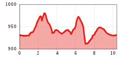
A quiet running route through the forest from Lake Achensee to the Rodelhütte Jenbach and back. The route is over 10 kilometres long with around 205 metres of elevation gain.
Tour information

  • Length: 10.4 km
  • Duration: 2:00 h
  • Elevation uphill:205 hm
  • Elevation downhill:205 hm
Highest point990 m

Starting point

Maurach, SEE-Bad Atoll Achensee

Finishing point

Maurach, SEE-Bad Atoll Achensee
  • Fitness level 2 / 6
  • Technique 2 / 6

Best time of year

  • January
  • February
  • March
  • April
  • May
  • June
  • July
  • August
  • September
  • October
  • November
  • December
Source: Achensee Tourismus

Description

From the SEE-Bad of the Atoll Achensee, this route leads along the lake promenade and then slightly uphill to the district of Lärchenwiese. At the junction, the route continues in the direction of Weißenbachtal. Follow the signposts to the Rodlhütte Jenbach. From here, the route leads back to the Lärchenwiese and continues along the lakeside promenade back to the starting point.

Getting here

  • Arrival by public transport

    Take the regional bus (lines 4080 or 390) to Maurach and get off at the "Maurach a. A. Atoll Achensee" stop. Atoll Achensee is located on the lakeshore in the Buchau district.

  • Parking

    Follow the Achensee main road (B181) to Maurach and continue straight ahead. The Atoll Achensee is prominently located on the main road in the Buchau district, right on the lakeshore, and is easy to spot from a distance.
    Atoll Achensee car park in Maurach (paid parking)

Weather

Today

mainly clear
17°C/6°C
65%1.6l5 km/h

Sun

partly Cloudy
15°C/6°C
5%0l10 km/h

Mon

clear sky
17°C/5°C
5%0l10 km/h

More tours in the surrounding area

  • Handbike ride Pertisau - Falzthurnalm

    Difficulty:difficult
    Length:3.3 kmDuration:1:00 hElevation uphill:105 m
  • 13 Zillertal Cycle Path

    Difficulty:easy
    Length:36.4 kmDuration:2:00 hElevation uphill:120 m
  • Dalfaz Alm

    Difficulty:medium
    Length:10.5 kmDuration:4:30 hElevation uphill:840 m
  • 465 Rund um den Guffert

    Difficulty:medium
    Length:41.0 kmDuration:6:00 hElevation uphill:990 m
  • Buchau - Gramaialm

    Difficulty:easy
    Length:32.9 kmDuration:3:00 hElevation uphill:540 m
  • 435 Feilkopf

    Difficulty:medium
    Length:8.3 kmDuration:2:00 hElevation uphill:580 m
  • Gramai Alm - Gramai Hochleger - Sonnjoch - Gramai Alm

    Difficulty:difficult
    Length:10.8 kmDuration:6:30 hElevation uphill:1,200 m
  • Rofan tour - stage 1

    Difficulty:medium
    Length:5.0 kmDuration:2:00 hElevation uphill:840 m
  • Rofan tour - stage 4

    Difficulty:medium
    Length:4.1 kmDuration:1:45 h
  • Rofan tour - stage 2 - alternative summit route

    Difficulty:difficult
    Length:8.7 kmDuration:5:00 hElevation uphill:670 m
  • Rofan tour- stage 2 - scenic tour

    Difficulty:medium
    Length:9.3 kmDuration:3:30 hElevation uphill:370 m
  • Rofan tour

    Difficulty:medium
    Length:30.5 kmDuration:4 daysElevation uphill:1,450 m
  • Steinberg - Panoramarunde

    Difficulty:easy
    Length:6.1 kmDuration:2:00 hElevation uphill:200 m
  • Bärenwald circuit

    Difficulty:easy
    Length:4.9 kmDuration:1:30 hElevation uphill:170 m
  • Eben - Astenau Alpe - Eben

    Difficulty:medium
    Length:4.5 kmDuration:2:15 hElevation uphill:505 m
Newsletter

The mountain is calling? So does our newsletter!

In our monthly newsletter we reveal the best holiday tips for Tyrol.
