Glockner Crown Variant 1

Kals am Großglockner / Granatspitzgruppe
Difficulty ratings: difficult
Route length: 13.0 km
Duration: 6:00 h

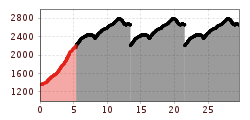
Hike the Jewels at the Southpart of the Großglockner in six stages.

Tour information

  • Requirement: difficult
  • Length: 13.0 km
  • Duration: 6:00 h
  • Elevation uphill:1,580 hm
  • Elevation downhill:280 hm
Highest point2,650 m

Starting point

Kals/Großdorf

Finishing point

Sudetendeutsche Hütte
  • Fitness level 5 / 6
  • Technique 5 / 6

Features

  • Multi-day hike

Best time of year

  • January
  • February
  • March
  • April
  • May
  • June
  • July
  • August
  • September
  • October
  • November
  • December

Trail condition

Hiking tour classyfied in black, which means for experienced, sure-footed hikers only and without fear of heights.

Equipment

Hiking boots, rain protection, hiking sticks, warm changing cloths, snacks, sun protection, cap, gloves

Description

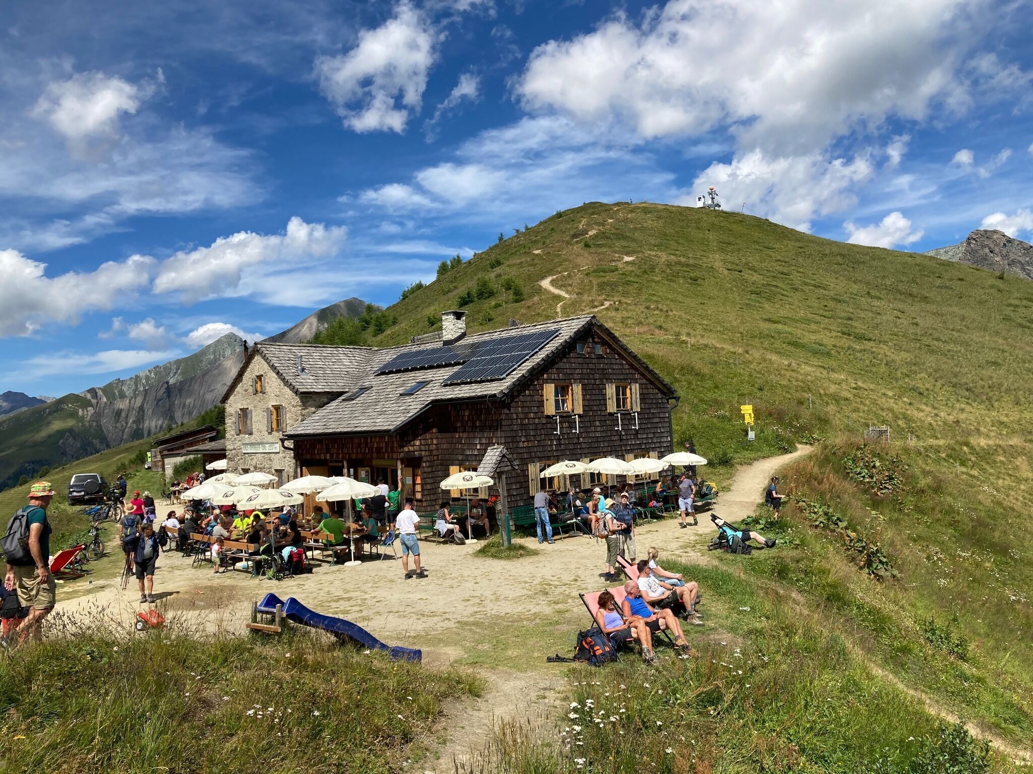
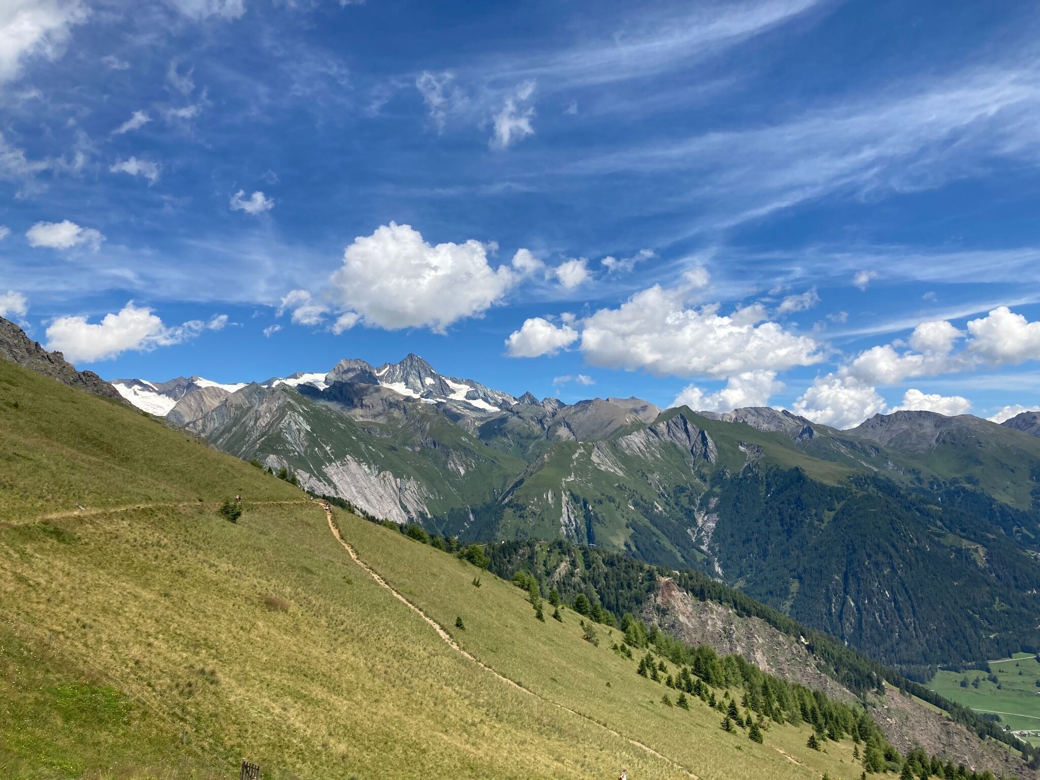
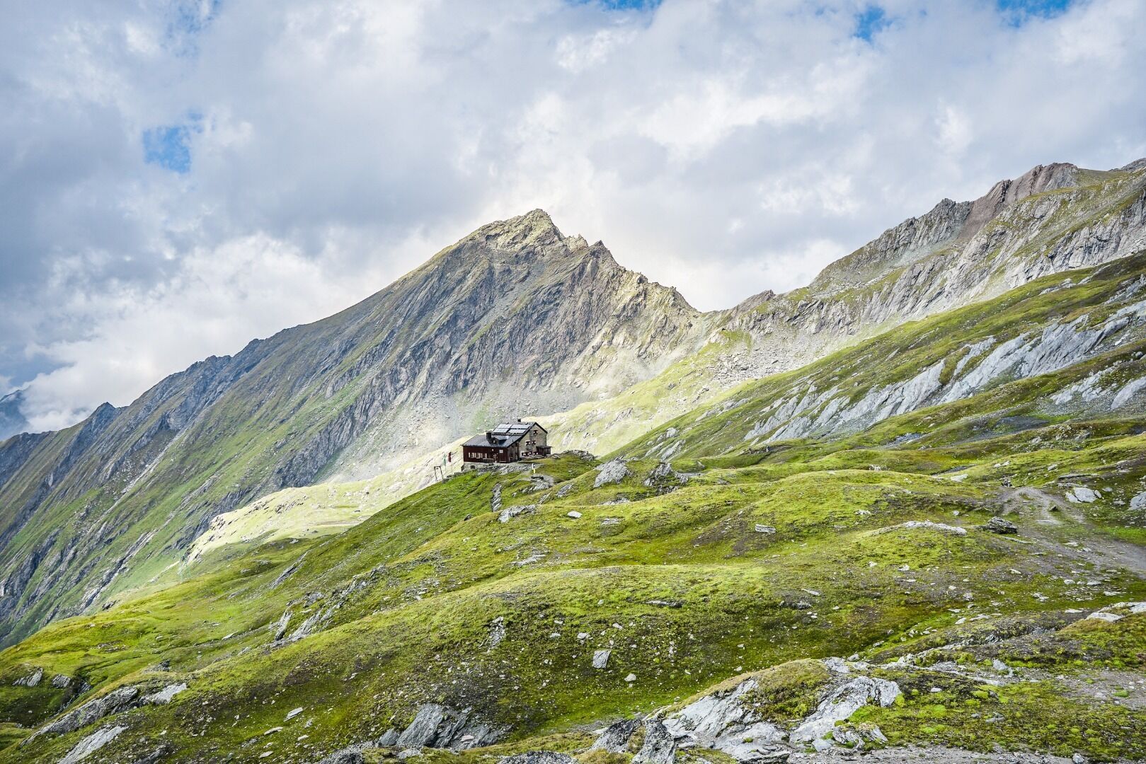
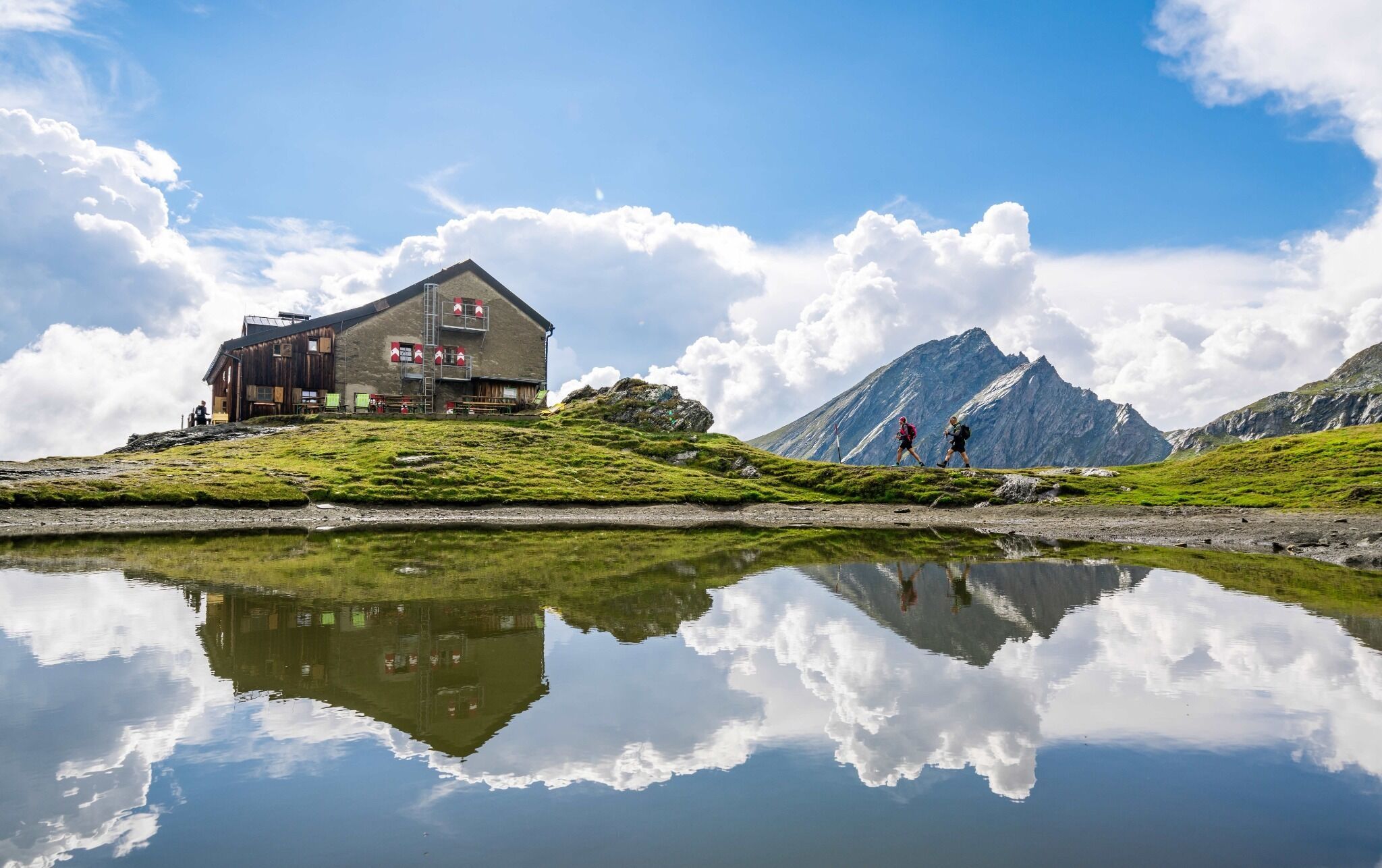
By using this hiking variation of the Glockner crown you may start directly in Kals am Großglockner and don't have to use the taxi transfer to Matrei/Glanz. But please be aware that one part of this hikingpath the so called "Dürrenfeldscharte" is categorized in black, which means you have to be experienced in alpine hiking, make secure steps and you may not be afraid of the hight. The starting point is in Kals/Großdorf, then take the hiking route nr. AV 502 B to Kals-Matreier-Törl-Haus, further to the Kalser Höhe and Hochtor until you reach the Sudetendeutschen Hütte. 

Getting here

  • Arrival by public transport


    Per bus line 952 to the bus stop in Kals/Gemeindeamt or Kals/Großdorf

  • Parking

    Parking in the center of Kals/Ködnitz or at the parking of the cable car in Kals/Großdorf

More tours in the surrounding area

Newsletter

The mountain is calling? So does our newsletter!

In our monthly newsletter we reveal the best holiday tips for Tyrol.