Mountain hikes Blankasee from Komperdell

closed
Serfaus / Samnaungruppe
Difficulty ratings: medium
Route length: 3.9 km
Duration: 4:00 h

Beautiful hike on narrow trail with several lakes and splendid views.

Tour information

  • Requirement: medium
  • Length: 3.9 km
  • Duration: 4:00 h
  • Elevation uphill:667 hm
  • Elevation downhill:20 hm
Highest point2,627 m

Starting point

Komperdell top station

Finishing point

Blankasee
Source: Serfaus-Fiss-Ladis

Description

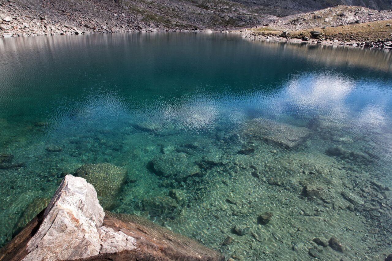
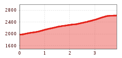
From the Komperdell top station (S201) short and steep ascent northwestwards, then gradually ascending in a westerly direction (trail no. 21). At the crossing (S208) turn onto trail no. 22 to the Untere Glockhäuser lakes (S261). Continue on trail no. 22a to the Obere Glockhäuser lakes (S263) and the last meters on trail no. 24 to the Blankasee lake (S266).

Nearby huts and mountain restaurants

More tours in the surrounding area

  • Wild Animals Trail

    Opening hours:closed
    Difficulty:easy
  • Marmot Trail

    Opening hours:closed
    Difficulty:easy
    Length:573 mDuration:0:20 hElevation uphill:12 m
  • Fiss to the Oberen Sattelkopf

    Opening hours:closed
    Difficulty:medium
    Length:5.6 kmDuration:3:00 hElevation uphill:1,079 m
  • Forscherpfad

    Opening hours:closed
    Difficulty:easy
    Length:3.4 kmDuration:1:30 hElevation uphill:219 m
  • Six Senses trail

    Opening hours:open
    Difficulty:easy
    Length:5.7 kmDuration:4:00 h
  • Six Senses trail

    Opening hours:closed
    Difficulty:easy
    Length:6.5 kmDuration:4:00 hElevation uphill:99 m
  • Murmeltiersteig (Marmot alpine trail)

    Opening hours:closed
    Difficulty:medium
    Length:6.9 kmDuration:3:00 hElevation uphill:302 m
Newsletter

The mountain is calling? So does our newsletter!

In our monthly newsletter we reveal the best holiday tips for Tyrol.