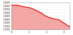
Open interactive mapOpen this POI on the interactive mapElevation profiledownloadBrandalm - Juns - Tux-Lanersbach.gpx
Hochalm Sommer Außenansicht © Hochalm Berwang circular hike AlmkopfDifficulty:easyLength:8.9 kmDuration:3:30 hElevation uphill:466 mSee trailSee trail: Berwang circular hike Almkopf
Summit hike Salfainssee - Schaflegerkogel (2,405 m) - Kemater Alm mountain hutDifficulty:mediumLength:14.8 kmDuration:7:00 hElevation uphill:1,029 mSee trailSee trail: Summit hike Salfainssee - Schaflegerkogel (2,405 m) - Kemater Alm mountain hut
Filmoor-Standschützenhütte über das LeitertalDifficulty:mediumLength:8.5 kmDuration:5:30 hElevation uphill:900 mSee trailSee trail: Filmoor-Standschützenhütte über das Leitertal
Hike to LaponesalmDifficulty:easyLength:6.2 kmDuration:2:00 hElevation uphill:242 mSee trailSee trail: Hike to Laponesalm
BiathlonpfadDifficulty:mediumLength:14.0 kmDuration:4:00 hElevation uphill:360 mSee trailSee trail: Biathlonpfad
Maria-Waldrast_Sommer_JohannesBitter_TVB-Wipptal_120823_067-Bearbeitet.jpg © JOHANNES BITTER Serles (2.717m)Difficulty:difficultLength:8.0 kmDuration:4:30 hElevation uphill:1,080 mSee trailSee trail: Serles (2.717m)
31732266.jpg © TVB Wipptal Round tour Griesberg-Wolfendorn-Wildseespitz-Landshuter Hütte-VenntallDifficulty:difficultLength:25.0 kmDuration:10:00 hElevation uphill:1,780 mSee trailSee trail: Round tour Griesberg-Wolfendorn-Wildseespitz-Landshuter Hütte-Venntall
Familienwanderung-Golzentipp-Kindermeile-TVB-Osttirol-c-Attic-FilmGmbH-Obertilliach.jpg © Attic Film GmbH Children's mile GolzentippDifficulty:easyLength:3.7 kmDuration:2:00 hElevation uphill:140 mSee trailSee trail: Children's mile Golzentipp
Round tour OttenspitzDifficulty:mediumLength:7.0 kmDuration:3:30 hElevation uphill:735 mSee trailSee trail: Round tour Ottenspitz
Schwaz, Kellerjochhütte_Tirol Werbung_Schwarz Charly_Schwaz (2) © Tirol Werbung | Charly Schwarz From Grafenast to the KellerjochDifficulty:mediumLength:7.9 kmDuration:3:30 hElevation uphill:520 mSee trailSee trail: From Grafenast to the Kellerjoch
Museum goes wild - digital circular walkDifficulty:easyLength:700 mDuration:0:30 hSee trailSee trail: Museum goes wild - digital circular walk
Kirchdachspitze (2.840m) from TrinsDifficulty:difficultLength:16.0 kmDuration:8:00 hElevation uphill:1,609 mSee trailSee trail: Kirchdachspitze (2.840m) from Trins
Wildlahner round tour via Ramsgrubnersee, Schoberspitzen (2,602m) and Steinernes Lamm (2,528m)Difficulty:mediumLength:13.0 kmDuration:8:00 hElevation uphill:1,380 mSee trailSee trail: Wildlahner round tour via Ramsgrubnersee, Schoberspitzen (2,602m) and Steinernes Lamm (2,528m)
Jausenstation-St-Magdalena_JohannesBitter_TVB-Wipptal_130823_079.jpg © JOHANNES BITTER To the pilgrimage church of St. Magdalena (1,661 m)Difficulty:mediumLength:3.0 kmDuration:2:30 hElevation uphill:450 mSee trailSee trail: To the pilgrimage church of St. Magdalena (1,661 m)
Lake Obernberg circular routeDifficulty:easyLength:6.0 kmDuration:2:30 hElevation uphill:269 mSee trailSee trail: Lake Obernberg circular route
Bike&Hike-Gschnitz_JohannesBitter_TVB-Wipptal_300624_018.jpg © Johannes Bitter BlaserDifficulty:mediumLength:11.0 kmDuration:4:30 hElevation uphill:1,067 mSee trailSee trail: Blaser
Ridge hike to the LichtseeDifficulty:mediumLength:13.0 kmDuration:3:30 hElevation uphill:834 mSee trailSee trail: Ridge hike to the Lichtsee
Niederkaiser Region St. Johann in Tirol © Franz Gerdl Niederkaiser with waterfall SchleierwasserfallDifficulty:mediumLength:16.1 kmDuration:7:00 hElevation uphill:954 mSee trailSee trail: Niederkaiser with waterfall Schleierwasserfall
Navis, Stöcklalm_Tirol Werbung_Bitter Johannes_Navis (2) © Tirol Werbung | Johannes Bitter StöcklalmDifficulty:mediumLength:14.0 kmDuration:3:40 hElevation uphill:828 mSee trailSee trail: Stöcklalm
2015_1046.jpg © Innsbruck Tourismus / Moser Grünberg - Simmeringalm mountain hutDifficulty:mediumLength:6.4 kmDuration:3:30 hElevation uphill:781 mSee trailSee trail: Grünberg - Simmeringalm mountain hut
Mit dem Nationalpark Ranger unterwegs © NPHT/Martin Lugger Hiking tour to Lucknerhütte 2.241mDifficulty:mediumLength:5.2 kmDuration:2:20 hElevation uphill:320 mSee trailSee trail: Hiking tour to Lucknerhütte 2.241m
Stöttlalmbrücke circular hikeDifficulty:easyLength:8.7 kmDuration:2:30 hElevation uphill:117 mSee trailSee trail: Stöttlalmbrücke circular hike
sunnenseiten-weg-stubai-contwise-02.jpg © Andre Schönherr Sunnenseit'n Weg: Round tourDifficulty:mediumLength:8.2 kmDuration:3:00 hElevation uphill:400 mSee trailSee trail: Sunnenseit'n Weg: Round tour
Horn-Gipfel-Höhenweg auf der Kitzbüheler Seite © Mirja Geh Kitzbüheler Horn via Horn-Gipfel-HöhenwegDifficulty:mediumLength:5.0 kmDuration:3:00 hElevation uphill:455 mSee trailSee trail: Kitzbüheler Horn via Horn-Gipfel-Höhenweg
Wanderung am Schlegeis mit Blick auf dem Stausee © Archiv TVB Mayrhofen Summit hike: Ginzling Schlegeis reservoir - Hoher RifflerDifficulty:difficultLength:17.0 kmDuration:7:30 hElevation uphill:1,500 mSee trailSee trail: Summit hike: Ginzling Schlegeis reservoir - Hoher Riffler
Give feedback for a chance to win a special holiday experience!Click here for the surveyClick here for the survey


 neu.jpg")


")


 (1).jpg")

.jpg")

")


