
Opening hours:Open today
Place:Sölden
:Alpine pasture / hut / mountain restaurant
SÖLDEN --> Brunnenberg --> BRUNNENKOGELHAUS

Red mountain paths are moderately difficult: some narrow and steep, but secured walking and climbing sections await hikers. The corresponding signs have a yellow background and indicate difficulty with a red circle.
Moderately difficult mountain path; suitable for sure-footed and experienced mountain hikers; good physical condition, mountain experience and mountaineering equipment (see equipment section) are necessary.
Please check the current weather forecast at: https://www.oetztal.com/de/sommer.html
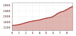
Appropriate equipment such as breathable and weather-appropriate outdoor clothing, ankle-high hiking boots, wind, rain and sun protection, a hat and possibly gloves is recommended! It is also important to bring sufficient provisions as well as a first aid kit, a mobile phone and possibly a hiking map.From the leisure arena, hike to the Platte district up to the Moosalm, then continue via forest and hiking trail to the Brunnenbergalm.
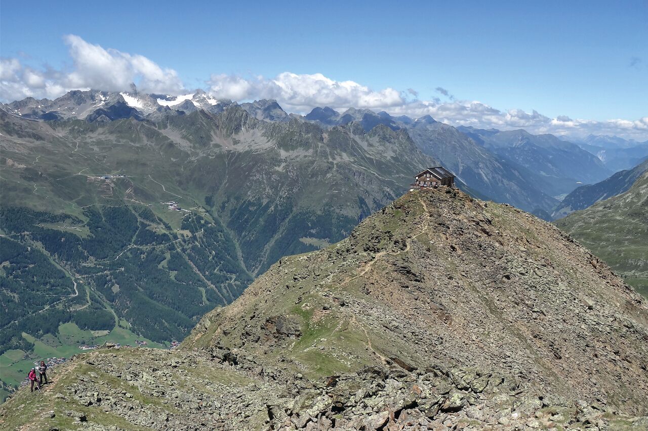
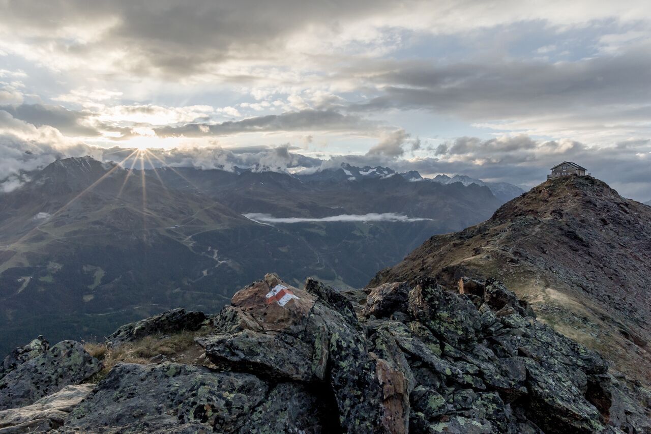
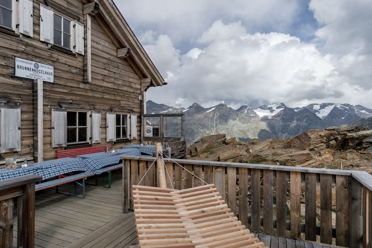
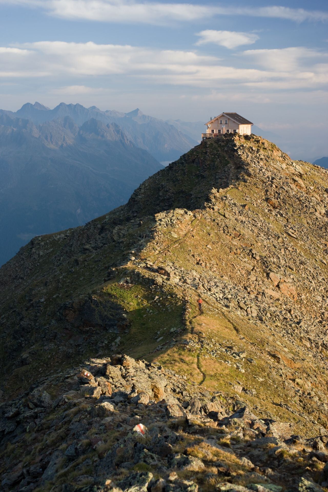
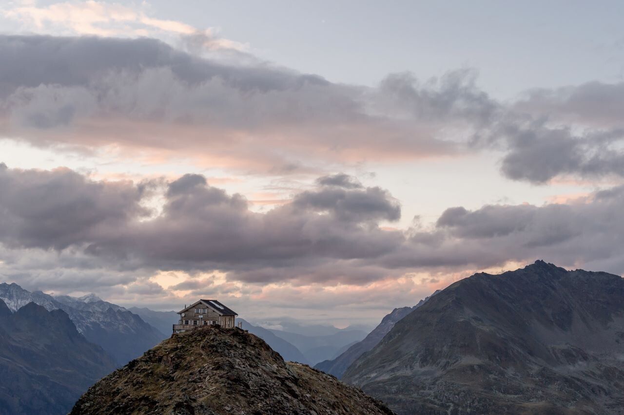
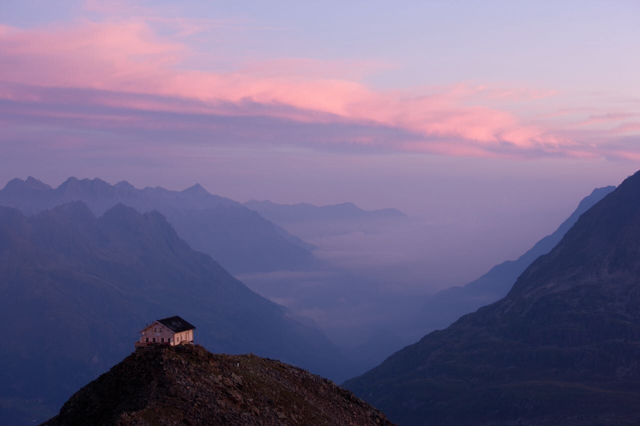
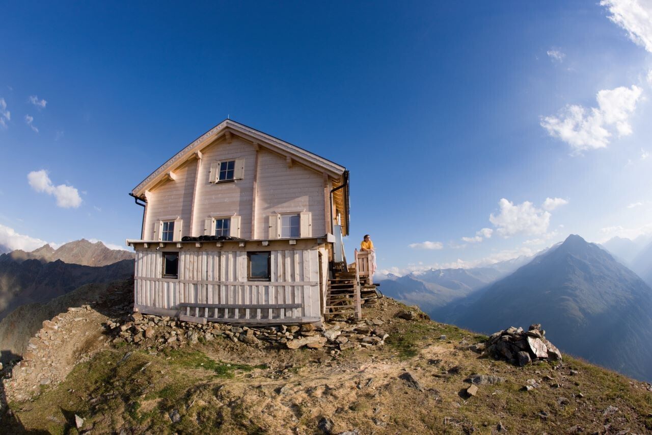
From the alm, follow the steep mountain path first through the beautiful larch-stone pine forest, then over broad pastures and later in serpentine bends to the Brunnenkogelhaus at 2,738 m.
From above, enjoy a fantastic view of the Venter and Gurgler valleys, separated by the mighty Nederkogel.
Travel comfortably and safely by train to the Ötztal train station. The final station or exit point is the ÖTZTAL train station. Then you can conveniently and quickly travel by public transport or local taxi companies through the entire valley to your desired destination.
The current bus timetable is available at: http://fahrplan.vvt.at
In Sölden, the following parking options are available:
Parking in Sölden is subject to fees.
For parking over several days (e.g. hut route):


.jpg")


.jpg")


.jpg")


