
Opening hours:Open today
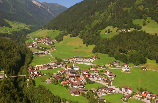
Place:Finkenberg
:Restaurant
Pure natural bliss in the Tux Valley. A perfect little getaway surrounded by nature!
Correct footwear (sole with a tread, firm hiking shoes)
Clothing (quickly drying, protection against wind, rain and cold)
Sunscreen – ATTENTION: strong sunlight in the mountains! Sunglasses, head protection, sunscreen with a high sun protection factor
First aid kit (gauze bandage, plaster)
Charged mobile phone
Drinks and food (drink plenty of fluid on hikes – but avoid alcohol!)
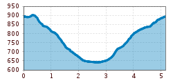
Proceed from the Devil's bridge along the gorge at path no. 32 through the nature reserve known as "Glocke". Extremly beautiful and recommended walk down to the district of Hochsteg. On path no. 12 to the district of Gstan and then back on path no. 31 to the starting point.
busline 4104
Bus stop Finkenberg Teufelsbrücke
Finkenberger Almbahnen car park/garage during operating hours, Persal 200
Car park on the left in front of the fire station/Hotel Panorama, Persal 226


 neu.jpg")


")


 (1).jpg")

.jpg")

")


