Mountain hikes Eiskögele

Sölden / Ötztaler Alpen
Difficulty ratings: difficult
Route length: 11.6 km
Duration: 8:00 h

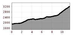
OBERGURGL -> Schönwieshütte -> Langtalereckhütte -> EISKÖGELE

Tour information

  • Requirement: difficult
  • Length: 11.6 km
  • Duration: 8:00 h
  • Elevation uphill:1,352 hm
  • Elevation downhill:59 hm
Highest point3,228 m

Starting point

Obergurgl

Finishing point

Eiskögele
  • Fitness level 5 / 6

Best time of year

  • January
  • February
  • March
  • April
  • May
  • June
  • July
  • August
  • September
  • October
  • November
  • December

Equipment

For climbers free from vertigo, sure-footed, and experienced in high-alpine terrain; excellent physical condition, comprehensive mountain experience, alpine climbing equipment, securing and orientation tools, and good weather conditions are recommended. Please check the current weather report at: www.oetztal.com/de/sommer.html

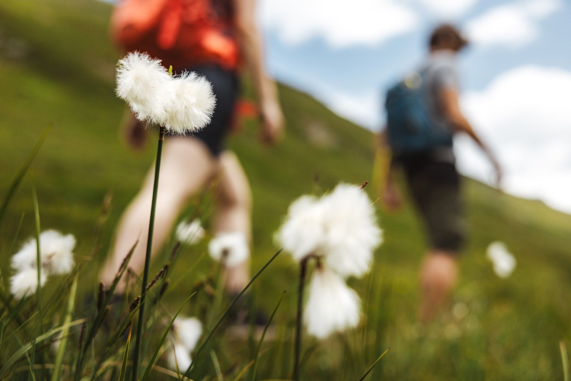
Appropriate equipment such as breathable and weather-adapted outdoor clothing, ankle-high hiking boots, wind, rain and sun protection, a hat, and possibly gloves is required for all hikes and routes. Carrying a first-aid kit, a mobile phone, and possibly a hiking map, as well as sufficient provisions for hikes without the possibility of stopping for food, is necessary.

Source: Ötztal

Description

From Obergurgl center head south to the end of the village. From there, continue along the promenade to a ledge (way cross and bench) opposite the Nose Wall. Now ascend to the left picturesquely through the 400-year-old Swiss pine forest to a small rise. Now follow the west slope of the Hohe Mut, gently to moderately ascending on a good gravel path towards Rotmoostal and across the bridge to the managed Schönwieshütte.

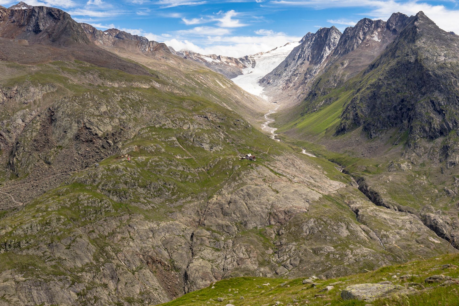
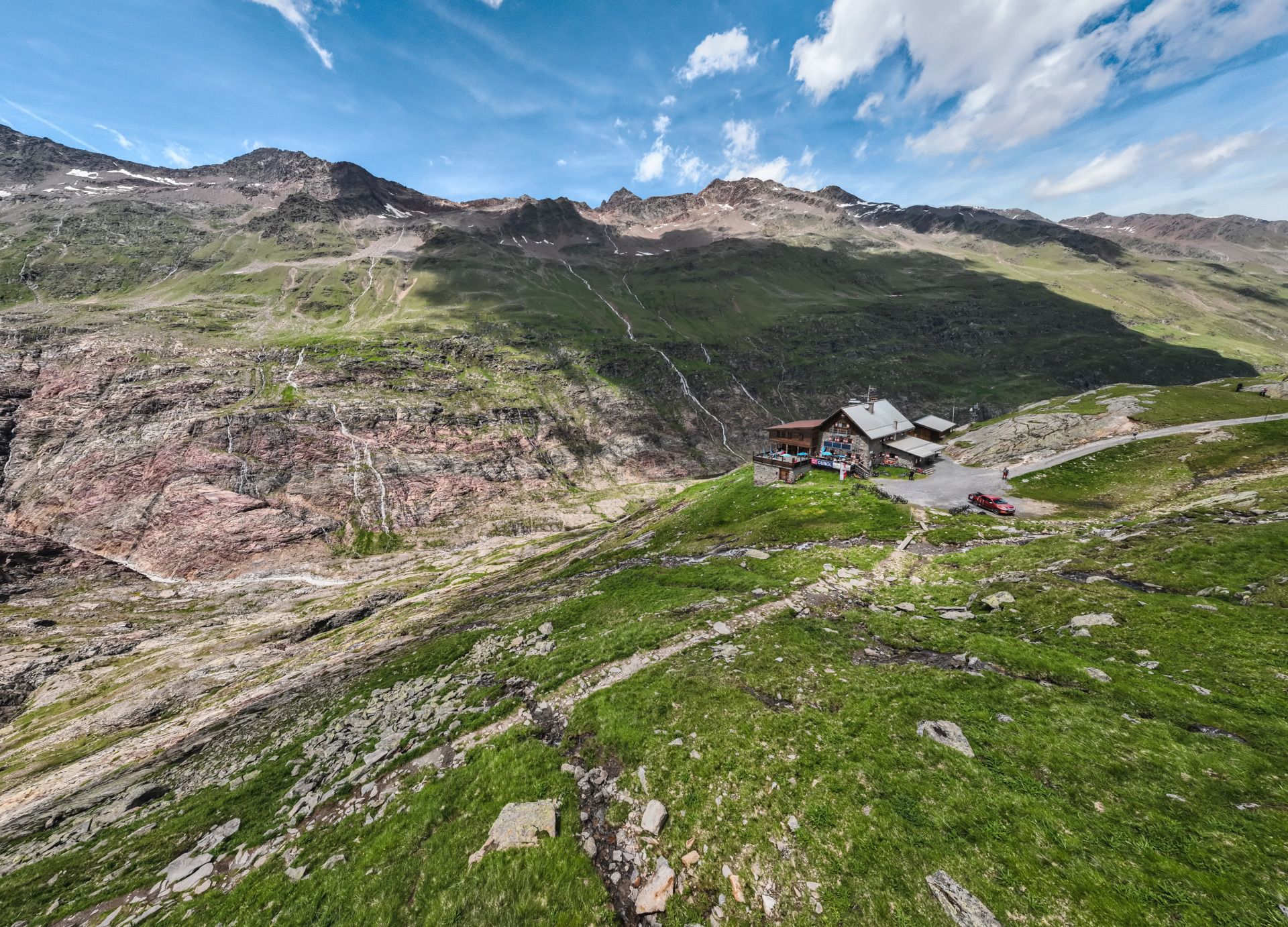
From there, the forest road first gently descends to the Gurgler Alm (an 8000-year-old cultural landscape) with the stone-built shepherd's hut. From there, continue into the valley passing the slopes of the Hangerer, past a small chapel, ascending to the old customs hut and over the saddle to the Langtalereck hut.

Follow the marking to the Seelenferner in the valley of the Langtalerferners, first gently ascending. Then the path becomes steeper, and at the end of the section a red-marked cairn shows the turnoff to the Seelenferner to the right, and from here a path marked with stakes to the Eiskögele to the left. No signposting. You have to keep your eyes open to find the rather sparse markings. Head northwards, crossing another rock step (T4) into the Hochkar in front of the Eiskögele. From here, simply head east to the summit. Descend from the summit back the same way to the Langtalereck hut.


Nearby huts and mountain restaurants

Getting here

  • Arrival by public transport

    Travel comfortably and safely by train to the Ötztal train station. The final stop or disembarkation point is the ÖTZTAL station. Afterwards, you can conveniently and quickly continue by public bus or local taxi companies through the entire valley to your desired destination! The current bus timetable is available at: http://fahrplan.vvt.at

  • Parking

     The following parking options are available in Gurgl:

    Parking garage village center Obergurgl (go down right in front of the church), paid | € 2.00 per hour

    Parking garage village entrance – Festkoglbahn valley station, paid | € 6.00 per day

    Parking lot Hochgurglbahn valley station, free – no overnight parking

    Parking lot Top Mountain Crosspoint, free

    Parking lot Hochgurgl, free (very small parking lot)

More tours in the surrounding area

  • Ötztal Trek Stage 4

    Difficulty: difficult
    Length: 8.9 km Duration: 4:00 h Elevation uphill: 802 m
  • Ötztal Trek Stage 3

    Difficulty: difficult
    Length: 10.4 km Duration: 4:00 h Elevation uphill: 842 m
  • Ötztal Trek Stage 10

    Difficulty: difficult
    Length: 11.1 km Duration: 4:30 h Elevation uphill: 1,476 m
  • Ötztal Trek Stage 8

    Difficulty: difficult
    Length: 9.3 km Duration: 3:30 h Elevation uphill: 274 m
  • Ötztal Trek Stage 14

    Difficulty: difficult
    Length: 6.3 km Duration: 3:00 h Elevation uphill: 1,004 m
  • Ötztal Trek Stage 20

    Opening hours: closed
    Difficulty: medium
    Length: 6.4 km Duration: 3:00 h Elevation uphill: 610 m
  • Ötztal Trek Stage 11

    Difficulty: difficult
    Length: 12.0 km Duration: 5:00 h Elevation uphill: 705 m
  • Ötztal Trek Stage 5

    Difficulty: difficult
    Length: 8.1 km Duration: 3:30 h Elevation uphill: 1,125 m
  • Ötztal Trek Stage 6

    Difficulty: difficult
    Length: 7.6 km Duration: 3:30 h Elevation uphill: 640 m
  • Ötztal Trek Stage 7

    Difficulty: difficult
    Length: 5.3 km Duration: 2:00 h Elevation uphill: 376 m
  • Ötztal Trek Stage 1

    Difficulty: medium
    Length: 18.6 km Duration: 6:30 h Elevation uphill: 1,561 m
  • Ötztal Trek Stage 17

    Difficulty: difficult
    Length: 16.4 km Duration: 6:00 h Elevation uphill: 1,080 m
  • Ötztal Trek Stage 12

    Difficulty: difficult
    Length: 4.8 km Duration: 2:00 h Elevation uphill: 592 m
  • Ötztaler Urweg

    Length: 189.1 km Duration: 72:19 h Elevation uphill: 9,428 m
  • Ötztal Trek Stage 22

    Difficulty: difficult
    Length: 21.5 km Duration: 8:00 h Elevation uphill: 647 m
  • Ötztal Trek Stage 21

    Difficulty: difficult
    Length: 9.4 km Duration: 4:30 h Elevation uphill: 1,270 m
  • Ötztal Trek

    Length: 246.4 km Duration: 84:25 h Elevation uphill: 18,910 m
  • Ötztal Trek Stage 16

    Difficulty: difficult
    Length: 6.9 km Duration: 2:30 h Elevation uphill: 358 m
  • Vent - Breslauer Hütte - Vernagthütte

    Difficulty: medium
    Length: 10.4 km Duration: 4:00 h Elevation uphill: 1,203 m
  • Mutsbühl

    Difficulty: medium
    Length: 4.5 km Duration: 1:30 h Elevation uphill: 470 m
  • Mountain peak Rosskopf

    Difficulty: medium
    Length: 2.0 km Duration: 2:00 h Elevation uphill: 379 m
Newsletter

The mountain is calling? So does our newsletter!

In our monthly newsletter we reveal the best holiday tips for Tyrol.