
Opening hours:Open today
Place:Finkenberg
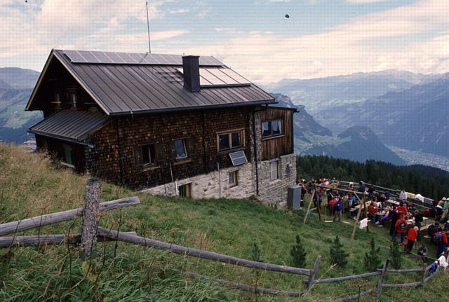
:Restaurant, Alpine pasture / hut / mountain restaurant
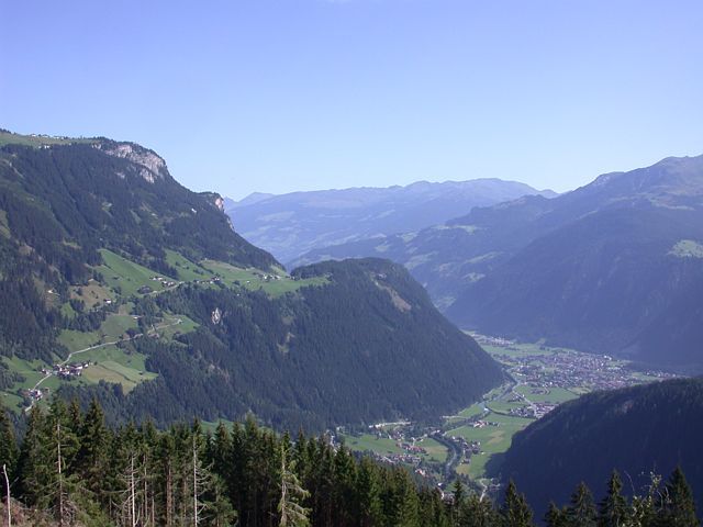
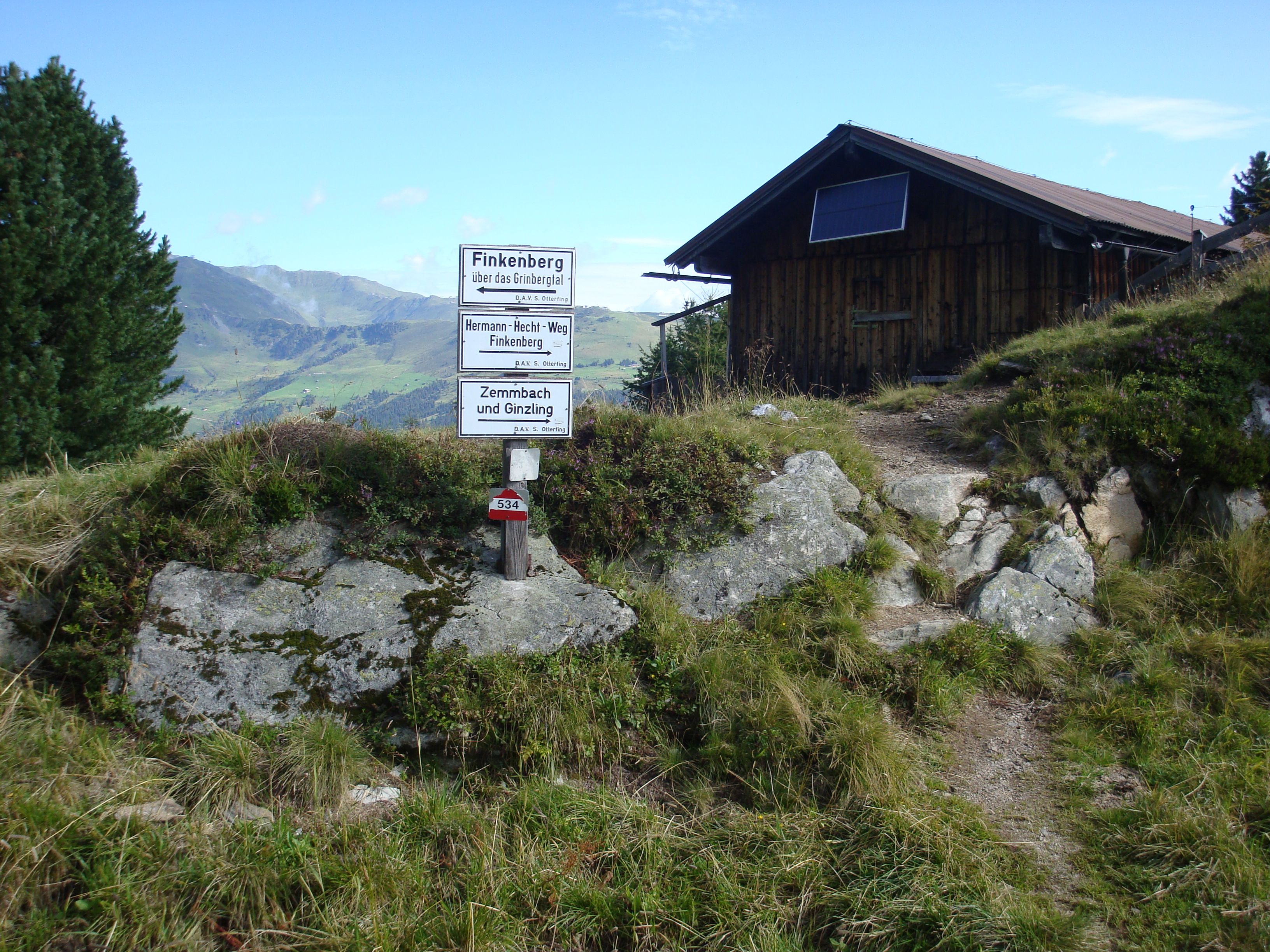
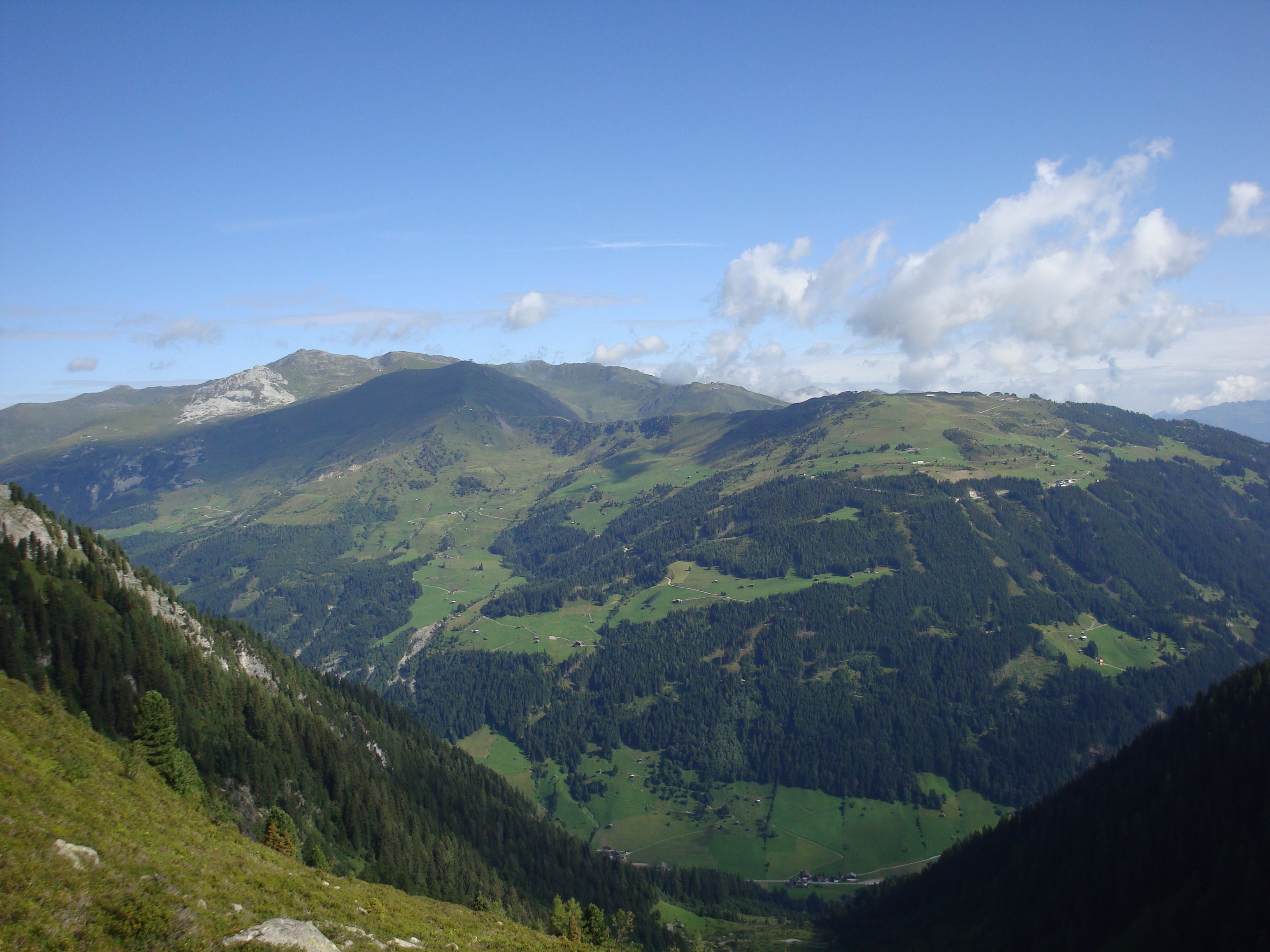
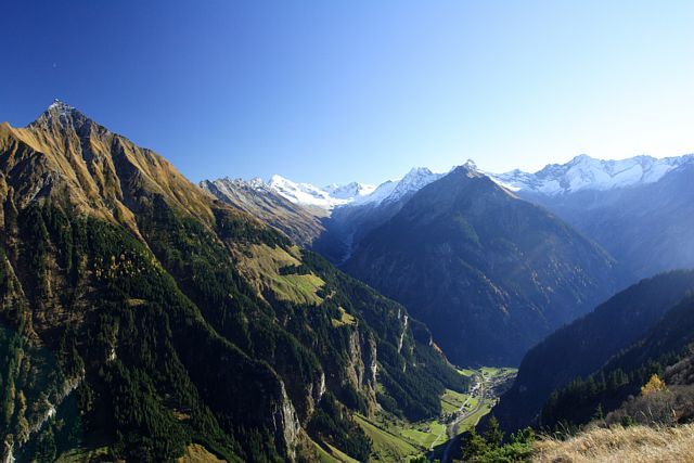
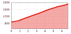
Sporty ascent via the Hermann Hecht Trail with many hairpin bends to the Gamshütte hut high above Finkenberg.
Correct footwear (sole with a tread, firm hiking shoes)
Clothing (quickly drying, protection against wind, rain and cold)
Sunscreen – ATTENTION: strong sunlight in the mountains! Sunglasses, head protection, sunscreen with a high sun protection factor
First aid kit (gauze bandage, plaster)
Charged mobile phone
Drinks and food (drink plenty of fluid on hikes – but avoid alcohol!)
Walk from the bus-stop in Finkenberg to the Teufelsbrücke (Devil's bridge), cross the bridge and take the road on the right through the district Dornau direction Brunnhaus. At the tennis-court (Brunnhaus 404) the Hermann-Hecht-Weg (trail no. 533) branches off to the left and takes you in countless turns upwards through the forest. At "Kraxentrager" (1,800 m) the most part of the ascent has been done; a little later you will leave the forest and you can even see the Gamshütte, which will be reached few minutes later.
This climb to the Gamshütte is the first stage of the Berliner Höhenweg.
Linienbus
4104
Bus stop Finkenberg Teufelsbrücke
Day parking lots at Finkenberg: Teufelsbrücke, Tenniscourt, sportscourt


 neu.jpg")


")


 (1).jpg")

.jpg")

")


