
Opening hours:Open today
Place:Vent
:Alpine pasture / hut / mountain restaurant
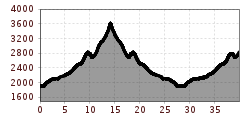
Vent - Martin-Busch Hut - Hintere Schwärze - Martin-Busch Hut - Vent
For those free from dizziness, sure-footed and experienced in high alpine climbing; excellent physical condition, extensive mountain experience, alpine climbing equipment, securing and orientation tools, good weather conditions recommended Please note the current weather report at: https://www.oetztal.com/de/sommer.html
Appropriate equipment such as breathable and weather-appropriate outdoor clothing, ankle-high hiking boots, wind, rain and sun protection, hat, possibly gloves, is required for all hikes and tours. Bringing a first aid kit, a mobile phone and possibly a hiking map as well as sufficient provisions for hikes without the possibility of stopping is necessary.
Hintere Schwärze – The dark soul of the Ötztal Alps
Rising 3,628 meters, the Hintere Schwärze (Italian: Cima Nera) stands silently and majestically over the glacier sea of the Ötztal Alps. It is the fourth highest peak of the mountain range – a mountain of impressive presence whose name alone inspires awe. Its first ascent in 1867 by Ernst Pfeiffer from Vienna with mountain guides Benedikt Klotz and Josef Scheiber was a pioneering act – today it remains a destination for climbers with a feel for the pristine.
The ascent from the Martin-Busch Hut via the Marzellferner to the west ridge is demanding but rewarding. Steep firn slopes, crevasses and vast ice fields require alpine experience, endurance and a clear mind. Those who reach the summit are rewarded with one of the most sublime views in the Ötztal – a view of the ice giants Similaun, Weißkugel and Ortler that lingers.
Off the well-known routes, the Hintere Schwärze lies in the half-shadow of its famous neighbors – yet this silence is what makes it so special. It is not a mountain that opens itself easily – but one that opens to those willing to engage. For experienced alpinists, it is a goal of deep intensity and lasting memory.
Travel comfortably and safely by train to Ötztal train station. The final stop or exit point is the ÖTZTAL station. Afterwards, travel conveniently and quickly by public transport or local taxi companies through the entire valley to your desired destination! The current bus schedule is available at: http://fahrplan.vvt.at
In the mountaineering village Vent, the following parking options are available.
- In summer in front of the village (parking meter, coins or EC card only) and at the valley station of the chairlift (at the ticket office of the mountain railways)
- In winter only at the valley station of the chairlift
Parking fee applies!


