Mountain hikes Hintereggkogel 2.638m

Matrei in Osttirol / Venediger Group
Difficulty ratings: difficult
Route length: 8.2 km
Duration: 7:00 h

Picutresque summit above Zedlach

Tour information

  • Requirement: difficult
  • Length: 8.2 km
  • Duration: 7:00 h
  • Elevation uphill:1,170 hm
  • Elevation downhill:1,170 hm
Highest point2,638 m

Starting point

Car park Zedlacher Paradies 1.420m

Finishing point

Car park Zedlacher Paradies 1.420m
  • Fitness level 5 / 6
  • Technique 5 / 6

Best time of year

  • January
  • February
  • March
  • April
  • May
  • June
  • July
  • August
  • September
  • October
  • November
  • December

Trail condition

Gravel, hiking trail, rock
Source: TVB Osttirol

Description

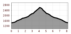
The hike starts at the car park Zedlacher Paradies. From here you can either take the forest road to the Wodenalm, or you go up the narrower trail no. 53C. This trail is shorter, but also steeper. The trail from the Wodenalm is an alpine route and therefore not to be underestimated.
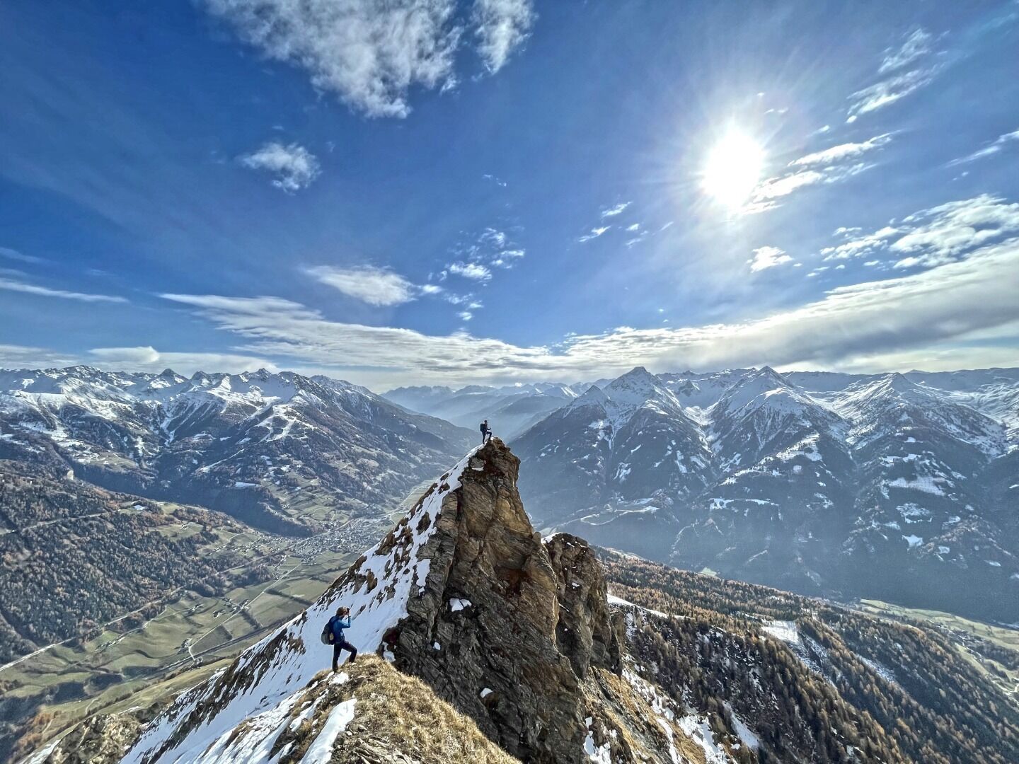
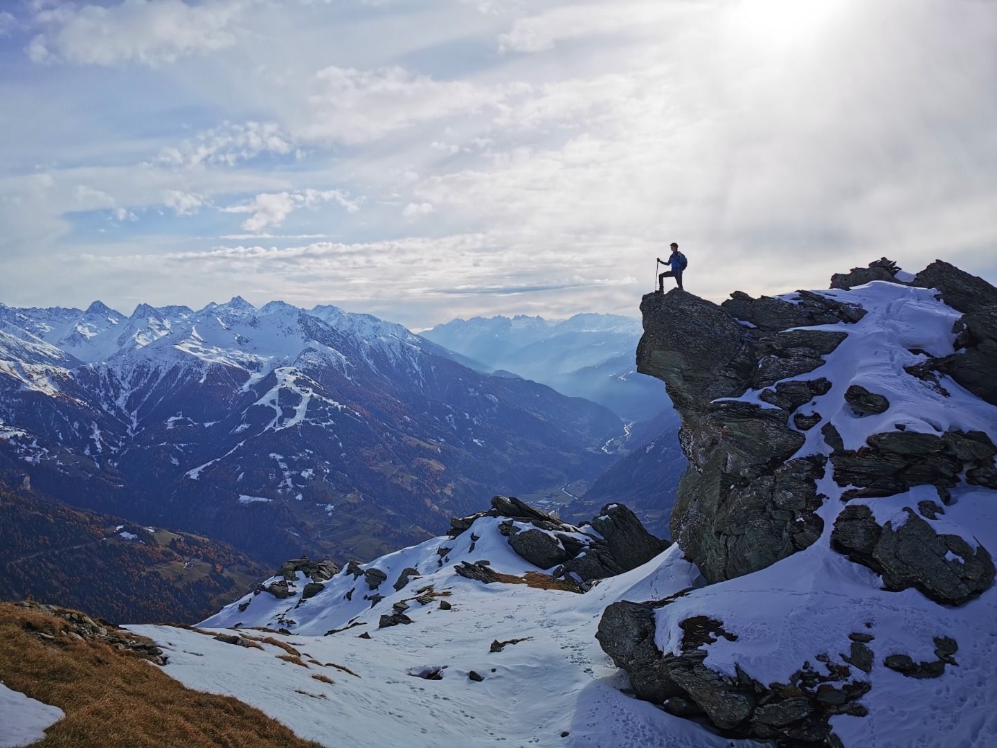
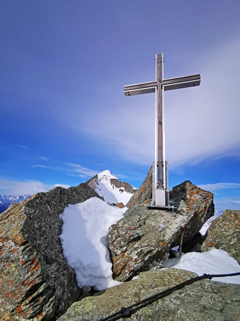
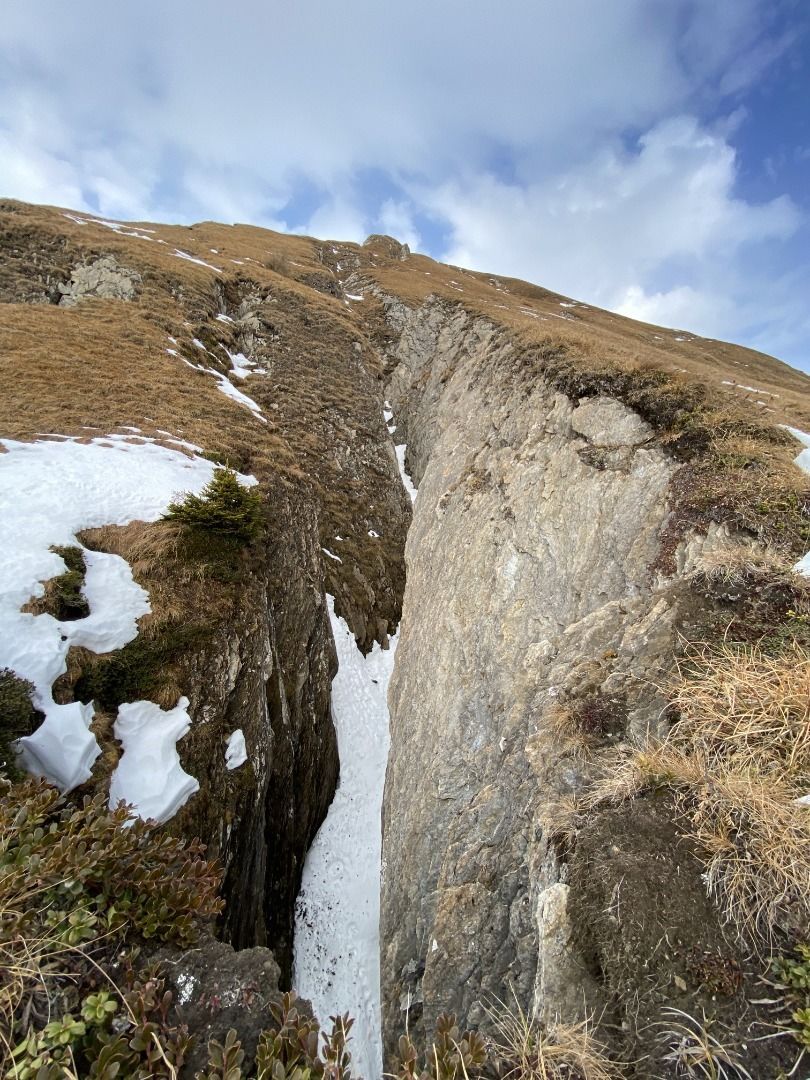
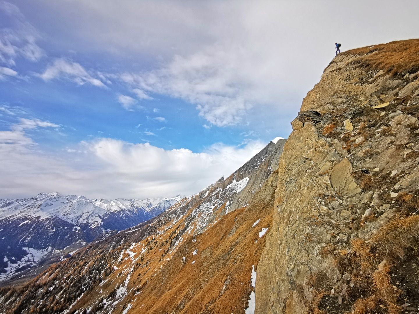
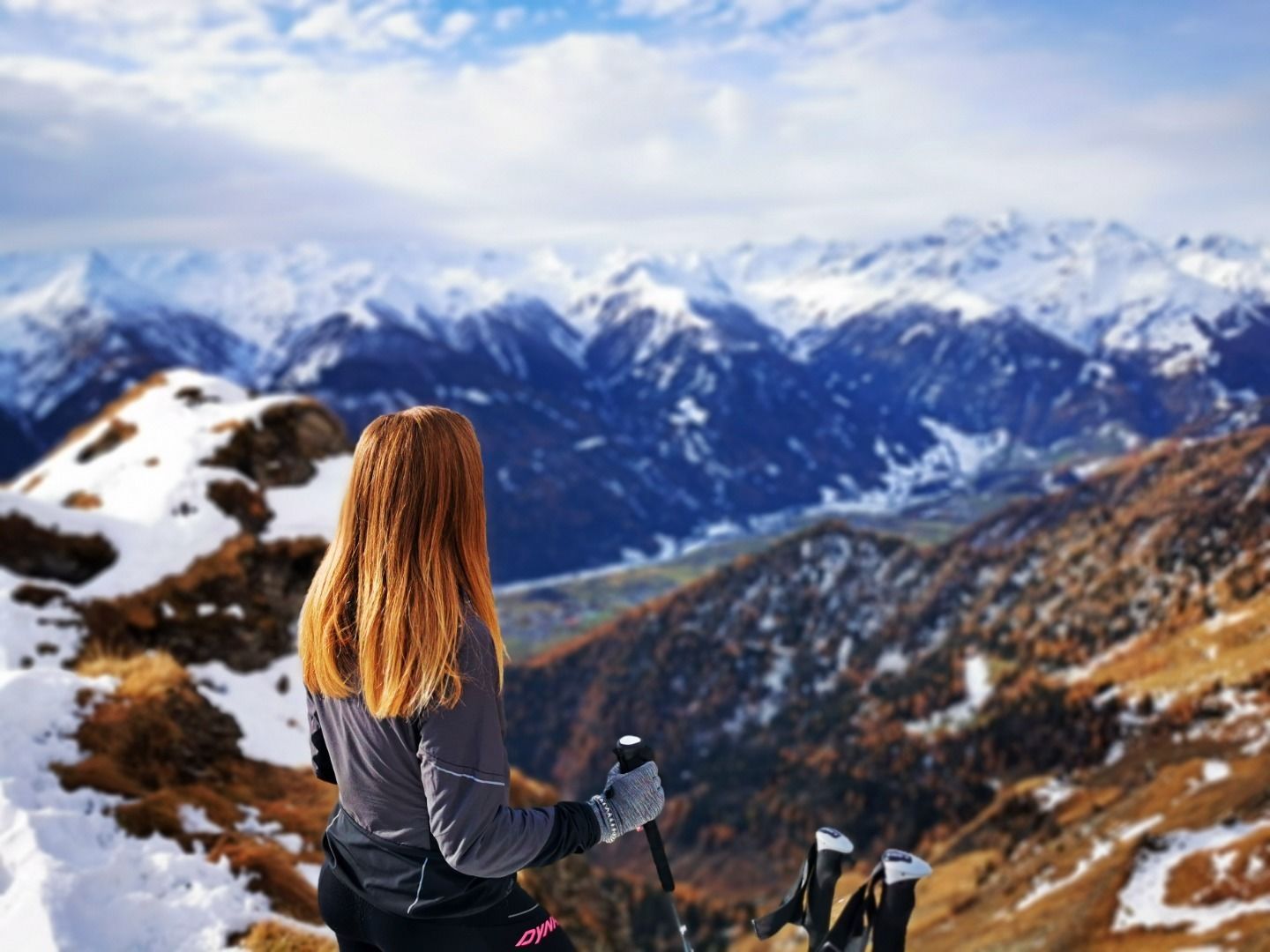
After about 45 minutes you reach the Planlißbichl. The entire Virgental Valley, including the glacier "Malhalm-Kees", lies at your feet. The shimmering silver summit cross already seems very close. On the right side, the view opens up into the deep cracks above Hinteregg. The further path is very steep and only very sparsely marked. The last 50 meters of altitude are mastered over a steep rocky flank. This piece is also partly secured with a steel rope. The summit itself is very small and extremely steep on the back side - danger of falling!
The way back is via the same path.

Nearby huts and mountain restaurants

Getting here

  • Parking

    Car park Zedlacher Paradies

More tours in the surrounding area

  • Muhs panorama trail

    Difficulty:medium
    Length:15.2 kmDuration:6:00 hElevation uphill:1,090 m
  • Lasörling altitude trail

    Difficulty:medium
    Length:57.0 kmDuration:25:00 hElevation uphill:3,740 m
  • Venediger altitude trail

    Difficulty:difficult
    Length:55.5 kmDuration:27:00 hElevation uphill:3,915 m
  • Figerhorn

    Difficulty:difficult
    Length:6.5 kmDuration:6:00 hElevation uphill:807 m
  • Theme path "Virgen crossroads"

    Difficulty:easy
    Length:3.2 kmDuration:1:00 hElevation uphill:104 m
  • Lasörling 3.098m

    Difficulty:difficult
    Length:22.0 kmDuration:12:00 hElevation uphill:1,940 m
  • Circular walk church St. Nikolaus

    Difficulty:easy
    Length:5.4 kmDuration:1:39 hElevation uphill:150 m
  • Hike to the Venedigerhaus Innergschlöß

    Difficulty:easy
    Length:8.6 kmDuration:2:30 hElevation uphill:184 m
  • Rollitour with Swiss Trac

    Difficulty:easy
    Length:3.2 kmDuration:1:30 hElevation uphill:135 m
  • Rotenkogel

    Difficulty:difficult
    Length:3.9 kmDuration:3:00 hElevation uphill:383 m
  • Umbal waterfalls nature force trail

    Difficulty:easy
    Length:6.0 kmDuration:2:30 hElevation uphill:257 m
  • Glacier trail Innergschlöss/Schlatenkees

    Difficulty:medium
    Length:9.4 kmDuration:4:50 hElevation uphill:680 m
  • Hike to Kalser Tauernhaus

    Difficulty:medium
    Length:12.2 kmDuration:4:00 hElevation uphill:244 m
  • Hiking tour to Zupalsee Hütte 2.350m

    Difficulty:medium
    Length:14.9 kmDuration:8:30 hElevation uphill:1,261 m
  • Lucknerhaus - Stüdlhütte

    Difficulty:medium
    Length:9.3 kmDuration:4:30 hElevation uphill:862 m
  • Hiking tour to Neue Sajathütte 2.600m

    Difficulty:medium
    Length:10.3 kmDuration:6:50 hElevation uphill:1,086 m
  • Hiking tour to St. Pöltner Hütte and 3 lakes

    Difficulty:difficult
    Length:14.8 kmDuration:7:40 hElevation uphill:1,119 m
  • Hike to Neuen Reichenberger Hütte

    Difficulty:medium
    Length:18.2 kmDuration:9:00 hElevation uphill:1,252 m
Newsletter

The mountain is calling? So does our newsletter!

In our monthly newsletter we reveal the best holiday tips for Tyrol.