Mountain hikes Hinterer Heuberg (2,578 m) via Komperdell

closed
Serfaus / Samnaungruppe
Difficulty ratings: medium
Route length: 14.3 km
Duration: 5:00 h

Hinterer Heuberg (2,578 m) via Komperdell

Tour information

  • Requirement: medium
  • Length: 14.3 km
  • Duration: 5:00 h
  • Elevation uphill:1,300 hm
  • Elevation downhill:929 hm
Highest point2,728 m

Starting point

Komperdell top station

Finishing point

Lazid top station
Source: Serfaus-Fiss-Ladis

Description

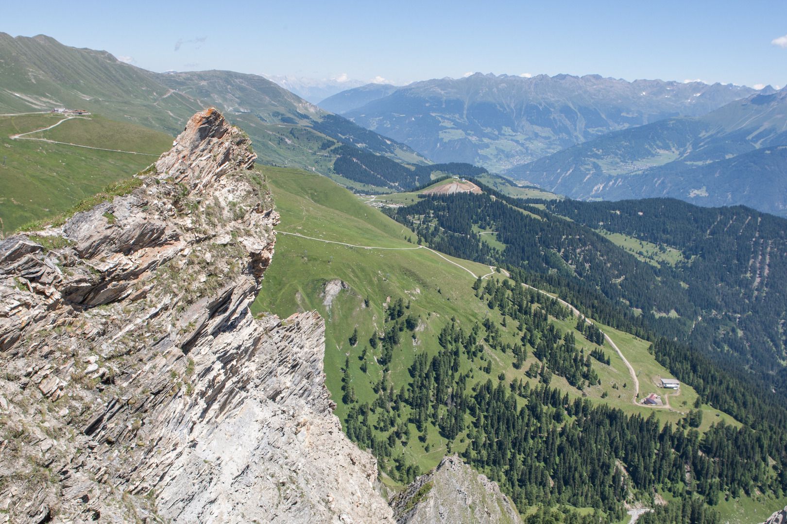
From the Komperdell top station (S104) to the Kölner Haus (S103). From there to the Lausbachbrücke bridge, past the Cervosa Alm. Descent on a vehicle track to the Lazidkreuz (S280). Further on trail no. 30, past the Böderhütte (S286) to the signpost (S290). Via serpentines steeply upwards to the Riefenjoch (S287). From here in 30 minutes you reach the summit of the Hinteren Heuberg (S295). From the Riefenjoch (S287) you reach the Pezidsattel (S292) and the Pezidbahn mountain terminal (closed in summer) – but only via the Riefenkopf and via a brittle-stone ridge suitable only for experienced hikers. Behind the mountain terminal is a trail to the main summit of the Pezid (2,770 m). Descent on the vehicle track, from the signpost (S227) onto the trail to the crossing (S223) and on trail no. 26 to Scheid (S217) and further on to the Lazidbahn mountain terminal (S301).

Nearby huts and mountain restaurants

More tours in the surrounding area

  • Wild Animals Trail

    Opening hours:closed
    Difficulty:easy
  • Marmot Trail

    Opening hours:closed
    Difficulty:easy
    Length:573 mDuration:0:20 hElevation uphill:12 m
  • Fiss to the Oberen Sattelkopf

    Opening hours:closed
    Difficulty:medium
    Length:5.6 kmDuration:3:00 hElevation uphill:1,079 m
  • Forscherpfad

    Opening hours:closed
    Difficulty:easy
    Length:3.4 kmDuration:1:30 hElevation uphill:219 m
  • Six Senses trail

    Opening hours:open
    Difficulty:easy
    Length:5.7 kmDuration:4:00 h
  • Six Senses trail

    Opening hours:closed
    Difficulty:easy
    Length:6.5 kmDuration:4:00 hElevation uphill:99 m
  • Murmeltiersteig (Marmot alpine trail)

    Opening hours:closed
    Difficulty:medium
    Length:6.9 kmDuration:3:00 hElevation uphill:302 m
Newsletter

The mountain is calling? So does our newsletter!

In our monthly newsletter we reveal the best holiday tips for Tyrol.