Mountain hikes Hochoetz Route 2 - The Rough

Oetz / Stubaier Alpen
Difficulty ratings: medium
Route length: 6.9 km
Duration: 2:30 h

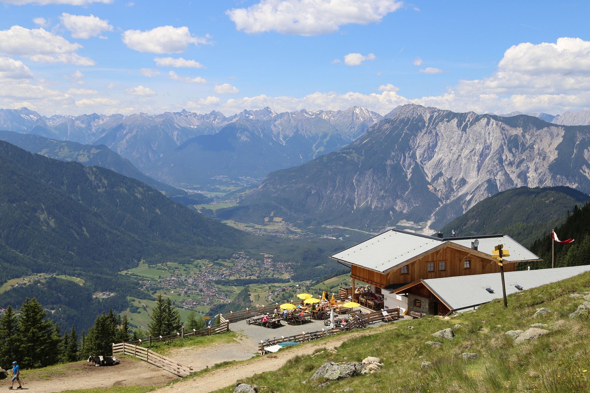
PANORAMA RESTAURANT HOCHOETZ -> Acherberg Alm -> OETZ

Tour information

  • Requirement: medium
  • Length: 6.9 km
  • Duration: 2:30 h
  • Elevation uphill:3 hm
  • Elevation downhill:1,200 hm
Highest point2,020 m

Starting point

Panorama Restaurant Hochoetz

Finishing point

Oetz
  • Fitness level 3 / 6

Best time of year

  • January
  • February
  • March
  • April
  • May
  • June
  • July
  • August
  • September
  • October
  • November
  • December

Equipment

Moderate mountain path; suitable for sure-footed and experienced hikers; good physical condition, mountain experience, and mountain equipment (see under equipment) necessary. Please check the current weather report at: www.oetztal.com/en/summer.html

Appropriate equipment such as breathable and weather-appropriate outdoor clothing, ankle-high hiking boots, wind, rain and sun protection, a hat, and possibly gloves is required for all hikes and routes. Carrying a first aid kit, a mobile phone, and possibly a hiking map, as well as sufficient provisions for hikes without any possibility of stopping for food, is necessary. 

Source: Ötztal

Description

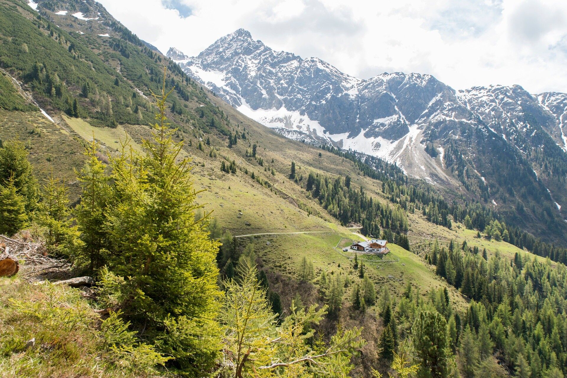
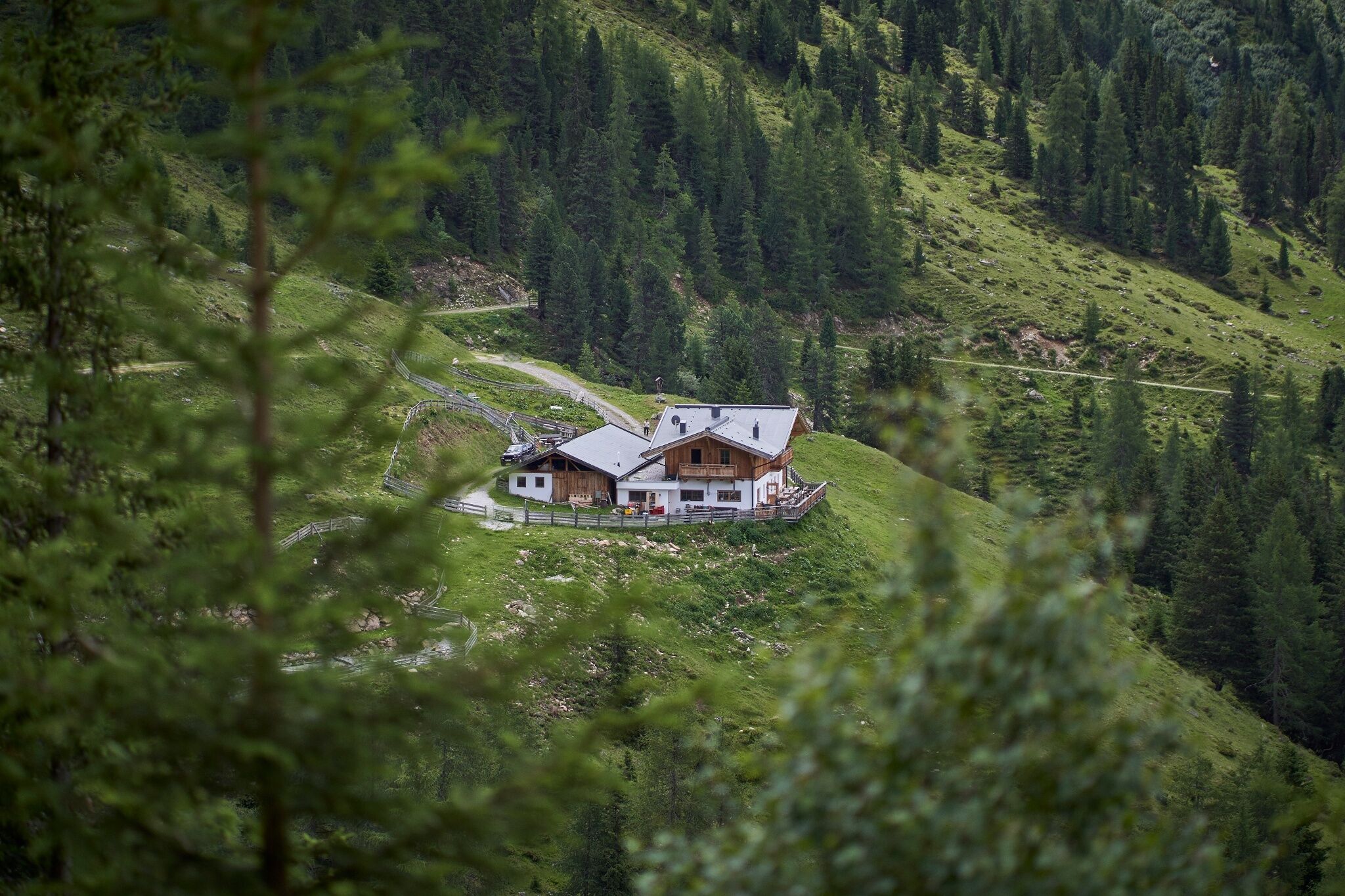
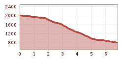
From the Hochoetz mountain station, you hike along the wide forest road for about 45 minutes to the Acherberg Alm. From the alpine hut, the steep hiking trail then branches off down to Oetz. The path mainly leads through the forest, and you overcome a total of 1,200 meters in elevation. You reach the village of Oetz at the edge of town near the adventure swimming pool and the KIDS PARK. 


Nearby huts and mountain restaurants

Getting here

  • Arrival by public transport

    Travel comfortably and safely by train to the Ötztal train station. The final stop or exit point is the ÖTZTAL train station. Afterwards, you can travel conveniently and quickly with public transport or local taxi companies through the entire valley to your desired destination! The current bus timetable is available at: http://fahrplan.vvt.at

  • Parking

    The following parking options are available:

    • Acherkogelbahn parking lot (paid)
    • Rafting entry parking lot (at the edge of town in Oetz on the right side) (paid) 
    • Oetz town center parking lot (paid)
    • Overnight parking during multi-day trips: Oetz town center parking lot. The ticket is available at the Oetz information office.

More tours in the surrounding area

  • Ötztal Trek Stage 3

    Difficulty: difficult
    Length: 10.4 km Duration: 4:00 h Elevation uphill: 842 m
  • Ötztal Trek Stage 10

    Difficulty: difficult
    Length: 11.1 km Duration: 4:30 h Elevation uphill: 1,476 m
  • Ötztal Trek Stage 1

    Difficulty: medium
    Length: 18.6 km Duration: 6:30 h Elevation uphill: 1,561 m
  • Ötztal Trek Stage 14

    Difficulty: difficult
    Length: 6.3 km Duration: 3:00 h Elevation uphill: 1,004 m
  • Ötztal Trek Stage 11

    Difficulty: difficult
    Length: 12.0 km Duration: 5:00 h Elevation uphill: 705 m
  • Winter hiking trail Rotes Wandl - No. 431

    Opening hours: closed
    Difficulty: easy
    Length: 1.5 km Duration: 0:45 h Elevation uphill: 52 m
  • Ötztal Trek Stage 21

    Difficulty: difficult
    Length: 9.4 km Duration: 4:30 h Elevation uphill: 1,270 m
  • Ötztal Trek Stage 6

    Difficulty: difficult
    Length: 7.6 km Duration: 3:30 h Elevation uphill: 640 m
  • Ötztal Trek Stage 17

    Difficulty: difficult
    Length: 16.4 km Duration: 6:00 h Elevation uphill: 1,080 m
  • Mountain peak Rosskopf

    Difficulty: medium
    Length: 2.0 km Duration: 2:00 h Elevation uphill: 379 m
  • Mutsbühl

    Difficulty: medium
    Length: 4.5 km Duration: 1:30 h Elevation uphill: 470 m
  • Fundusfeiler - Umhausen

    Difficulty: difficult
    Length: 4.5 km Duration: 3:00 h Elevation uphill: 1,109 m
  • Wilder Mann

    Difficulty: medium
    Length: 2.4 km Duration: 2:30 h Elevation uphill: 665 m
  • Siegerlandhütte - Sölden

    Difficulty: medium
    Length: 8.0 km Duration: 3:30 h Elevation uphill: 780 m
  • Stuibenfall hike - Umhausen

    Opening hours: open
    Difficulty: easy
    Length: 2.9 km Duration: 1:45 h Elevation uphill: 456 m
  • Ötztal Trek Stage 4

    Difficulty: difficult
    Length: 8.9 km Duration: 4:00 h Elevation uphill: 802 m
  • Ötztal Trek Stage 7

    Difficulty: difficult
    Length: 5.3 km Duration: 2:00 h Elevation uphill: 376 m
Newsletter

The mountain is calling? So does our newsletter!

In our monthly newsletter we reveal the best holiday tips for Tyrol.