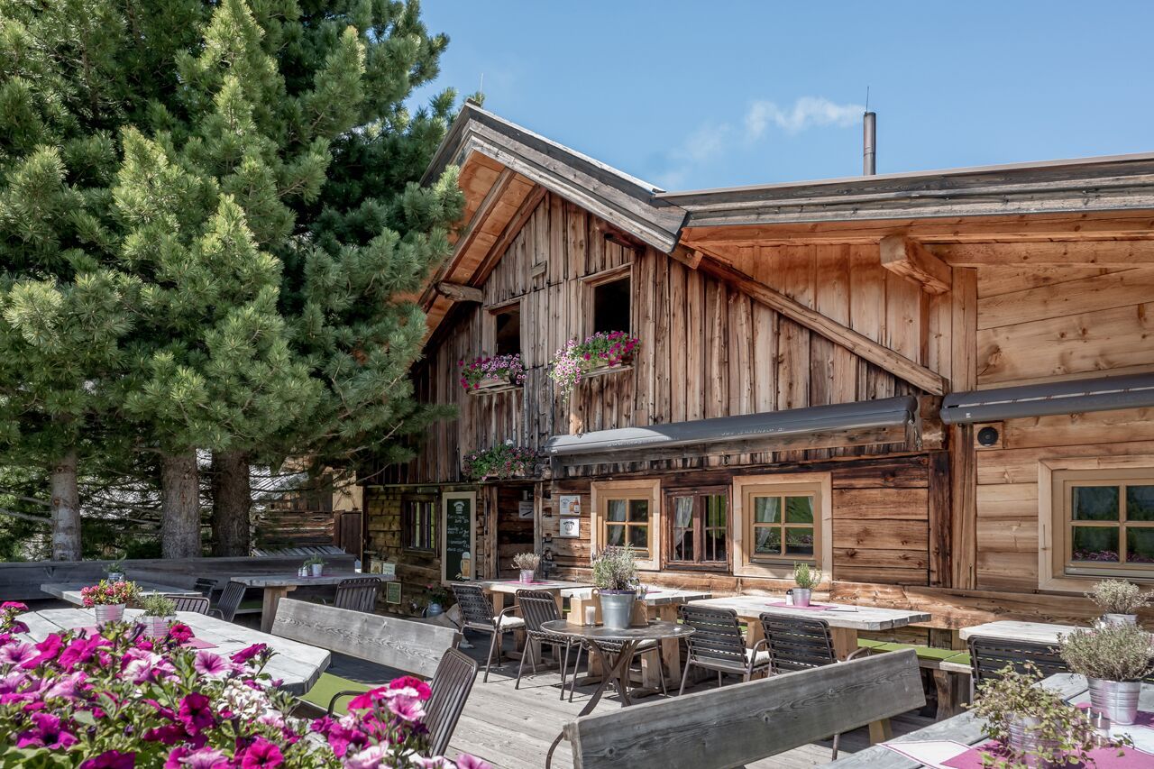
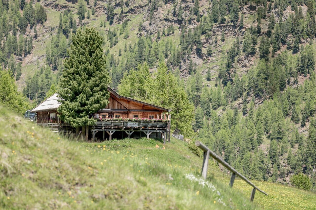
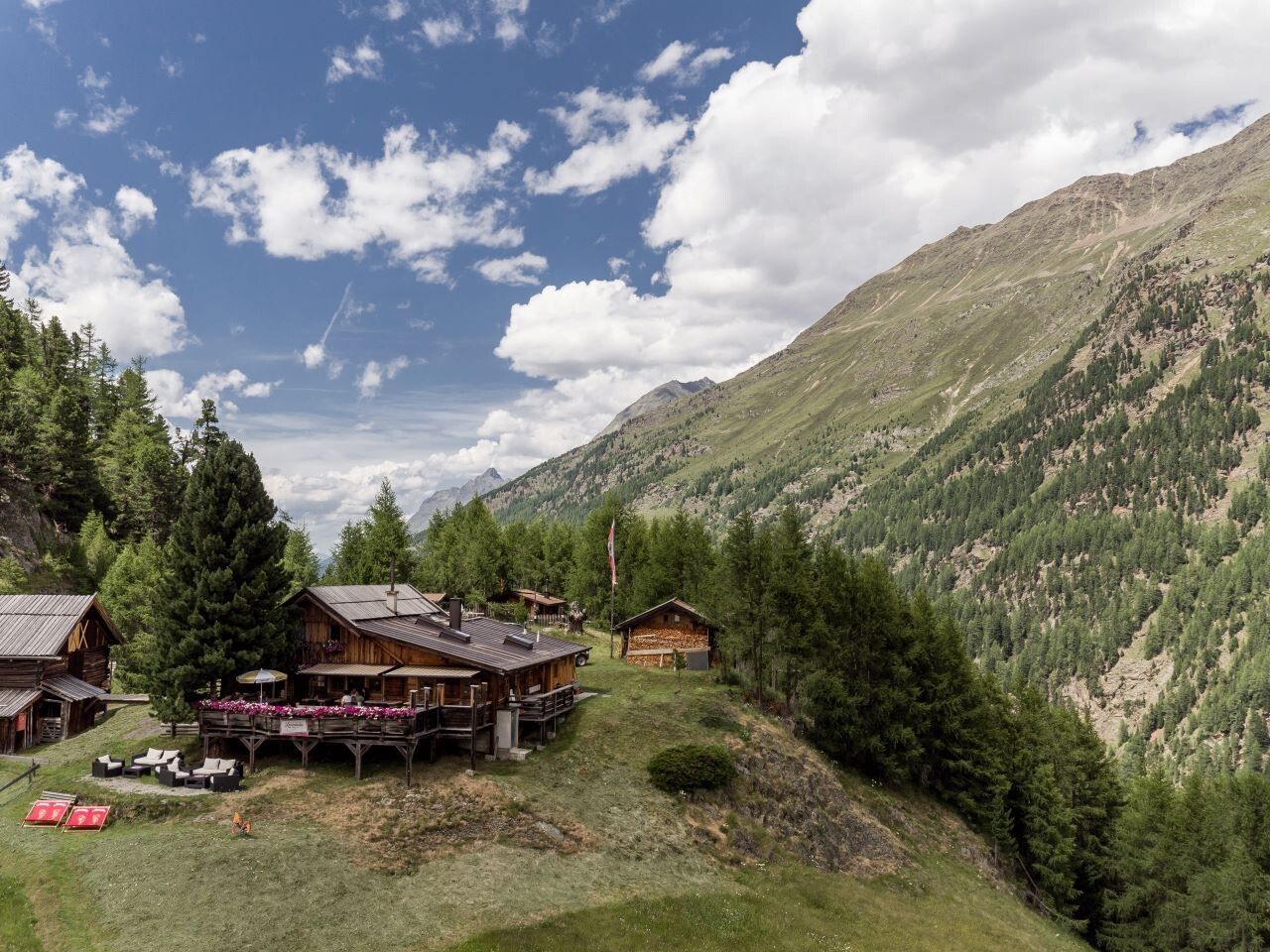
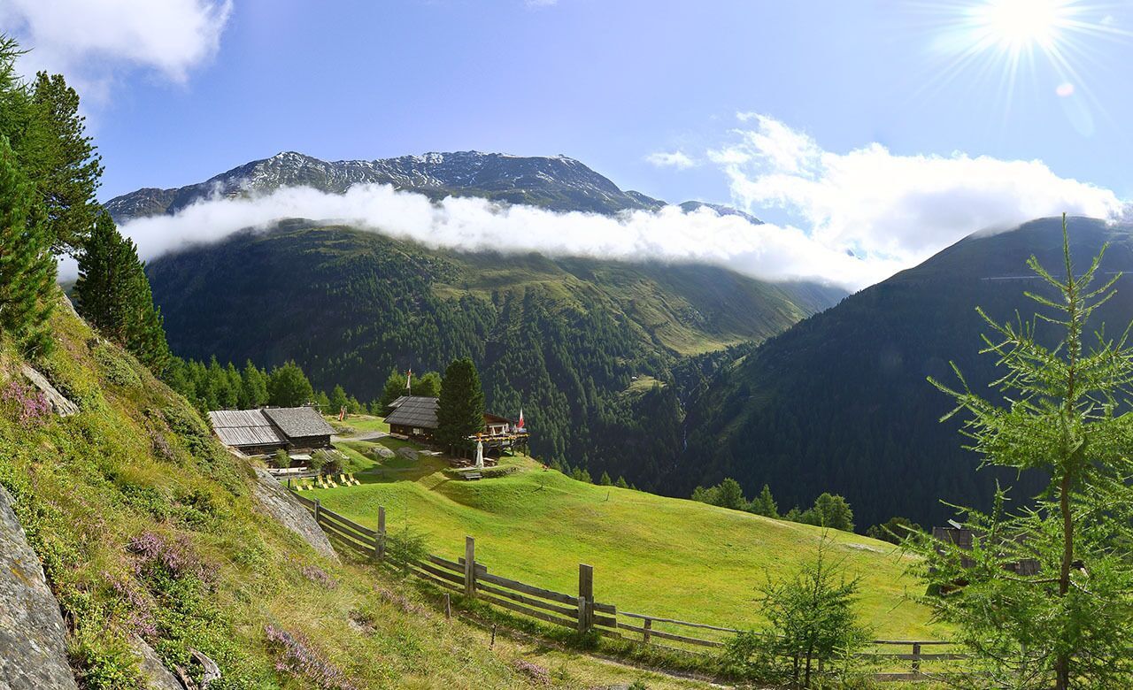
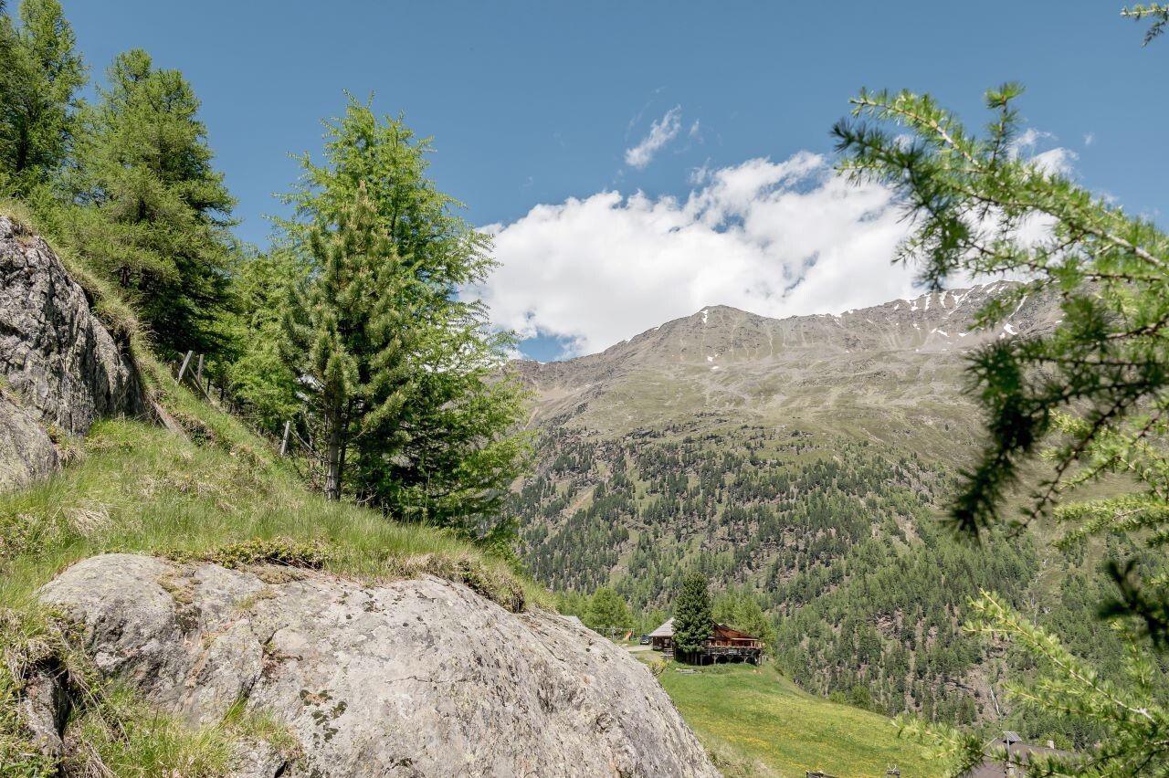
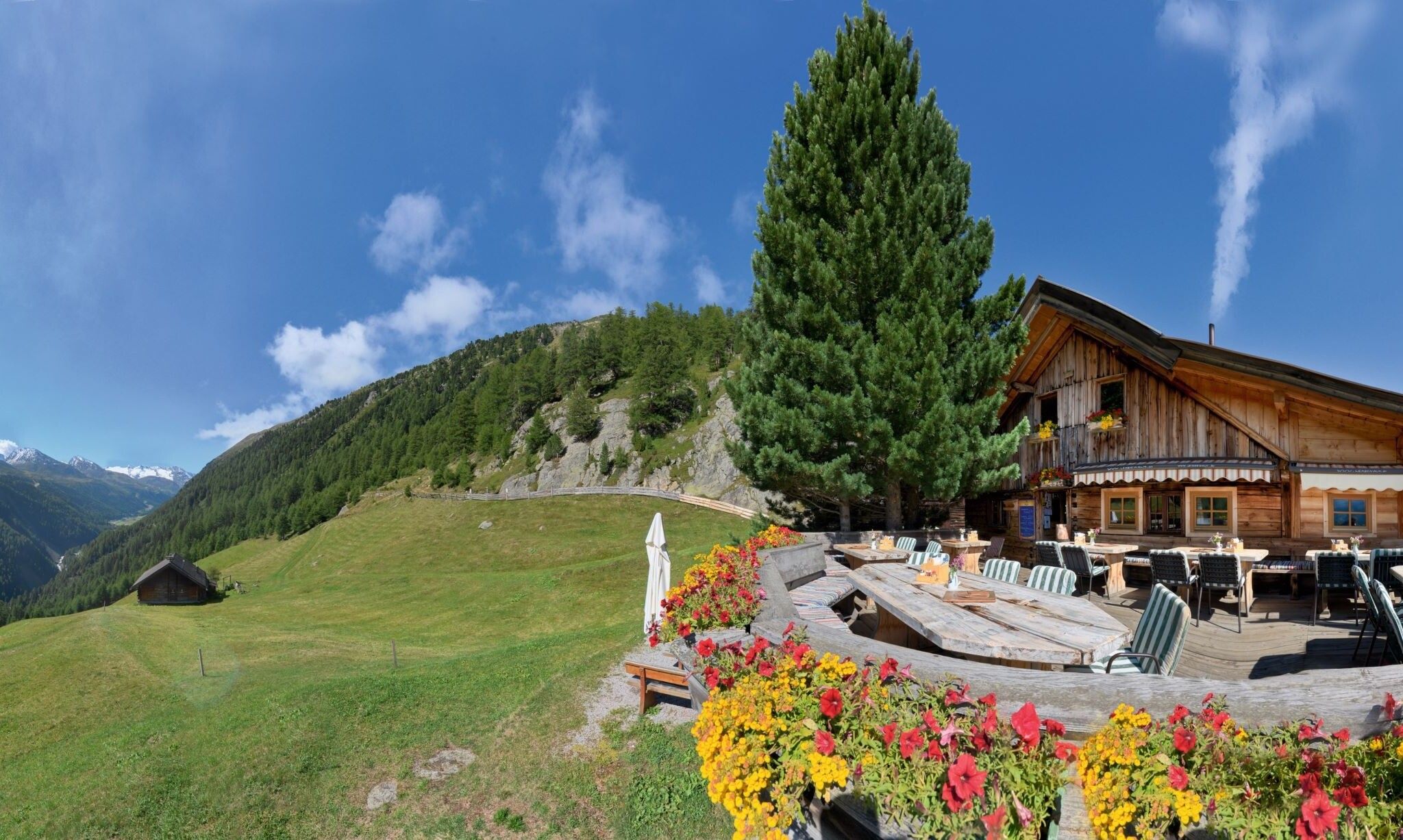
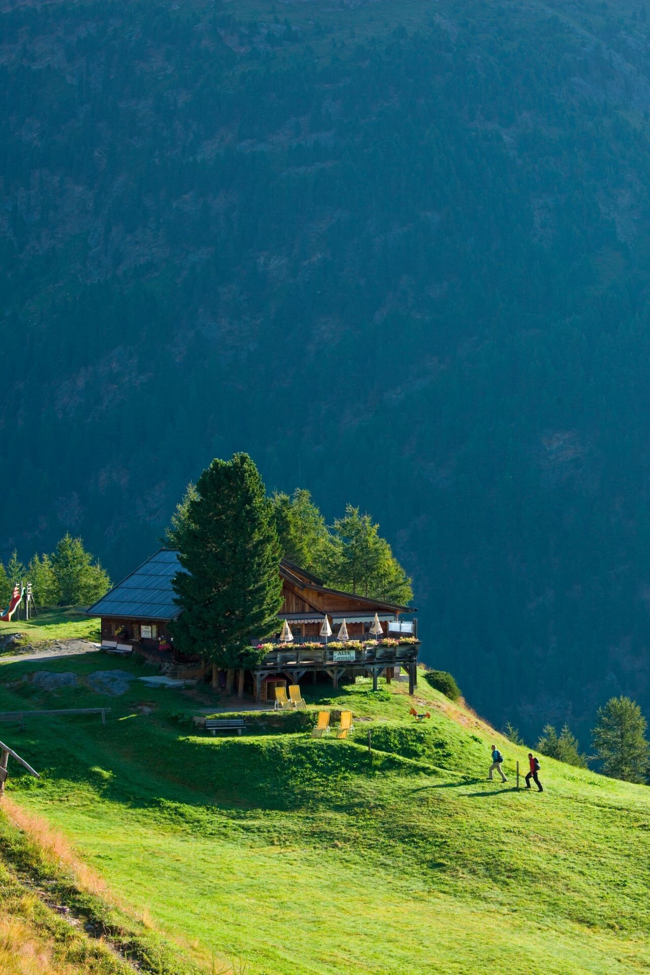
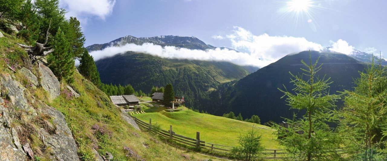
Mountain hikes Lenzenalm

Sölden / Ötztal Alps
Difficulty ratings: medium
Route length: 2.7 km
Duration: 1:30 h

ZWIESELSTEIN BRIDGE/GURGLER ACHE -> LENZENALM

Tour information

  • Requirement: medium
  • Length: 2.7 km
  • Duration: 1:30 h
  • Elevation uphill:443 hm
  • Elevation downhill:1 hm
Highest point1,896 m

Starting point

Zwieselstein

Finishing point

Lenzenalm
  • Fitness level 3 / 6

Best time of year

  • January
  • February
  • March
  • April
  • May
  • June
  • July
  • August
  • September
  • October
  • November
  • December

Equipment

For red mountain trails: medium-difficulty mountain path; suitable for sure-footed and experienced mountain hikers; good physical fitness, mountain experience, and mountaineering equipment (see equipment) required.Please observe the current weather report at: www.oetztal.com/de/sommer.html

Appropriate equipment such as breathable and weather-appropriate outdoor clothing, ankle-high hiking shoes, wind, rain, and sun protection, a cap, possibly gloves, is required for all hikes and routes. Carrying a first aid kit, a mobile phone, and possibly a hiking map, as well as sufficient provisions on hikes without dining options, is necessary. 

Source: TVB Ötztal Tourismus

Description

From Zwieselstein Bridge/Gurgler Ache over wooden bridge towards the church, ascending through sparse forest to Gurgler Street. Continue along the hiking trail to the Lenzenalm junction. Over a wide ascending forest road to the alpine hut. Or continue along the street to the next marker, then the narrow moderately to steeply ascending footpath to the alpine hut.


Nearby huts and mountain restaurants

Getting here

  • Arrival by public transport

    Travel comfortably and safely by train to Ötztal station. The final stop or point to get off is ÖTZTAL station. Then you can travel conveniently and quickly with public transport or local taxi services through the entire valley to your desired destination. The current bus schedule is available at: fahrplan.vvt.at

  • Parking

    The following parking options are available in Sölden:

    • Postplatz parking lot
    • Stiegele parking lot
    • Step parking lot
    • Giggijochbahn + underground garage
    • Gaislachkoglbahn + underground garage
    • Hochsölden parking lot
    • Hochsölden parking garage 1st deck

    The parking lots are subject to charges.

    For parking multiple days (e.g., hut tour):

    • Gaislachkoglbahn parking garage, parking ticket either online or directly at the Gaislachkoglbahn ticket office

More tours in the surrounding area

  • Ötztal Trek Stage 6

    Difficulty:difficult
    Length:7.6 kmDuration:3:30 hElevation uphill:640 m
  • Ötztal Trek Stage 7

    Difficulty:difficult
    Length:5.3 kmDuration:2:00 hElevation uphill:376 m
  • Ötztal Trek

    Length:246.4 kmDuration:84:25 hElevation uphill:18,910 m
  • Ötztal Trek Stage 17

    Difficulty:difficult
    Length:16.4 kmDuration:6:00 hElevation uphill:1,080 m
  • Ötztal Trek Stage 16

    Difficulty:difficult
    Length:6.9 kmDuration:2:30 hElevation uphill:358 m
  • Ötztal Trek Stage 11

    Difficulty:difficult
    Length:12.0 kmDuration:5:00 hElevation uphill:705 m
  • Ötztal Trek Stage 3

    Difficulty:difficult
    Length:10.4 kmDuration:4:00 hElevation uphill:842 m
  • Ötztal Trek Stage 1

    Difficulty:medium
    Length:18.6 kmDuration:6:30 hElevation uphill:1,561 m
  • Ötztal Trek Stage 14

    Difficulty:difficult
    Length:6.3 kmDuration:3:00 hElevation uphill:1,004 m
  • Ötztal Trek Stage 12

    Difficulty:difficult
    Length:4.8 kmDuration:2:00 hElevation uphill:592 m
  • Ötztal Trek Stage 4

    Difficulty:difficult
    Length:8.9 kmDuration:4:00 hElevation uphill:802 m
  • Ötztal Trek Stage 10

    Difficulty:difficult
    Length:11.1 kmDuration:4:30 hElevation uphill:1,476 m
  • Ötztal Trek Stage 8

    Difficulty:difficult
    Length:9.3 kmDuration:3:30 hElevation uphill:274 m
  • Ötztal Trek Stage 20

    Opening hours:closed
    Difficulty:medium
    Length:6.4 kmDuration:3:00 hElevation uphill:610 m
  • Ötztaler Urweg

    Length:189.1 kmDuration:72:19 hElevation uphill:9,428 m
  • Ötztal Trek Stage 22

    Difficulty:difficult
    Length:21.5 kmDuration:8:00 hElevation uphill:647 m
  • Ötztal Trek Stage 21

    Difficulty:difficult
    Length:9.4 kmDuration:4:30 hElevation uphill:1,270 m
  • Ötztal Trek Stage 5

    Difficulty:difficult
    Length:8.1 kmDuration:3:30 hElevation uphill:1,125 m
  • Siegerlandhütte - Sölden

    Difficulty:medium
    Length:8.0 kmDuration:3:30 hElevation uphill:780 m
Newsletter

The mountain is calling? So does our newsletter!

In our monthly newsletter we reveal the best holiday tips for Tyrol.