
Opening hours:Open today
Place:Sölden
:Alpine pasture / hut / mountain restaurant
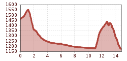
STAGE 09:GRANSTEIN –> Hochwald –> Aschbach –> Huben –> Duringweg –> LÄNGENFELD The Duringweg will remain closed until spring 2026.

Moderately difficult mountain path; suitable for sure-footed and experienced mountain hikers; good physical condition, mountain experience, and mountain equipment (see under Equipment) necessary. Please pay attention to the current weather report.
Appropriate equipment such as breathable and weather-appropriate outdoor clothing is required for all hikes and routes. Carrying a first aid kit, a mobile phone, and possibly a hiking map, as well as sufficient provisions for hikes without the possibility of stopping, is necessary.
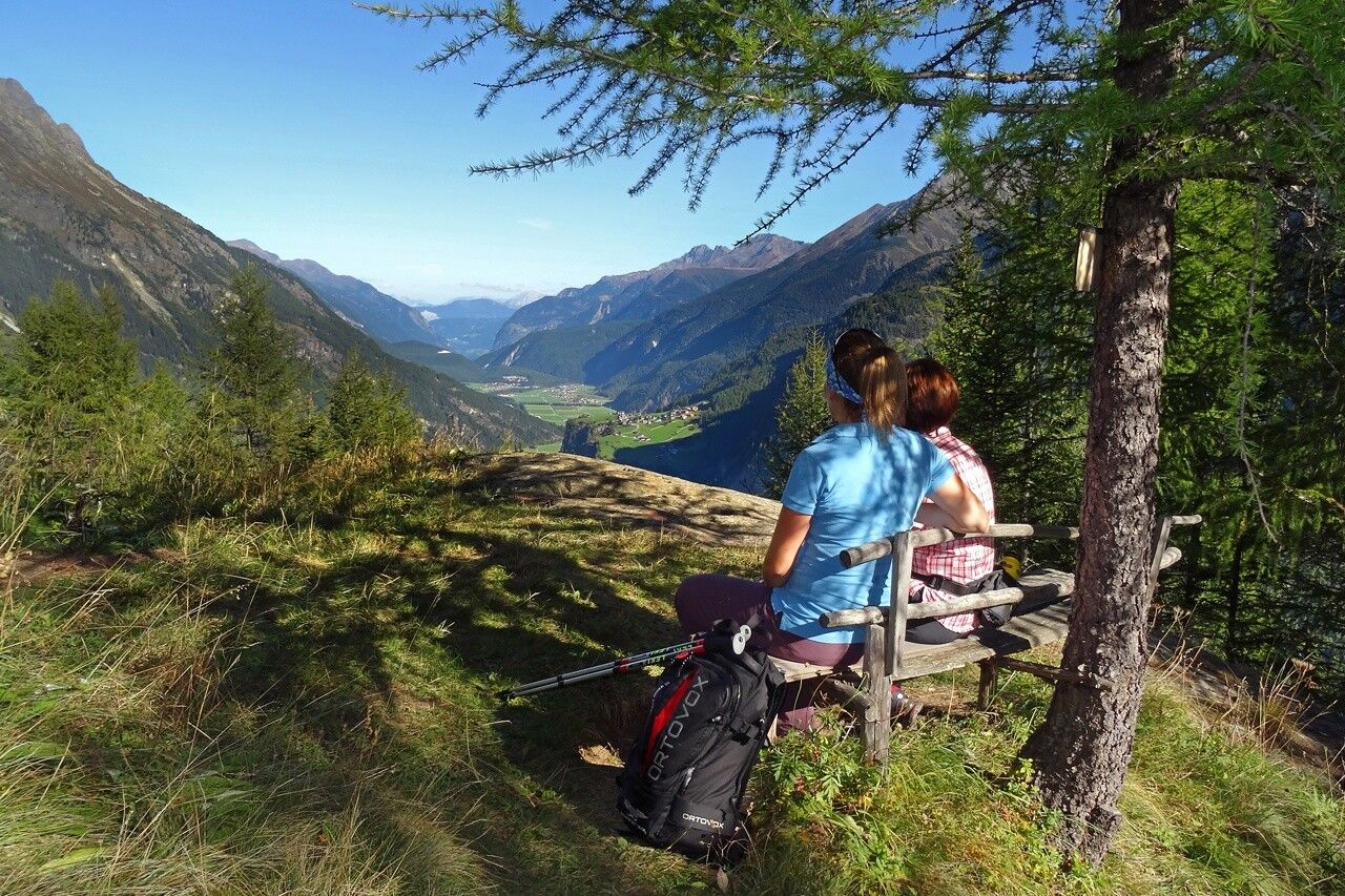
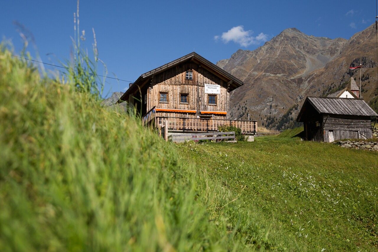
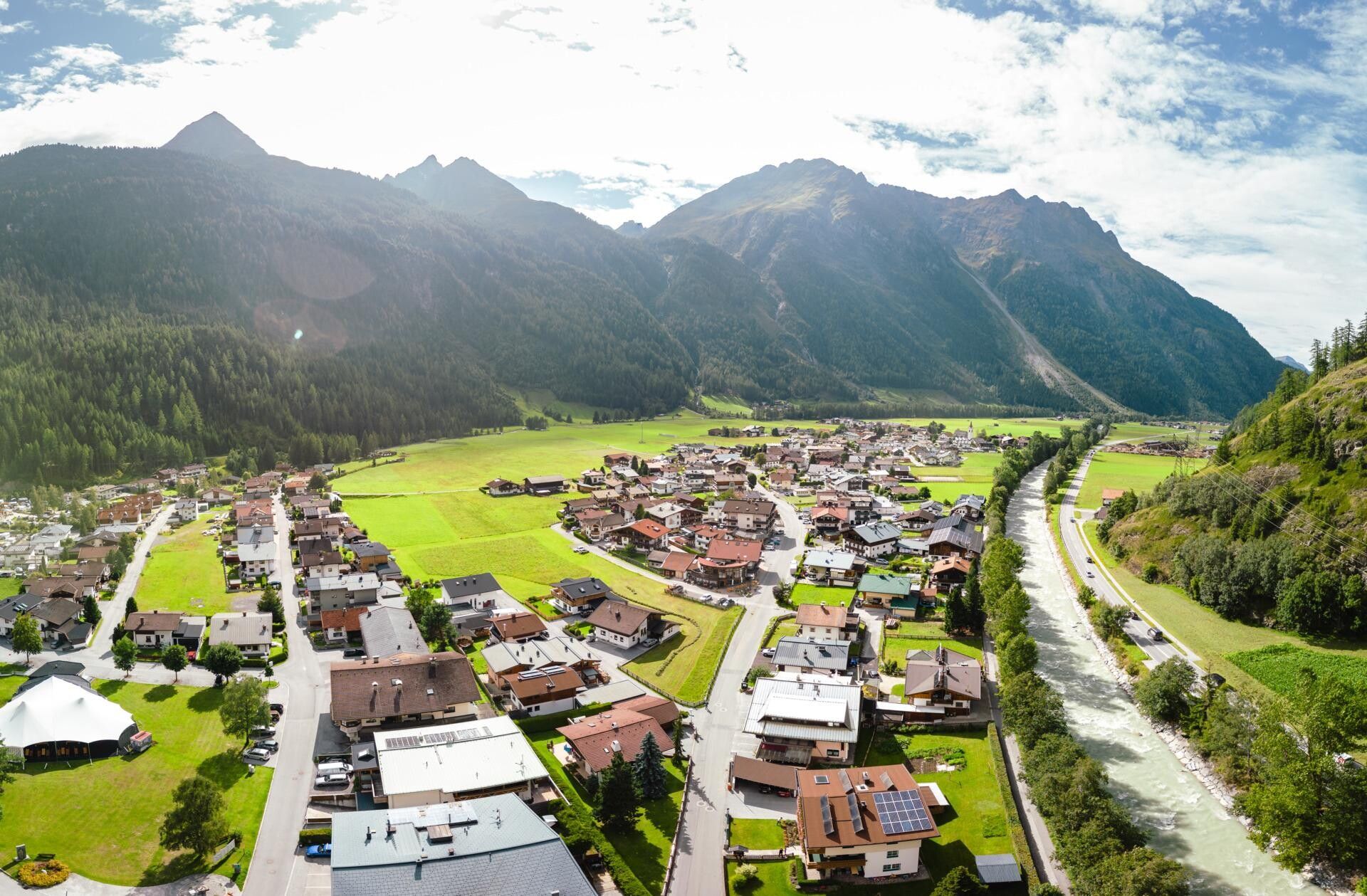
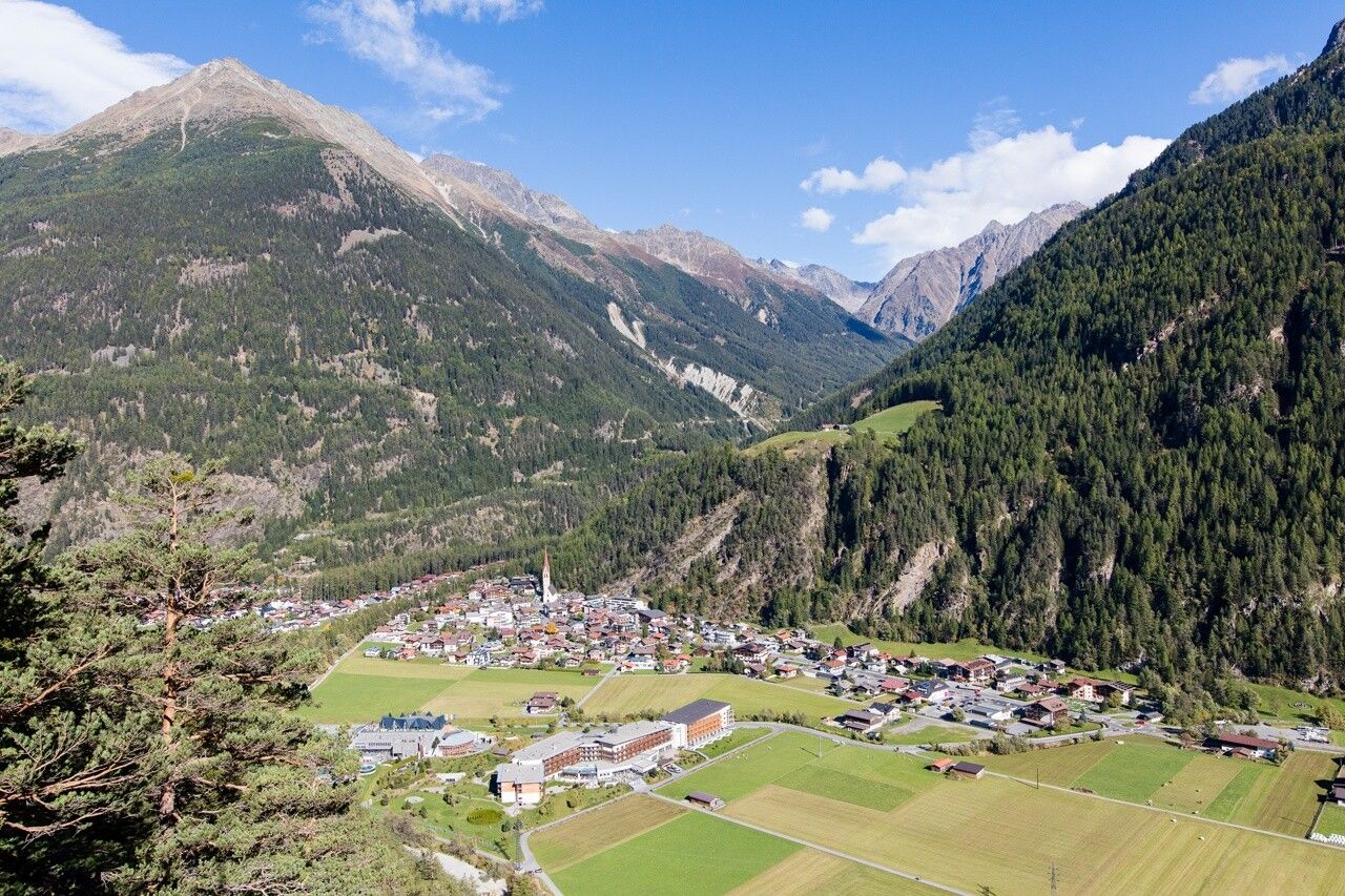
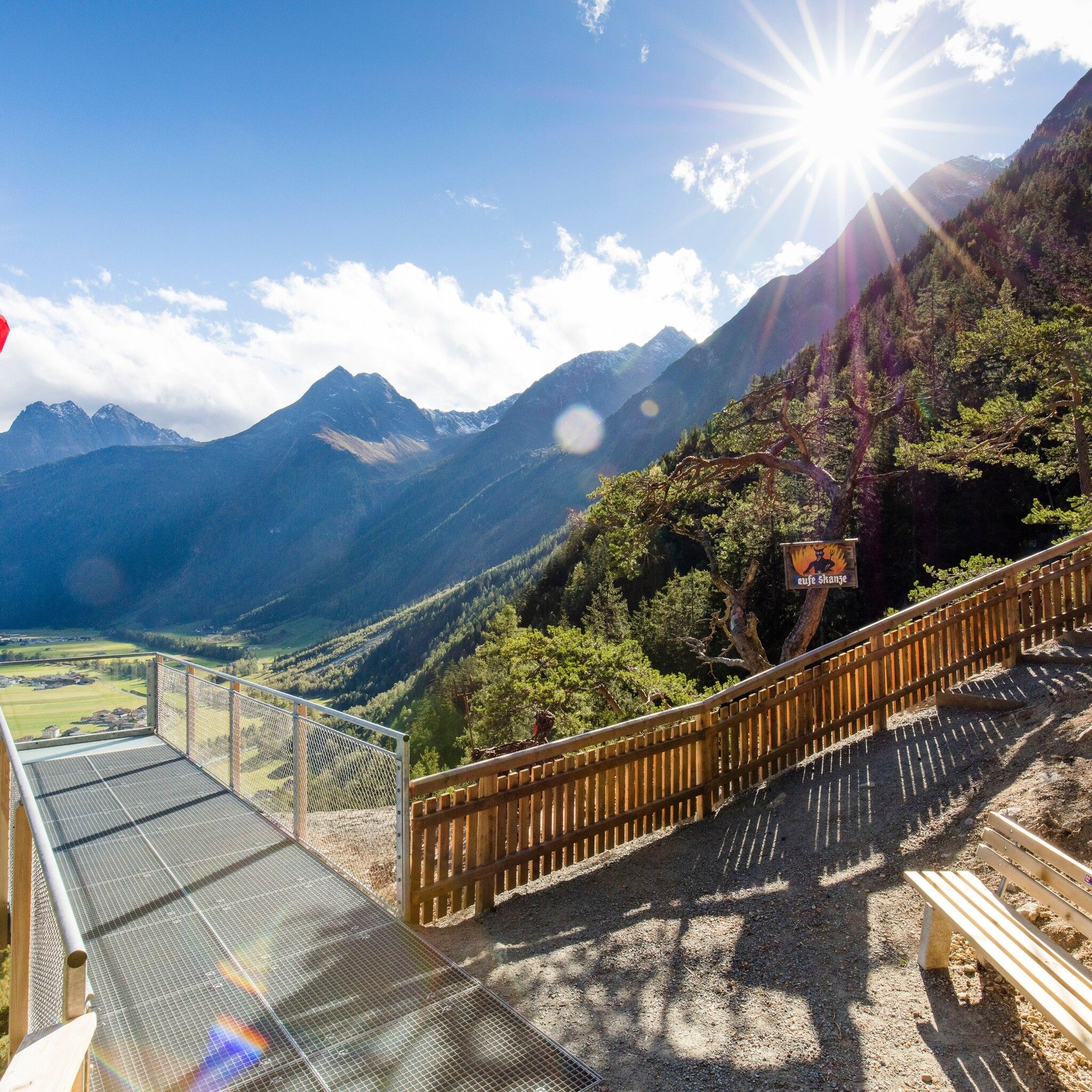
FROM SÖLDEN TO THE LANGEN FIELDSAs quietly and idyllically located as Granstein is Hochwald. A small hamlet not far from Sölden, surrounded by countless larch trees, in a forest clearing. Here you get another look back at the valley metropolis with the gigantic mountain backdrop that gives the picture the right frame. The path leads past water, forests, and small hamlets at the foot of the steep valley sides between Sölden and Huben. At Huben, the path passes the starting point of the Ötztal legend trail, one of 10 power spots in Längenfeld. Further energy fields are crossed by the Duringweg, a high-altitude path above the small villages and hamlets down in the valley, equipped with many old farms. Buildings from past times show the Ötztalers' awareness of tradition. "Hellishly good" is how we feel at the Teufelskanzel, the next power spot. The panoramic view from up here prevails; opposite, in majestic height, you find the suspension bridge between Brandalm and Burgstein.
Travel comfortably and safely by train to the Ötztal station. The final stop or exit point is the ÖTZTAL station. Afterwards, you can travel conveniently and quickly with public transport or local taxi companies through the entire valley to your desired destination.
The current bus timetable is available at: fahrplan.vvt.at
The following parking options are available in Sölden:
- Postplatz car park
- Stiegele car park
- Multi-level car park
- Giggijochbahn + underground garage
- Gaislachkoglbahn + underground garage
- Hochsölden car park
- Hochsölden underground garage, 1st parking level
- Zwieselstein car park
- Zwieselstein/Sports field car park.
Parking spaces in Sölden are subject to a fee.
For parking for several days (e.g., hut tour):
- Gaislachkoglbahn underground garage, parking ticket either online or directly at the cash desk of the Gaislachkoglbahn


