
Opening hours:Open today
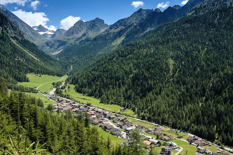
Place:Niederthai
:Alpine pasture / hut / mountain restaurant
GRIES -> Winnebach -> Winnebachseehütte -> Zwieselbachjoch -> Schweinfurter Hütte -> Larstigalm -> NIEDERTHAI
Moderate mountain trail; suitable for sure-footed and experienced hikers;
Good physical condition, mountain experience and mountain equipment (see equipment section) necessary
Please check the current weather report at: www.oetztal.com/de/sommer.html
Wearing hiking gear such as breathable and weather-appropriate outdoor clothing, ankle-high hiking boots, wind, rain and sun protection, a hat, and possibly gloves is recommended! It is also important to bring sufficient provisions, a first aid kit, a mobile phone, and possibly a hiking map.
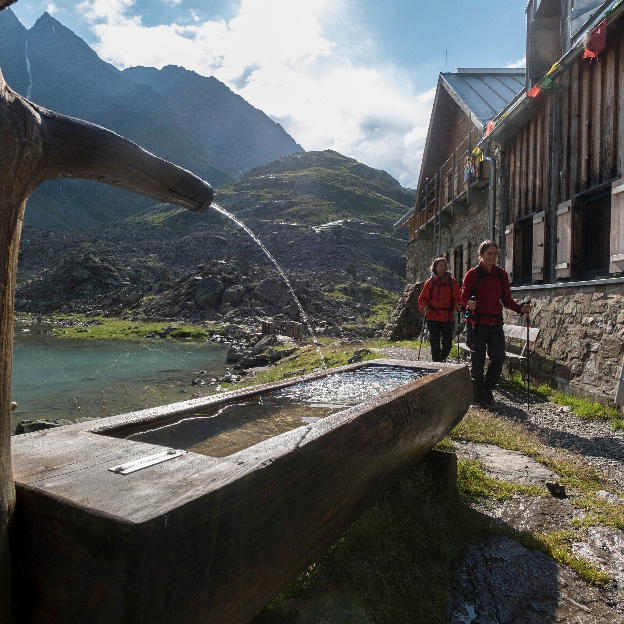
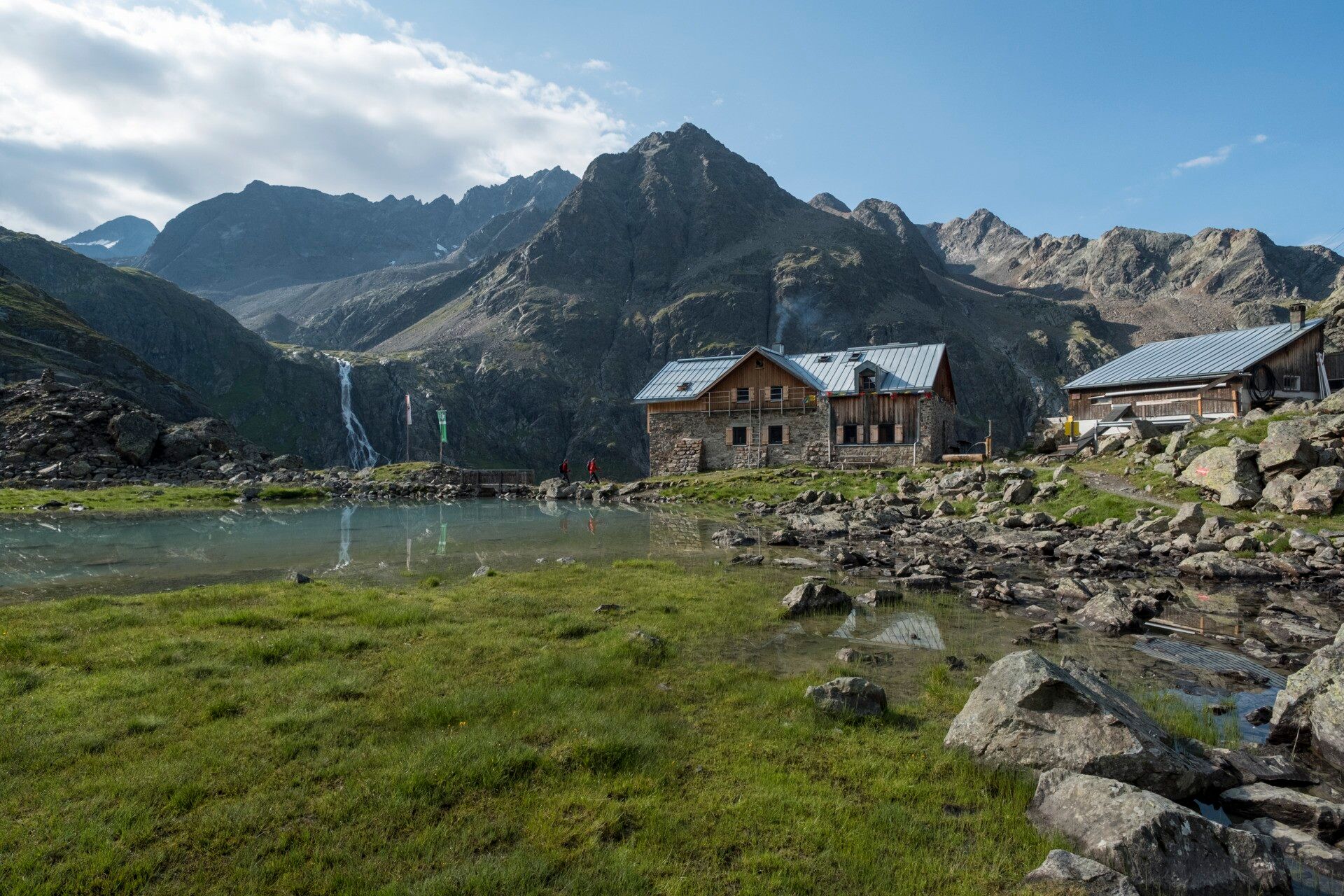
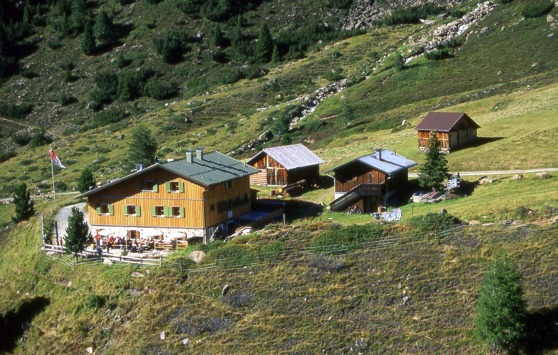
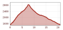
Some years ago, this march was completed annually in one day. We recommend combining this route with a cabin overnight stay for the magnificent views. From the parking lot at the end of Gries, follow the road to the hamlet of Winnebach to take the trail towards Winnebachseehütte. Soon, the path leads out of the forest past numerous avalanche tracks. The well-constructed path finally climbs steeply to the Winnebachseehütte, which is reached after about 2 hours of walking. After a break or overnight stay, follow the path behind the hut past the lake through meadows towards Zwieselbachjoch. The ascent to the saddle partly takes place over rocky terrain. The descent to Schweinfurterhütte (overnight stay) leads through the Zwieselbach valley. The path there is well marked but initially goes over a lot of scree and boulders. The destination Niederthai, which can be reached via a wide forest road, is now about 2 hours' walking time away.
Travel comfortably and safely by train. The final stop or exit point is ÖTZTAL train station. Afterwards, you can conveniently and quickly travel through the entire valley to your desired destination by public bus service or local taxi companies. The current bus schedule is available at: fahrplan.vvt.at
The following parking options are available:


