Mountain hikes Postalm from Münster

Münster / Brandenberger Alpen (Rofan)
Difficulty ratings: medium
Route length: 11.8 km
Duration: 4:00 h

Leisurely hike over the beautiful Kniepaß chapel to the Postalm

Tour information

  • Requirement: medium
  • Length: 11.8 km
  • Duration: 4:00 h
  • Elevation uphill:610 hm
  • Elevation downhill:610 hm
Highest point1,097 m

Starting point

Village center Münster

Finishing point

Village center Münster
  • Fitness level 3 / 6

Best time of year

  • January
  • February
  • March
  • April
  • May
  • June
  • July
  • August
  • September
  • October
  • November
  • December

Equipment

Hiking gear such as hiking boots, trekking poles, headwear, drinks, snacks, and even a camera

Source: Alpbachtal Tourismus

Description

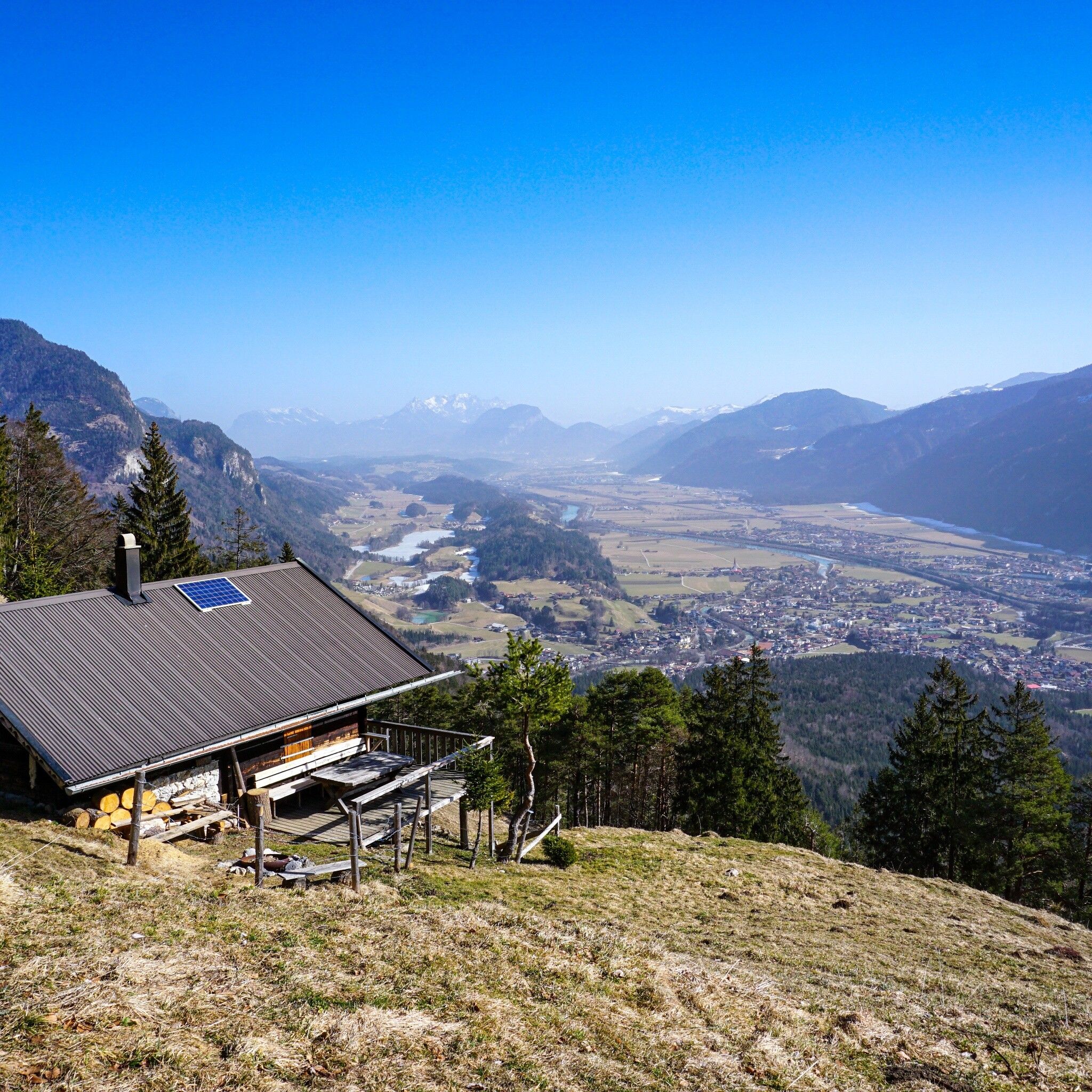
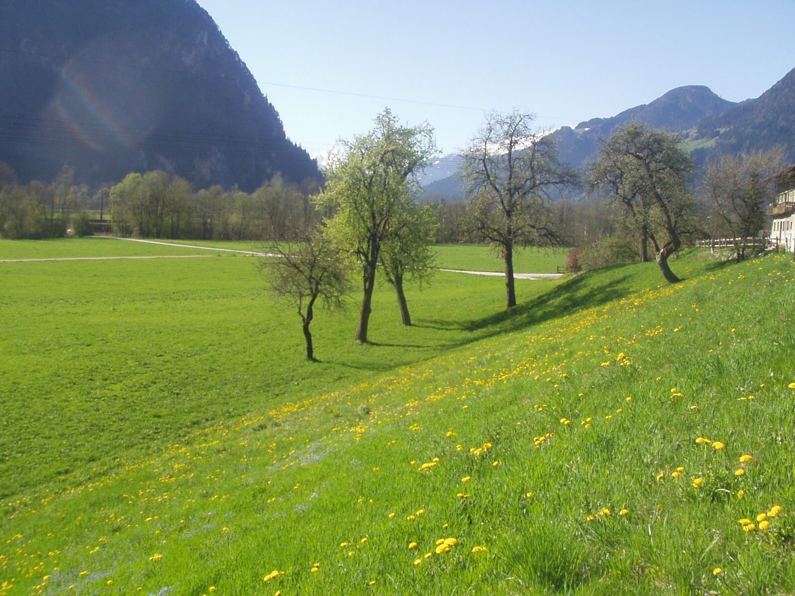
The hike starts in the village center of Münster and leads you from the district of Grünsbach on a forest road through a picturesque landscape in many switchbacks up to the Kniepass chapel. The path winds through the woods and offers repeated views of the surrounding nature.

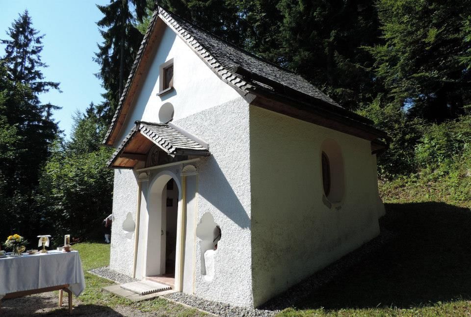
After reaching the Kniepass chapel, you can take a short break and enjoy the peace at this spiritual place. From there, the route continues on a relaxed loop over the unserviced Postalm back to Grünsbach and finally to the starting point of the hike.

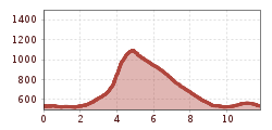
With only 600 meters of elevation gain and a hiking time of about 4 hours, this route is manageable and perfect for a relaxed day in nature. Enjoy the fresh air, the impressive views, and the tranquility away from everyday life on this pleasant hike.


Nearby huts and mountain restaurants

Getting here

  • Arrival by public transport

    www.vvt.at with Bus 601

  • Parking

    Village center

More tours in the surrounding area

  • Voldöpper Spitze Loop Hike

    Difficulty: medium
    Length: 12.9 km Duration: 5:00 h Elevation uphill: 988 m
  • Day 1: 4 days - 4 summits tour

    Difficulty: medium
    Length: 9.8 km Duration: 5:00 h Elevation uphill: 984 m
  • 3-peak-tour Kienberg-Plessenberg-Heuberg

    Difficulty: medium
    Length: 8.6 km Duration: 4:30 h Elevation uphill: 779 m
  • Loop tour Juppi Zauberwald

    Difficulty: easy
    Length: 2.5 km Duration: 1:00 h Elevation uphill: 93 m
  • Kundler Klamm

    Opening hours: closed
    Difficulty: easy
    Length: 6.4 km Duration: 2:00 h Elevation uphill: 116 m
  • Farmkehralm 1.521 m

    Difficulty: medium
    Length: 9.3 km Duration: 3:30 h Elevation uphill: 506 m
  • Barrier-free path Lake Reintal

    Difficulty: easy
    Length: 6.5 km Duration: 1:45 h Elevation uphill: 15 m
  • Day 3: 4 days - 4 summits tour

    Difficulty: medium
    Length: 19.3 km Duration: 8:00 h Elevation uphill: 1,371 m
  • 4 days - 4 summits tour

    Difficulty: medium
    Length: 54.4 km Duration: 23:00 h Elevation uphill: 3,408 m
  • Kaiser Gorge - loop trail

    Opening hours: closed
    Difficulty: easy
    Length: 4.2 km Duration: 1:00 h Elevation uphill: 198 m
  • 3-day Family Tour Alpbachtal

    Difficulty: easy
    Length: 18.3 km Duration: 7:00 h Elevation uphill: 998 m
  • Wiedersberger Horn Panorama Path

    Difficulty: easy
    Length: 4.1 km Duration: 1:30 h Elevation uphill: 195 m
  • Discovering the Tiefenbach Gorge Hike

    Opening hours: closed
    Difficulty: medium
    Length: 5.7 km Duration: 3:30 h Elevation uphill: 669 m
Newsletter

The mountain is calling? So does our newsletter!

In our monthly newsletter we reveal the best holiday tips for Tyrol.