
Opening hours:Open today
Place:Oetz
:Restaurant
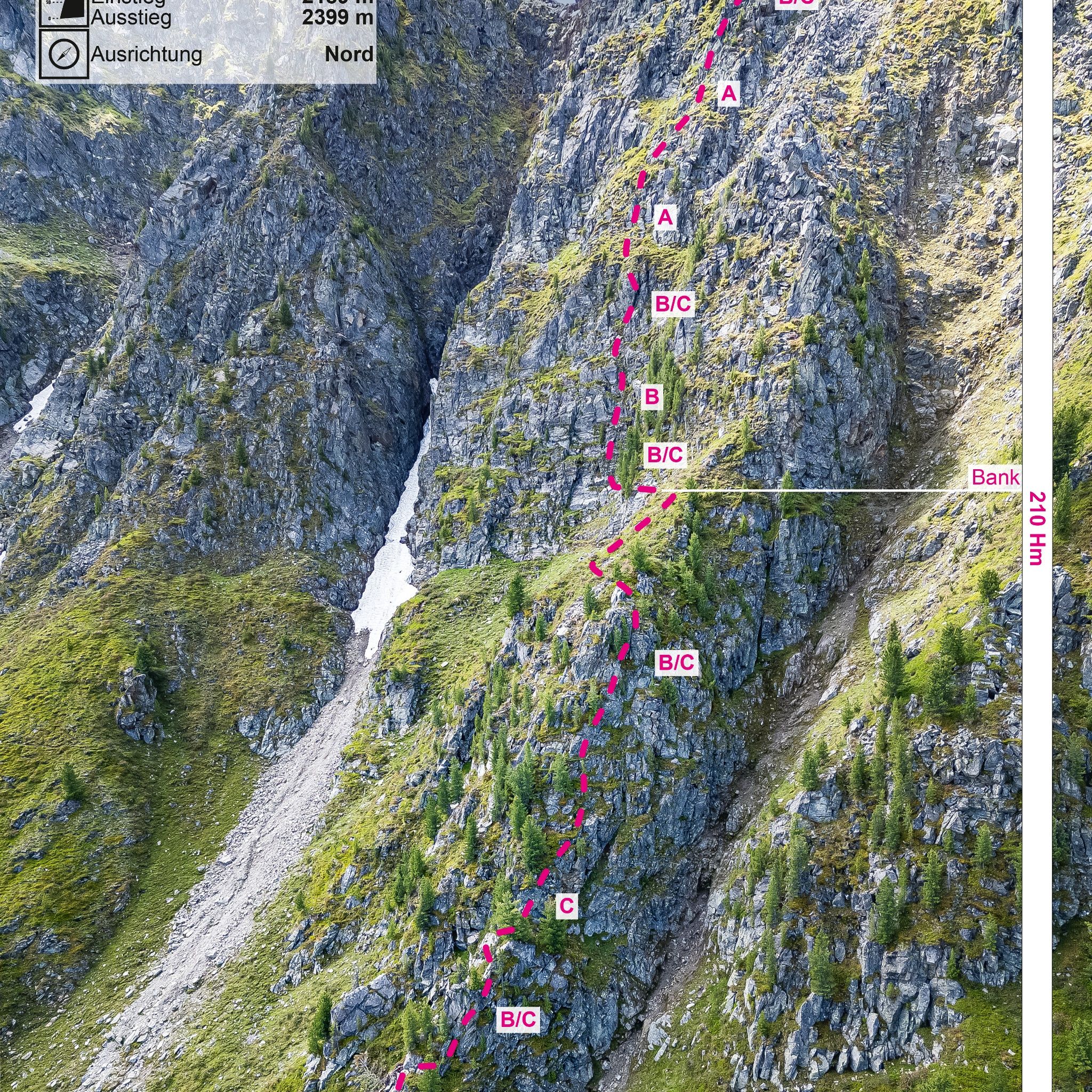
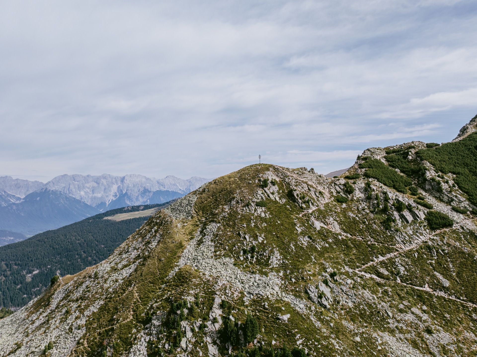
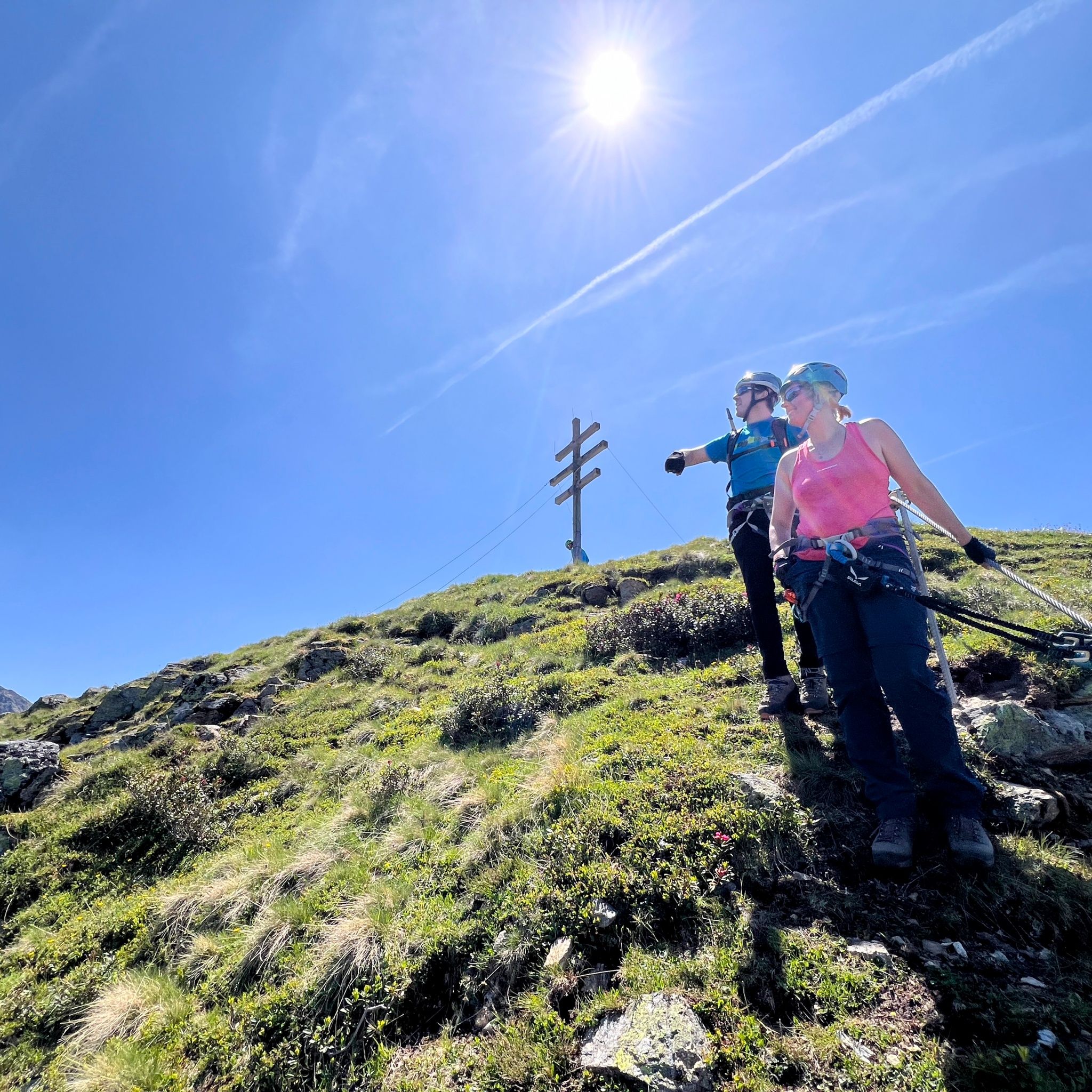
The Rosskopf via ferrata runs along the impressive north side of the Rosskopf at 2399 m and offers an alpine experience with a magnificent panoramic view over the Ötztal.
SAFETY ON THE VIA FERRATA
The Austrian Alpine Club has formulated 10 recommendations for climbing via ferratas to increase safety:
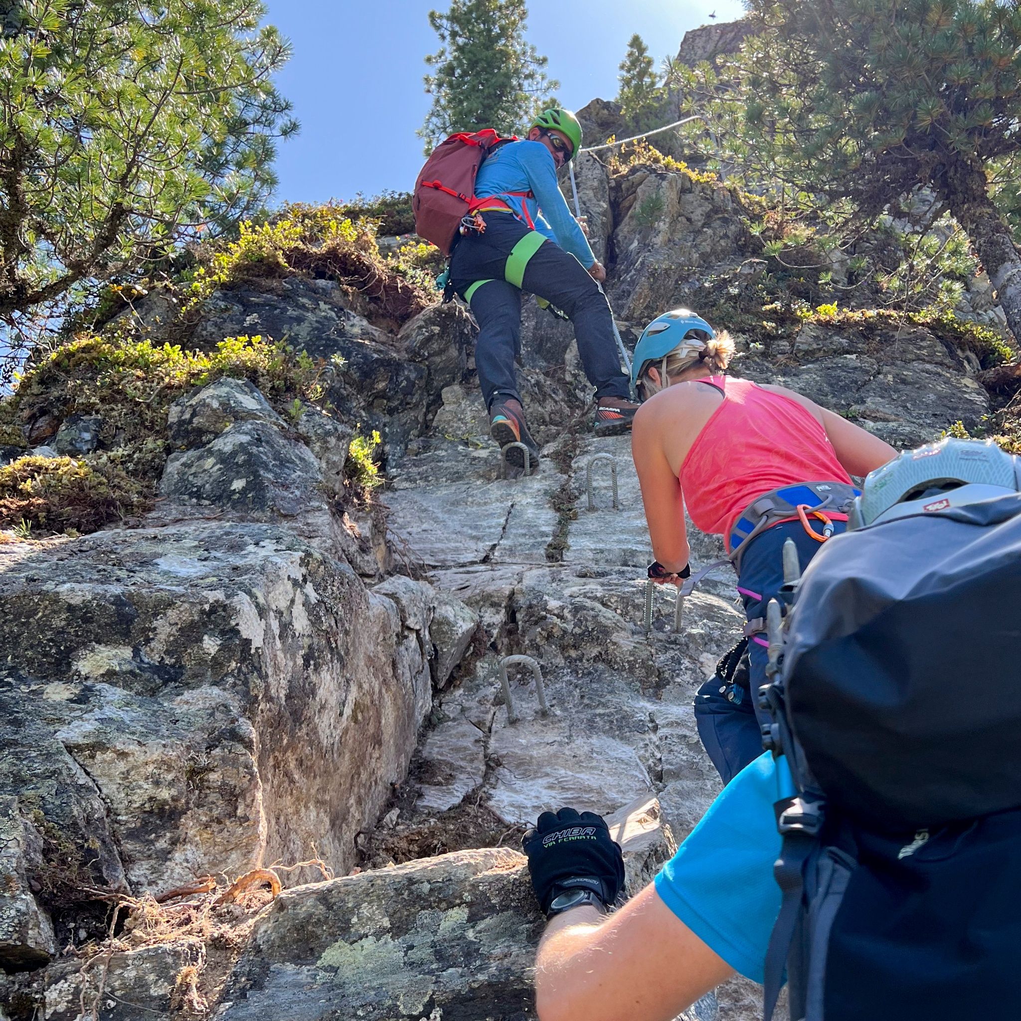
Helmet, climbing harness with via ferrata set, via ferrata gloves, suitable footwear. Possibly poles for the descent, enough to drink
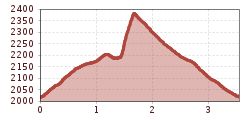
The Rosskopf via ferrata runs along the impressive north side of the Rosskopf at 2399 m and offers an alpine experience with a magnificent panoramic view over the Ötztal. The route continuously ranges from difficulty level B to B/C with a short section at level C. It is characterized by varied passages with slabs, short steep sections, as well as ridge sections. Surefootedness and a head for heights are required. A bench on a wide rock plateau about halfway along the route invites you to a short break with a view. The via ferrata ends directly below the summit of the Rosskopf.
APPROACH
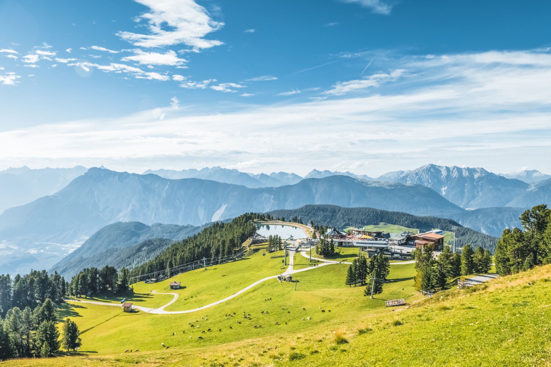
The starting point is the mountain station of the Acherkogelbahn (2020 m). From there, follow the well-marked hiking trail towards Schafer Kreuz. From the cross, an old sheep trail leads to the start of the via ferrata. Helmets are mandatory on this section of the approach. Walking time: approx. 45 min (approx. 1.5 km).
VIA FERRATA
The route is technically not excessively demanding but challenging due to its length and exposed sections. It offers numerous secured spots, solid footholds, and an impressive line. The north orientation provides pleasant climbing conditions on hot days but can be damp in places during the early season.
DESCENT
The descent is close to the summit. Return along the south side of the Rosskopf on a marked hiking trail back to the Acherkogelbahn mountain station. Walking time: approx. 1 hour, 390 m descent.
NOTE
The via ferrata is suitable for surefooted, fearless, and athletic climbers with some previous via ferrata experience. The north-facing position can bring icy or wet sections; please check the current weather situation! Beware if sheep are on the grass ledge (risk of falling rocks)!
Please allow enough time, the last valley ride is at 4:30 pm.
EQUIPMENT
Helmet, climbing harness with via ferrata set, via ferrata gloves, sturdy mountain boots
Travel comfortably and safely by train to the Ötztal railway station. The terminus or exit point is the ÖTZTAL station. Afterwards, you can conveniently and quickly travel through the entire valley to your desired destination using public transport or local taxi companies! The current bus timetable is available at: fahrplan.vvt.at
In Oetz, the following parking options are available:
- Acherkogelbahn parking lot | paid


")


