
Opening hours:Today closed
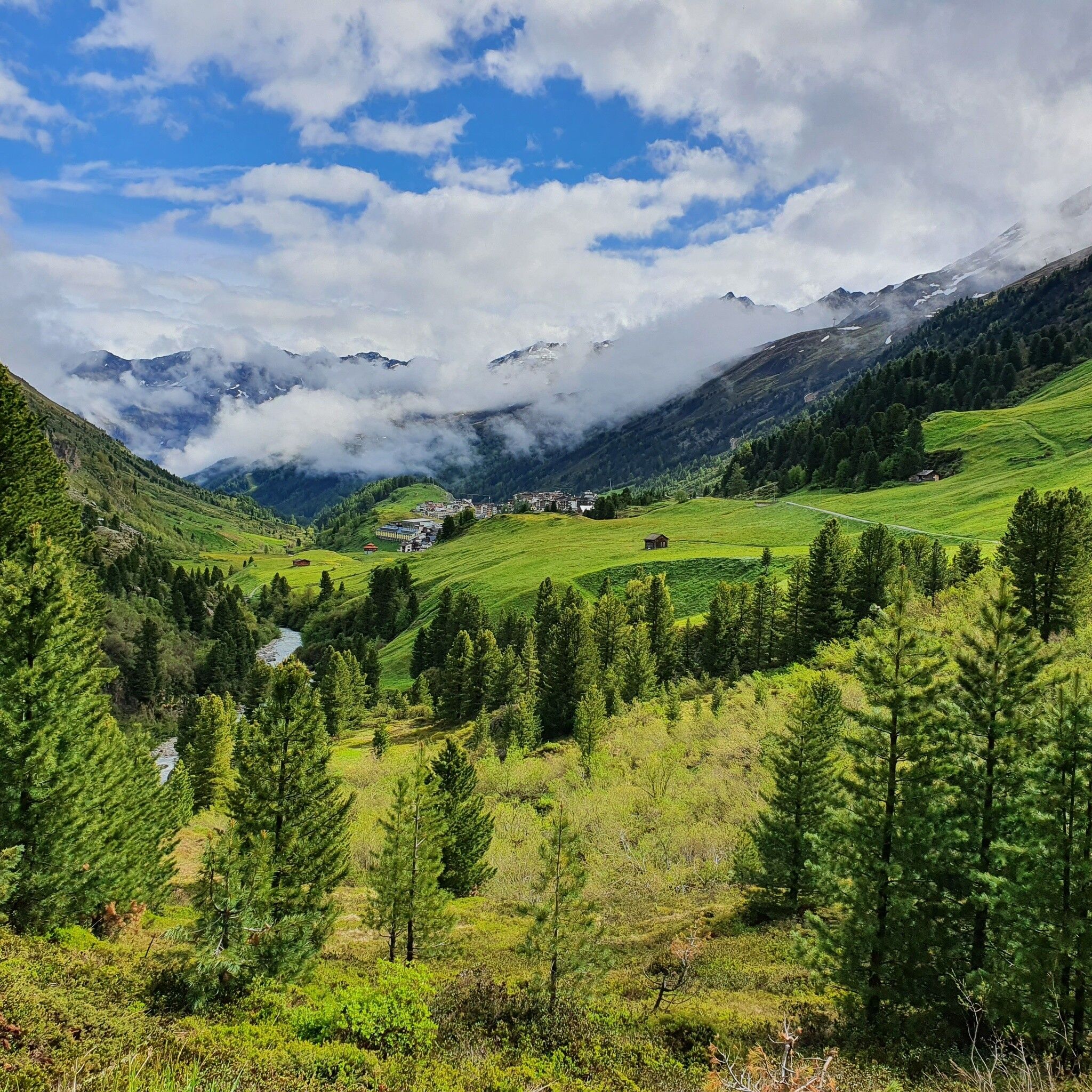
Place:Obergurgl
:Restaurant
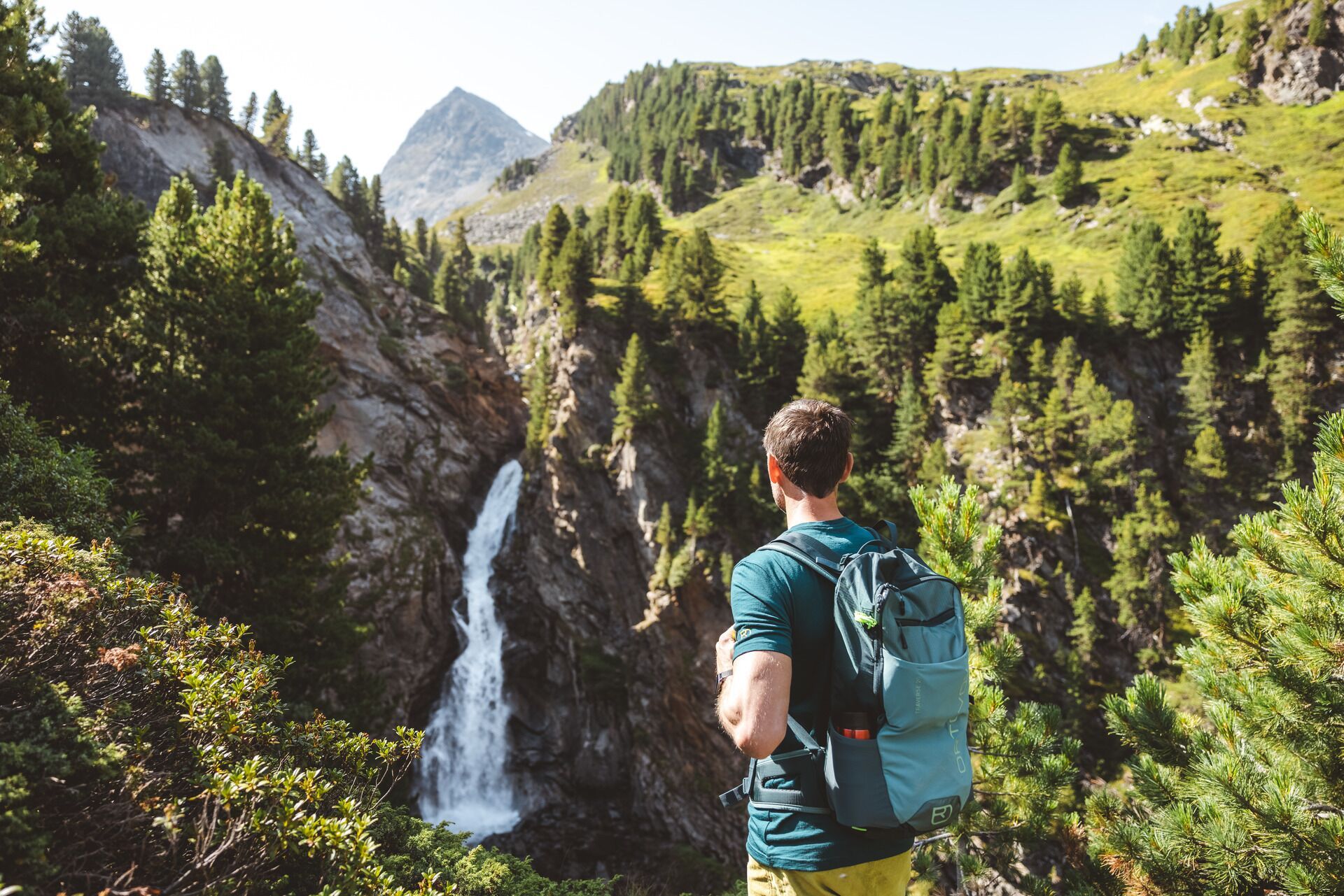
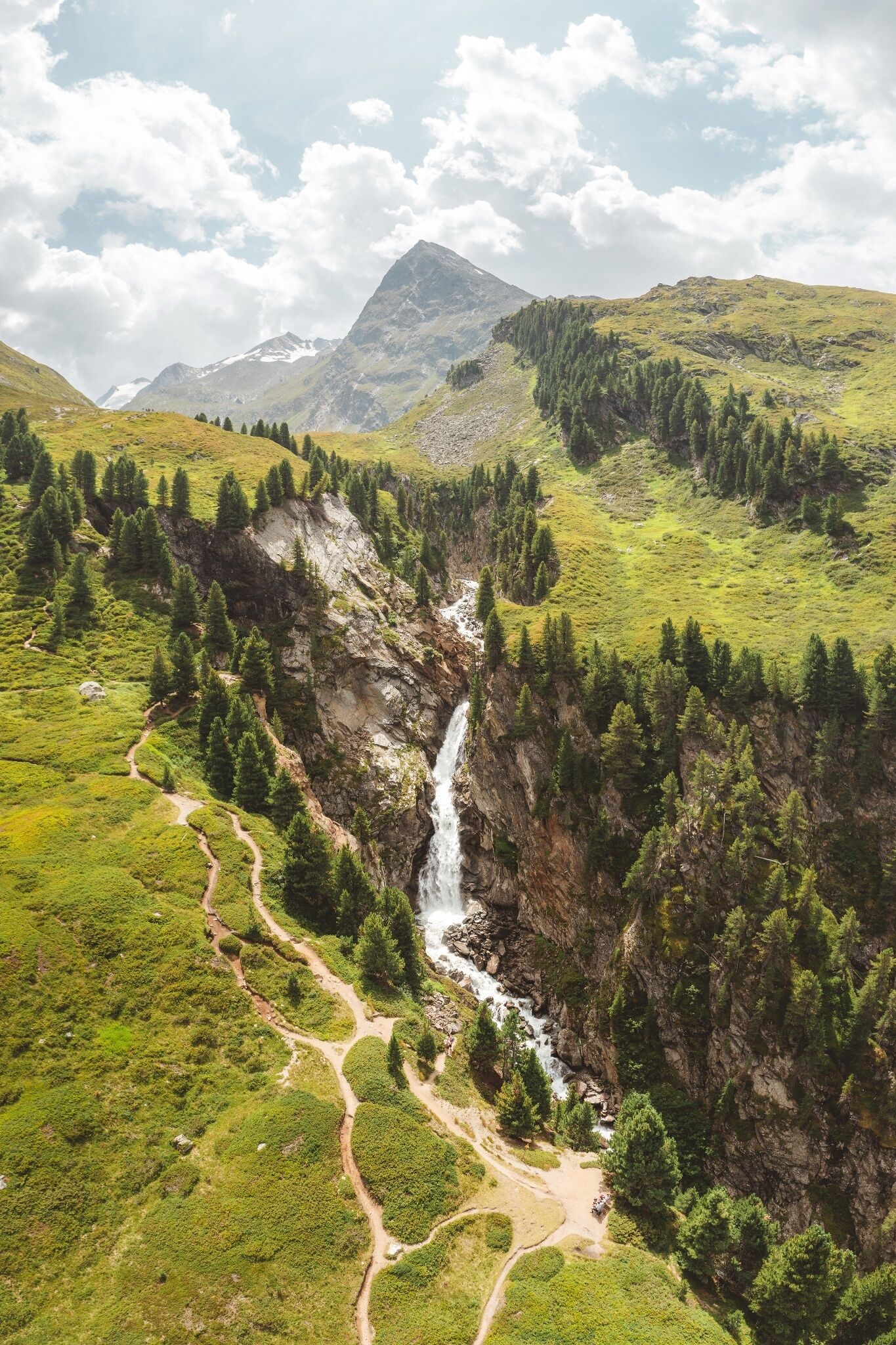
OBERGURGL -> Zirbenwald -> ROTMOOSWASSERFALL

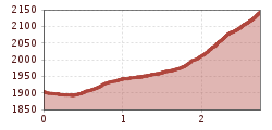
Easy hiking trail; suitable for beginners and walkers. Please note the current weather report at: https://www.oetztal.com/de/sommer.html.
Appropriate equipment such as breathable and weather-adapted outdoor clothing, ankle-high hiking boots, wind, rain and sun protection, a hat, possibly gloves, is required for all hikes and routes. Carrying a first aid kit, a mobile phone and possibly a hiking map, as well as sufficient provisions for hikes without dining opportunities, is necessary.
From Obergurgl head south to the last houses. From there, follow the path to the Zirben Alm and continue along the walking path to a promontory (way cross and bench) opposite the Nasenwand. Then, turning half right on the Alpenrose slope, ascend in switchbacks past beautiful moor pools and pastures to the impressive Rotmooswasserfall of the deeply carved Rotmoos gorge. The path continues quite steeply to the Schönwieshütte or northwards back to the Gaisberg.
Travel comfortably and safely by train to the Ötztal train station. The final stop or exit point is the ÖTZTAL station. Afterwards, you can conveniently and quickly travel by public transport or local taxi companies through the entire valley to your desired destination. The current bus schedule can be found at: fahrplan.vvt.at.
The following parking options are available in Gurgl:


")


