
Opening hours:Today closed
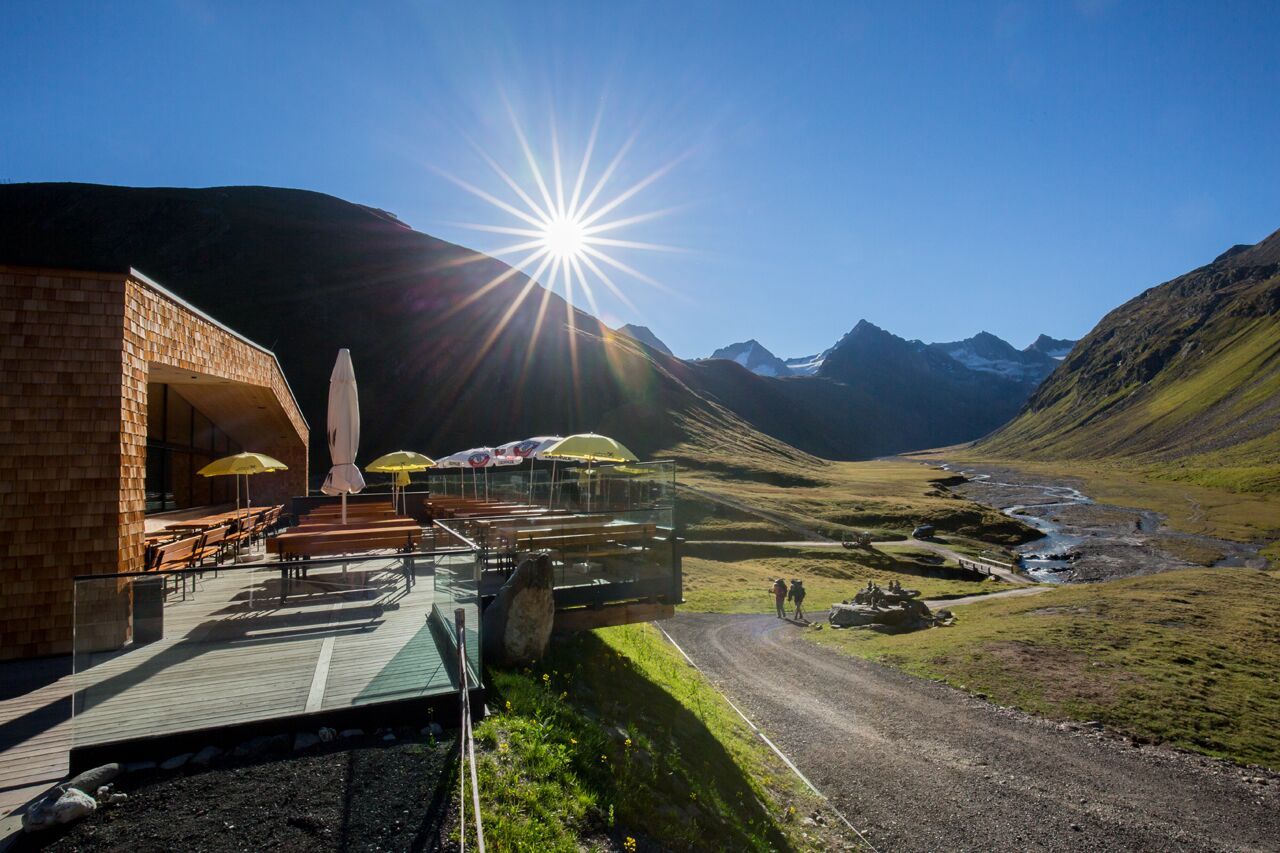
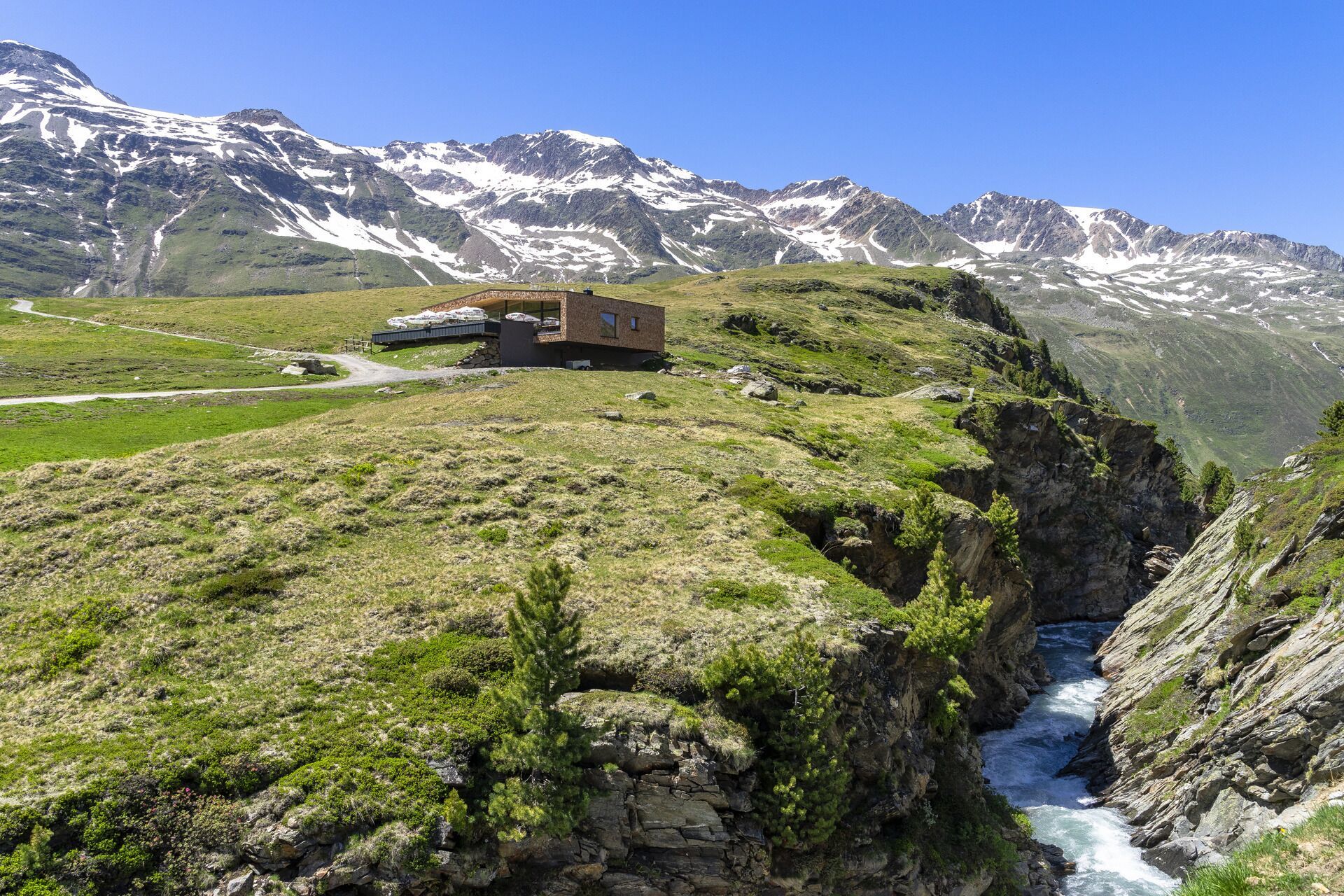
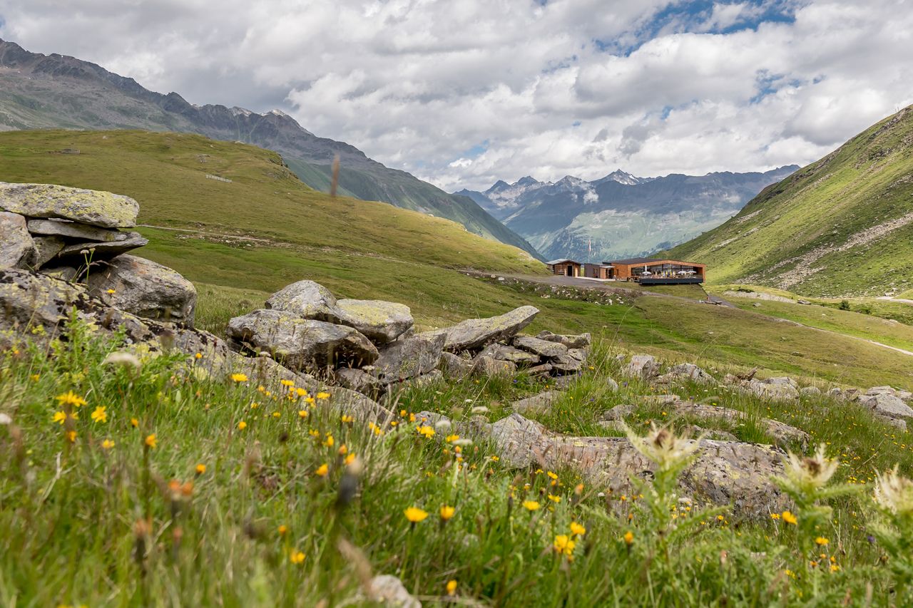
Place:Obergurgl
:Restaurant
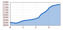
OBERGURGL -> Zirbenwald -> Rotmooswasserfall -> SCHÖNWIESHÜTTE
Easy hiking route; suitable for beginners and walkers. Please pay attention to the current weather report at: https://www.oetztal.com/de/sommer.html.
Appropriate equipment such as breathable and weather-appropriate outdoor clothing, ankle-high hiking boots, wind, rain, and sun protection, a hat, and possibly gloves, is required for all hikes and routes. Carrying a first-aid kit, a mobile phone, and possibly a hiking map, as well as sufficient provisions for hikes without the option to stop at a hut, is necessary.
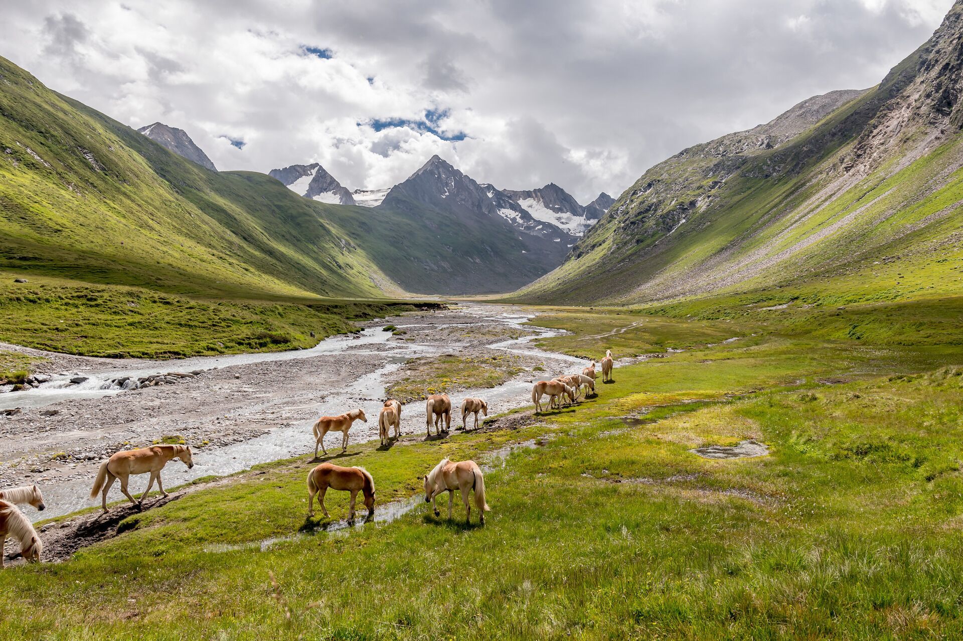
From Obergurgl center heading south, follow the promenade path at the end of the village to the Zirbenwald. From there continue on the promenade path to a vantage point (way cross and bench) opposite the Nasenwand. Now turn left and ascend pictorially through the 400-year-old Zirbenwald to a small hill. Now it goes lightly to moderately uphill on a good gravel path along the west slope of the Hohe Mut towards Rotmoostal and over the bridge to the serviced Schönwieshütte. From there a recommended short hike (1/4 hour) over grassy slopes uphill to the Schönwieskopf with a beautiful view down into the Gurgler Rotmoostal.
Travel comfortably and safely by train to Ötztal station. The terminus or exit point is ÖTZTAL station. Afterwards, travel conveniently and quickly by public transport or local taxi companies through the entire valley to your desired destination! The current bus timetable is available at: http://fahrplan.vvt.at
The following parking options are available in Gurgl:


")


