Winter hike Schweinfurter Hut - Niederthai 322

open
Umhausen / Stubaier Alpen
Difficulty ratings: easy
Route length: 5.8 km
Duration: 2:00 h

PARKPLATZ SENNHOF -> Larstigalm -> Schweinfurter Hut -> PARKPLATZ SENNHOF

Tour information

  • Requirement: easy
  • Length: 5.8 km
  • Duration: 2:00 h
  • Elevation uphill:493 hm
  • Elevation downhill:1 hm
Highest point2,033 m

Starting point

Sennhof Parking Lot

Finishing point

Schweinfurter Hut
  • Fitness level 2 / 6
  • Technique 2 / 6

Best time of year

  • January
  • February
  • March
  • April
  • May
  • June
  • July
  • August
  • September
  • October
  • November
  • December

Equipment

Please observe the current snow and avalanche report for the coming days:

https://www.oetztal.com/de/winter.html & https://lawinen.report/bulletin/latest

The Ötztal Tourism team will be happy to inform you personally about the condition of the winter hiking trails. 

Ötztal Tourism, T +43 5 72 00 400, umhausen@oetztal.com 

Appropriate equipment such as breathable and weather-adapted outdoor clothing, wind, rain, snow, and sun protection, a hat, and gloves are required for all hikes and routes. Taking a first aid kit, a mobile phone, and possibly a route map, as well as sufficient provisions for tours without dining options, is necessary. 

Source: Ötztal

Description

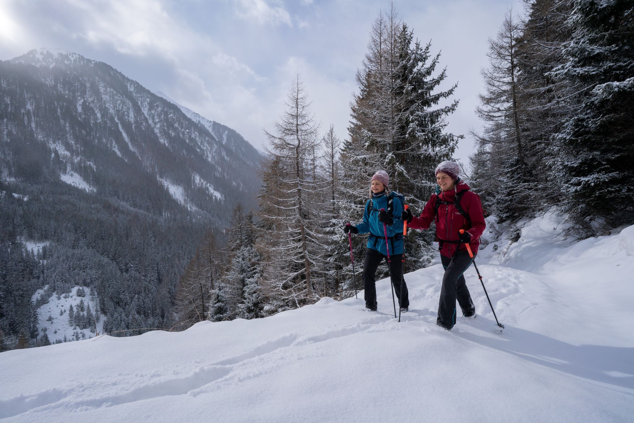
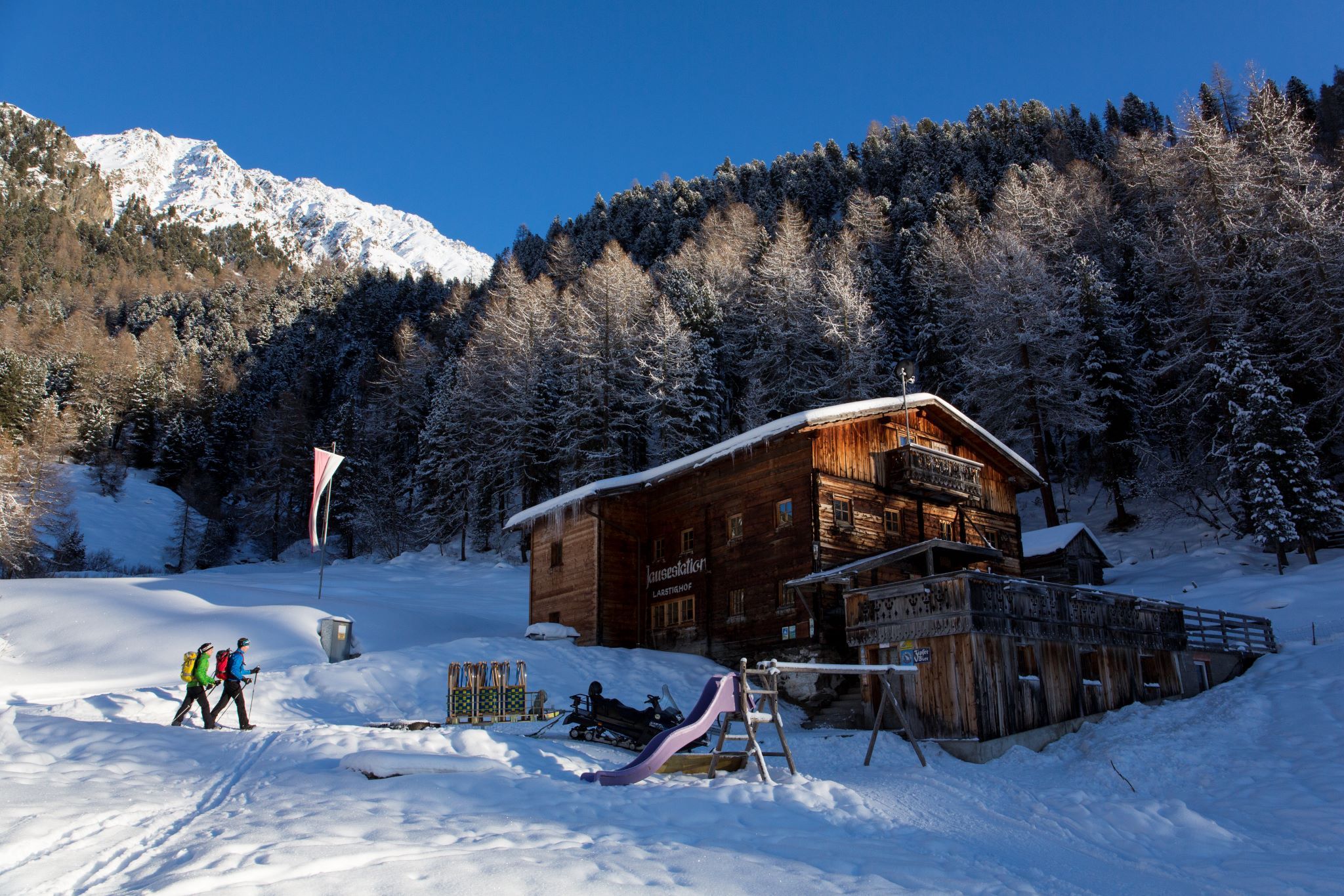
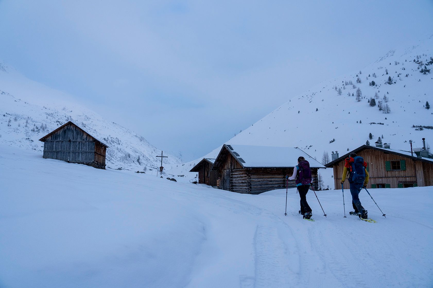
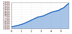
Directly from the Sennhof parking lot, a wide forest road with a pleasantly steady incline runs alongside the Horlachbach into the valley. After about an hour, the Larstigalm (1,778 m) lies to the right of the path. Another hour on foot leads somewhat steeper to the Schweinfurter Hut (2,028 m), which is impressively situated on a saddle below the Sömmer Spitze. The mountains around the hut are among the quietest in the Ötztal in winter, so the hut is considered a stronghold for winter hikers, sledders, snowshoers, and ski tourers. 


Nearby huts and mountain restaurants

Getting here

  • Arrival by public transport

    Travel comfortably and safely by train to the Ötztal train station. The final stop or exit point is the ÖTZTAL station. Afterwards, you can conveniently and quickly travel through the entire valley to your desired destination by public transport or local taxi services! The current bus schedule is available at: http://fahrplan.vvt.at

  • Parking

    Sennhof Parking Lot

    The parking lot is subject to fees from 7:00 am to 6:30 pm and is operated year-round.

    • Day ticket: €6.00 per car | Multi-day tickets available on-site
    • Guests with disabilities – please display a valid permit – park for free
    • Buses park for free

More tours in the surrounding area

  • Ötztal Trek Stage 6

    Difficulty: difficult
    Length: 7.6 km Duration: 3:30 h Elevation uphill: 640 m
  • Ötztal Trek Stage 7

    Difficulty: difficult
    Length: 5.3 km Duration: 2:00 h Elevation uphill: 376 m
  • Ötztal Trek

    Length: 246.4 km Duration: 84:25 h Elevation uphill: 18,910 m
  • Ötztal Trek Stage 17

    Difficulty: difficult
    Length: 16.4 km Duration: 6:00 h Elevation uphill: 1,080 m
  • Ötztal Trek Stage 16

    Difficulty: difficult
    Length: 6.9 km Duration: 2:30 h Elevation uphill: 358 m
  • Winter hiking trail Rotes Wandl - No. 431

    Opening hours: closed
    Difficulty: easy
    Length: 1.5 km Duration: 0:45 h Elevation uphill: 52 m
  • Ötztal Trek Stage 21

    Difficulty: difficult
    Length: 9.4 km Duration: 4:30 h Elevation uphill: 1,270 m
  • Ötztal Trek Stage 4

    Difficulty: difficult
    Length: 8.9 km Duration: 4:00 h Elevation uphill: 802 m
  • Ötztal Trek Stage 3

    Difficulty: difficult
    Length: 10.4 km Duration: 4:00 h Elevation uphill: 842 m
  • Ötztal Trek Stage 10

    Difficulty: difficult
    Length: 11.1 km Duration: 4:30 h Elevation uphill: 1,476 m
  • Ötztal Trek Stage 8

    Difficulty: difficult
    Length: 9.3 km Duration: 3:30 h Elevation uphill: 274 m
  • Ötztal Trek Stage 20

    Opening hours: closed
    Difficulty: medium
    Length: 6.4 km Duration: 3:00 h Elevation uphill: 610 m
  • Ötztal Trek Stage 11

    Difficulty: difficult
    Length: 12.0 km Duration: 5:00 h Elevation uphill: 705 m
  • Ötztal Trek Stage 5

    Difficulty: difficult
    Length: 8.1 km Duration: 3:30 h Elevation uphill: 1,125 m
  • Ötztal Trek Stage 1

    Difficulty: medium
    Length: 18.6 km Duration: 6:30 h Elevation uphill: 1,561 m
  • Ötztal Trek Stage 14

    Difficulty: difficult
    Length: 6.3 km Duration: 3:00 h Elevation uphill: 1,004 m
  • Ötztal Trek Stage 12

    Difficulty: difficult
    Length: 4.8 km Duration: 2:00 h Elevation uphill: 592 m
  • Ötztaler Urweg

    Length: 189.1 km Duration: 72:19 h Elevation uphill: 9,428 m
  • Ötztal Trek Stage 22

    Difficulty: difficult
    Length: 21.5 km Duration: 8:00 h Elevation uphill: 647 m
  • Vent - Breslauer Hütte - Vernagthütte

    Difficulty: medium
    Length: 10.4 km Duration: 4:00 h Elevation uphill: 1,203 m
Newsletter

The mountain is calling? So does our newsletter!

In our monthly newsletter we reveal the best holiday tips for Tyrol.