Snowshoe hike Snowshoe Trail Bielefelder Hut 03

Oetz / Stubaier Alpen
Difficulty ratings: difficult
Route length: 3.9 km
Duration: 3:00 h

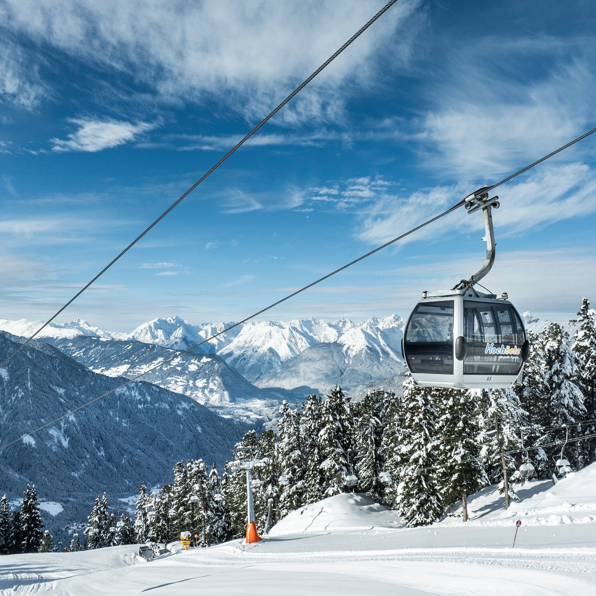
ACHERKOGELBAHN -> Acherkogelblick viewing platform -> Bielefelder Hut -> ACHERKOGELBAHN

Tour information

  • Requirement: difficult
  • Length: 3.9 km
  • Duration: 3:00 h
  • Elevation uphill:252 hm
  • Elevation downhill:252 hm
Highest point2,111 m

Starting point

Panoramic Restaurant Hochoetz

Finishing point

Panoramic Restaurant Hochoetz
  • Fitness level 5 / 6

Best time of year

  • January
  • February
  • March
  • April
  • May
  • June
  • July
  • August
  • September
  • October
  • November
  • December

Equipment

Please pay attention to the current snow and avalanche report for the coming days: www.oetztal.com/de/winter.html & avalanche.report/albina-web/bulletin/2019-01-07

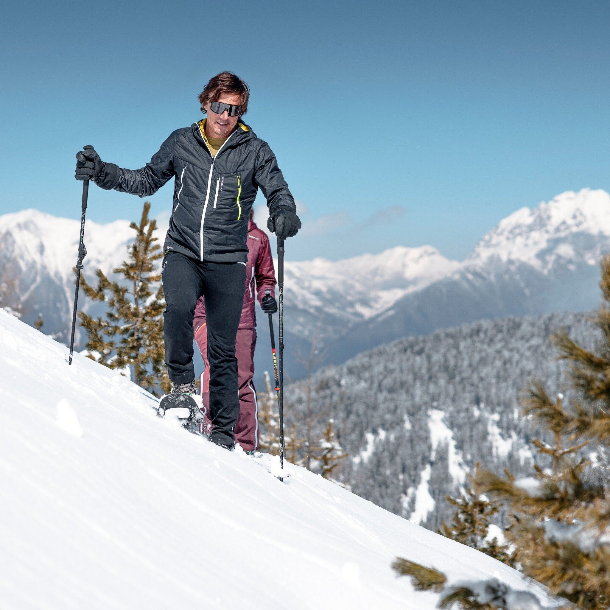
Appropriate equipment such as breathable and weather-appropriate outdoor clothing, wind, rain, snow, and sun protection, a hat and gloves are required for all hikes and routes. Carrying a first aid kit, a mobile phone, and possibly a map, as well as sufficient provisions for routes without refreshment options, is necessary.

Source: Ötztal

Description

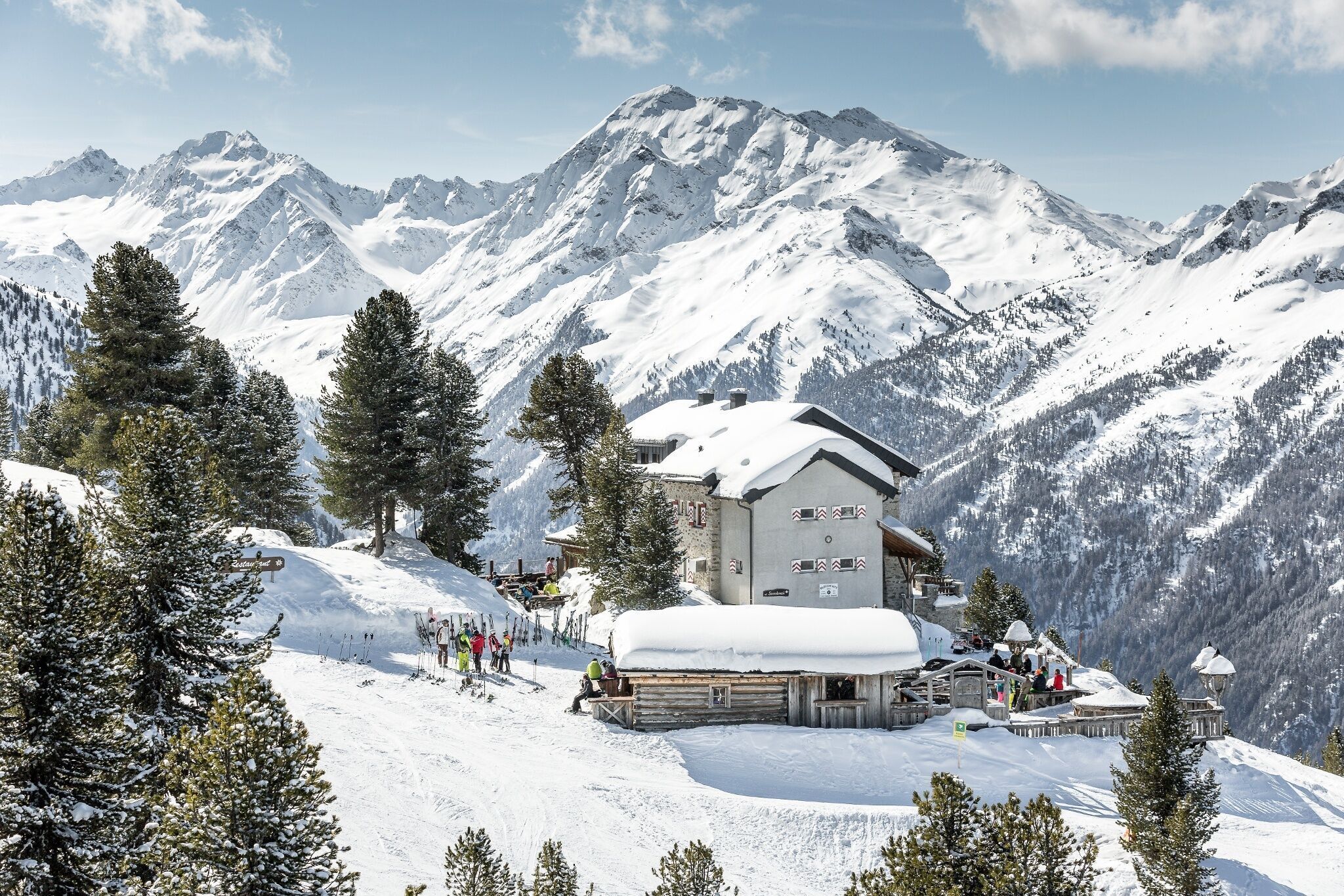
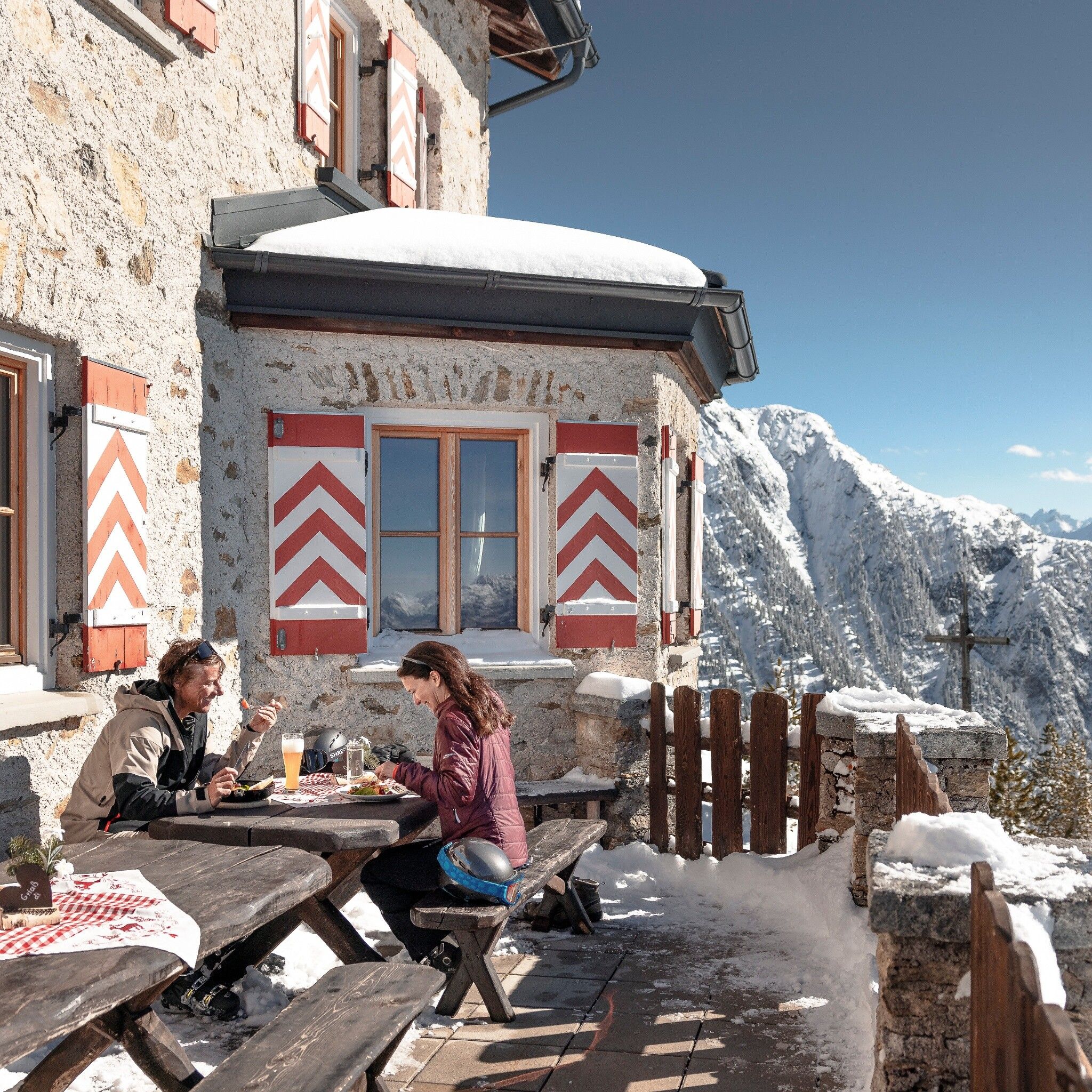
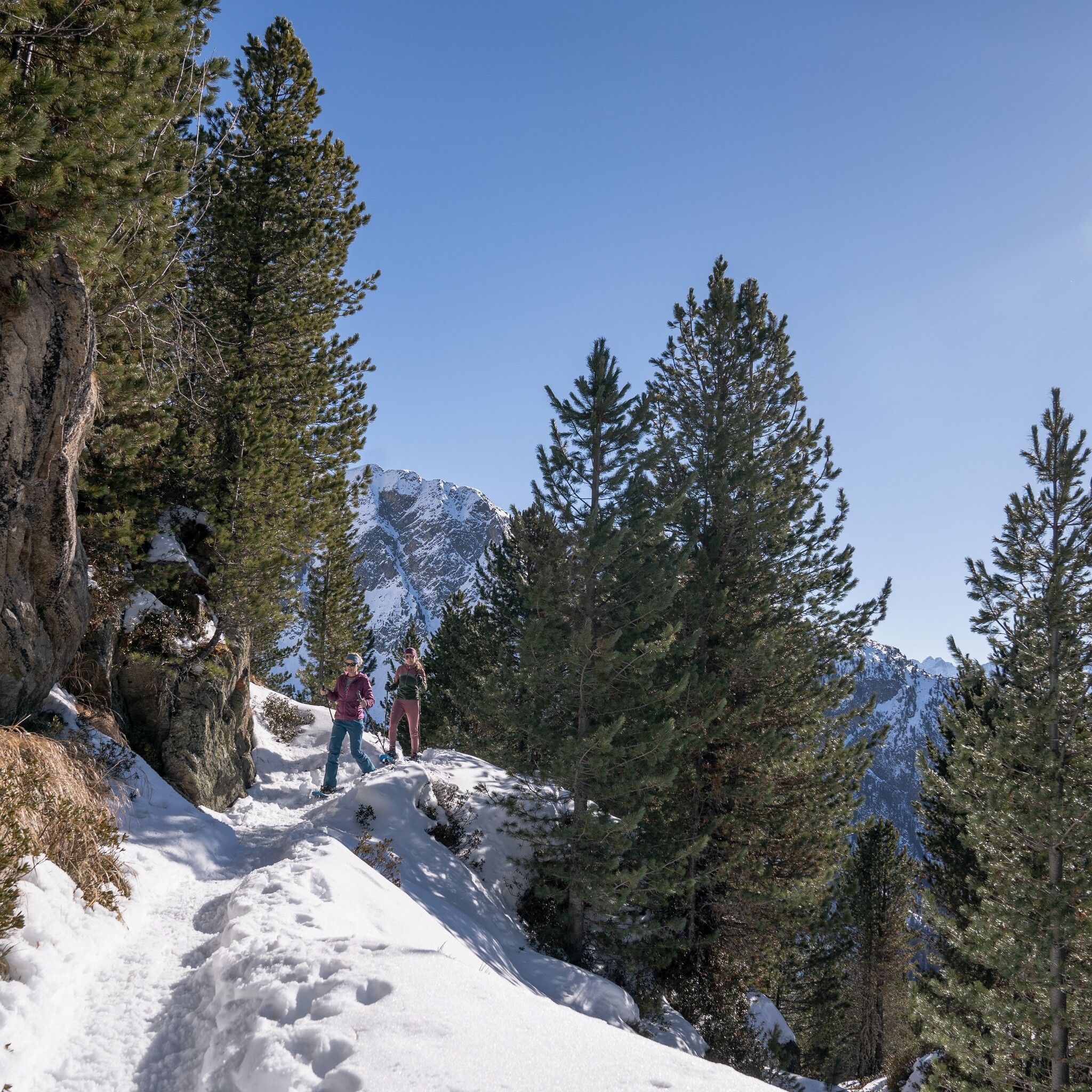
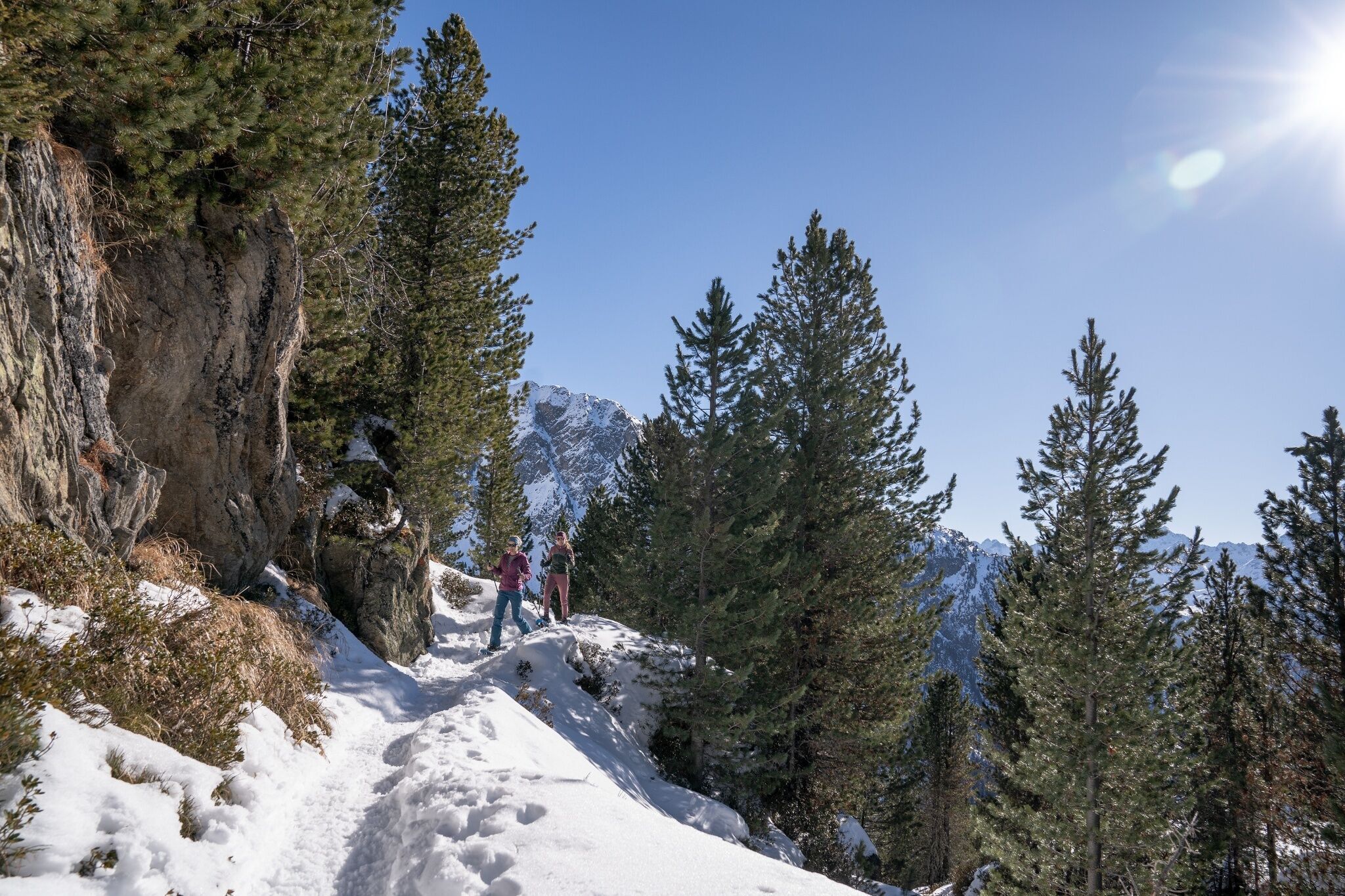
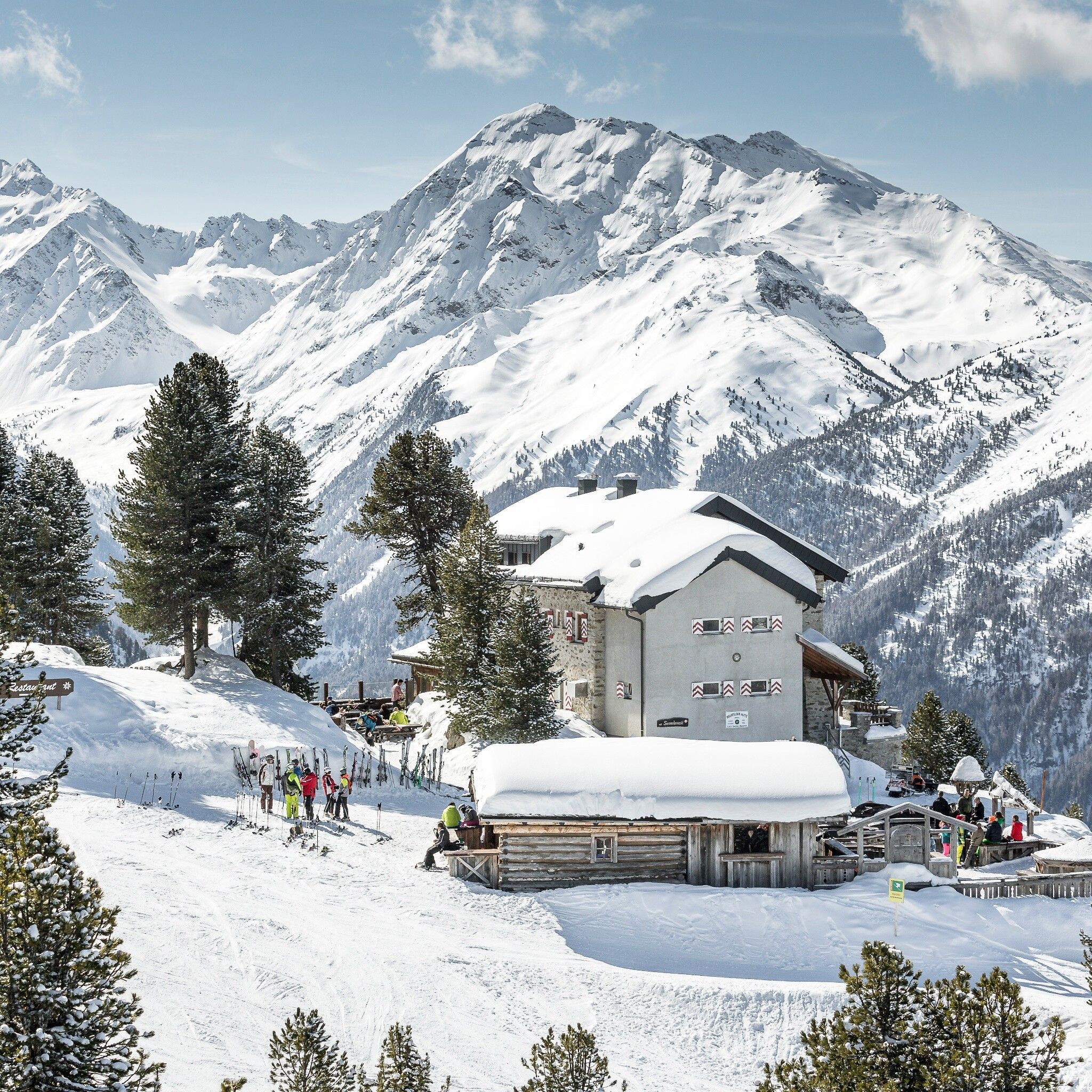
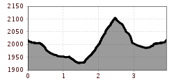
You take the Acherkogelbahn up to the Hochoetz ski area. The beautiful, signposted snowshoe trail starts below the panoramic restaurant (2020 m) heading towards "Rotes Wandl". From there, the trail first descends steeply, then more gently, always away from the piste through the forest, and then crosses below the Brunnenkopflift through the snowy winter forest to the Acherkogelblick viewing platform. The impressive view of the Acherkogel invites you to linger. The next part of the snowshoe trail becomes more challenging and requires some snowshoeing experience. After about 1 km and 170 m of elevation gain, you reach the Bielefelder Hut, where you can relax, enjoy the view, and regain strength with a Kaiserschmarrn. For the descent, follow the somewhat steeper path that leads right from the hut down until you reach the starting section of the route and then follow it back to the Acherkogelbahn.

Nearby huts and mountain restaurants

Getting here

  • Arrival by public transport

    Travel comfortably and safely by train to Ötztal station. At the station, you will find public transport or local taxi services happy to take you to your desired destination! The current bus schedule can be found at: http://fahrplan.vvt.at

  • Parking

    Parking options available:

    Parking lot at Acherkogelbahn (fee required)

    Parking lot at rafting entry point (at the town exit of Oetz on the right side) (fee required)

    Oetz town center parking (fee required)

    Overnight parking during multi-day tours: Oetz town center parking, tickets available at the Oetz information office.

More tours in the surrounding area

  • Ötztal Trek Stage 3

    Difficulty: difficult
    Length: 10.4 km Duration: 4:00 h Elevation uphill: 842 m
  • Ötztal Trek Stage 10

    Difficulty: difficult
    Length: 11.1 km Duration: 4:30 h Elevation uphill: 1,476 m
  • Ötztal Trek Stage 1

    Difficulty: medium
    Length: 18.6 km Duration: 6:30 h Elevation uphill: 1,561 m
  • Ötztal Trek Stage 14

    Difficulty: difficult
    Length: 6.3 km Duration: 3:00 h Elevation uphill: 1,004 m
  • Ötztal Trek Stage 11

    Difficulty: difficult
    Length: 12.0 km Duration: 5:00 h Elevation uphill: 705 m
  • Winter hiking trail Rotes Wandl - No. 431

    Opening hours: closed
    Difficulty: easy
    Length: 1.5 km Duration: 0:45 h Elevation uphill: 52 m
  • Ötztal Trek Stage 21

    Difficulty: difficult
    Length: 9.4 km Duration: 4:30 h Elevation uphill: 1,270 m
  • Ötztal Trek Stage 6

    Difficulty: difficult
    Length: 7.6 km Duration: 3:30 h Elevation uphill: 640 m
  • Ötztal Trek Stage 17

    Difficulty: difficult
    Length: 16.4 km Duration: 6:00 h Elevation uphill: 1,080 m
  • Mountain peak Rosskopf

    Difficulty: medium
    Length: 2.0 km Duration: 2:00 h Elevation uphill: 379 m
  • Mutsbühl

    Difficulty: medium
    Length: 4.5 km Duration: 1:30 h Elevation uphill: 470 m
  • Fundusfeiler - Umhausen

    Difficulty: difficult
    Length: 4.5 km Duration: 3:00 h Elevation uphill: 1,109 m
  • Wilder Mann

    Difficulty: medium
    Length: 2.4 km Duration: 2:30 h Elevation uphill: 665 m
  • Siegerlandhütte - Sölden

    Difficulty: medium
    Length: 8.0 km Duration: 3:30 h Elevation uphill: 780 m
  • Stuibenfall hike - Umhausen

    Opening hours: open
    Difficulty: easy
    Length: 2.9 km Duration: 1:45 h Elevation uphill: 456 m
  • Ötztal Trek Stage 4

    Difficulty: difficult
    Length: 8.9 km Duration: 4:00 h Elevation uphill: 802 m
  • Ötztal Trek Stage 7

    Difficulty: difficult
    Length: 5.3 km Duration: 2:00 h Elevation uphill: 376 m
Newsletter

The mountain is calling? So does our newsletter!

In our monthly newsletter we reveal the best holiday tips for Tyrol.