Snowshoe hike Snowshoe Trail Wesele Loop

Oetz / Stubaier Alpen
Difficulty ratings: medium
Route length: 900 m
Duration: 1:00 h

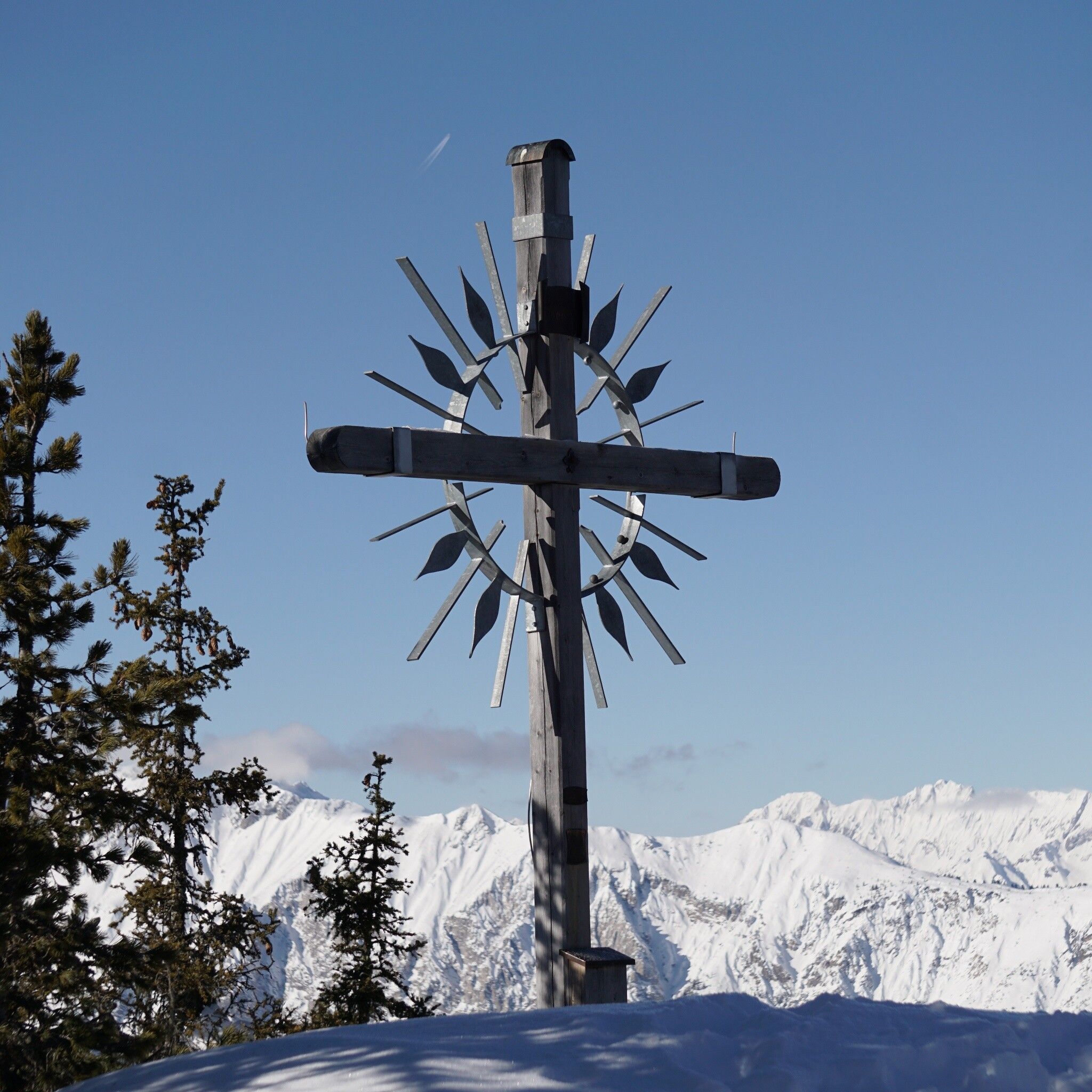
ACHERKOGELBAHN -> towards Rotes Wandl-> ACHERKOGELBAHN

Tour information

  • Requirement: medium
  • Length: 900 m
  • Duration: 1:00 h
  • Elevation uphill:55 hm
  • Elevation downhill:55 hm
Highest point2,016 m

Starting point

Panorama Restaurant Hochoetz

Finishing point

Panorama Restaurant Hochoetz
  • Fitness level 3 / 6

Best time of year

  • January
  • February
  • March
  • April
  • May
  • June
  • July
  • August
  • September
  • October
  • November
  • December

Equipment

Please note the current snow and avalanche forecast for the coming days: www.oetztal.com/de/winter.htmlavalanche.report/albina-web/bulletin/2019-01-07

Appropriate equipment such as breathable and weather-adapted outdoor clothing, wind, rain, snow and sun protection, a hat, and gloves is required for all hikes and tours. Bringing a first aid kit, a mobile phone, and possibly a tour map, as well as sufficient provisions for tours without refreshment options, is necessary.

Source: Ötztal

Description

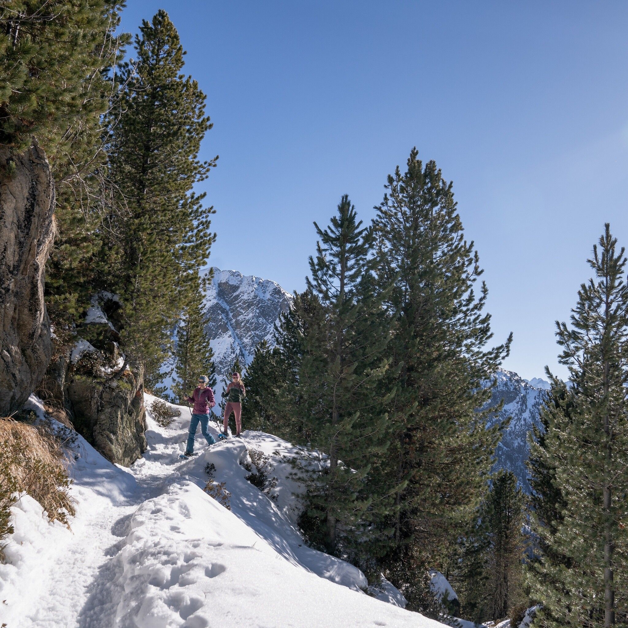
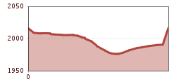
Take the Acherkogelbahn to the Hochoetz ski area. The beautiful, signposted snowshoe trail starts below the Panorama Restaurant (2020 m) and leads towards "Rotes Wandl". From there, the trail gently descends through the forest until a fork. Here you follow the trail signposted upwards, past the Wesele Lift, back to the Panorama Restaurant.  


Nearby huts and mountain restaurants

Getting here

  • Arrival by public transport

    Travel comfortably and safely by train to Ötztal Bahnhof. At the station, you will find public transport or local taxi companies happy to take you to your desired destination! The current bus schedule can be found at: http://fahrplan.vvt.at

  • Parking

    The following parking options are available:

    Parking lot Acherkogelbahn (paid)

    Parking lot Rafting entry point (at the end of Oetz on the right side) (paid)

    Oetz center parking lot (paid)

    Overnight parking during multi-day tours: Oetz center parking lot. Tickets are available at the Oetz information office.

More tours in the surrounding area

  • Ötztal Trek Stage 6

    Difficulty: difficult
    Length: 7.6 km Duration: 3:30 h Elevation uphill: 640 m
  • Ötztal Trek Stage 7

    Difficulty: difficult
    Length: 5.3 km Duration: 2:00 h Elevation uphill: 376 m
  • Ötztal Trek

    Length: 246.4 km Duration: 84:25 h Elevation uphill: 18,910 m
  • Ötztal Trek Stage 17

    Difficulty: difficult
    Length: 16.4 km Duration: 6:00 h Elevation uphill: 1,080 m
  • Ötztal Trek Stage 16

    Difficulty: difficult
    Length: 6.9 km Duration: 2:30 h Elevation uphill: 358 m
  • Winter hiking trail Rotes Wandl - No. 431

    Opening hours: closed
    Difficulty: easy
    Length: 1.5 km Duration: 0:45 h Elevation uphill: 52 m
  • Ötztal Trek Stage 21

    Difficulty: difficult
    Length: 9.4 km Duration: 4:30 h Elevation uphill: 1,270 m
  • Ötztal Trek Stage 4

    Difficulty: difficult
    Length: 8.9 km Duration: 4:00 h Elevation uphill: 802 m
  • Ötztal Trek Stage 3

    Difficulty: difficult
    Length: 10.4 km Duration: 4:00 h Elevation uphill: 842 m
  • Ötztal Trek Stage 10

    Difficulty: difficult
    Length: 11.1 km Duration: 4:30 h Elevation uphill: 1,476 m
  • Ötztal Trek Stage 8

    Difficulty: difficult
    Length: 9.3 km Duration: 3:30 h Elevation uphill: 274 m
  • Ötztal Trek Stage 20

    Opening hours: closed
    Difficulty: medium
    Length: 6.4 km Duration: 3:00 h Elevation uphill: 610 m
  • Ötztal Trek Stage 11

    Difficulty: difficult
    Length: 12.0 km Duration: 5:00 h Elevation uphill: 705 m
  • Ötztal Trek Stage 5

    Difficulty: difficult
    Length: 8.1 km Duration: 3:30 h Elevation uphill: 1,125 m
  • Ötztal Trek Stage 1

    Difficulty: medium
    Length: 18.6 km Duration: 6:30 h Elevation uphill: 1,561 m
  • Ötztal Trek Stage 14

    Difficulty: difficult
    Length: 6.3 km Duration: 3:00 h Elevation uphill: 1,004 m
  • Ötztal Trek Stage 12

    Difficulty: difficult
    Length: 4.8 km Duration: 2:00 h Elevation uphill: 592 m
  • Ötztaler Urweg

    Length: 189.1 km Duration: 72:19 h Elevation uphill: 9,428 m
  • Ötztal Trek Stage 22

    Difficulty: difficult
    Length: 21.5 km Duration: 8:00 h Elevation uphill: 647 m
  • Vent - Breslauer Hütte - Vernagthütte

    Difficulty: medium
    Length: 10.4 km Duration: 4:00 h Elevation uphill: 1,203 m
Newsletter

The mountain is calling? So does our newsletter!

In our monthly newsletter we reveal the best holiday tips for Tyrol.