Mountain hikes Theme path "Liegstätten in Timmeltal near Prägraten"

Prägraten am Großvenediger / Venedigergruppe
Difficulty ratings: easy
Route length: 4.3 km
Duration: 3:00 h

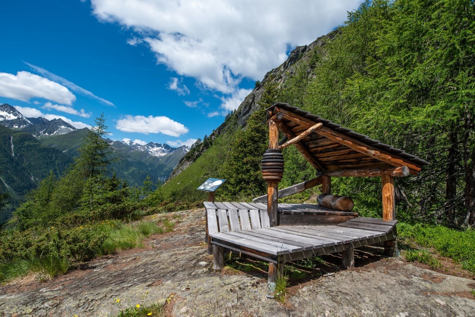
... from stone lounger to four-poster bed
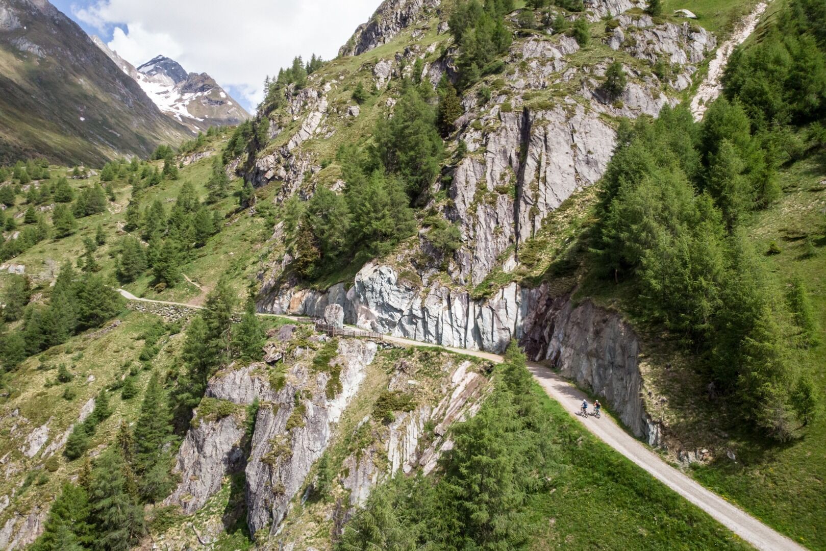
Tour information

  • Requirement: easy
  • Length: 4.3 km
  • Duration: 3:00 h
  • Elevation uphill:480 hm
  • Elevation downhill:480 hm
Highest point2,130 m

Starting point

Parkplatz Bodenalm

Finishing point

Liegstatt Grießer Oder
  • Fitness level 2 / 6
  • Technique 2 / 6

Features

  • Circular route
  • Suitable for families

Best time of year

  • January
  • February
  • March
  • April
  • May
  • June
  • July
  • August
  • September
  • October
  • November
  • December
Source: TVB Osttirol

Description

In the surroundings of the Bodenalm and Wallhorner Alm, wooden structures await hikers that are not commonplace. This "resting places", modelled on the historical resting places once used by farmers to relax while working in the mountain meadows. The entrance to the nature experience is at the parking place Bodenalm. The 4 stations are located between 1.950 and 2.130 m and do not have any steep inclines. The snack station Bodenalm (not open right now) can be reached from the parking place Bodenalm (fee required!) after a short hike of 40 minutes. The easy and family-friendly circular hike to all 4 resting places from the Bodenalm takes about 2 hours.

Getting here

  • Arrival by public transport

    Prägraten a.G. Wallhorn

  • Parking

    Parkplatz Bodenalm

More tours in the surrounding area

  • Lasörling altitude trail

    Difficulty: medium
    Length: 57.0 km Duration: 25:00 h Elevation uphill: 3,740 m
  • Venediger altitude trail

    Difficulty: difficult
    Length: 55.5 km Duration: 27:00 h Elevation uphill: 3,915 m
  • Figerhorn

    Difficulty: difficult
    Length: 6.5 km Duration: 6:00 h Elevation uphill: 807 m
  • Hike to the Venedigerhaus Innergschlöß

    Difficulty: easy
    Length: 8.5 km Duration: 2:30 h Elevation uphill: 180 m
  • Rotenkogel

    Difficulty: difficult
    Length: 3.9 km Duration: 3:00 h Elevation uphill: 383 m
  • Lasörling 3.098m

    Difficulty: difficult
    Length: 21.9 km Duration: 12:00 h Elevation uphill: 1,940 m
  • Umbal waterfalls nature force trail

    Difficulty: easy
    Length: 5.8 km Duration: 2:30 h Elevation uphill: 250 m
  • Muhs panorama trail

    Difficulty: medium
    Length: 15.2 km Duration: 6:00 h Elevation uphill: 1,090 m
  • Hike to Neuen Reichenberger Hütte

    Difficulty: medium
    Length: 9.1 km Duration: 9:00 h Elevation uphill: 1,210 m
  • Hiking tour to Lasörlinghütte 2.350m

    Difficulty: medium
    Length: 14.6 km Duration: 7:10 h Elevation uphill: 1,080 m
  • Badener Hütte

    Difficulty: difficult
    Length: 23.2 km Duration: 11:30 h Elevation uphill: 1,750 m
  • Lucknerhaus - Stüdlhütte

    Difficulty: medium
    Length: 9.3 km Duration: 5:30 h Elevation uphill: 862 m
  • Hike to Kalser Tauernhaus

    Difficulty: medium
    Length: 12.2 km Duration: 4:00 h Elevation uphill: 244 m
  • Hiking tour to Neue Sajathütte 2.600m

    Difficulty: medium
    Length: 10.3 km Duration: 6:50 h Elevation uphill: 1,080 m
  • Böses Weibl

    Difficulty: difficult
    Length: 14.1 km Duration: 8:00 h Elevation uphill: 1,193 m
  • Eagle Walk Stage O1: Ströden - Johannis Hütte

    Difficulty: medium
    Length: 13.0 km Duration: 6:30 h Elevation uphill: 1,430 m
Newsletter

The mountain is calling? So does our newsletter!

In our monthly newsletter we reveal the best holiday tips for Tyrol.