Mountain hikes Vernagt Hut - Hochjoch Hospice - Schöne Aussicht

Sölden / Ötztal Alps
Difficulty ratings: medium
Route length: 12.3 km
Duration: 4:00 h

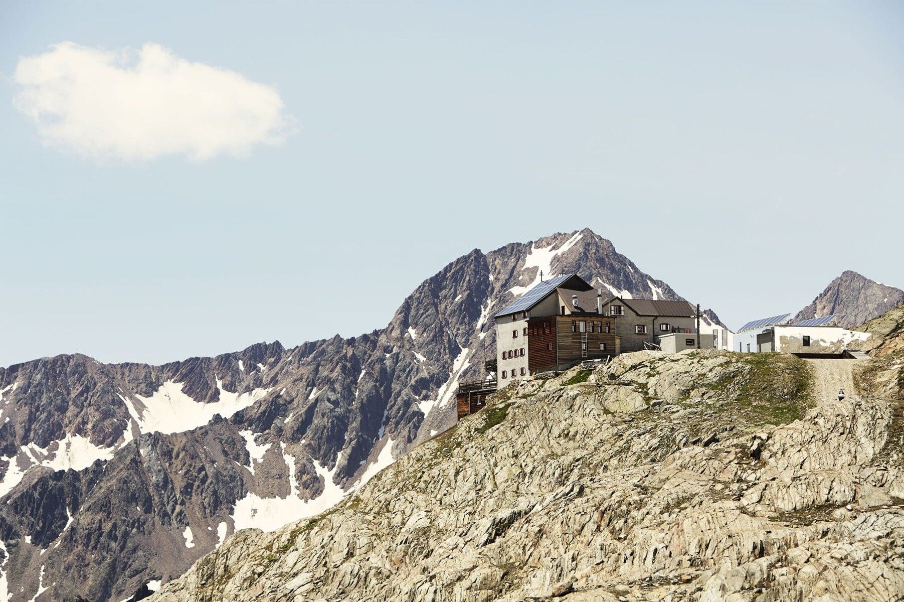
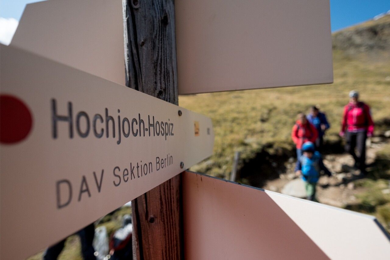
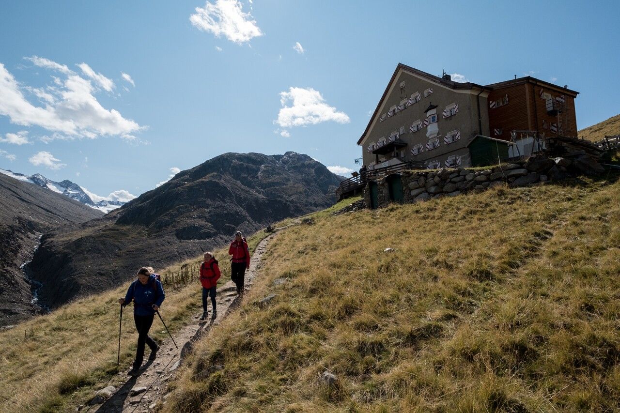
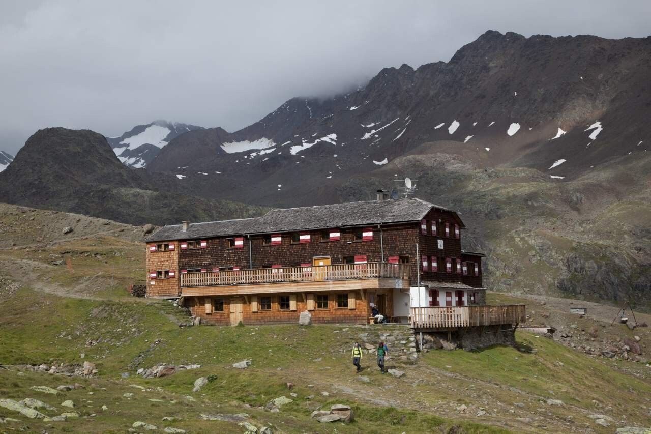
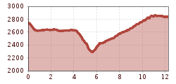
VERNAGT HUT -> Hochjoch Hospice -> SCHÖNE AUSSICHT

Tour information

  • Requirement: medium
  • Length: 12.3 km
  • Duration: 4:00 h
  • Elevation uphill:846 hm
  • Elevation downhill:755 hm
Highest point2,891 m

Starting point

Hochjoch Hospice

Finishing point

Schöne Aussicht
  • Fitness level 4 / 6

Best time of year

  • January
  • February
  • March
  • April
  • May
  • June
  • July
  • August
  • September
  • October
  • November
  • December

Equipment

Moderately difficult mountain path; suitable for sure-footed and experienced mountain hikers; good physical condition, mountain experience and mountain equipment (see equipment section) necessary. Please check the current weather forecast at: www.oetztal.com/de/sommer.html

Appropriate equipment such as breathable and weather-adapted outdoor clothing, ankle-high hiking boots, wind, rain and sun protection, a hat, possibly gloves, is required for all hikes and routes. Bringing a first aid kit, a mobile phone and possibly a hiking map, as well as sufficient provisions for hikes without any refreshment opportunities, is necessary.

Source: TVB Ötztal Tourismus

Description

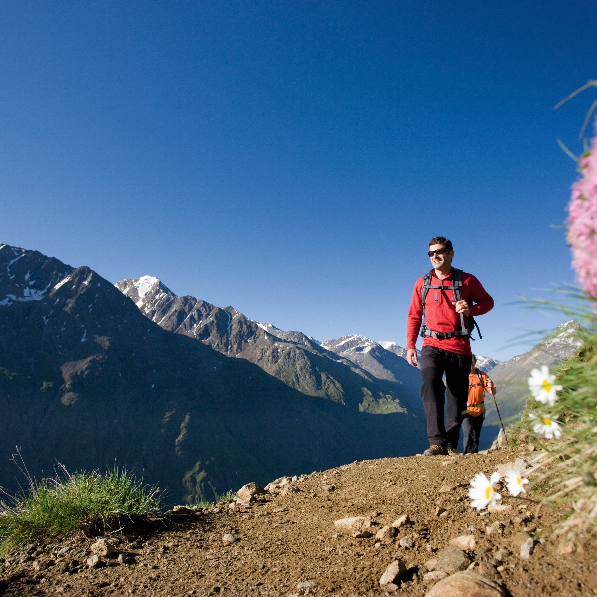
From the Vernagt Hut over a beautiful high-altitude path to the Hochjoch Hospice. From there, down a steep trail to the bridge that crosses the Hintereisbach. From there, up several switchbacks and moderately ascending above the Hochjoch Glacier to the Schöne Aussicht shelter.


Nearby huts and mountain restaurants

Getting here

  • Arrival by public transport

    Travel comfortably and safely by train to the Ötztal train station. The final station or exit point is ÖTZTAL station. Afterwards, you can conveniently and quickly travel through the entire valley to your desired destination by public local transport or local taxi companies! The current bus schedule is available at: http://fahrplan.vvt.at

  • Parking

    In the mountaineering village Vent, the following parking options are available.

    - In summer, in front of the village (parking meter, coins or EC card only) and at the valley station of the chairlift (at the cable car ticket office)

    - In winter, only at the valley station of the chairlift.

    Cost: € 5.00 per day/car

More tours in the surrounding area

  • Ötztal Trek Stage 6

    Difficulty:difficult
    Length:7.6 kmDuration:3:30 hElevation uphill:640 m
  • Ötztal Trek Stage 7

    Difficulty:difficult
    Length:5.3 kmDuration:2:00 hElevation uphill:376 m
  • Ötztal Trek

    Length:246.4 kmDuration:84:25 hElevation uphill:18,910 m
  • Ötztal Trek Stage 17

    Difficulty:difficult
    Length:16.4 kmDuration:6:00 hElevation uphill:1,080 m
  • Ötztal Trek Stage 16

    Difficulty:difficult
    Length:6.9 kmDuration:2:30 hElevation uphill:358 m
  • Ötztal Trek Stage 11

    Difficulty:difficult
    Length:12.0 kmDuration:5:00 hElevation uphill:705 m
  • Ötztal Trek Stage 3

    Difficulty:difficult
    Length:10.4 kmDuration:4:00 hElevation uphill:842 m
  • Ötztal Trek Stage 1

    Difficulty:medium
    Length:18.6 kmDuration:6:30 hElevation uphill:1,561 m
  • Ötztal Trek Stage 14

    Difficulty:difficult
    Length:6.3 kmDuration:3:00 hElevation uphill:1,004 m
  • Ötztal Trek Stage 12

    Difficulty:difficult
    Length:4.8 kmDuration:2:00 hElevation uphill:592 m
  • Ötztal Trek Stage 4

    Difficulty:difficult
    Length:8.9 kmDuration:4:00 hElevation uphill:802 m
  • Ötztal Trek Stage 10

    Difficulty:difficult
    Length:11.1 kmDuration:4:30 hElevation uphill:1,476 m
  • Ötztal Trek Stage 8

    Difficulty:difficult
    Length:9.3 kmDuration:3:30 hElevation uphill:274 m
  • Ötztal Trek Stage 20

    Opening hours:closed
    Difficulty:medium
    Length:6.4 kmDuration:3:00 hElevation uphill:610 m
  • Ötztaler Urweg

    Length:189.1 kmDuration:72:19 hElevation uphill:9,428 m
  • Ötztal Trek Stage 22

    Difficulty:difficult
    Length:21.5 kmDuration:8:00 hElevation uphill:647 m
  • Ötztal Trek Stage 21

    Difficulty:difficult
    Length:9.4 kmDuration:4:30 hElevation uphill:1,270 m
  • Ötztal Trek Stage 5

    Difficulty:difficult
    Length:8.1 kmDuration:3:30 hElevation uphill:1,125 m
  • Siegerlandhütte - Sölden

    Difficulty:medium
    Length:8.0 kmDuration:3:30 hElevation uphill:780 m
Newsletter

The mountain is calling? So does our newsletter!

In our monthly newsletter we reveal the best holiday tips for Tyrol.