Mountain hikes Walk "Nikolauskirche"

Difficulty ratings: easy
Route length: 5.7 km
Duration: 1:50 h

Walk "Nikolauskirche"

Tour information

  • Requirement: easy
  • Length: 5.7 km
  • Duration: 1:50 h
  • Elevation uphill:140 hm
  • Elevation downhill:140 hm
Highest point1,050 m

Starting point

Korberplatz

Finishing point

Korberplatz
  • Fitness level 1 / 6
  • Technique 1 / 6

Features

  • Circular route
  • Suitable for families

Best time of year

  • January
  • February
  • March
  • April
  • May
  • June
  • July
  • August
  • September
  • October
  • November
  • December
Source: TVB Osttirol

Description

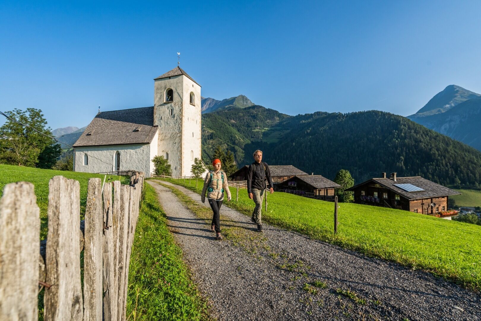
The starting point of this walk is the Korberplatz. From there you walk down the street Virgener Straße until reaching the bridge Brugger Brücke. Cross the bridge and walk along the sidewalk on the right side into the district Auerfeld. After about 100 m turn left into the district Weier and walk over the bridge Zeller Brücke. After the bridge turn right and keep left at the next junction. Follow the asphalt road. As soon as you have mastered the curve, you can already see the church St. Nikolauskirche. The Romanesque frescoes in the upper choir of the church were painted in the middle of the 13th century and are evidence of great painting skills. Then you follow the course of the road and gradually turn left. Then continue in a northerly direction to the district Bichl. At the house Bichl 1 (Ferienhaus Grofn) turn left and follow the road down to the river Isel. After the Bichler bridge, continue to walk left along the dam to the Zeller bridge. Approx. 1km after the bridge you turn right onto the Dammweg, which brings you back to the center of Matrei and to the Korberplatz.

More tours in the surrounding area

  • Wilder-Kaiser-Steig - Detour

    Difficulty: difficult
    Length: 33.0 km Duration: 16:49 h Elevation uphill: 2,311 m
  • 3-day Family Tour Alpbachtal

    Difficulty: easy
    Length: 18.3 km Duration: 7:00 h Elevation uphill: 998 m
  • Voldöpper Spitze Loop Hike

    Difficulty: medium
    Length: 12.9 km Duration: 5:00 h Elevation uphill: 988 m
  • Kundler Klamm

    Opening hours: closed
    Difficulty: easy
    Length: 6.4 km Duration: 2:00 h Elevation uphill: 116 m
  • 3-peak-tour Kienberg-Plessenberg-Heuberg

    Difficulty: medium
    Length: 8.6 km Duration: 4:30 h Elevation uphill: 779 m
  • Discovering the Tiefenbach Gorge Hike

    Opening hours: closed
    Difficulty: medium
    Length: 5.7 km Duration: 3:30 h Elevation uphill: 669 m
  • Loop tour Juppi Zauberwald

    Difficulty: easy
    Length: 2.5 km Duration: 1:00 h Elevation uphill: 93 m
  • Barrier-free path Lake Reintal

    Difficulty: easy
    Length: 6.5 km Duration: 1:45 h Elevation uphill: 15 m
  • Day 1: 4 days - 4 summits tour

    Difficulty: medium
    Length: 9.8 km Duration: 5:00 h Elevation uphill: 984 m
  • Kaiser Gorge - loop trail

    Opening hours: closed
    Difficulty: easy
    Length: 4.2 km Duration: 1:00 h Elevation uphill: 198 m
  • Farmkehralm 1.521 m

    Difficulty: medium
    Length: 9.3 km Duration: 3:30 h Elevation uphill: 506 m
  • Wiedersberger Horn Panorama Path

    Difficulty: easy
    Length: 4.1 km Duration: 1:30 h Elevation uphill: 195 m
  • Day 3: 4 days - 4 summits tour

    Difficulty: medium
    Length: 19.3 km Duration: 8:00 h Elevation uphill: 1,371 m
  • 4 days - 4 summits tour

    Difficulty: medium
    Length: 54.4 km Duration: 23:00 h Elevation uphill: 3,408 m
  • Ötztal Trek Stage 6

    Difficulty: difficult
    Length: 7.6 km Duration: 3:30 h Elevation uphill: 640 m
Newsletter

The mountain is calling? So does our newsletter!

In our monthly newsletter we reveal the best holiday tips for Tyrol.