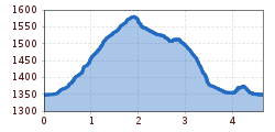
Themed hikes Water Walker Waal Path Mooserstegle Sölden

Sölden / Stubaier Alpen
Difficulty ratings: easy
Route length: 4.7 km
Duration: 2:00 h

Sölden -> Windach Valley -> Waal Path Mooserstegle -> Sölden

Tour information

  • Requirement: easy
  • Length: 4.7 km
  • Duration: 2:00 h
  • Elevation uphill:230 hm
  • Elevation downhill:230 hm
Highest point1,591 m

Starting point

Sölden

Finishing point

Sölden
  • Fitness level 2 / 6

Best time of year

  • January
  • February
  • March
  • April
  • May
  • June
  • July
  • August
  • September
  • October
  • November
  • December

Equipment

SurefootednessNo special difficulties

Appropriate equipment such as breathable and weather-adapted outdoor clothing, ankle-high hiking boots, wind, rain, and sun protection, a hat, and possibly gloves, is required for all hikes and routes. Carrying a first-aid kit, a mobile phone, and possibly a hiking map, as well as sufficient provisions on hikes without opportunities to stop, is necessary.
Source: Ötztal

Description

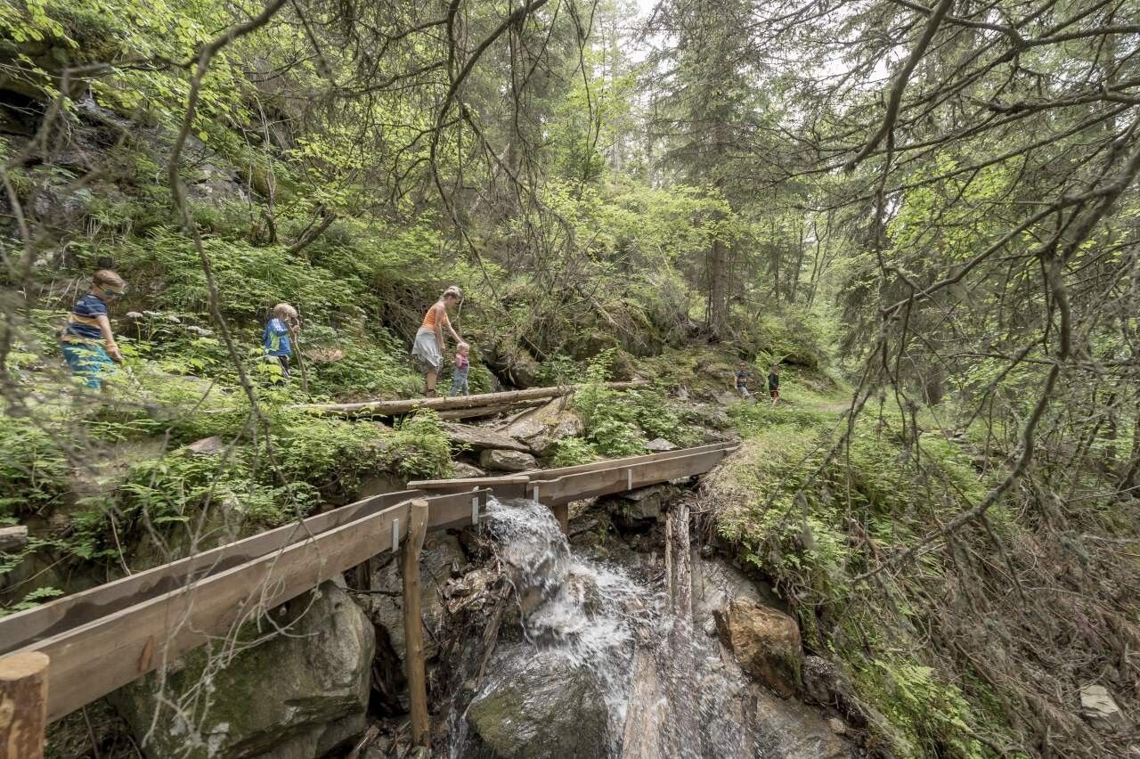
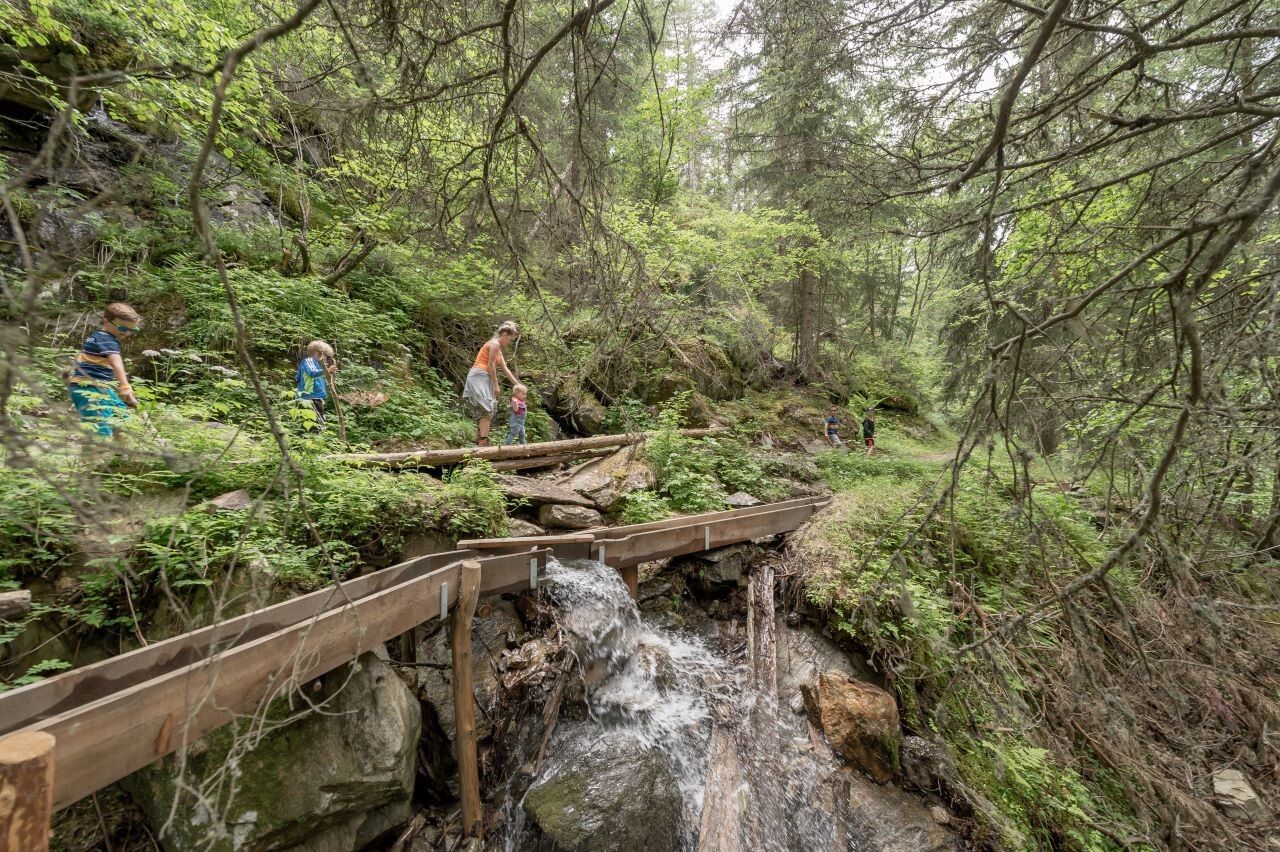
On this themed path you can enjoy the peace and beauty on Sölden's quiet side. The Mooserstegle is a waal path from an earlier time. These waals held great importance because they allowed the meadows to be irrigated. We hike along the old path into the Windach Valley with deep views into the gorge of the Windach Ache.

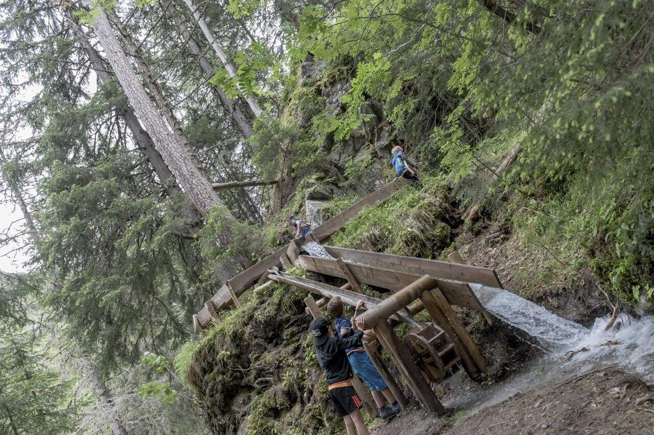
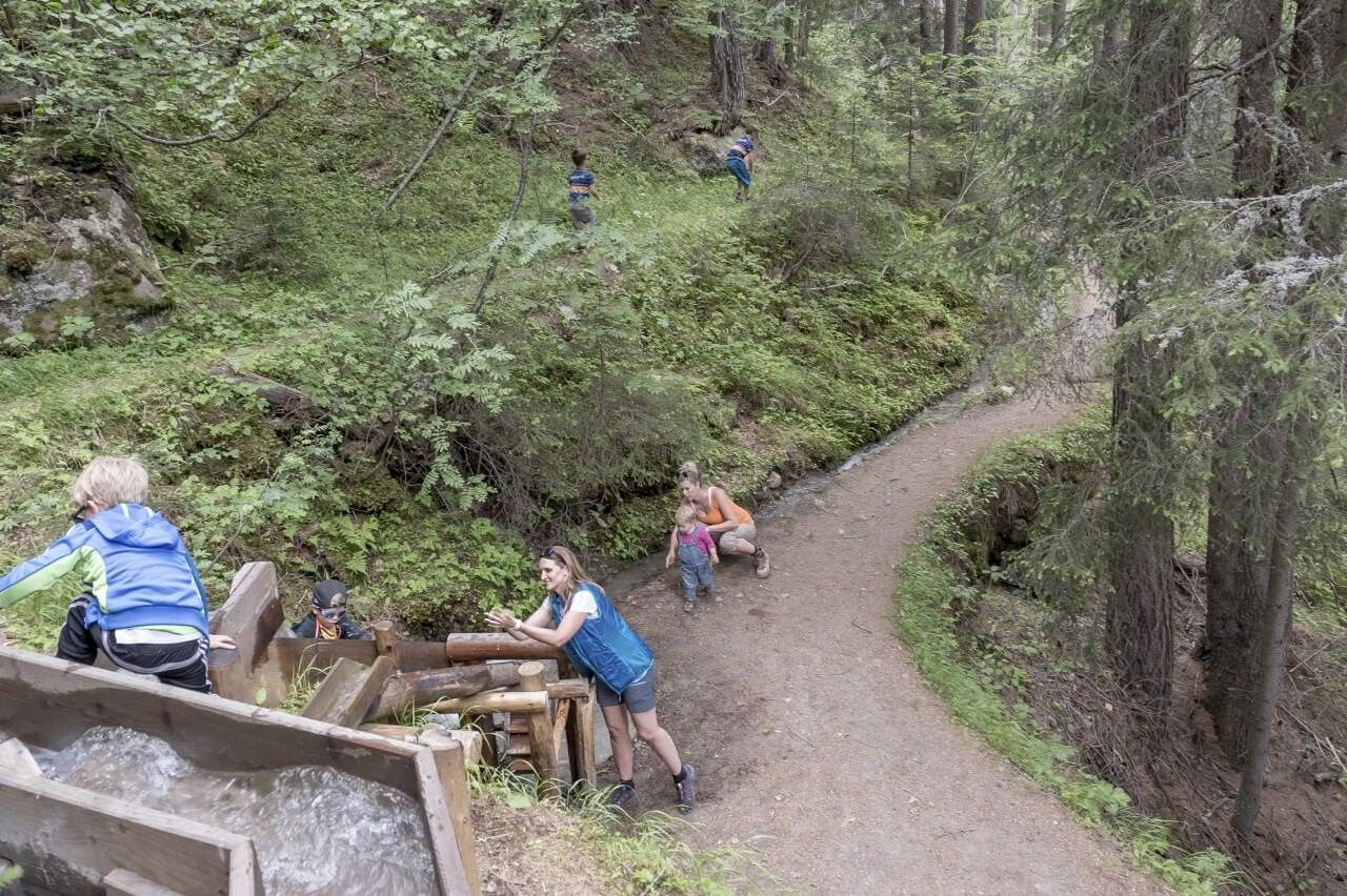
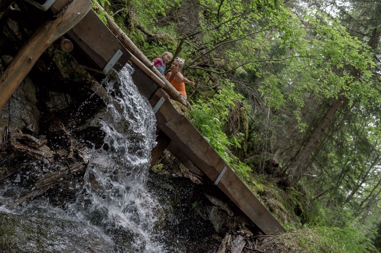
Here you can see the work of water over the past centuries, deeply cut into rock and stone. Further inside the valley, you come somewhat closer to the water. But before the path leads over a bridge to the Mooserstegle, we take a short break in the hammocks. Then you walk down to the right and through the mystical forest to the riverbed of the Windach Ache.

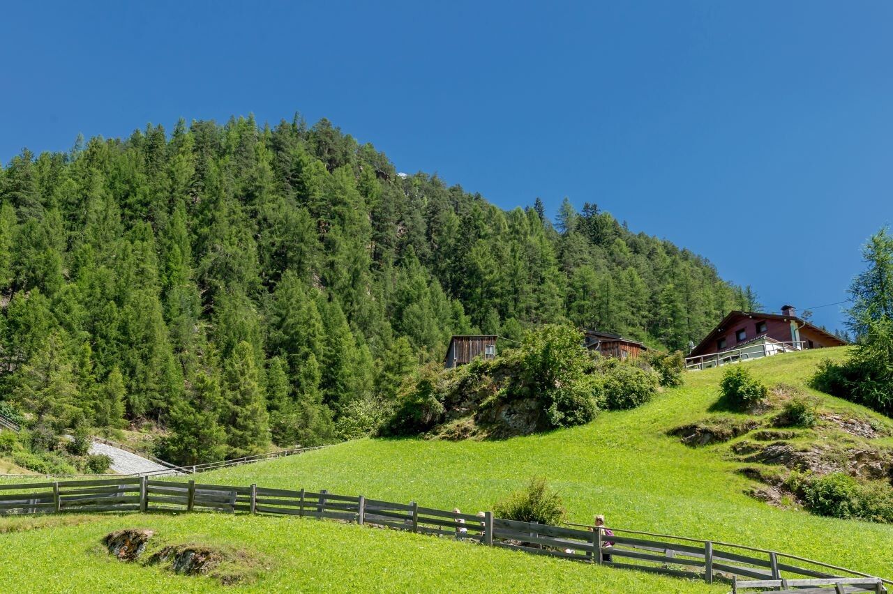
There you cross a small bridge and on the opposite side follow the Mooserstegle, a diverted waal of the Windach Ache from an earlier time. You continue walking, always accompanied by the reconstructed waal, which especially delights the smallest guests. It goes on leisurely past peaceful and fairytale-like places until shortly before the barbecue area. From there, the path leads downhill, past the Windau mill down into the Windau district. You can pause and gather strength at the station of the Ötztal Nature Park before returning to the starting point.


Getting here

  • Arrival by public transport

    Travel comfortably and safely by train to the Ötztal train station. The final stop or departure point is the ÖTZTAL station. Afterwards, you can conveniently and quickly continue your journey with the public bus service or local taxi companies throughout the valley to your desired destination! The current bus schedule can be found at: http://fahrplan.vvt.at

  • Parking

    In Sölden, the following parking options are available:

    • Postplatz parking lot
    • Stiegele parking lot
    • Terraced parking lot
    • Giggijochbahn + underground garage
    • Gaislachkoglbahn + underground garage

    The parking lots in Sölden are chargeable.

    For parking several days (e.g., hut tours):

    • Gaislachkoglbahn parking garage; parking tickets are available either online or directly at the Gaislachkoglbahn ticket office.

More tours in the surrounding area

Newsletter

The mountain is calling? So does our newsletter!

In our monthly newsletter we reveal the best holiday tips for Tyrol.